All Activity
- Past hour
-
I mean December was an expected loss anyway. Hoping for the late January into February/March boom
-
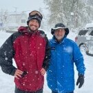
Not a bad day. The earliest I have ever skied is early December.
-
The remainder of this week will see highs in the lower 60s. Friday will be briefly cooler with highs mainly in the upper 50s, but temperatures will likely return to the lower 60s for the weekend. Dry conditions are likely through the weekend. The ENSO Region 1+2 anomaly was +5.2°C and the Region 3.4 anomaly was +3.3°C for the week centered around October 7. For the past six weeks, the ENSO Region 1+2 anomaly has averaged +4.98°C and the ENSO Region 3.4 anomaly has averaged +3.12°C. ENSO Region 3.4 ties the all-time record set in the prior week. The ongoing strong El Niño, will continue to strengthen through the mid-fall. The SOI was -35.00 today. The preliminary Arctic Oscillation (AO) was +2.237 today. Based on sensitivity analysis applied to the latest guidance, there is an implied near 71% probability that New York City will have a warmer than normal October (1991-2020 normal). October will likely finish with a mean temperature near 58.8° (0.9° above normal). Supplemental Information: The projected mean would be 1.9° above the 1981-2010 normal monthly value.
-
Beech and obviously birch do yellow pretty well. I agree, oak sucks. The one in my front year is usually shedding until the following spring.
-
Hey look what I found (cover your eyes Wiz!

-
I was in Phoenix about 30 years ago to visit a friend and we had a wild thunderstorm at night. Absolutely loved it. But yea phoenix itself does little for me
- Today
-
Started here this weekend, its easier to do it in chunks. We're surrounded by woods so a good blower does 90% of it.
-
https://getyarn.io/yarn-clip/dee34050-062a-48f7-9fec-23a384039518
-
colors are poppin, it's always usually the third week of October for peak here...now comes the clean up...

-
 metoprolol succinate toprol xl: generic for lopressor 50mg - other names for Lopressor
-
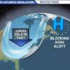
If we're getting a minor warming soon, the PV will probably restrengthen for December and we'll torch. But after that, we may get another warming in time for some blocking in Jan/Feb. That would be our window if it pans out.
-
Hearing of an early season potential PV elongation. any support other than one model for this idea?
-
Why do they never forecast BN in the northeast. I know it’s a bad bet most years but is this the only reason?
-
Well yes obviously. Many places in the metro have already had a freeze.
-
https://levocarepharma.com/# synthroid 25mcg price
-
https://levocarepharma.com/# order levothyroxine 175 mcg
-

Occasional Thoughts on Climate Change
WolfStock1 replied to donsutherland1's topic in Climate Change
That would be your opinion, and an incorrect one. I could enumerate the many facts that I have posted the past few days, which have *not* been refuted, but it wouldn't matter, since you ignore it all in your blindness and obstinance. -

2026-2027 Record-breaking El Nino
csnavywx replied to Stormchaserchuck1's topic in Weather Forecasting and Discussion
Some convergence from the guidance on a very early PV disruption this season, being driven by an absurd Urals-Scandanavian block. I'm taking this for the gift that it probably is for predictive skill: Seasons that have an early significant PV disruption like this usually have a second. Second, the westerly QBO has a tendency towards more a stable PV. So a vortex recovery into Dec with extreme warmth, then prob a mid-late season PV disruption again to round out the end of winter before flipping extremely warm again. -
Weather Sentinel "Big developments are beginning to emerge in the northern hemisphere. It appears as if we may be looking at a weakening of the polar vortex. This is a very anomalous situation as most El Niño winters do not feature this kind of event. This would literally throw a monkey wrench into the seasonal forecasts . This anticipated stretching and weakening of the polar vortex is exactly what happened last winter . Combining a weak vortex or an out right splitting of the vortex with this El Niño could trigger catastrophic winter storms over the Northeast . Personally I’m not super surprised this is occurring or may occur. One of my analog seasons was the 2009/10 one . This was because of a El Niño coupled with a negative phased Atlantic oriented ocean . I also believe the negative Pacific Decadal Oscillation is playing into this and maybe the actual cause of this vortex stretching out and weakening. No two El Ninos are ever alike . Even the 82/83 and 97/98 were different from each other . So how will this change the winter ? Number one is the anticipated moisture flow could be affected and be colder despite the warm Pacific air getting sucked into the US . More likely than not this could be a very volatile situation and may spawn some nasty severe weather over the south east not to mention snow in the north. Another developing situation is the Siberian snow pack . It is progressing at a pace not seen since 2015 and is more on par with 2009 by all accounts. This snow pack is also anticipated to grow exponentially in the next few weeks. This matters as this region is the source of most of the cold air that eventually makes its way into the US in winter . More snow cover equals more cold . If you like snow then the stars may be aligning for a big season this year. This could very well range from west to east . More than anything it looks volatile. I think this may lead to more snow getting into the I-95 corridor and possibly further south . At this stage I believe the Mid Atlantic will be the bullseye. I will be updating this information as it becomes available."
-
order synthroid overnight [url=https://levocarepharma.com/#]buy synthroid with fast shipping[/url] buy authentic synthroid tablets
-
the three times I had to go to PHX for work there was some weird weather phenomena...one flash flooding storm, actually made the salt river flow violent for a couple days, a heat wave in July 125+ during the day but the 95+ night wind was worse, and a crazy sand storm I saw coming from south mountain across sky harbor, don't like PHX but Tempe and Mesa were cool. Tempe especially because ASU campus is all around with a plethora of establishments to check out.
-
Heat Island effect - most areas away from the city will experience < 32 well before NYC
-

2026-2027 Record-breaking El Nino
MJO812 replied to Stormchaserchuck1's topic in Weather Forecasting and Discussion
Stop trolling Its annoying -
Torch !
-
The latest first freeze for LGA which is the UHI capital was 1-4-16. NYC snuck one in on 11-24-15. The average first freeze for LGA since then has been 11-30 and NYC 11-20. Frost/Freeze Summary for LAGUARDIA AIRPORT, NY Each section contains date and year of occurrence, value on that date. Click column heading to sort ascending, click again to sort descending. 2015 03-29 (2015) 27 01-04 (2016) 15 280 2001 03-28 (2001) 31 12-23 (2001) 32 269 1998 03-22 (1998) 31 12-22 (1998) 24 274 2021 04-02 (2021) 29 12-19 (2021) 31 260 Data for November 24, 2015 through November 24, 2015 Click column heading to sort ascending, click again to sort descending. NY MONTAUK AIRPORT WBAN 37 NY SETAUKET STRONG COOP 35 NY LAGUARDIA AIRPORT WBAN 33 NY NY CITY CENTRAL PARK WBAN 32 NY JFK INTERNATIONAL AIRPORT WBAN 31 Frost/Freeze Summary for LAGUARDIA AIRPORT, NY Each section contains date and year of occurrence, value on that date. Click column heading to sort ascending, click again to sort descending. Minimum 03-01 (2020) 11-08 (2019) 226 Mean 03-25 11-30 249 Maximum 04-06 (2016) 01-04 (2016) 281 2025 03-23 (2025) 32 12-04 (2025) 25 255 2024 03-24 (2024) 32 11-30 (2024) 32 250 2023 03-30 (2023) 32 11-25 (2023) 32 239 2022 03-30 (2022) 30 11-19 (2022) 32 233 2021 04-02 (2021) 29 12-19 (2021) 31 260 2020 03-01 (2020) 26 12-08 (2020) 32 281 2019 03-13 (2019) 32 11-08 (2019) 31 239 2018 04-02 (2018) 32 11-15 (2018) 30 226 2017 03-23 (2017) 26 11-10 (2017) 27 231 2016 04-06 (2016) 32 12-09 (2016) 32 246 2015 03-29 (2015) 27 01-04 (2016) 15 280 Frost/Freeze Summary for NY CITY CENTRAL PARK, NY Each section contains date and year of occurrence, value on that date. Click column heading to sort ascending, click again to sort descending. Minimum 03-01 (2020) 10-31 (2020) 218 Mean 03-28 11-20 236 Maximum 04-10 (2016) 12-09 (2016) 250 2025 04-09 (2025) 31 11-29 (2025) 32 233 2024 03-24 (2024) 31 11-30 (2024) 30 250 2023 03-30 (2023) 31 11-25 (2023) 30 239 2022 03-30 (2022) 29 11-19 (2022) 31 233 2021 04-03 (2021) 32 11-23 (2021) 32 233 2020 03-01 (2020) 25 10-31 (2020) 32 243 2019 03-18 (2019) 32 11-08 (2019) 29 234 2018 04-09 (2018) 32 11-14 (2018) 32 218 2017 03-23 (2017) 23 11-10 (2017) 25 231 2016 04-10 (2016) 31 12-09 (2016) 29 242 2015 04-01 (2015) 32 11-24 (2015) 32 236