Records:
Highs:
EWR: 102 (1966)
NYC: 100 (1966)
LGA: 101 (1966)
JFK: 101 (1966)
Lows:
EWR: 56 (2001)
NYC: 56 (2001)
LGA: 58 (2001)
JFK: 56 (2001)
Historical:
1833 - An unusually large New England tornado, one half to three quarters of a mile wide, went from Salem Pond to Norton Pond, VT, and then into Canada. It prostrated nearly everything in its path. (The Weather Channel)
1833: The following is from the "History and Description of New England" published in 1860: "On the 2nd of July, 1833, this town (Holland, Vermont) was visited by a violent tornado, which commenced on Salem Pond in Salem, and passed over this place in a northeasterly direction. It was from half to three-quarters of a mile wide and prostrated and scattered nearly all the trees, fences, and buildings in its course. It crossed the outlet of Norton Pond and passed into Canada, and its path could be traced through the forests nearly to Connecticut River."
1843 - An alligator reportedly fell from the sky onto Anson Street in Charleston, SC, during a thunderstorm. (David Ludlum)
1932: Boston, Massachusetts recorded its lowest pressure 29.21 inches of mercury for the month of July. (Ref. NOAA Boston Weather Events)
1944: Today began the longest dry spell in Las Vegas, NV history which lasted until October 10th, a total of 101 days. (Ref. Wilson Wx. History)
1965: A cool morning 50° at Sterling, 61° at DCA. A cool 51° minimum temperature equaled July record low on 15th in 1940 in Richmond, VA. (Ref. Richmond Weather Records - KRIC)
1972: Large hail and damaging winds accompanied severe thunderstorms across parts of central Oklahoma. Baseball-size hail fell in the Oklahoma City metropolitan area, and winds reached 75 to 100 mph. The wind took down power lines and damaged or destroyed at least 23 mobile homes. Winds gusted to 100 mph at Lindsay, and 80 mph at Norman. The wind in these areas mainly damaged trees and blew down power lines, but also damaged a few roofs. (Ref. Wilson Wx. History)
1980: Wichita Falls, TX broke their old record by 10 degrees as the temperature hit 114°. This was the 9th consecutive day of temperatures above 100°. (Ref. Wilson Wx. History)
1986: Amazingly, an F2 tornado at Jacksonville, NC that killed three people was the deadliest twister of the year as the United States experienced only 15 tornado deaths during the year. This was an all-time low since records began in 1916. (Ref. Wilson Wx. History)
1987 - Thunderstorms in Colorado produced hail as large as golf balls northwest of Kiowa, which accumulated to a depth of twelve inches. Hail two and a half inches in diameter was reported at Black Forest. Hail damaged 900 acres of crops south of the town of Wiggins. (The National Weather Summary) (Storm Data)
1988 - Twenty-six cities in the eastern U.S. reported record low temperatures for the date. The morning low of 47 degrees at Roanoke, VA, broke the July record set the previous day. (The National Weather Summary)
1989 - Thunderstorms produced severe weather in the south central U.S., with 158 reports of large hail and damaging winds through the day. Evening thunderstorms in northeastern Texas produced softball size hail which caused more than five million dollars damage at Allen, and wind gusts to 90 mph at Dallas, which injured eight persons and caused seven million dollars damage. Winnfield LA reported 29.52 inches of rain in six days, for a total of 62.50 inches for the first six months of the year. Midland, TX, reported an all-time record high of 112 degrees. (Storm Data) (The National Weather Summary)
1992: An usually cold air mass for the time of year was in place across northern New York and Vermont. Saranac Lake, NY dipped to 30°. An observer in West Charleston, VT dropped to 30° as well with widespread frost and a frozen garden hose. A total of six cooperative observer stations in Vermont reported freezing low temperatures with East Haven reporting the lowest with 29°. Burlington, VT set a record low with 40°. (Ref. Wilson Wx. History)
1994: A US Air jet crashed near Charlotte, NC during a thunderstorm. The cause of the crash was officially listed as wind shear. Major efforts to understand and avoid wind shear have resulted in a dramatic reduction in the number of air accidents involving this deadly phenomenon. (Ref. Wilson Wx. History)
2001: In Michigan, frost and freezing temperatures were observed in some locations with Grant dropping to 29 degrees. Muskegon reported their coldest July temperature on record with 39 degrees. Other daily record lows included: Lansing: 38, Muskegon: 39, Flint: 40, Youngstown, Ohio: 40, and Grand Rapids, Michigan: 43 degrees.
2003: Thunderstorm wind gusts to 75 mph at Bigfork, MN, blew off the top of a tree, which went through the windshield of a car and impaled the driver in his seat; he lived. At Basswood Lake, a storm gust toppled a tree onto a tent; 1 camper killed and 1 hurt.
(Weather Guide Calendar with Phenomenal Weather Events 2011 Accord Pub. 2010, USA)
2004: It was about a half hour into the storm that my grandmother recalls hearing what she calls a "blood curtailing scream" coming from me. She looked over to see me lifted from about 6 inches off the ground and dropped back down again. At first she though I had just become scared and jumped as she could tell that the lightning had struck not to far away. Read the full story at the following Ref.
(Ref. A Lightning Survivor)
2007: All-time record dew point depression set at las vegas today June 27, 2011 at 432 PM PDT today the dew point depression at Mccarran International Airport in Las Vegas reached 129 degrees. The dew point depression is defined as the difference between the air temperature and the dew point temperature. In the case of today the air temperature was 107 degrees at 432 PM and the dew point temperature was -22 degrees. This made for a relative humidity of 1 percent at the time. The previous all-time record dew point depression for Las Vegas was 120 degrees set on July 2, 2007. The above information is preliminary and is subject to a final review before being certified by the national climatic data center.
(Ref. NWS - A New Record To Be Certified)
2019: Measurable rain fell at the Richmond International Airport for the first time in 13 days. The drought began on June 20th and ended on July 3, 2019. (Ref. NWS - The Richmond International Airport Records)
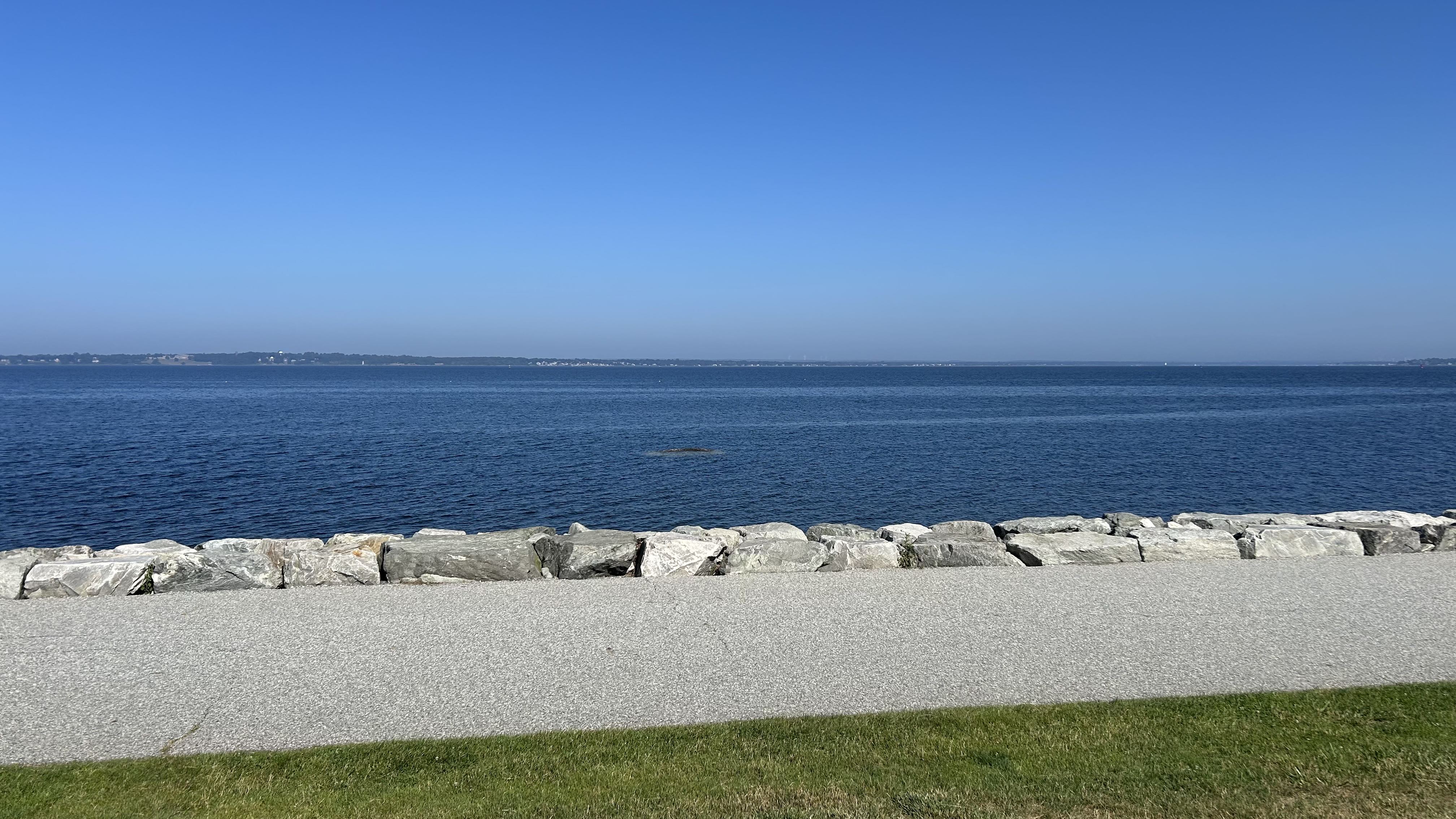
 Good morning from Colt State Park in Bristol, a hazy 79 degrees with light breeze.
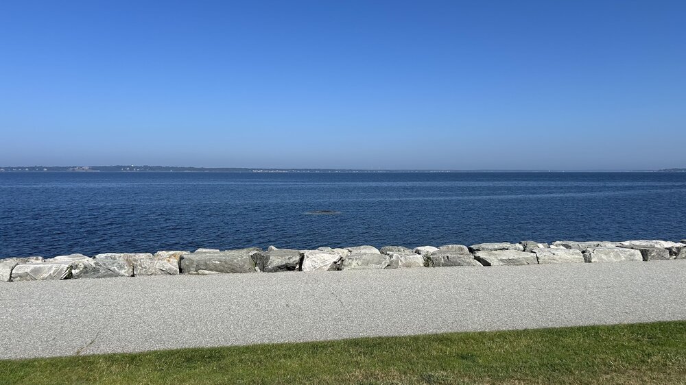
 Valid point ... the 9 by 9 was a Boston market thing at WHDH with Harv' ..but I heard Dick Albert over on ABC/Channel 5 Boston and Barry on Channel 4 also use that expression in the early 1990s - jesus... you wonder if all adages older than 300,000 years need to be re-evaluated, which come think about it ... maybe that's true due to CC anyway. Anyway, that fits what you suspect there, about the HFD-BOS region. Y'all up there's more of a pseudo alpine climo anyway. 10 after 10's up next. By the way... I noticed a lot of sites were struggling in the 91 range yesterday, and unilaterally ... many of them leaped to 95 to even few 97's at around 3pm, all at once. So yeah..there's no rule that these things have to be very linear. The purpose of today's tedious Asperger obsession is to test these adages.
 Just a sprinkle here last night and we are off to the races at 86 .
 I always thought 90@9 was too aggressive. MHT did 19 after 9 yesterday. It probably works better for a place that stays very mixed overnight like BOS or ORH.
 A lot of evaporation going on too with the rain that moved through. When I went outside with the dog earlier it was like a sauna with the steam rising.