All Activity
- Past hour
-
I bet they’ll be at least one day well above that.
-
Euro!
-
Moderate snow, 31°
-
Yup . Torch gone
-
Hopefully it holds for the next 10 months
-
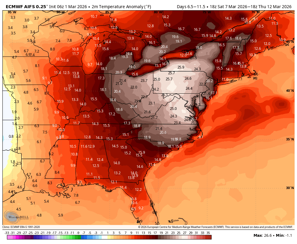
This is probably how the torch will verify, late spring to our west and southwest with 70s to 80. While we top out in the 50s and 60s outside chance one day breaks into the 70s for SNE but that will be hard to do.. Considering how nice 54 felt yesterday I'll take a week of 55-60.

-
Flurries have just started here....25.5⁰
-
Doubtful.
-
Effing chipmunks are back digging burrows in the snow. Dead.
-
Not the surge due only by the storm, but IIRC the high water was 14.1 on the 10th and 14.4 on the 13th.
-
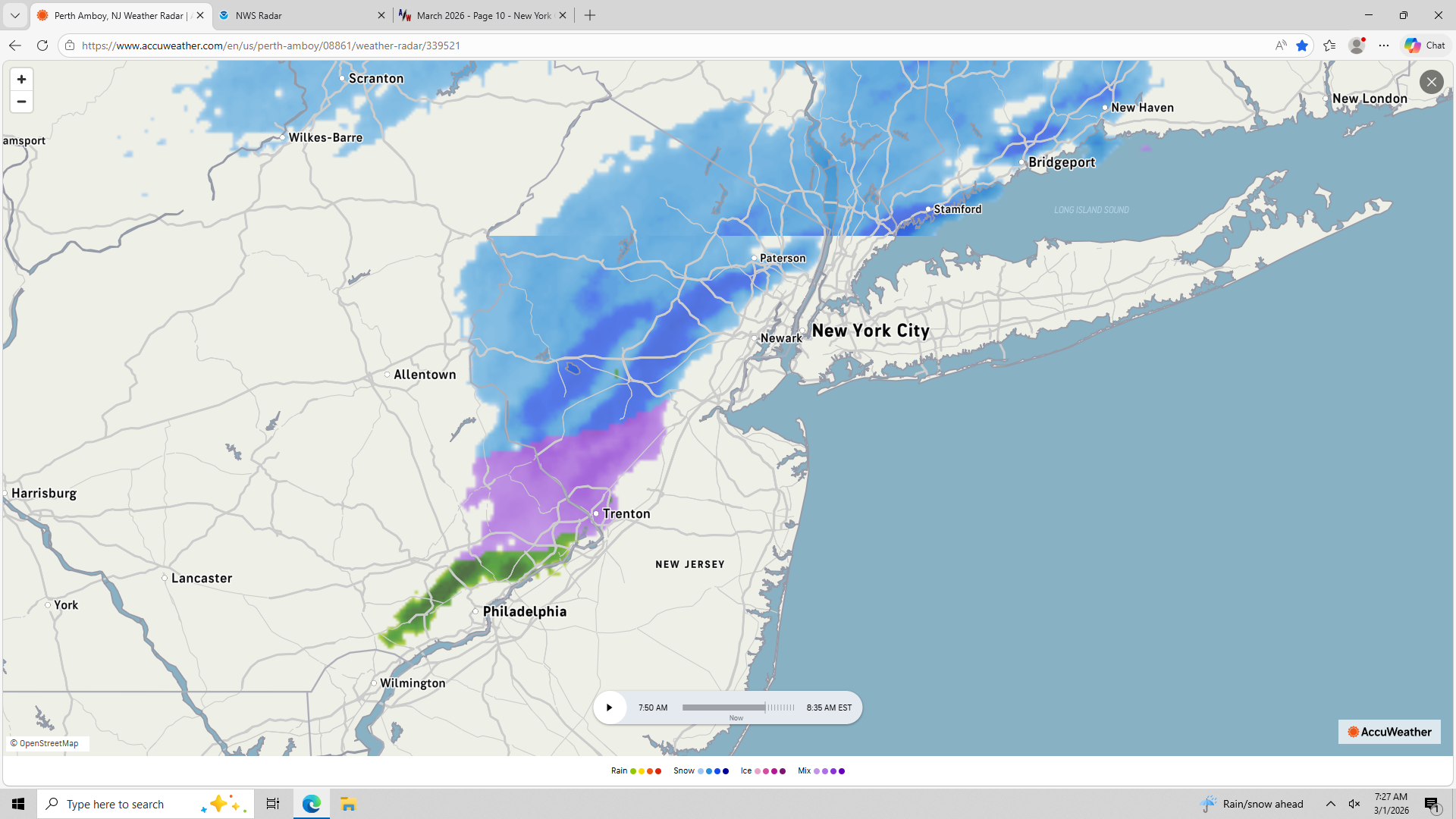
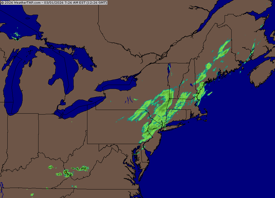
HRRR blows again for this one, officially has zero snow for all of western CT. However this is the current radar
-

-
glad we don't live there.. Excited for my 1.4" to get me to 64"
-
There are a couple narrow, strong bands of snow or mix showers in western NJ moving rapidly eastward. Some of us will see a strong snow shower or two. They seem to be aimed at Metsy.
-
We lost the phased western trough in the LR. It gets cutoff in the SW. That would prob make it easier for us to CAD. Ensmebkes have that Hudson Bay PV pressing by mid-month still, so I’m buying that idea of one more round of chances. Esp over interior but fresh cold means even coast could get in on it too if we keep seeing that PV press.
-

Winter 2025-26 Medium/Long Range Discussion
DocATL replied to michsnowfreak's topic in Lakes/Ohio Valley
Low likelihood outside of climo favored areas to the north. At least for majority of March. . -
Wintah is ova Next three days is noise; not the signal. We are let out; and it will be earlier than last year with +NAO state.
-
25⁰ here in my little valley
-
Stat padder!
-
excited for my 0.4
-
thundersnow this morning?
-
We torch.
-
Put this on repeat 1) sunny, 55, slight breeze gusting to 20mph 2)Backdoor cold front with areas north and east of DC staying in the 40s and low 50s while Fredericksburg is 70 and sunny
-

February 2026 OBS & Discussion
donsutherland1 replied to Stormlover74's topic in New York City Metro
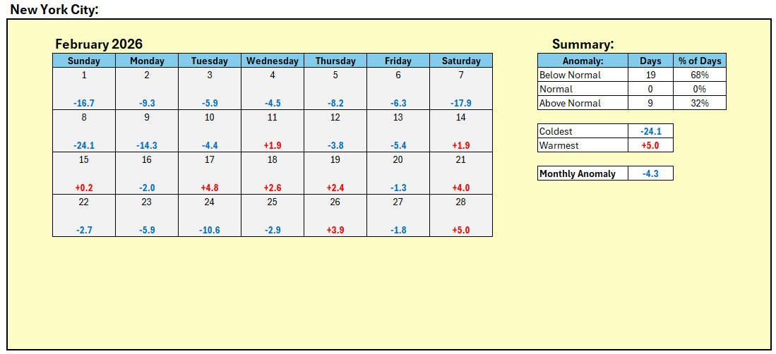
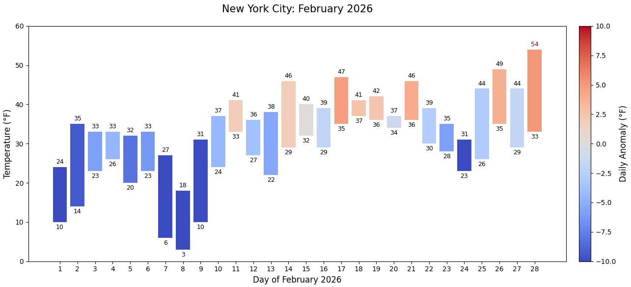
February 2026 in New York City: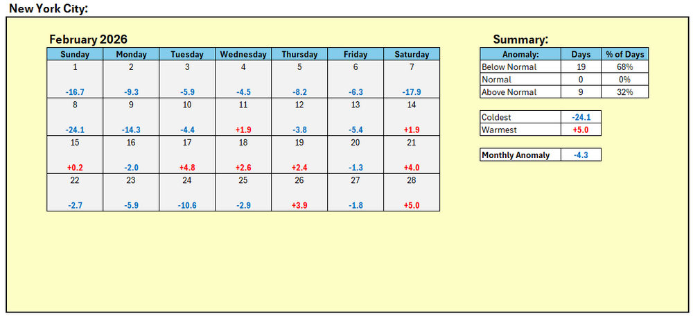

-
Sleet here at the moment; pinging on the roof.