All Activity
- Past hour
-
DVN issued a blizzard warning for their entire area. The snow forecast is 4-8", which seems a bit high, plus wind up to 60 mph.
-
Pacific is kinda crap but that's a legit NAO Rex Block as advertised. In late March, that could work.
-
You're in for an epic storm. If i didn't have work Monday I would definitely venture north to document this.
-
I was gonna suspend the WB account yesterday but I didn't want to rely on WW for maps just in case something unusual happens lol.
-
APX just issued an advisory here in Alpena,MI for 5" then maybe just plain rain Sunday night and Rogers city a warning for 8" and .50" of ice. Only 25 miles difference,so can definitely change. They aren't confident at all,but admitted it. Now cast it is!
-
Hubcapsgone Mass
-

Central PA Spring 2026 Discussion/Obs Thread
anotherman replied to Voyager's topic in Upstate New York/Pennsylvania
-
I obviously think the probability is low for a high end snow, but I’m still keeping my eye on that period. It’ll be the last one for this area until next season. It’s intriguing to say the least.
-
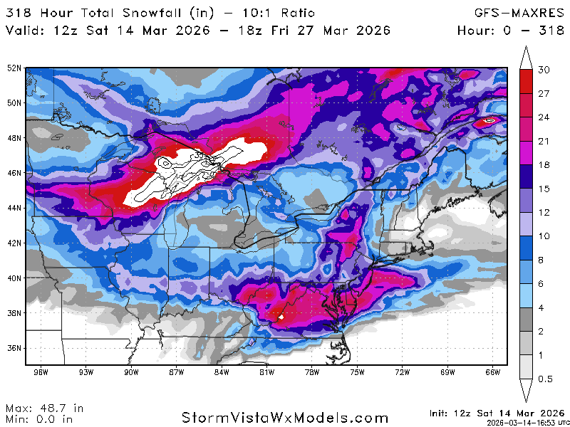
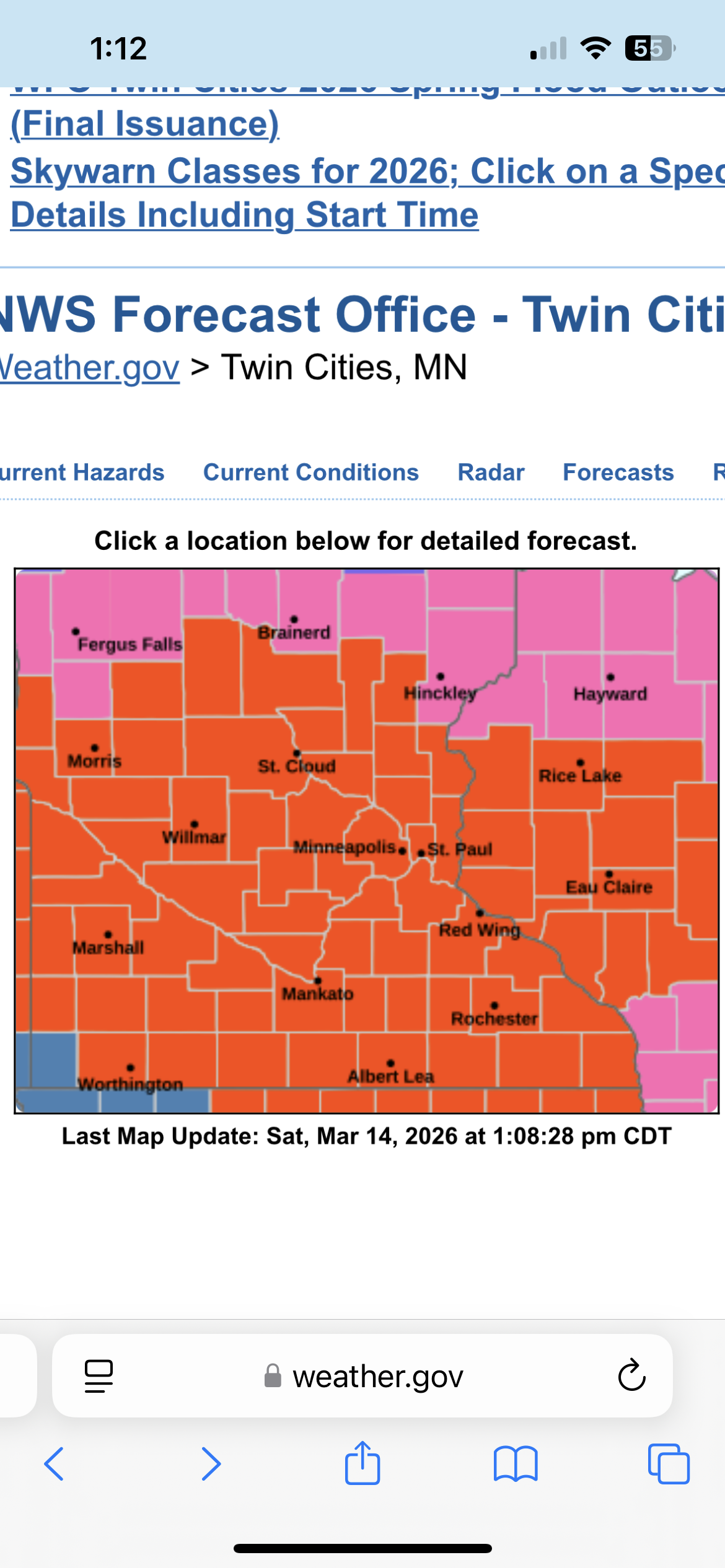
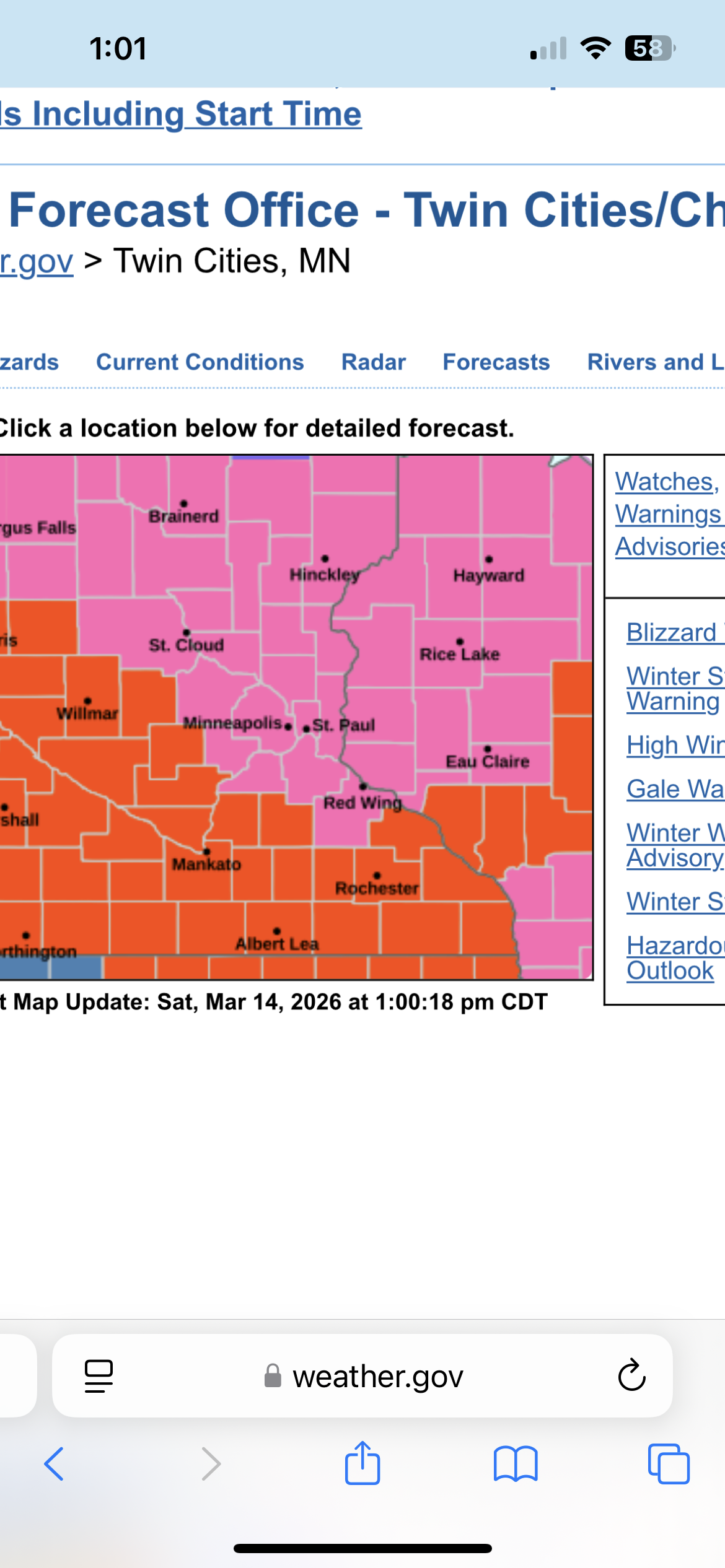
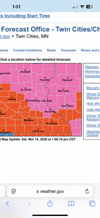
There it is. The entire MPX CWA is under a blizzard warning. That might be a first. .

-
That’s not true. This subforum is amazing at wind, heat, CAD, and failure
-
The Chill WDI remains favorable.
-

Central PA Spring 2026 Discussion/Obs Thread
canderson replied to Voyager's topic in Upstate New York/Pennsylvania
NAM has an incredibly nasty QLCS rush hour ish Monday. It’d cause significant issues. -
300+ hour snowmap on the op GFS at the end of March. That deserves a double bun!! lmfaoooooo
-
Was mentioning that last night to my colleague on the winter desk. Basically anything north of GB up into the U.P is going get clocked. I’d love to post up in Iron Mountain, MI right on the WI/MI border. Should see 2-3’ there. Marquette area and the Huron Mtns will probably see 3-5’ with the storm and additional LES. Insane storm for up there
-
I did post an h5 map for that window a couple days ago- I said it was awfully late outside of the mountains, but ya never know. Shit can happen the last week of March, and this might be the winter for it given we have scored multiple times without the 'ideal' upper level pattern.
-
Probably gone by Tuesday but some yards still have legit 12 to 16 in them then others bare
-
December (2024) and February (2025) were near normal. January being well below average made the winter BN. This December, January, and February were all well below average. The first time since January, February, and March 2015. Of course, that was followed by a near record warm May.
-
I thought dragons lives there?
-
Euro continues to be super wet for Monday
-
Gotta imagine we have a blizzard warning incoming here in MSP .
-

Spring 2026 Pattern Discussion Thread
Carvers Gap replied to Carvers Gap's topic in Tennessee Valley
Oh man - I just saw this. I hate to hear that. We will be praying for you and your family. -

Central PA Spring 2026 Discussion/Obs Thread
Blizzard of 93 replied to Voyager's topic in Upstate New York/Pennsylvania
The way this Winter has gone, you never know… I just have a feeling that we get one last ride… -
Make it 5x now.
-
The snow will accumulate if the pattern is right.
-
Euro has nothing but the potential is there.