rochesterdave Posted February 6, 2020 Share Posted February 6, 2020 Ukie looked good. Bet euro is similar. Link to comment Share on other sites More sharing options...
tim123 Posted February 6, 2020 Share Posted February 6, 2020 Looks to be a bit stronger farther west so far Link to comment Share on other sites More sharing options...
rochesterdave Posted February 6, 2020 Share Posted February 6, 2020 Stronger. Tic NW. cold Link to comment Share on other sites More sharing options...
tim123 Posted February 6, 2020 Share Posted February 6, 2020 And remember euro also cant pick up lake enhanced preicip good either Link to comment Share on other sites More sharing options...
rochesterdave Posted February 6, 2020 Share Posted February 6, 2020 Good run. Foot plus with ratios for all of us. Link to comment Share on other sites More sharing options...
rochesterdave Posted February 6, 2020 Share Posted February 6, 2020 Roc looks good for 10-16 for both. BUF 8-12. SYR 12+. Adirondacks 1-2 feet Link to comment Share on other sites More sharing options...
BuffaloWeather Posted February 6, 2020 Share Posted February 6, 2020 Going to bed at just under 5" of snow so far and still snowing moderately should be able to make it close to 6" by morning. Definite over performer for round 1. Link to comment Share on other sites More sharing options...
tim123 Posted February 6, 2020 Share Posted February 6, 2020 Still think that's too low. 977 mb over Hudson valley warm lake almost ideal 850s north nw wind. All ingredients there for a south shore shillacking Link to comment Share on other sites More sharing options...
tim123 Posted February 6, 2020 Share Posted February 6, 2020 I think roc gets a foot plus from second system. Link to comment Share on other sites More sharing options...
rochesterdave Posted February 6, 2020 Share Posted February 6, 2020 Very well might. I’d love to see kuchera from 0z. The 18z gave Roc 17... Link to comment Share on other sites More sharing options...
Syrmax Posted February 6, 2020 Share Posted February 6, 2020 00Z Euro looks a bit deeper than 12Z run, for the 18Z Friday timeframe... slp position is about same, about over White Plains NY but 00Z has 972 mb vs 977 mg at 12Z. The 12Z slp might be a touch left of 00Z but that may be noise. Curiously, looks like qpf for CNY down a few tenths on 00Z. Not sure if it's due to intense banding signature over ENY. It looks really epic for Plattsburgh. Still looks good overall. Link to comment Share on other sites More sharing options...
Syrmax Posted February 6, 2020 Share Posted February 6, 2020 00Z Ukie brings the noise. Qpf up from 12 Z and banding signature is west of Euro, more in CNY than ENY. Slp is about same location as Euro, about over White Plains but at 968 mb. Geeziz. Link to comment Share on other sites More sharing options...
Syrmax Posted February 6, 2020 Share Posted February 6, 2020 00Z NAM snow output. Link to comment Share on other sites More sharing options...
Syrmax Posted February 6, 2020 Share Posted February 6, 2020 Bedtime here. We have about 2" down already per my calibrated eyeball. 1 am and 2 am vis at Hancock Field is 0.5 mi. That's close to 1" per hour over past 2 hours (since it started). Link to comment Share on other sites More sharing options...
rochesterdave Posted February 6, 2020 Share Posted February 6, 2020 6z NAM going deep and probably even further west. BUF is gonna end up the sweet spot Link to comment Share on other sites More sharing options...
rochesterdave Posted February 6, 2020 Share Posted February 6, 2020 976 to Binghamton. Great for WNY. Roc looks to get hammered. Warm air well into the Dacks prior to the crash. It’s a big one. Link to comment Share on other sites More sharing options...
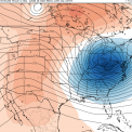
rochesterdave Posted February 6, 2020 Share Posted February 6, 2020 Link to comment Share on other sites More sharing options...
Thinksnow18 Posted February 6, 2020 Share Posted February 6, 2020 4.1" for round one. All counties added to WSW and this looks to be our big storm for the year. Link to comment Share on other sites More sharing options...
Geez150 Posted February 6, 2020 Share Posted February 6, 2020 Just a rough measurement, got 4-5 in the north west corner of Livingston county, in Caledonia. Link to comment Share on other sites More sharing options...
Buckeyes_Suck Posted February 6, 2020 Share Posted February 6, 2020 Rain and 27 degrees here right now. Solid 4” of snow on the ground Link to comment Share on other sites More sharing options...
wolfie09 Posted February 6, 2020 Share Posted February 6, 2020 3.5" here..NWS only going with 3"-5" for round 2 here.. Hopefully NAM is onto something lol Even though the model likes to be overly wet.. Close again on the high Rez Canadian.. Link to comment Share on other sites More sharing options...
wolfie09 Posted February 6, 2020 Share Posted February 6, 2020 3k Nam for Friday, still going big.. Kbuf Because of the considerable spread in model guidance, the forecast uses a consensus approach. Forecast confidence is below average given the timeframe. For example, the NAM has considerably more QPF than most other guidance, and the GFS is considerably warmer than most other guidance. In each case, these solutions are plausible but the most likely outcome is somewhere in between Link to comment Share on other sites More sharing options...
Thinksnow18 Posted February 6, 2020 Share Posted February 6, 2020 2 minutes ago, wolfie09 said: 3k Nam for Friday, still going big.. Kbuf Because of the considerable spread in model guidance, the forecast uses a consensus approach. Forecast confidence is below average given the timeframe. For example, the NAM has considerably more QPF than most other guidance, and the GFS is considerably warmer than most other guidance. In each case, these solutions are plausible but the most likely outcome is somewhere in between I take. Link to comment Share on other sites More sharing options...
Flying MXZ Posted February 6, 2020 Share Posted February 6, 2020 Around 1" of sleet and freezing rain overnight here in the northern Catskills. Must have started as freezing rain with the coating on my car, then changed to sleet at some point. Pretty nasty drive to work at 5:30. Out of the game here for anything meaningful but hoping the Tug to Old Forge area get a nice storm. Link to comment Share on other sites More sharing options...
wolfie09 Posted February 6, 2020 Share Posted February 6, 2020 Well according to the NWS this is barely an advisory Snowfall east of Ontario, mostly 2"-4" in P&C forecast, maybe a 3"-5" if you're lucky.. Link to comment Share on other sites More sharing options...
CNY_WX Posted February 6, 2020 Share Posted February 6, 2020 KBGM is still calling for heavy snow tomorrow: Things turn for the worse tonight onward as a strong and further deepening low pressure moves up the Appalachians, and then right across our region Friday morning. This will be in concert with a strong upper wave and very good double-jet support (right entrance region of one, left exit of the other) providing forced ascent. Frontogenesis axis at the mid levels appears to set up right over the Finger Lakes through NY Thruway, with dynamic cooling changing rain to heavy snow late tonight-early Friday. The axis may pivot into the Twin Tiers for a time early-to-mid Friday before precipitation begins to take on a more showery nature, and lake-enhanced for that matter southeast of Lake Ontario late Friday into Friday night. Within the frontogenetical band, 1-2 inch per hour snowfall rates appear achievable. Though the Winter Storm Watch counties - much of Central NY - is where confidence is higher for heavy snowfall totals, it should be noted that even to the south in the Twin Tiers, snowfall rates could be heavy at times Friday morning to midday even if overall totals are not as much as points north. Also, for most the area, some freezing rain and sleet could occur during the rain-to-snow transition late tonight into Friday. Models are in good agreement that this low will be rapidly deepening - right into the 970s mb range - while heading through and then out of the area later Friday. Concern is growing that just after the new layer of moisture-laden snow and some ice collects on trees, northwesterly wind gusts of 30-40 mph Friday afternoon-evening could cause some tree damage and thus scattered power outages. Due to this, as well as continued lake-enhanced snow southeast of Lake Ontario persisting for awhile, the Winter Storm Watch was extended through Friday evening. Link to comment Share on other sites More sharing options...
Syrmax Posted February 6, 2020 Share Posted February 6, 2020 20 minutes ago, wolfie09 said: Well according to the NWS this is barely an advisory Snowfall east of Ontario, mostly 2"-4" in P&C forecast, maybe a 3"-5" if you're lucky.. Not sure what they're looking at. Noone uses the GFS for anything but wiping their ass. Of course NWS and PWSP's will change their forecasts so many times that verification becomes impossible. Link to comment Share on other sites More sharing options...
wolfie09 Posted February 6, 2020 Share Posted February 6, 2020 Yeah, the updated clown map this morning shows 6" but P&C has 2"-4" lol I think CNY is in a good spot personally.. Plenty of evidence of a more easterly track with the heaviest snow from 81 east... Even the father west tracks of the Nam products nail this area.. Link to comment Share on other sites More sharing options...
BuffaloWeather Posted February 6, 2020 Share Posted February 6, 2020 Finished with 5.4" for round 1. Winner was in Wyoming county 6.6". Link to comment Share on other sites More sharing options...
Syrmax Posted February 6, 2020 Share Posted February 6, 2020 3.8" snow here, and a tidy 0.37" liquid equivalent. 10:1 basically for Round 1. Link to comment Share on other sites More sharing options...

Recommended Posts
Archived
This topic is now archived and is closed to further replies.