snowstormcanuck Posted February 28, 2015 Share Posted February 28, 2015 I'm with michsnowfreak. I don't find sunshine to be interesting from a weather standpoint, especially since Detroit has a predominantly sunny climate compared to other places I've lived. It's not as if the sun won't be beating down on us all summer long. I'd prefer to enjoy winter while it lasts. Let it snow. Back to the topic at hand, the NAM shows a snow --> fzra scenario, but if you look at the soundings I think I'd lean toward the snow lasting longer than the raw model output would indicate. The lift is quite strong and the warm layer is shallow and very marginal for 2-3 hours. But what michsnowfreak is saying is that he'd take cold/sun over warm/rain, I gather to preserve his snowpack. Link to comment Share on other sites More sharing options...
michsnowfreak Posted February 28, 2015 Share Posted February 28, 2015 really? This time of the year, I'll take any active weather over suppression. The sun is so bright now, I just see no reason to want to keep snowpack, unless it's a stat record or something like that. Well first of all, we are creeping into the top 10 for longest consecutive stretches of snowcover. After last year set #2, this year could easily set #1. Not to mention total days for a winter season of snowcover. Last year set #1, this year could easily be in top 10 or top 5. Second of all, as I said, we keep the snowcover regardless...however....suppression keeps it what it is now....snow makes it even deeper...and rain makes it a sludgy mess that will simply refreeze into mega-glacier anyway. So to reiterate...rainstorm is my last option. Link to comment Share on other sites More sharing options...
michsnowfreak Posted February 28, 2015 Share Posted February 28, 2015 But what michsnowfreak is saying is that he'd take cold/sun over warm/rain, I gather to preserve his snowpack. Correct. Though cold/cloudy is preferred In a normal year, obviously in March, sun is the enemy of snow and I even could not care less about snowcover unlike Nov-Feb. Of course I want it, but I have to be realistic. Remember all those times in the past youd get a March snow, lets say a good 5" snowfall. A day of sun and 35F, you come home, and the snow hasnt budged in the shade and its 2" of mashed potatoes in the sun. But the last 2 years have been different with a deep glacier. Link to comment Share on other sites More sharing options...
Chicago Storm Posted February 28, 2015 Share Posted February 28, 2015 Preserving snowpack in March lol. Link to comment Share on other sites More sharing options...
michsnowfreak Posted February 28, 2015 Share Posted February 28, 2015 I'm with michsnowfreak. I don't find sunshine to be interesting from a weather standpoint, especially since Detroit has a predominantly sunny climate compared to other places I've lived. It's not as if the sun won't be beating down on us all summer long. I'd prefer to enjoy winter while it lasts. Let it snow. Back to the topic at hand, the NAM shows a snow --> fzra scenario, but if you look at the soundings I think I'd lean toward the snow lasting longer than the raw model output would indicate. The lift is quite strong and the warm layer is shallow and very marginal for 2-3 hours. #1) Where have you lived? and #2) Make sure you give your previous addresses to Powerball so he knows never to set foot in those places Link to comment Share on other sites More sharing options...
snowstormcanuck Posted February 28, 2015 Share Posted February 28, 2015 Snow? Yes. Rain? No. I'm guessing if you didn't have snow cover you'd take rain over sun? Link to comment Share on other sites More sharing options...
michsnowfreak Posted February 28, 2015 Share Posted February 28, 2015 Preserving snowpack in March lol. Umm...when it involves records? Why not. So to fit in with the cool kids, Im supposed to want the snowpack to melt even though records are at play and the sun is strong, BUT Im not supposed to want sun, Im supposed to want heavy rain. Heavy rain that falls on frozen ground with deep snow which STILL wont rid us of the snowpack but will give a ton of street/freeway flooding and make my commute 2 hours Tuesday evening. Got it. Link to comment Share on other sites More sharing options...
dmc76 Posted February 28, 2015 Share Posted February 28, 2015 #1) Where have you lived? and #2) Make sure you give your previous addresses to Powerball so he knows never to set foot in those places Never heard that before that this a very sunny place. Lol. Fooled me Link to comment Share on other sites More sharing options...
michsnowfreak Posted February 28, 2015 Share Posted February 28, 2015 I'm guessing if you didn't have snow cover you'd take rain over sun? I really wouldnt care. Actually probably rather have sun. I like rain in a summer thunderstorm. Thats about it. I hate spring. My least favorite season by a MILE. Link to comment Share on other sites More sharing options...
weatherbo Posted February 28, 2015 Share Posted February 28, 2015 The snow here is still powder. A deep dense 10-12" water laden snowpack. Once snow becomes a glacier, I'd just as soon see the melt come on. Detroit has had several thaws creating glacier, not the case here. 95% of the time, I'd take active weather over sunshine. Except in Nov-Jan when I'd really prefer not to have rain. Clear blue skies and 10 degrees in March just really starts to make me a little stir crazy. Link to comment Share on other sites More sharing options...
michsnowfreak Posted February 28, 2015 Share Posted February 28, 2015 The snow here is still powder. A deep dense 10-12" water laden snowpack. Once snow becomes a glacier, I'd just as soon see the melt come on. Detroit has had several thaws creating glacier, not the case here. 95% of the time, I'd take active weather over sunshine. Except in Nov-Jan when I'd really prefer not to have rain. Clear blue skies and 10 degrees in March just really starts to make me a little stir crazy. The kicker is the snow still looks like powder. Doesnt look like glacier at all because of the powder on top. BTW it was only one thaw, and that was Feb 7-8. Link to comment Share on other sites More sharing options...
weatherbo Posted February 28, 2015 Share Posted February 28, 2015 The kicker is the snow still looks like powder. Doesnt look like glacier at all because of the powder on top you and I are usually on the same page regarding snow and snow cover. I think the brutal cold and 4 months straight of snow on the ground has given me a bit of cabin fever this year. more so than I can ever remember. Link to comment Share on other sites More sharing options...
Chicago Storm Posted February 28, 2015 Share Posted February 28, 2015 Umm...when it involves records? Why not. So to fit in with the cool kids, Im supposed to want the snowpack to melt even though records are at play and the sun is strong, BUT Im not supposed to want sun, Im supposed to want heavy rain. Heavy rain that falls on frozen ground with deep snow which STILL wont rid us of the snowpack but will give a ton of street/freeway flooding and make my commute 2 hours Tuesday evening. Got it. YOU know I AM all for records, especially if the pattern isn't going to sig change. AND that I would also prefer sun over rain. SO lol at that, and I HOPE you enjoy your commute. Link to comment Share on other sites More sharing options...
michsnowfreak Posted February 28, 2015 Share Posted February 28, 2015 you and I are usually on the same page regarding snow and snow cover. I think the brutal cold and 4 months straight of snow on the ground has given me a bit of cabin fever this year. more so than I can ever remember. This is how it looks out the window right now. Doesnt look like a dirty glacier at all. Link to comment Share on other sites More sharing options...
Stebo Posted February 28, 2015 Share Posted February 28, 2015 Hoping for suppression in March is ridiculous. Lets enjoy another season for once. Link to comment Share on other sites More sharing options...
michsnowfreak Posted February 28, 2015 Share Posted February 28, 2015 Hoping for suppression in March is ridiculous. Lets enjoy another season for once. All 5 hours of it? To clarify...my comments regarding sun/snow/suppression/rain/etc are based on whats going on, what has been going, and what the weather looks like going forward. It doesnt matter what track the storm takes, it will be 20 degrees a few hours after the storm departs. I see ZERO redeeming quality in dousing, cold, heavy rain with no thunder, no severe potential, snow everywhere, and temps plunging right after. Now if it was going to be in the 60s Wed and I was saying I hope the severe threat goes south, then I get you. Link to comment Share on other sites More sharing options...
TugHillMatt Posted February 28, 2015 Share Posted February 28, 2015 All 5 hours of it? To clarify...my comments regarding sun/snow/suppression/rain/etc are based on whats going on, what has been going, and what the weather looks like going forward. It doesnt matter what track the storm takes, it will be 20 degrees a few hours after the storm departs. I see ZERO redeeming quality in dousing, cold, heavy rain with no thunder, no severe potential, snow everywhere, and temps plunging right after. Now if it was going to be in the 60s Wed and I was saying I hope the severe threat goes south, then I get you. I'd much rather have the sun in March melt the snowpack gradually (like last year), than have huge ponds of water laying around everywhere and nasty mush and mud from heavy rain everywhere. Last year was a wonderful meltdown. Link to comment Share on other sites More sharing options...
Stebo Posted February 28, 2015 Share Posted February 28, 2015 All 5 hours of it? To clarify...my comments regarding sun/snow/suppression/rain/etc are based on whats going on, what has been going, and what the weather looks like going forward. It doesnt matter what track the storm takes, it will be 20 degrees a few hours after the storm departs. I see ZERO redeeming quality in dousing, cold, heavy rain with no thunder, no severe potential, snow everywhere, and temps plunging right after. Now if it was going to be in the 60s Wed and I was saying I hope the severe threat goes south, then I get you. Yes all 5 hours of it, considering how cold it has been since November. Link to comment Share on other sites More sharing options...
Younar Posted February 28, 2015 Share Posted February 28, 2015 Getting this back on topic... 12z GFS brings the goods back to MSP after 6z scooted south. Could seriously use the moisture up this way. Link to comment Share on other sites More sharing options...
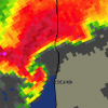
weatherbo Posted February 28, 2015 Share Posted February 28, 2015 Looks like a thin area of ice and even a small open area between me and the Keweenaw. With the track of the low this could provide some added moisture and upslope lift to the snow Tuesday/Tuenight. GFS seems to be hinting to that as well. Link to comment Share on other sites More sharing options...
smoof Posted February 28, 2015 Share Posted February 28, 2015 12z Crazy Uncle still much slower and not buying into the north solutions fwiw. Link to comment Share on other sites More sharing options...
dmc76 Posted February 28, 2015 Share Posted February 28, 2015 12z Crazy Uncle still much slower and not buying into the north solutions fwiw. Gotta love our crazy Uncle Louie. Link to comment Share on other sites More sharing options...
Stebo Posted February 28, 2015 Share Posted February 28, 2015 12z Crazy Uncle still much slower and not buying into the north solutions fwiw. Other models have been trending subtly South with this one, especially the Euro and gem. Although the GFS has slightly as well. Link to comment Share on other sites More sharing options...
Rainman Posted February 28, 2015 Share Posted February 28, 2015 #1) Where have you lived? and #2) Make sure you give your previous addresses to Powerball so he knows never to set foot in those places The cloudiest place would be the coast of the Pacific Northwest. Winters are a little cloudier than Detroit, but summer is basically overcast season. From my perspective, summer in Detroit might as well be Hawaii. Relentless sun all the time, almost every day, but I do realize that this is basically the cloud capital of the eastern U.S. It is just perspective & personal experience. People think I'm crazy. Point being, it's not like the sun isn't going to come out all summer long (which can't be said for a lot of places), so I'm in no hurry to end winter. If we're going to get a winter storm, I'd like it to be snow. When summer comes, rest assured, I'll be closing the shutters to keep that junk out of my house First glance at the 12z Canadian is much weaker with the surface low and mainly snow. No time to dig in further. Link to comment Share on other sites More sharing options...
Chitown Storm Posted February 28, 2015 Share Posted February 28, 2015 Getting this back on topic... 12z GFS brings the goods back to MSP after 6z scooted south. Could seriously use the moisture up this way. Good trends the last 2 days, other than the off-peak runs of the GFS. Not a monster storm at this point, but it would put down some much needed snow before spring. I say bring it. Link to comment Share on other sites More sharing options...
Hoosier Posted February 28, 2015 Share Posted February 28, 2015 In the morning afd, IWX alluded to what went on in northern IL last winter. Difference this time is that this event is much later in the season with a stronger sun angle, so not sure how easy it would be for continued ice accretion on surfaces with temps above freezing. I guess we'll find out. SECOND SYSTEM FOR MONDAY NIGHT AND TUESDAY STILL LOOKS ON TRACK. GFS STARTING TO BACK OFF ON PCPN ARRIVAL UNTIL TUESDAY. KEPT LOW TO MID CHANCE POPS GOING LATE MONDAY NIGHT. THIS LATER ARRIVAL WILL ACTUALLY ALLOW LOW TEMPS TO DROP MONDAY NIGHT INTO TEENS AND LOWER 20S. STILL EXPECT ACTUAL SFC TEMPS TO LAG WARMING ALOFT TUE GIVEN THE CURRENT ARCTIC AIR IN PLACE WITH DEEP AND FRESH SNOWPACK AND A FROZEN GROUND DOWN TO A DEPTH OF NEARLY A FOOT. THEREFORE PERIOD OF FREEZING PCPN TUESDAY MORNING STILL LOOKS POSSIBLE AT ONSET AND WILL KEEP THE MIXED TYPE IN FORECAST. ALSO A LITTLE CONCERN THAT DESPITE MEASURED 2M AIR TEMPS RISING ABOVE FREEZING...ACTUAL SFC TEMPS MAY REMAIN AT OR BELOW FREEZING A LITTLE LONGER DUE TO THE EXTREME COLD AND SNOW PACK. THIS IS SIMILAR TO AN EVENT LAST WINTER IN NORTHERN IL WHERE FREEZING RAIN CONTINUED ON SURFACES DESPITE AIR TEMPS IN THE MID TO UPPER 30S FOR SEVERAL HOURS. THIS IS RARE BUT HAS OCCURRED FOLLOWING PROLONGED EXTREME COLD EVENTS. SOMETHING TO KEEP IN MIND TUESDAY ESPECIALLY ACROSS OUR FAR NORTH AND NORTHEAST. Link to comment Share on other sites More sharing options...
TugHillMatt Posted February 28, 2015 Share Posted February 28, 2015 Pittsburgh might have Detroit beat in "cloudiness capital of the east". Canadian looks good for much of West Michigan. http://collaboration.cmc.ec.gc.ca/cmc/cmdn/pcpn_type/pcpn_type_gem_reg.html Link to comment Share on other sites More sharing options...
Gilbertfly Posted February 28, 2015 Share Posted February 28, 2015 Precip rate should play a decent roll also wrt to ZR....rates look high, which could cut down on accretion. The snowpack as it stands right now imby seems very dense and not really all that drippy despite the sun angle...which could give some more credence to low level frozen hanging on a bit.... Fwiw and imo Link to comment Share on other sites More sharing options...
Baum Posted February 28, 2015 Share Posted February 28, 2015 Precip rate should play a decent roll also wrt to ZR....rates look high, which could cut down on accretion. The snowpack as it stands right now imby seems very dense and not really all that drippy despite the sun angle...which could give some more credence to low level frozen hanging on a bit.... Fwiw and imo Still waiting for which model goes south and weaker Link to comment Share on other sites More sharing options...
RCNYILWX Posted February 28, 2015 Share Posted February 28, 2015 12z GEM is all snow roughly north of I-80 on Tuesday. Link to comment Share on other sites More sharing options...

Recommended Posts
Archived
This topic is now archived and is closed to further replies.