Jonger Posted February 25, 2015 Share Posted February 25, 2015 Looks like a badass storm for northern Michigan. Link to comment Share on other sites More sharing options...
OntarioChaser Posted February 25, 2015 Author Share Posted February 25, 2015 Back in business. Link to comment Share on other sites More sharing options...
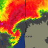
Brewers Posted February 25, 2015 Share Posted February 25, 2015 Pretty much sums things up right now. Link to comment Share on other sites More sharing options...
Baum Posted February 25, 2015 Share Posted February 25, 2015 I like a compromise. Link to comment Share on other sites More sharing options...
Chitown Storm Posted February 25, 2015 Share Posted February 25, 2015 I'd take the 995mb low over the QC....why not. The trough setup for early next week would suggest there is more room for a more northern hit here compared to this weekend. Ensembles are a hot mess though. Oy. Link to comment Share on other sites More sharing options...
Stebo Posted February 25, 2015 Share Posted February 25, 2015 Pretty much sums things up right now. Looks like a majority for the southern stream piece is there going through Ohio in some form with the northern stream piece near Thunder Bay. Of course the issue is these ensembles like the op runs have been shifting every 6 to 12 hours. Link to comment Share on other sites More sharing options...
wxman1952 Posted February 26, 2015 Share Posted February 26, 2015 Hoping for one good snowstorm yet then I'll be ready for spring. Other than one storm of 8", all we've seem to have all winder is 1-2" clippers. Link to comment Share on other sites More sharing options...
smoof Posted February 26, 2015 Share Posted February 26, 2015 Hoping for one good snowstorm yet then I'll be ready for spring. Other than one storm of 8", all we've seem to have all winder is 1-2" clippers. That's what I'm hoping for 30 miles NW of you, I haven't had a winter storm warning this season, it's been 7 years since my last double digit snowstorm, would love to get a big dog, enjoy the snowpack for a week, then go into spring lol. Link to comment Share on other sites More sharing options...
Rainman Posted February 26, 2015 Share Posted February 26, 2015 That's what I'm hoping for 30 miles NW of you, I haven't had a winter storm warning this season, it's been 7 years since my last double digit snowstorm, would love to get a big dog, enjoy the snowpack for a week, then go into spring lol. You missed out on Jan 5 2014? Impressive. Link to comment Share on other sites More sharing options...
smoof Posted February 26, 2015 Share Posted February 26, 2015 You missed out on Jan 5 2014? Impressive. Jan 3rd-4th I acually got 7.5" Cement while only under a winter weather advisory, was just a crazy local thing where I can catch cold dry air from Oscoda flowing to me with a slight elevation increase out of the saginaw valley. but that was my only big storm of the season, I got 4.5" pixie dust from the GHD2 storm. Link to comment Share on other sites More sharing options...
OntarioChaser Posted February 26, 2015 Author Share Posted February 26, 2015 GFS takes a step back, CMC takes a step forward. Thoughts? Link to comment Share on other sites More sharing options...
Powerball Posted February 26, 2015 Share Posted February 26, 2015 GFS takes a step back, CMC takes a step forward. Thoughts? Ho-hum. Do you have maps for the CMC? BTW, I think the temp for your location is wrong. Otherwise, we're really sleeping on some record-breaking warmth for late February, lol. Link to comment Share on other sites More sharing options...
cyclone77 Posted February 26, 2015 Share Posted February 26, 2015 Man there is a ton of energy coming in with this long-wave trough early next week. That combined with a strong northern vort in southern Canada could make for one hell of a storm for someone if this thing can phase properly. Someone could get dumped on big time with this thing. Link to comment Share on other sites More sharing options...
Powerball Posted February 26, 2015 Share Posted February 26, 2015 Man there is a ton of energy coming in with this long-wave trough early next week. That combined with a strong northern vort in southern Canada could make for one hell of a storm for someone if this thing can phase properly. Someone could get dumped on big time with this thing. Indeed. Link to comment Share on other sites More sharing options...
OntarioChaser Posted February 26, 2015 Author Share Posted February 26, 2015 http://www.tropicaltidbits.com/analysis/models/gem/2015022600/gem_mslp_pcpn_frzn_us_25.png Link to comment Share on other sites More sharing options...
cyclone77 Posted February 26, 2015 Share Posted February 26, 2015 FWIW the new UK has 998 over Dubuque IA at 144. Possibly could imply a good hit for the MSP crew. UK has been real good this winter, but this still may be a bit early for it to be setting into a solution. Link to comment Share on other sites More sharing options...
Hoosier Posted February 26, 2015 Share Posted February 26, 2015 850 mb temps of 10C here on the 00z ECMWF at 144 hours. I'd imagine a sig snow/mixed precip hit north of here. Link to comment Share on other sites More sharing options...
cyclone77 Posted February 26, 2015 Share Posted February 26, 2015 Euro has the 540 thickness line up to near LaCrosse at 138hrs. Looks like a decent hit from the southeast 1/3 of MN into central WI. Link to comment Share on other sites More sharing options...
Hoosier Posted February 26, 2015 Share Posted February 26, 2015 Depending how this system evolves, we may have to watch for an associated severe threat at least for the Ohio Valley. Link to comment Share on other sites More sharing options...
Thundersnow12 Posted February 26, 2015 Share Posted February 26, 2015 It's a big front end thumping for most of IA/northern IL/northern IN/WI/MI Link to comment Share on other sites More sharing options...
Thundersnow12 Posted February 26, 2015 Share Posted February 26, 2015 Euro has the 540 thickness line up to near LaCrosse at 138hrs. Looks like a decent hit from the southeast 1/3 of MN into central WI. This is a could case IMO where the 540 line will not be a good rain/snow line Link to comment Share on other sites More sharing options...
Stebo Posted February 26, 2015 Share Posted February 26, 2015 850 mb temps of 10C here on the 00z ECMWF at 144 hours. I'd imagine a sig snow/mixed precip hit north of here. Other than the front end hit, it is completely void of cold sector precip. Link to comment Share on other sites More sharing options...
Hoosier Posted February 26, 2015 Share Posted February 26, 2015 Other than the front end hit, it is completely void of cold sector precip. eek Oh well, plenty of time to go. Link to comment Share on other sites More sharing options...
Minnesota Meso Posted February 26, 2015 Share Posted February 26, 2015 FWIW the new UK has 998 over Dubuque IA at 144. Possibly could imply a good hit for the MSP crew. UK has been real good this winter, but this still may be a bit early for it to be setting into a solution. I think this is the right solution, the 02/26 0z run of the Euro just misses the connection of the 500mb to 700mb moisture transport coming off the Eastern Pacific with the 850mb transport off the western gulf. With the 998 over eastern IA I'm amusing the UKMET makes the connection. Although this may be a RST to EAU special. Link to comment Share on other sites More sharing options...
Brewers Posted February 26, 2015 Share Posted February 26, 2015 Well the Euro ensembles look much improved this morning with a mean low position near Southern Lake Michigan. Link to comment Share on other sites More sharing options...
blizzardof96 Posted February 26, 2015 Share Posted February 26, 2015 Euro has 4-5" of snow and then ~0.2" of ZR for the GTA. Link to comment Share on other sites More sharing options...
Powerball Posted February 26, 2015 Share Posted February 26, 2015 Other than the front end hit, it is completely void of cold sector precip.Verbatim, the EURO is mostly snow/ice here...Another thing to bear in mind is that the fresh deep snowpack from the initial overrunning event could help the cause for more snow/ice than models are showing now (thanks to low level CAD). Link to comment Share on other sites More sharing options...
Northern_IN_Wx Posted February 26, 2015 Share Posted February 26, 2015 10 inch frost depth at the office...here comes the flood. Link to comment Share on other sites More sharing options...
Thundersnow12 Posted February 26, 2015 Share Posted February 26, 2015 Fairly interesting 12z GEM evolution, front end thumping and then a new sfc low tries to take over in srn IL running north of the Ohio River Link to comment Share on other sites More sharing options...
weatherbo Posted February 26, 2015 Share Posted February 26, 2015 10 inch frost depth at the office...here comes the flood. I remember when I lived there, every Spring the lakes would flood. especially that area near the rr tracks at Pike Lake. Def a downside to not having consistent deep snow. I wonder what the frost depth is here considering there's been 2'+ of snow since Nov 11th? Link to comment Share on other sites More sharing options...

Recommended Posts
Archived
This topic is now archived and is closed to further replies.