poolz1
-
Posts
2,764 -
Joined
-
Last visited
Content Type
Profiles
Blogs
Forums
American Weather
Media Demo
Store
Gallery
Everything posted by poolz1
-
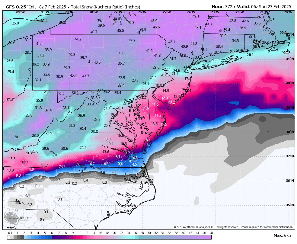
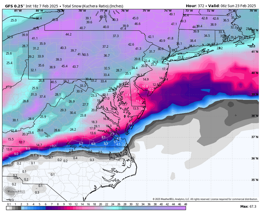
23/16 wishing I was 29/20 1-3 seems realistic here. 2-4 if wave 2 gives a thump.
-
That high N of VT/NH isn't just sliding east like our typical ice-->rain scenario. Not that it is in a great spot but not bad for keeping CAD entrenched.
-
RGEM with 2-4 with that second wave. Agreed, we need that to juice up if we want a shot at 2-4. Euro tried at it.
-
Grain of salt no doubt. But 2 LR GFS op runs the past 24hrs that spit out sick amounts of snow. Just indicative of the high ceiling of potential in the pattern.
-
Alrighty then...
-
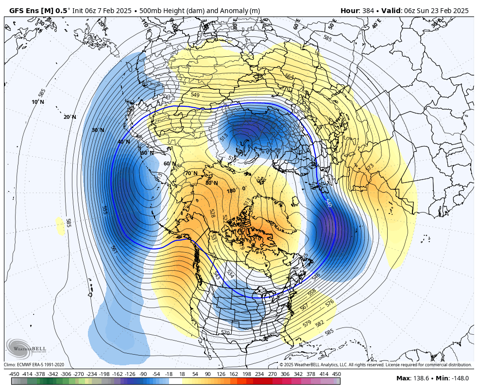
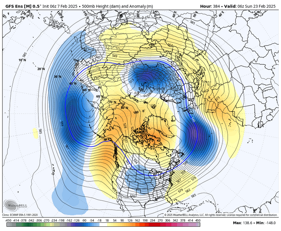
6Z GEFS moved toward the CMC ens look posted above. Vey nice PAC pattern with everything else looking ripe as well.
-
Sleet/Rain mix. 33/24
-
Im ok with the EPO being neutral to slightly neg on average. Don't get me wrong, the Jan pattern was fun but cold and dry was the main feature and was due to the massive +PNA/-EPO ridge. Even a few days ago the ops were hinting at another return of the avocado due to the impressive -EPO. I do get the lowlands wanting that massive push of cold to set the stage but we are later in the season and a -AO/NAO combo should be all we need. Maybe higher risks of rain/ice but def higher reward potential imo.
-
Hit -7.0 just before sunrise. Confirmed by a station about 2 miles away which is at -6.3 and truck therm read -6 when I left the house at 630 this morning.
-
-3 for the low. -2.7 currently. Freeze your nose hair weather! Love it.
-
Radiating nicely. 6/0
-
1/16 - .5" 1/19 - 4.75" Season Total - 12"
-
1/19 - The Roulette Wheel 29 Black Storm - OBS
poolz1 replied to DDweatherman's topic in Mid Atlantic
Looks like 2"+ so far. -
1/19 - The Roulette Wheel 29 Black Storm - OBS
poolz1 replied to DDweatherman's topic in Mid Atlantic
Looks.lile.mod snow at home on the cam. Starting to accumulate finally. 33/30 -
1/19 - The Roulette Wheel 29 Black Storm - OBS
poolz1 replied to DDweatherman's topic in Mid Atlantic
Riding this one out just east of Harrisburg. At Spooky Nook for my daughters volleyball tournament. Steady light snow here. Homestead obs...Steady light snow 34/31 -
Surprised to find just under .5" when I got home. Looking at radar a solid .5" + seems likely. 26/23
-
12/15 - .75" 1/6 - 4.5" 1/10 - 1.5" Season Total - 6.75"
-
1.5 snow .11 liquid
-
Mod snow. Dusting so far. 26/16
-
12z GFS is a just a little chilly. Amazing how stable the Ak ridge is even on the op run. We may run the entire month of Jan without a real relaxation to the cold if that look holds.
-
12/15 - .75" 1/6 - 4.5" Season Total - 5.25"
-
4.5" snow. Melted down to .45" liquid. Exactly 10:1. My guess is the WAA snow was slightly less than 10:1 and the last 1.25" of snow was probably 12-15:1. Lots of fine flakes with the WAA.
-
First hvy snow of the event! 3.75" so far. 25/23
-
We typically have some type of high pressure to our north during these WAA thumps. Whether its sliding east or just a weak GL high. I wonder if the lack of the typical banding we'd expect was due to this?
-
Fine flakes just starting. 27/13