poolz1
-
Posts
2,764 -
Joined
-
Last visited
Content Type
Profiles
Blogs
Forums
American Weather
Media Demo
Store
Gallery
Everything posted by poolz1
-
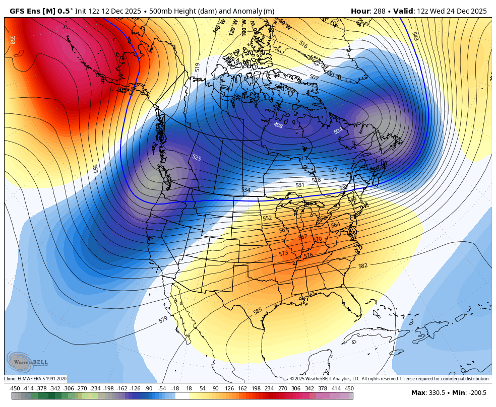
Couldn't stay awake for the runs last night either. Needed a good night's sleep. Hopefully, we have seen the constant jumps north come to and end after the 6z gfs. The first run I have seen that actually had a slight bump south. Unless I am missing anything. Too many posts to sift through! Hoping the euro at least holds.
-
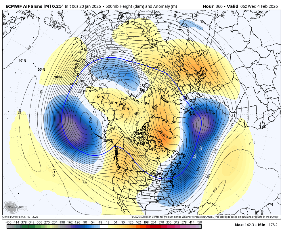
Nice to get a storm at the beginning of the pattern. All ens looking very Nino-like at the end of their runs. 6z AIFS as an example. May be a heater on the way!

-
Euro has snow breaking out mid morning Saturday with temps in the single digits.
-
Both Ai 12z runs bring the Baja low out for the 25th event. Both buried that low just like the GFS, at least in the last 4 runs. Another good medium range test for both of them.
-
Plenty to focus on in the medium range but hopefully we have this to look forward to as well.
-
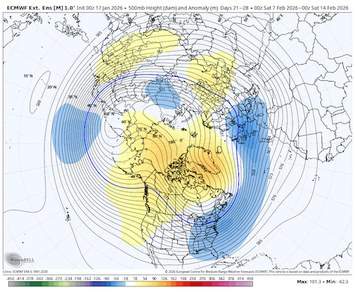
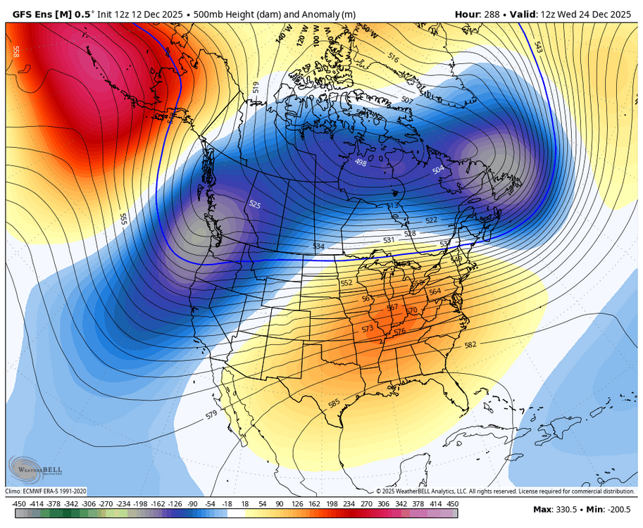
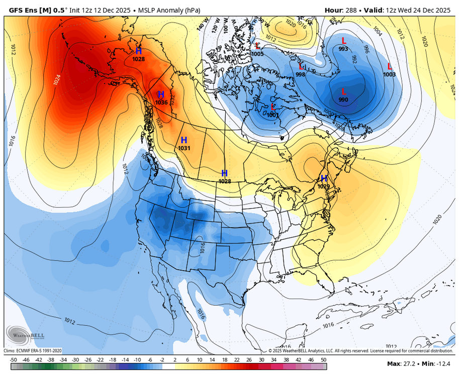
Just looking way out there, we may see a repeat of the upcoming 2 weeks reload and repeat the 2nd and 3rd week in February. With the first week in feb being a brief relax. You can already see the Pac ull start to pull back at the end of the EPS. Looks like the ridge is about to spike again out west. Follows the weeklies evolution. All while the Atlantic remains favorable. Maybe we see a Nina start to the winter and a Nino ending.
-
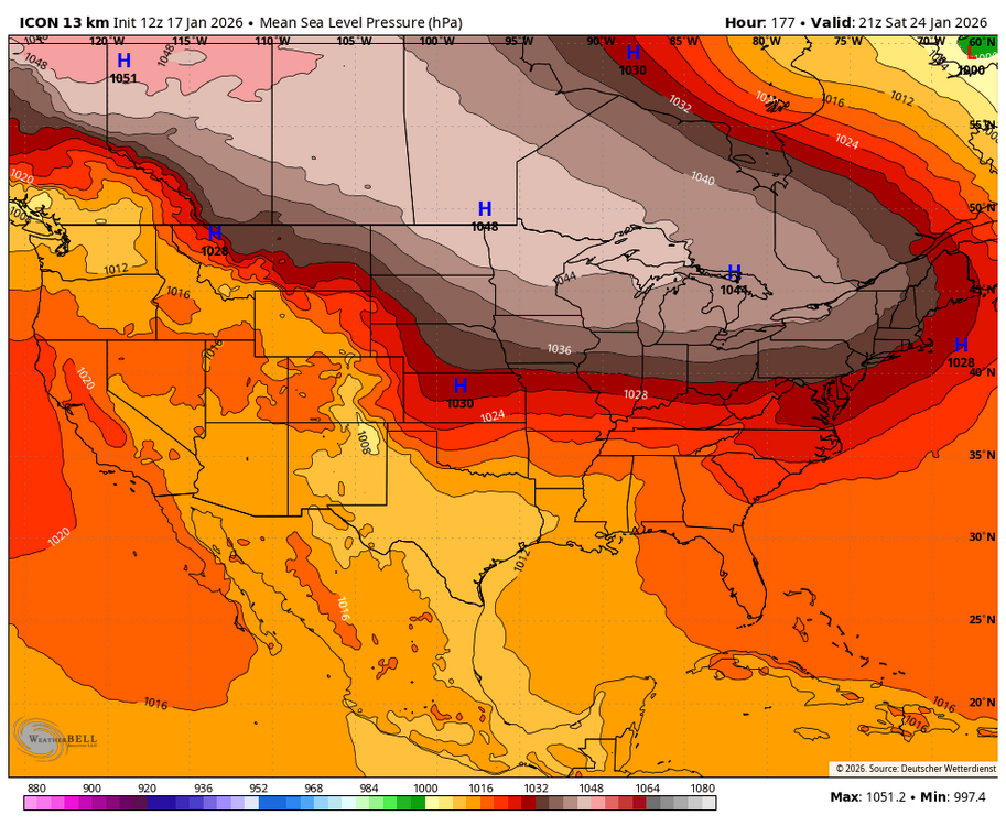
ICON looked poised to deliver some cold smoke. That is one heck of an arctic HP. Just need something with a little pep to attack.
-
Same thing down this way. Quick dusting under light greens. The radar blossoms and under dark green/yellows the snow stops. Not a flake since. Oddest thing.
-
I remember being around 12 years old and being upset because I just assumed I would be growing out of this odd obsession with snow. I loved it so much and thought it was just a childhood thing. I remember creeping down the hallway at night to the laundry room so I could flip on the flood lights and see if it was snowing. I had a 4x8 map of the Atlantic on my wall where I would track tropical systems with dry erase markers. Now at 48 years old I am still up at all hours to watch the snowfall. Little did I know that the obsession would just continue to grow. Gardening is another hobby/obsession of mine. I would bet that most in here love hobbies or have interests that can really never be perfected. There is always something new to learn, always something that throws a wrench in the works but that 18" of cold powder or that bountiful harvest makes it worth it. I am thankful for this forum and the continued education I receive in here from all of the red taggers and other knowledgeable folks. Too many to mention and would probably leave someone out. This is a great place to feed my addiction and I appreciate it!
- 67 replies
-
- 12
-

-
Been watching it regularly also. That band just seemed to jump to the north. Looks like you can see the dark clouds from that band on the 1st cam feed. I've caught many salmon around that bridge. Cool little town especially if you like fishing/hunting.
-
Little bit of light sleet falling. 31/18
-
The end of the 6z gefs looks like it is a day or 2 from that JMA look. EPS also. GEFS
-
Got it! Thank you. But what the hell is the white color? Not even on the scale. lol. I'm just bored, it doesn't really matter. Ready to track something other than the weeklies.
-
I see no scale on the euro site, unless i am missing something? I mean, WB is to the 10th of a degree scale. To me, the Euro site is just much more broad scale. Which is probably better when analyzing a mean temp at range but Wb is probably more accurate if you want to dig into the weeds of a 30 day mean.
-
Like you said, grasping a little here but the Euro and the GFS have the same ULL entering Cali and trying to make its way across under the ridge. I actually thought the 6z GFS was going to do something with it but the ridge just gets bullied east and squashes it.

-
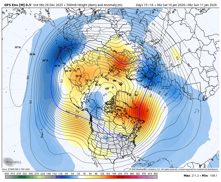
The end of the 06z GFS run is how I would hope to see things evolve and seems like a realistic evolution. Not every detail of course. Significant GL block develops, it takes several cutters and NS systems to feed the developing 50/50ish low. Eventually, the vortex trapped under the GL block becomes the dominant low compared to the one in the GOA/west coast. I don't see the GOA low vanishing but with ebbs and flows we get PNA spikes of varying degrees.
-
Low of 11 and currently 12.
-
Not enough to coat but a nice mod snow for a few minutes. Blustery, roof blizzards and sideways snow squalls. I like days like today. Looks like a few more coming from the NW. 20/9
-
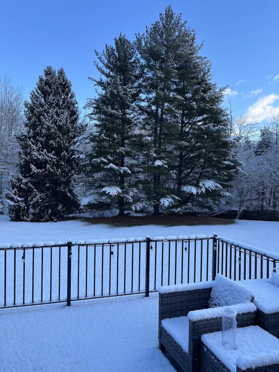
2.25" 23/15 Beautiful winter morning.
-
.25" or so. Mod snow. 33/29
-
Exactly my thoughts. Getting a system to take a track south of us may be asking a lot but any HP to the north should be a legit airmass.
-
With such a narrow "win" zone it is going to be tough to please everyone. I'll hug the 18z euro because it is the best run for NW zones so far. Not going to jack out this way, just trying to get in on the action and have if look like winter.
-
The temp crash during the day Sunday on the euro is pretty impressive. FDK is 32 at 4am and 18 at 1pm with a gusty NW wind.
-
First single digit temp of the season. Currently 9.6/5 wish we had some snow cover up this way.
-
I just got to work in Frederick after getting on 340 there by the bridge to Harpers Ferry. One of the worse drives I have had in a while. Bet I saw a dozen accidents.