
1234snow
-
Posts
1,819 -
Joined
-
Last visited
Content Type
Profiles
Blogs
Forums
American Weather
Media Demo
Store
Gallery
Everything posted by 1234snow
-
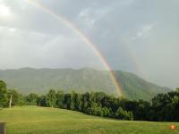
Some flurries in Kingsport!
-

Summer-Fall 2024 Weather Disco Med/Long Range
1234snow replied to John1122's topic in Tennessee Valley
I guess the 18z GFS woke me up from my “fall” hibernation [emoji23]- 688 replies
-
- 6
-

-

-

-
- heat
- thunderstorms
- (and 7 more)
-
Summer-Fall 2024 Weather Disco Med/Long Range
1234snow replied to John1122's topic in Tennessee Valley
My 100 year old Oak tree completely uprooted today. Unfortunately it went on the neighbors house. Thankfully they are okay.- 688 replies
-
- 5
-
-

-
- heat
- thunderstorms
- (and 7 more)
-
Summer-Fall 2024 Weather Disco Med/Long Range
1234snow replied to John1122's topic in Tennessee Valley
Still don’t have power. I came to Bristol to watch the VT game- 688 replies
-
- 1
-
-
- heat
- thunderstorms
- (and 7 more)
-
Summer-Fall 2024 Weather Disco Med/Long Range
1234snow replied to John1122's topic in Tennessee Valley
Tuesday had heavy rains as well in Scott County from the tornado warned storm that hit Kyle’s Ford. Just all around a perfect storm and generational storm.- 688 replies
-
- 3
-
-
- heat
- thunderstorms
- (and 7 more)
-
Radar velocities are still increasing.
-
Summer-Fall 2024 Weather Disco Med/Long Range
1234snow replied to John1122's topic in Tennessee Valley
I’m really curious of the wind aspect for all of us. I surely hope the model projections are too high. This is just an extremely rare situation with flooding rains for 2 days, full leaves, and then the potential for 50-60+mph gusts. I wonder how the typical mountain wave locations will fair. @Math/Met ?- 688 replies
-
- 3
-
-
- heat
- thunderstorms
- (and 7 more)
-
Summer-Fall 2024 Weather Disco Med/Long Range
1234snow replied to John1122's topic in Tennessee Valley
Several counties in NE TN are under a flash flood warning currently until 10 pm. The firehose doesn’t seem to end soon.- 688 replies
-
- 1
-
-
- heat
- thunderstorms
- (and 7 more)
-
Yeah I went for a little run but kept close to my car. I’m glad I did because the lightning got intense fast.
-
Summer-Fall 2024 Weather Disco Med/Long Range
1234snow replied to John1122's topic in Tennessee Valley
0z HRRR: The hurricane at hour 48 was just across the state line in Georgia.- 688 replies
-
- 2
-
-
- heat
- thunderstorms
- (and 7 more)
-
This is now a confirmed tornado
-
Tornado warned storm with a nice hook on radar just went over Sneedville
-
Decent spin just west of Jamaica. I’m assuming just the MLC is there or does it appear that a LLC is forming in that area?
-
Summer-Fall 2024 Weather Disco Med/Long Range
1234snow replied to John1122's topic in Tennessee Valley
KTRI got to 95 today which broke the record of 94- 688 replies
-
- 1
-
-
- heat
- thunderstorms
- (and 7 more)
-
Summer-Fall 2024 Weather Disco Med/Long Range
1234snow replied to John1122's topic in Tennessee Valley
You certainly called that scenario happening. It was the highest heat index since 1996 I believe Dave Dierks said last night.- 688 replies
-
- 2
-
-
- heat
- thunderstorms
- (and 7 more)
-
Summer-Fall 2024 Weather Disco Med/Long Range
1234snow replied to John1122's topic in Tennessee Valley
KTRI tied the record at 96 today which beat Knoxville and Chattanooga by 1.- 688 replies
-
- 2
-
-
- heat
- thunderstorms
- (and 7 more)
-
Summer-Fall 2024 Weather Disco Med/Long Range
1234snow replied to John1122's topic in Tennessee Valley
93 at KTRI today. Next 2-3 days will be just as hot if not approaching 94-95.- 688 replies
-
- 1
-
-
- heat
- thunderstorms
- (and 7 more)
-
Tornado warned cell heading toward Morristown.
-
First tornado warning of the day for Clay, Jackson and Overton counties.
-
Not a Tennessee Valley Observation but I have found myself at Eldora Speedway in Ohio to watch the eclipse. Mostly sunny currently with some high cirrus clouds. Fingers crossed that it stays that way.
-
There was a big bolt of lightning earlier in Kingsport.
-
Some lightning tonight. [emoji102]
-
Has anyone looked any individual members of the 18z GEFS? The mean really upticked in precip.
- 750 replies
-
- 4
-
-
- snow elk
- wooly worm
- (and 1 more)
-
It was 69 today in Kingsport. Got back home and it was 61 degrees with some snow cover hanging on. Today finally put a big dent in the snow. I probably had 3 inches of snow depth last night.