Jump to content

1234snow

Members
  • Posts

    1,725
  • Joined

  • Last visited

Everything posted by 1234snow
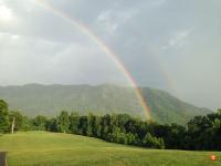
  1. It was a major shift from the 0z CMC where on that run it dumped the trough out west at the end of the run.
  2. Received a nice dusting around 30 minutes ago.
  3. According to the warning a large and dangerous tornado was in Sharon, TN moving northeast toward Dresden, TN
  4. Is that the LLC going over the western tip of Cuba or the MLC?
  5. WJHL was showing a CC drop but very hard to tell if I was an accurate reading. Please be safe in the Kingsport area especially on south side of town.
  6. There it is: Tornado warning for Hawkins, Sullivan, Washington and Greene. Rotation just north of Fall Branch currently.
  7. It is pouring down hard here. The storm just east of the tornado warning looks like it is developing a little hook to me. Heading close to Colonial Heights.
  8. Tornado warning now for Hawkins County. Radar indicated.
  9. 7 severe thunderstorm warnings across East Tennessee at the moment.
  10. You can click on the timestamp on the bottom right and it brings up a calendar where you go chose the date and time. Pretty cool.
  11. https://www.spc.noaa.gov/exper/mesoanalysis/new/viewsector.php?sector=17
  12. Some #’s from the SPC meso page for East TN Super cell composite up to 16 Bulk wind shear effective up to 50kts CAPE - 2500 to 3500 Helocity 100-200 depending on which layer you look at Sig Tor is up to 3
  13. That storm over John will have to be watched closely as it moves eastward. Already pretty meaty.
  14. Looks like a few dry days because the northwest flow kicks back in at the end of the week.
  15. That pocket of storms popped up right over you and would not move east at all.
  16. 467 ACUS11 KWNS 251531 SWOMCD SPC MCD 251530 TNZ000-NCZ000-VAZ000-KYZ000-251730- Mesoscale Discussion 1251 NWS Storm Prediction Center Norman OK 1030 AM CDT Sun Jun 25 2023 Areas affected...Portions of far southern KY...middle/eastern TN...western NC...and extreme southwestern VA Concerning...Severe potential...Watch possible Valid 251530Z - 251730Z Probability of Watch Issuance...40 percent SUMMARY...The threat for scattered damaging winds may gradually increase over the next couple of hours. Watch issuance is possible. DISCUSSION...A small cluster of convection is ongoing late this morning across parts of south-central KY into middle TN. This activity is loosely tied to thunderstorms that occurred overnight and early this morning across the Upper Midwest. Well-below-severe wind gusts have been observed at various ASOS and KY Mesonet sites over the past hour or so, suggesting that the stronger velocities noted on area radars are not yet reaching the surface. The 12Z observed sounding from BNA shows a rich low-level airmass already in place across middle TN, with mid 60s surface dewpoints and 14 g/kg mean mixing ratio. A similar boundary-layer moisture profile will also exist across eastern TN and vicinity, downstream of the ongoing thunderstorms. As daytime heating warms surface temperatures into the 80s across this area over the next couple of hours, destabilization and erosion of lingering MLCIN should quickly occur. MLCAPE exceeding 1000-1500 J/kg seems increasingly likely by 17Z, and convection may become surface based by early afternoon. Although details regarding convective evolution remain uncertain, there appears to be some potential for ongoing thunderstorms to consolidate into a loosely organized cluster while spreading east-southeastward across eastern TN and vicinity this afternoon. A veering boundary-layer wind profile observed on recent KOHX VWPs, and westerly winds strengthening with height through mid levels, will foster around 25-35 kt of deep-layer shear, aiding in some convective organization. Steepening low-level lapse rates ahead of the possible cluster should allow for a more efficient transfer of strong/gusty winds with downdrafts to the surface with time. Scattered damaging winds may become an increasing concern through the early afternoon, and isolated severe hail may occur with any supercell that can form/persist on the southwest flank of the cluster. While not immediately likely, observational trends will be monitored for possible watch issuance by early afternoon. ..Gleason/Grams.. 06/25/2023 ...Please see www.spc.noaa.gov for graphic product... ATTN...WFO...GSP...MRX...JKL...LMK...OHX... LAT...LON 35038500 35188572 35738629 36348604 36858546 36968483 36888375 36718292 36468239 36178215 35778226 35458252 35168292 34998370 35038500
  17. The current line in Kentucky may make it to the Valley/Knoxville area after lunch if it holds together.
  18. Alot of days this month we have struggled to make it to 80. May not make it to 80 in many places this week. Hopefully much needed rains this week and not flooding for some spots. Knoxville area has had 3-5” of rain today estimated .
  19. Tornado warning for Lee, Wise and Scott with some rotation over Pennington Gap.
  20. Tornado warning now for Bland and Tazewell counties in Virginia.
×
×
  • Create New...