LongBeachSurfFreak
-
Posts
9,479 -
Joined
-
Last visited
Content Type
Profiles
Blogs
Forums
American Weather
Media Demo
Store
Gallery
Everything posted by LongBeachSurfFreak
-
 Check out Rhode Island right now. That’s a serious slug of moisture.
 -
Here’s carol

-
Those big decaying former MDR majors are always disappointing up here. Their circulations are so large that they entrain a ton of dry air by the time they arrive. Gloria being a great example. What you want is either rapid speed, 1938 or a home grown storm like Bob 91 or carol 54.
-
Another crazy convection flair up in the same location.
-
That’s my theory. This time of year there is a huge temperature difference at the north wall of the Gulf Stream. From 80 degree water to 50s in a matter of miles. And the convection seems to fire just to the north west of the north wall.
-
Pretty amazing that it has such a similar look on the radar from the last event. Maybe 30 miles west. Almost like atmospheric recall.
-
Flagstaff is a great spot. Super high though, like altitude sickness high.
-
The rain should make you’re allergies temporarily better as it knocks the pollen out of the air. Maybe you have some mold issues too?
-
Yeah I’m in West Hempstead at my gf place and it just got really dark. If we end up with any very heavy rain I’ll have to head home to monitor the basement. We had 7’ of water in it during the heavy rains August 23 when we had 10”. My landlord blamed my veggie garden for the flooding! So I have a channel cut through it now that drains out to the street. I graded the ground perfectly so I’m waiting to see how it handles some really heavy rain.
-
Yeah that’s what I was thinking. Norwalk is low elevation right near the coast. Norfolk the opposite.
-
20” at Norwalk seems highly sus.
-
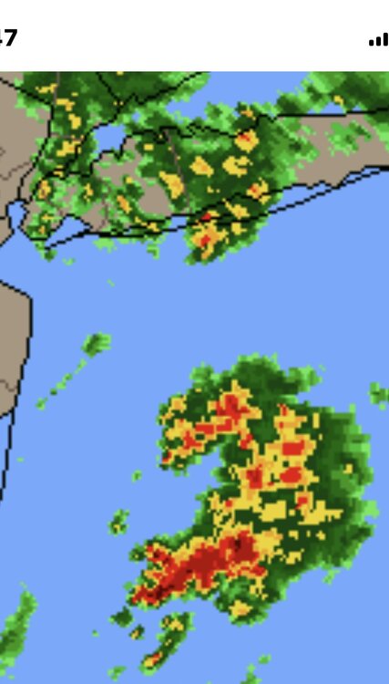
Yeah I could see the east end getting crushed again while further west gets slotted. We had that super persistent area of convection off the Jersey Shore with the last event too. Must be some sort of feedback with a Gulf Stream eddy.
-
Surprised to see a flood watch for the island. There are some discrete cells off the jersey shore, that could consolidate as they head north.
-
Perfect weather on the south shore. Deep blue sky and temps around 70.
-
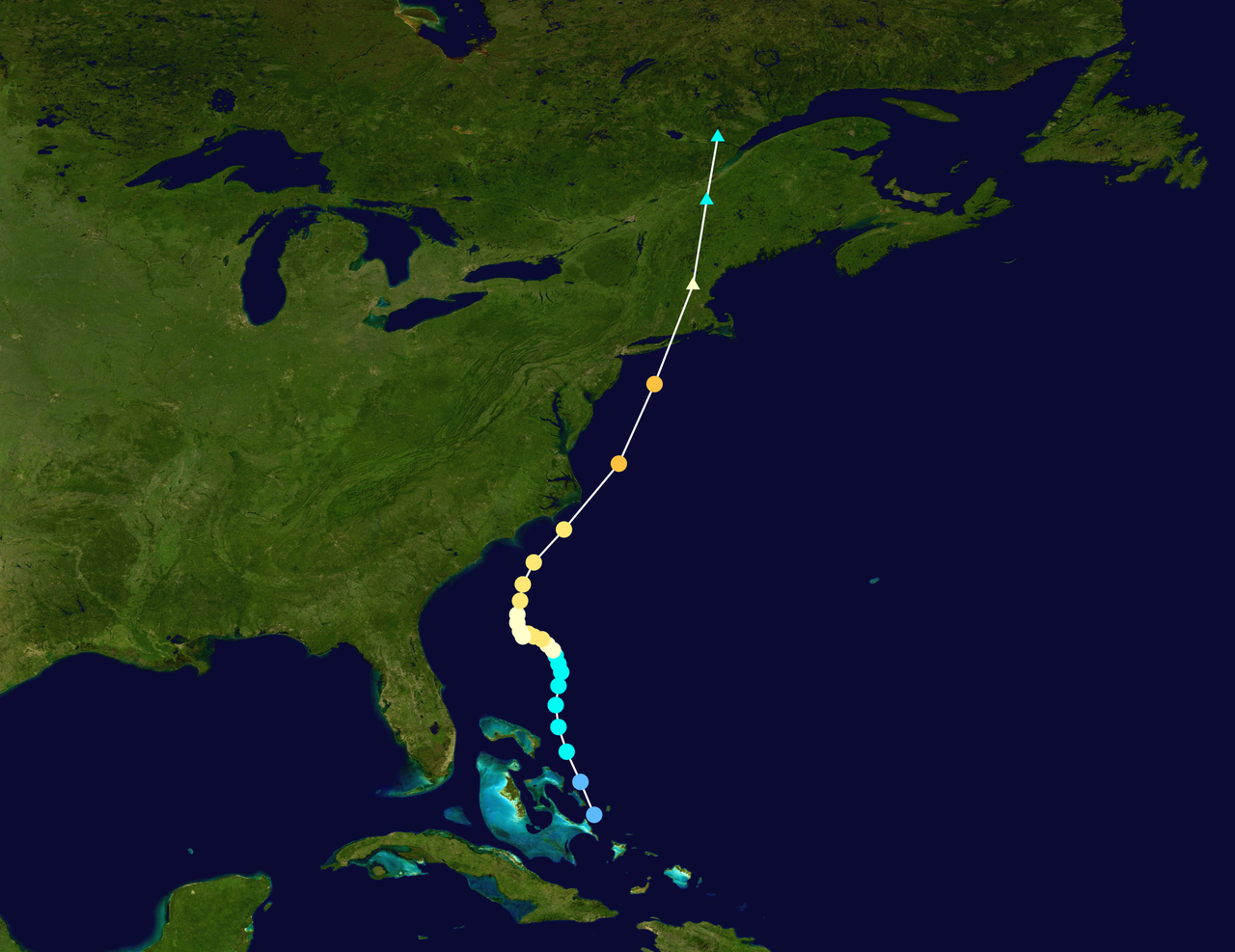
2025 Atlantic Hurricane Season
LongBeachSurfFreak replied to BarryStantonGBP's topic in Tropical Headquarters
I’m super biased because I’m an east coast surfer and we get our best waves as a result of tropical activity. But I think your right. The peak of last season illustrates that perfectly. Water temps will likely support another hyperactive season, but it’s one piece of the puzzle. Let’s see where ITCZ sets up as we head into June. -
The roller coaster precipitation pattern. Either excessive rainfall or complete lack of. As the jet tends toward stagnant configurations. Fits the climate change forecasts and should only intensify.
-
I fully agree in the short term. When we cross the 2c threshold and the negative consequences become so glaringly obvious there will be across the board support for change. When sea level rises another 3 feet you start inundating extremely valuable coastal land. When summer temps are so high in the worlds bread baskets that cereal crops can no longer grow. That’s when the general populace has to wake up. When the destruction of wealth leds the charge. Capitalism is highly flawed in regards to long term greater good tendency. As we currently have the knowledge and tech to prevent most of this from happening.
-
It was remarkably dark before here in SW Nassua but has since really lightened up. Missed the rain to the east. Most likely the dry zone today as the convection to the west will have trouble making it into the marine layer.
-
Strange how that area of convection off the jersey shore keeps firing over and over in the same area. It doesn’t seem to move north with the flow either. Must have to do with the Gulf Stream
-
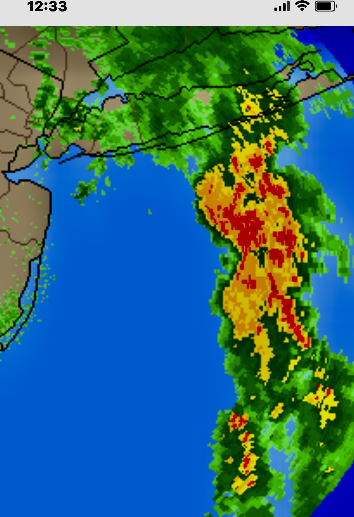
Another moisture plume showing up off the Jersey shore. Looks headed toward western LI this time. Anyone have a map with all the local rain totals for last night? Curious what the east end saw last night other then the AOS and meso stations
-
Right now worst of it looks to be east towards KFOK. Almost has a similar look to the plume from the infamous Islip floods. Though that was a higher dew, higher moisture and higher rates event due to the warmer water temps later in the season.
-
Ummmmm what in the actual F is that on radar south of central Suffolk! It’s obviously a major moisture plume, but wow, if that holds together there will be major flooding out there overnight!!!!
-
Steady moderate rain again in SW Nassua, rare for this to be the jackpot area. But it seems to just want to train here today. I’ll take it, my veggies are pretty stoked.
-
This is a stretch for this particular topic but this is the climate change thread. Personally I’m now hopeful fusion will solve the CO2 crisis. The only thing stopping us from removing CO2 back down to pre industrial levels is a lack of energy. CO2 removal (pumping into the ground being the most effective method) requires a ridiculous amount of energy. With fusion tech and the resulting near limitless energy it’s entirely feasible. AI will likely fast track fusion viability. So a glimmer of light at the end of the tunnel.