MN Transplant
-
Posts
17,845 -
Joined
-
Last visited
Content Type
Profiles
Blogs
Forums
American Weather
Media Demo
Store
Gallery
Everything posted by MN Transplant
-
It is in a river
-
Late February will be rocking. February Long range Discussion thread
MN Transplant replied to Ji's topic in Mid Atlantic
The cold in the northern plains in 1996 rivaled or surpassed 1994. In the days of the old wind chill charts we were in the -60 to -80 range. Just obscene -20 for a high stuff. https://www.weather.gov/arx/cold_feb96 -
It isn't fun weather, but we aren't talking enough about how windy/cold Friday is going to be. A slightly less crappy version of December 23rd.
-
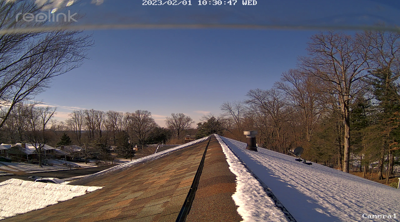
2/1 - 0.5"
-
Sun angle szn

-
Stay safe Jebman
-
Jan 31 - Feb 1 Snow/Sleet/Misery Obs & Disco
MN Transplant replied to NorthArlington101's topic in Mid Atlantic
0.5” -
Jan 31 - Feb 1 Snow/Sleet/Misery Obs & Disco
MN Transplant replied to NorthArlington101's topic in Mid Atlantic
Sticking nicely to the vegetation. Will be a pretty sight in the morning.
- 546 replies
-
- 11
-

-
Jan 31 - Feb 1 Snow/Sleet/Misery Obs & Disco
MN Transplant replied to NorthArlington101's topic in Mid Atlantic
Will be interesting to see what DCA records. This is usually a bad setup for them with temps still at 34, but nighttime helps. I think we get on the board, taking the shutout off the table. -
Jan 31 - Feb 1 Snow/Sleet/Misery Obs & Disco
MN Transplant replied to NorthArlington101's topic in Mid Atlantic
My pup’s first snow. 31.5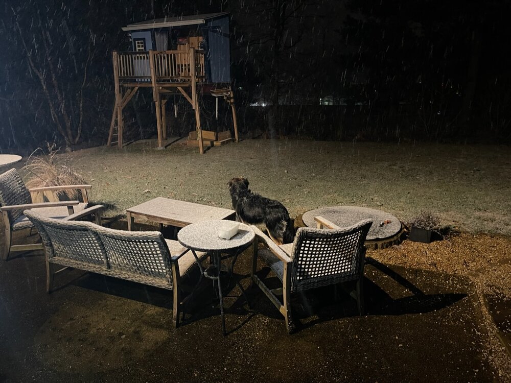
-
Jan 31 - Feb 1 Snow/Sleet/Misery Obs & Disco
MN Transplant replied to NorthArlington101's topic in Mid Atlantic
33.3 in Falls Church. Pleased with the temps. -
The simple answer is that the Apps both help us and hurt us for ice storms. We tend to get smaller events due to cold-air damming, but unless there is a really significant cold air outbreak (see 1994), we don't get that clash of straight-from-Canada cold and return moisture from the Gulf.
-
IAD will get the warmest January on record. BWI is battling it out for 3rd.
-
The Seasonal Snowfall Futility Markers
MN Transplant replied to North Balti Zen's topic in Mid Atlantic
'97/'98 is interesting. BWI recorded snowfall in Dec, Jan and Mar for a 3.2" total. IAD had snow in Dec, Jan, Feb for 5.9". And yet, DCA ends up with 0.1" of pity snowfall in December. -
Casual +13 on the high
-
DCA looks like it is locked into the 3rd warmest January on record. BWI will likely be top-5. IAD will be battling with 2006 for the top spot over the next few days.
-
January/February Mid/Long Range Disco IV: A New Hope
MN Transplant replied to stormtracker's topic in Mid Atlantic
Good trend on temps vs 00z and 06z for Tuesday. 06z had dewpoints at 35 during the event. 12z has them in the upper 20s. Edit - snow depth map is a 0.5"-1" event -
Mix of sleet and rain. 37.6
-
The Timberline ski cam looks good. 37.4 here.
-
My parents keep sending pics of the snow from back home in Minnesota. They've had a really nice year. That gradient between Minneapolis and Milwaukee/Chicago is something.
-
So, in the wake of that low and front, we have a +6 yesterday and at least a +4 today. +8.1 January. Really good shot at a top-5 warmest January. 1 and 2 look out of reach.
-
Month and 2023 so far.
-
DCA: +8.8 IAD: +9.7 BWI: +11.0
-
The Seasonal Snowfall Futility Markers
MN Transplant replied to North Balti Zen's topic in Mid Atlantic
+9 to 11 -
2023 Mid-Atlantic Garden, Lawn, and Other Green Stuff Thread
MN Transplant replied to mattie g's topic in Mid Atlantic
First open crocus sighting