MN Transplant
-
Posts
17,845 -
Joined
-
Last visited
Content Type
Profiles
Blogs
Forums
American Weather
Media Demo
Store
Gallery
Everything posted by MN Transplant
-
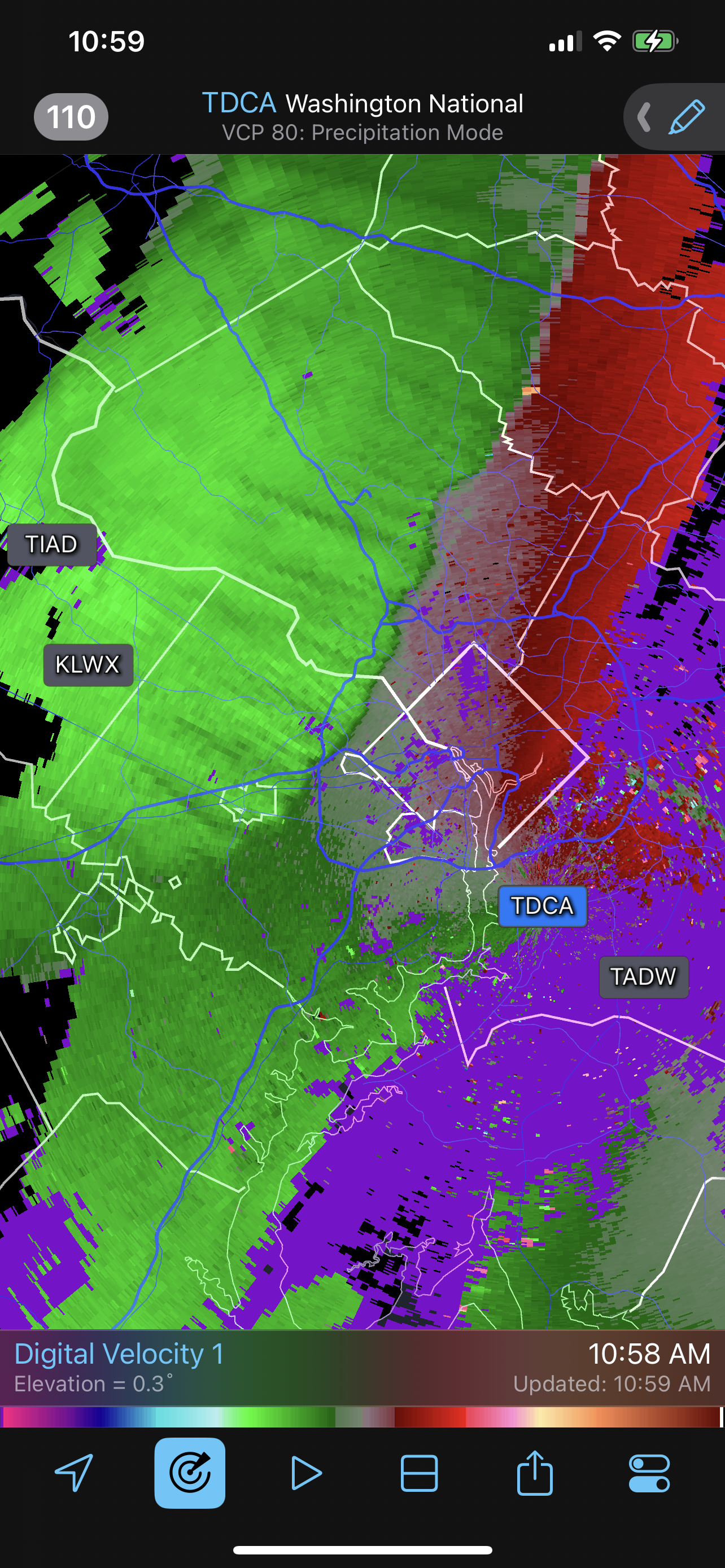
The front is now well defined on radar. Should be through Frederick/Leesburg now.
-
Looks like the front is still back in the mountains. Deep Creek area has flipped to NW winds.
-
Late February will be rocking. February Long range Discussion thread
MN Transplant replied to Ji's topic in Mid Atlantic
Not that I want California to burn down, but I have appreciated the ridge west/trough east summers lately. I’m not looking forward to the next time we have a summer 2010-2012 pattern. -
Highs: +21 at DCA +24 at IAD/BWI
-
Tickling 70 at IAD
-
Late February will be rocking. February Long range Discussion thread
MN Transplant replied to Ji's topic in Mid Atlantic
Euro looking ok for next Wednesday -
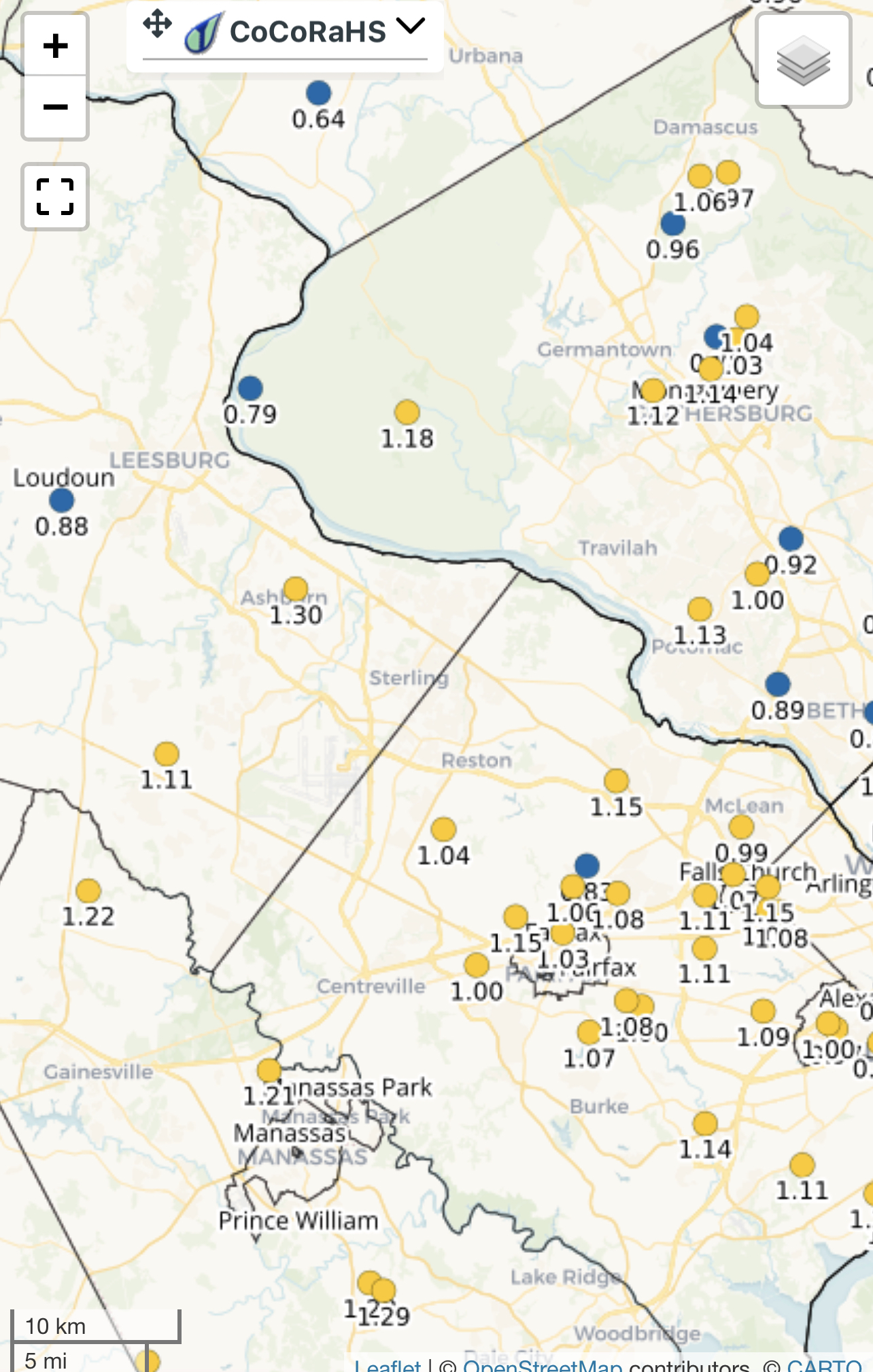
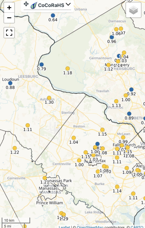
Yeah, that says 2.04” at my house vs 1.11” actual.
-
Terp, manual gauge or not? 2”+ would be a big outlier
-
It looks like a damn snowstorm loop. So frustrating.
-
0.77” and still coming down. Wet models win this round.
-
35.2 and rain. Just the worst.
-
2023 Mid-Atlantic Garden, Lawn, and Other Green Stuff Thread
MN Transplant replied to mattie g's topic in Mid Atlantic
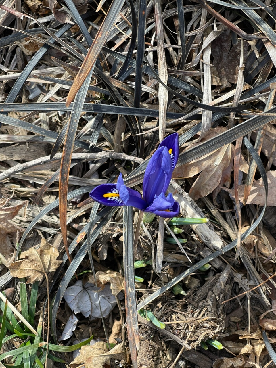
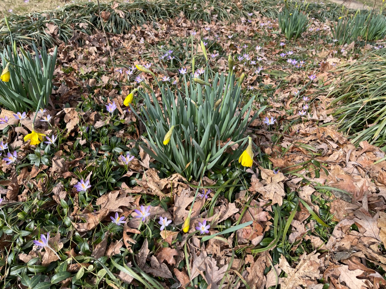
First iris today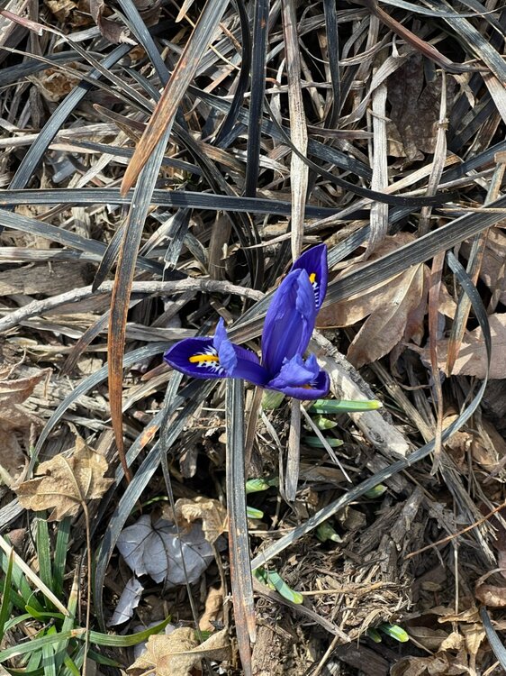
-
That is amazing. A sub 980 low taking a Madison WI track putting down multiple inches of QPF would be an all-timer around there. Even without the Kucera enhancement.
-
+20 at IAD today, +15 at DCA
-
65.7 at 7:30pm on Feb. 9th. Yeah.
-
+16 to +18 on the climo sites
-
It is really nice out. If it isn't going to snow, it should do this.
-
Exactly the same here. Stayed in the 13s most of the night and then a quick dip below at 7:30am. DCA looks like 16.
-
Yeah, the mountains are getting it good. Reading the NE thread is fun. The -40 isotherm at 850 is tantalizingly close to the US. That's pretty rare.
-
Bigger problem with going very cold is that the 850s stall or begin to rise overnight. I think the HRRR is reasonable with single digits in the traditionally cooler spots and low teens at BWI/DCA.
-
Woof.
-
20.7. Peak wind was within the last 30 min here.
-
Effectively over Lake Erie