

MN Transplant
-
Posts
17,845 -
Joined
-
Last visited
Content Type
Profiles
Blogs
Forums
American Weather
Media Demo
Store
Gallery
Everything posted by MN Transplant
-
Winter 2022-2023 Digital Snow Thread
MN Transplant replied to SnowenOutThere's topic in Mid Atlantic
NAM’d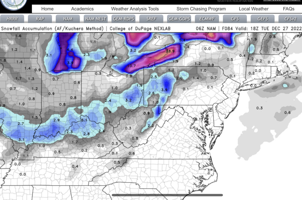
-
December 22-23, 2022: Warm Rain to Arctic Chill
MN Transplant replied to WxUSAF's topic in Mid Atlantic
5.4. Less than 3 degrees away from the coldest temp in the dozen years at my location. -
December 22-23, 2022: Warm Rain to Arctic Chill
MN Transplant replied to WxUSAF's topic in Mid Atlantic
DCA official 55/12. 43 degrees. Very impressive. -
December 22-23, 2022: Warm Rain to Arctic Chill
MN Transplant replied to WxUSAF's topic in Mid Atlantic
12/23/2022 joins the list. 55/15 so far. -
December 22-23, 2022: Warm Rain to Arctic Chill
MN Transplant replied to WxUSAF's topic in Mid Atlantic
55 is the climo high for DCA. We are going to be 40+ high to low for certain. -
Pre-Christmas (Dec 21-23rd) Winter Storm Part 2
MN Transplant replied to Chicago Storm's topic in Lakes/Ohio Valley
-
This is what winter looks like in my home area
-
December 22-23, 2022: Warm Rain to Arctic Chill
MN Transplant replied to WxUSAF's topic in Mid Atlantic
I tried to take the top off the CoCoRaHS rain gauge and it was frozen solid. Ground is starting to get crunchy. Not yet on paved surfaces. 23.5. Max gust 37 -
December 22-23, 2022: Warm Rain to Arctic Chill
MN Transplant replied to WxUSAF's topic in Mid Atlantic
Fully agree, and it is a very common occurrence around here. That said, there was so much rain that the ground is still “leaking”. I think at least the sidewalks will get real dicey once we get to 4-5pm. -
December 22-23, 2022: Warm Rain to Arctic Chill
MN Transplant replied to WxUSAF's topic in Mid Atlantic
It is the timing that is more rare. If this was happening in late January, it would be compelling, but not a massive story. Also, I posted stats last night that showed that the daily drop in DC will probably be top-5 in the last 30-40 years. We will also be setting low max records on Christmas Eve. That is very noteworthy. -
December 22-23, 2022: Warm Rain to Arctic Chill
MN Transplant replied to WxUSAF's topic in Mid Atlantic
31.8. Now we stay below freezing for a while. -
December 22-23, 2022: Warm Rain to Arctic Chill
MN Transplant replied to WxUSAF's topic in Mid Atlantic
Flurries and the breeze picked up -
December 22-23, 2022: Warm Rain to Arctic Chill
MN Transplant replied to WxUSAF's topic in Mid Atlantic
Mulch is whitening. That’s a win, right? -
December 22-23, 2022: Warm Rain to Arctic Chill
MN Transplant replied to WxUSAF's topic in Mid Atlantic
The cold air at the surface always lags due to the Apps -
December 22-23, 2022: Warm Rain to Arctic Chill
MN Transplant replied to WxUSAF's topic in Mid Atlantic
They probably do. The mesoscale models aren’t putting out massive short-term temp drops, though. Partially because we are going to step down to the low 40s before the front, and partially because the low level cold always takes it’s sweet time crossing the Apps. In the end, I think the daily number will look most impressive. -
December 22-23, 2022: Warm Rain to Arctic Chill
MN Transplant replied to WxUSAF's topic in Mid Atlantic
Fairfax County failed to pick up my leaves on time this year. I’m thinking that they are going to have a rough go of it if they try next week. Trying to find a good name for this soon-to-be-frozen pile. Leafburg? Rock Leafster? 1.94”, 52.9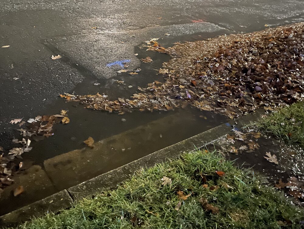
-
December 22-23, 2022: Warm Rain to Arctic Chill
MN Transplant replied to WxUSAF's topic in Mid Atlantic
NAM Nest joins the HRRR in keeping us below 20 on Christmas Eve. Still, a bit different from my home territory. -
December 22-23, 2022: Warm Rain to Arctic Chill
MN Transplant replied to WxUSAF's topic in Mid Atlantic
Front timing is still 9-10am along 95 tomorrow. HRRR a touch faster than the NAM. HRRR still more aggressive on the cold, but the NAM 3km is now <10 for most of us tomorrow night. -
December 22-23, 2022: Warm Rain to Arctic Chill
MN Transplant replied to WxUSAF's topic in Mid Atlantic
Heaviest rainfall rates of the day so far. Up to 1.42" total, 52 degrees. -
December 22-23, 2022: Warm Rain to Arctic Chill
MN Transplant replied to WxUSAF's topic in Mid Atlantic
More fun climo stats. There have been 68 days in DCA's climate record with a 40+ spread between high and low temps. Most of those are in the distant past. There have only been 5 cases in the past 40 years: 3/23/1994 - 83/39 1/19/1996 - 62/20 (the Potomac flood final push) 12/22/1998 - 67/24 4/8/2000 - 78/38 1/13/2018 - 62/21 We might be able to add to this list tomorrow if we can hold the 50s until midnight. -
December 22-23, 2022: Warm Rain to Arctic Chill
MN Transplant replied to WxUSAF's topic in Mid Atlantic
I think Christmas Eve has a solid chance of being the coldest December day since 12/22-24/1989 (17/5, 22/7, 23/10). Really just needs to surpass 12/20/2004 (24/11). -
December 22-23, 2022: Warm Rain to Arctic Chill
MN Transplant replied to WxUSAF's topic in Mid Atlantic
It looks like the HRRR is running 4-5 degrees colder than the other models, so 10 is a better forecast. Still, a pretty good situation to get DCA low since we aren’t counting on radiational cooling. My lowest December temp since getting my station in 2011 is 13. Should have no trouble beating that. -
December 22-23, 2022: Warm Rain to Arctic Chill
MN Transplant replied to WxUSAF's topic in Mid Atlantic
The 12z HRRR is calling for a near record low at DCA (5 degrees, 1983) on Saturday. I don’t recall off the top of my head the last time DCA was in the single digits. 2019? -
December 22-23, 2022: Warm Rain to Arctic Chill
MN Transplant replied to WxUSAF's topic in Mid Atlantic
Now -13. Good stuff. 56 drop in 3 hours. -
December 22-23, 2022: Warm Rain to Arctic Chill
MN Transplant replied to WxUSAF's topic in Mid Atlantic
Cheyenne, WY 43 degrees at 1:05pm local. 11 degrees nine minutes later.


