

MN Transplant
-
Posts
17,845 -
Joined
-
Last visited
Content Type
Profiles
Blogs
Forums
American Weather
Media Demo
Store
Gallery
Everything posted by MN Transplant
-
I didn’t notice it too much until walking around today, but the sunny areas are really drying out now. That said, just another ridiculously beautiful day out there.
-
The models seem to agree that Monday is a lost cause, but there is still a difference in how much of Sunday we can salvage.
-
It is back!
-
An interesting analog is 1986. Very dry first half of the year with a dying Nina. Then precip normalized as we went through the second half of the year into a Nino, culminating in a nice winter.
-
Just like April, we are going to need a late stick save to stop this from being one of the driest Mays on record. 2nd place right now (0.43”) at DCA and nothing in store until the weekend.
-
Kudos to the mesoscale models which had enhancements to the line just south of 66.
-
Euro is not that far off from a similar solution.
-
-
0.15 yesterday and looks excellent today. 06Z NAM Nest looks good for rain on Tuesday.
-
We might salvage a decent Saturday Evening and a very nice Mother's Day.
-
Our pool installed a new heater and they sent out a message saying that it was 81 degrees and they are opening this weekend. Of course, the Saturday weather looks poor.
-
Yeah, we squeaked in a very nice early morning before the clouds/rain get here. 0.10” overnight
-
NAM is definitely more aggressive with precip, but they all tell the same story that tomorrow is gloomy and chilly.
-
Yeah, the humidity is quite apparent as we reach the mid-60s DPs.
-
Tomorrow looks spectacular
-
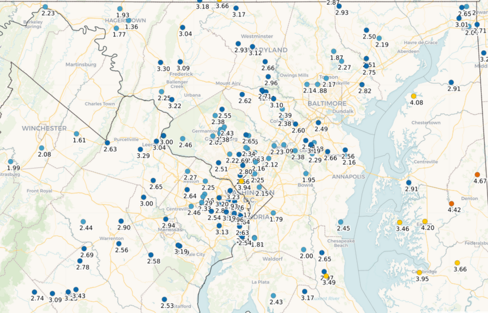
Good soaker. 3.20" for the period.
-
Blazing start to the year.
-
Quick .5”. Enjoying the thunder.
-
2.26”. That was perfect.
-
Raining harder now than at any point since the 1pm hour
-
1.82”. Starting to see some of that enhancement as the little vort gets closer.
-
The models did a great job with that.
-
The trench was definitely on the order of 4' deep. The guys who were down in there were up to their chests. Our gas lines must have been deeper because they only had to dig around the existing water supply line to the house and not the gas line.
-
1.08”. Good stuff.


