MN Transplant
-
Posts
17,845 -
Joined
-
Last visited
Content Type
Profiles
Blogs
Forums
American Weather
Media Demo
Store
Gallery
Everything posted by MN Transplant
-
Yeah, straight up disgusting outside. Officially 87/76 at DCA
-
2023 Mid-Atlantic Severe Wx Thread (General Discussion)
MN Transplant replied to Kmlwx's topic in Mid Atlantic
I like the UH signature right through the DC Beltway on the 12z NAM nest.- 2,785 replies
-
- 1
-

-
- severe
- thunderstorms
- (and 3 more)
-
Pouring here, but looks brief. Still better than drought.
-
1 run with 12 Ks for the Twins. We’ll see Duran vs the top of the Os lineup. The Twins do have one of the best pitching staffs in the league. The hitting, not so good.
-
5 Ks through 3 with no guys past second base. On pace!
-
I was bummed I didn't make the trip up! Don't worry, the Twins will strike out 15 times this afternoon and not get a guy beyond 2nd base.
-
Ha, stick save
-
So, you are backdating it to this morning's report?
-
Nothing. Air quality improved a touch.
-
82.5 mph on this station near Indianola, IL: https://ambientweather.net/dashboard/b30b4bfc5287a664831e9627778376be/tiles
-
The problem with complex, interconnect models like these are that you can’t just simply “fix” one thing and make it better. Let’s say you increase the resolution. While there are huge benefits to that, there are also potential downsides because every weather model has estimates built in and those may not be valid anymore at a different resolution. It also depends on what is being verified. The modeling centers run and assess for quite a while before release. But if they are focused on, say, heights and temperature, they may not care as much if east coast cyclones are now not handled quite as well.
-
I wish there was a middle ground where the map starts off as just dots, which looks cleaner, and then as you zoom in you can see the numbers. PurpleAir and Paku both show the values all the time while this one doesn’t show them at all. CoCoRaHS got it right with their interactive precip map.
-
I thought it smelled more yesterday but the 2.5 levels are a bit higher today. Should diminish starting tomorrow as we go to a south wind.
-
2023 Mid-Atlantic Severe Wx Thread (General Discussion)
MN Transplant replied to Kmlwx's topic in Mid Atlantic
Tomorrow!- 2,785 replies
-
- 1
-

-
- severe
- thunderstorms
- (and 3 more)
-
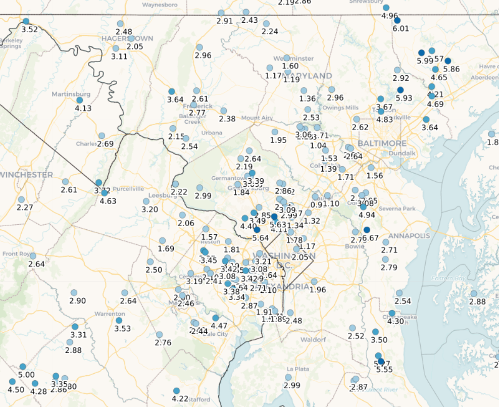
Brutal difference between west and east of Baltimore month-to-date.

-
Heard from a co-worker in Oakton that they had a "wicked" storm. He's from Long Island, not Boston, but still.
-
2023 Mid-Atlantic Severe Wx Thread (General Discussion)
MN Transplant replied to Kmlwx's topic in Mid Atlantic
Down almost 20 from the high and at the low of the day, 65.7. 0.13", so not a ton of rain. -
2023 Mid-Atlantic Severe Wx Thread (General Discussion)
MN Transplant replied to Kmlwx's topic in Mid Atlantic
I had an outflow gust in the 30s, but nothing once the rain got here. -
2023 Mid-Atlantic Severe Wx Thread (General Discussion)
MN Transplant replied to Kmlwx's topic in Mid Atlantic
Let’s go!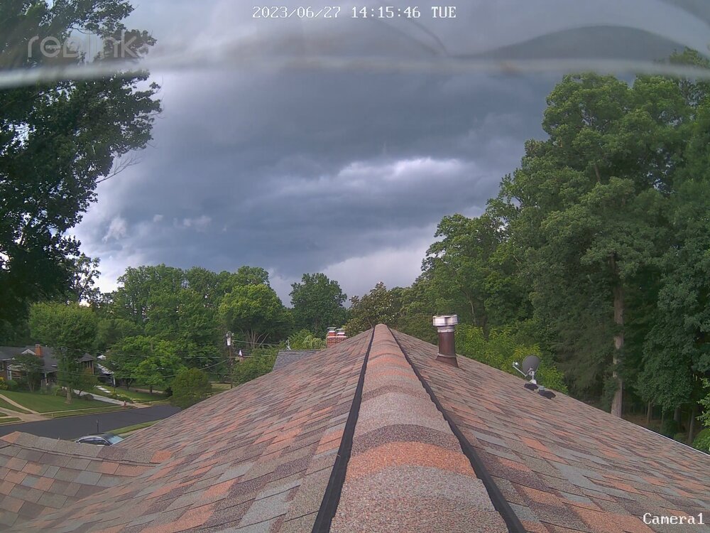
- 2,785 replies
-
- 8
-
-
- severe
- thunderstorms
- (and 3 more)
-
2023 Mid-Atlantic Severe Wx Thread (General Discussion)
MN Transplant replied to Kmlwx's topic in Mid Atlantic
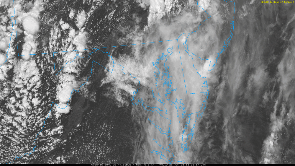
It is interesting that there were several "gaps". It wasn't only DC, but the VA/NC border, the NC/SC border, and NE PA. These are things that are just simply unpredictable at this point.- 2,785 replies
-
- 2
-
-
- severe
- thunderstorms
- (and 3 more)
-
The good news is that when ECMWF pushes the envelope, Congress pays attention.
-
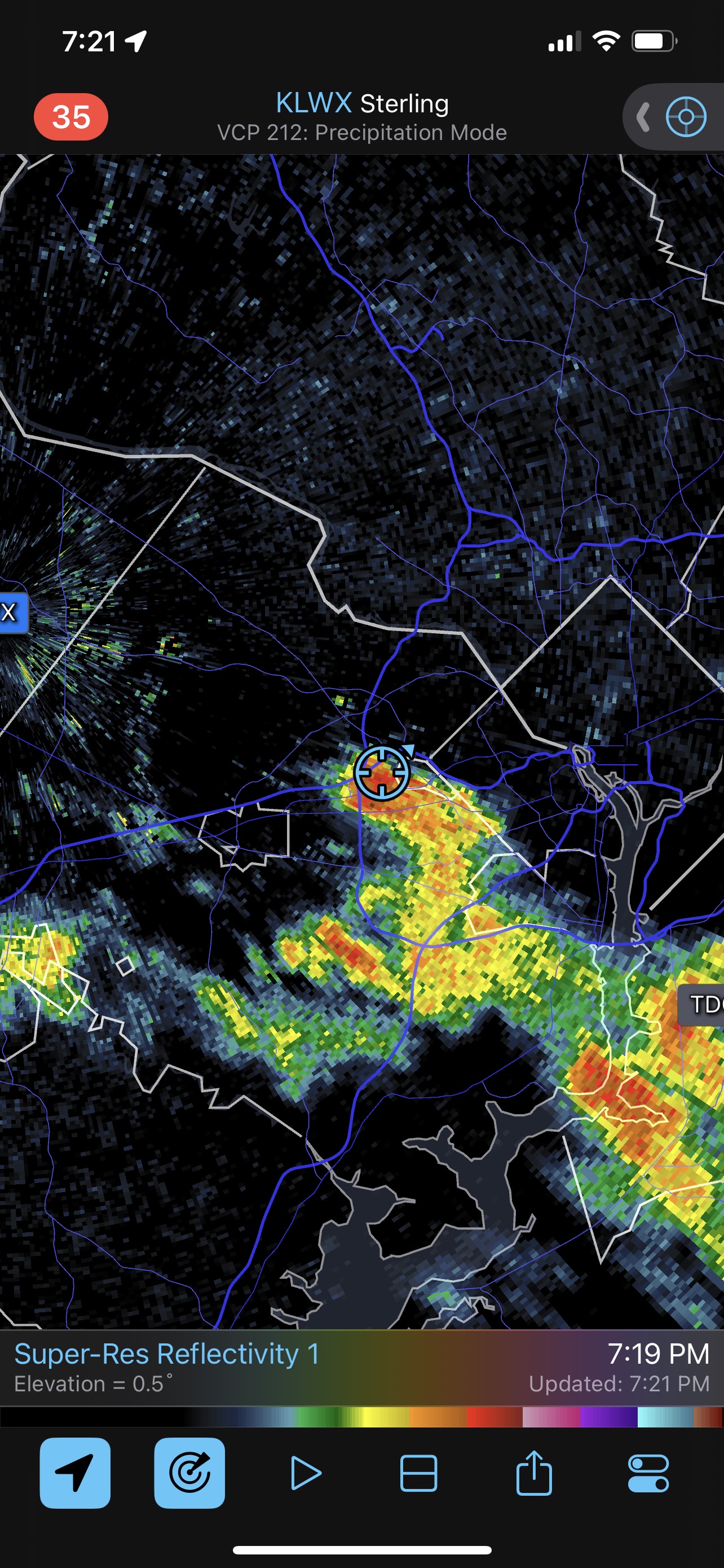
Looks like that one just started producing lightning.
-
2023 Mid-Atlantic Severe Wx Thread (General Discussion)
MN Transplant replied to Kmlwx's topic in Mid Atlantic
Possibly, but it is unlikely to be significant in this case. Research has found that large, slow-moving MCSs have more impact. https://www.researchgate.net/publication/258795094_A_Numerical_Simulation_Study_of_the_Effects_of_Anvil_Shading_on_Quasi-Linear_Convective_Systems- 2,785 replies
-
- 1
-
-
- severe
- thunderstorms
- (and 3 more)
-
2023 Mid-Atlantic Severe Wx Thread (General Discussion)
MN Transplant replied to Kmlwx's topic in Mid Atlantic
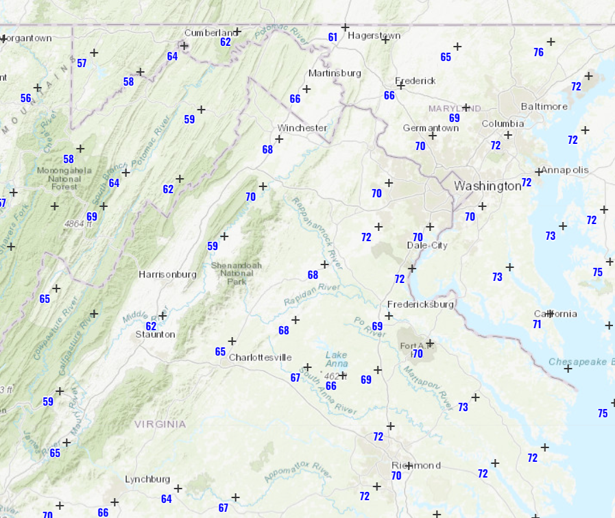
Maybe the most encouraging ob is the 68 degree DP out in Winchester.
- 2,785 replies
-
- 2
-
-
- severe
- thunderstorms
- (and 3 more)
-
2023 Mid-Atlantic Severe Wx Thread (General Discussion)
MN Transplant replied to Kmlwx's topic in Mid Atlantic
There is a realistic fail mode here that has been hinted at by some models where there are good storms up in PA where the dynamics are solid and down in southern VA and NC where the instability is better.- 2,785 replies
-
- 2
-
-
- severe
- thunderstorms
- (and 3 more)