MN Transplant
-
Posts
17,845 -
Joined
-
Last visited
Content Type
Profiles
Blogs
Forums
American Weather
Media Demo
Store
Gallery
Everything posted by MN Transplant
-
0.01”. Now we’re rolling.
-
T so far. The stuff coming in from the SW looks light. Going to have to rely on the development later and that might be hit/miss.
-
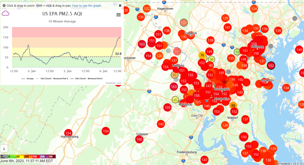
Actually had a few sprinkles from that. Problem is that the air quality is worse on the east side and it is moving west.
-
Definitely better out there now than this morning. Still gross, but less so.
-
It is so much worse than yesterday. Wow.
-
More so the northerly flow. The gulf has not been open this year.
-
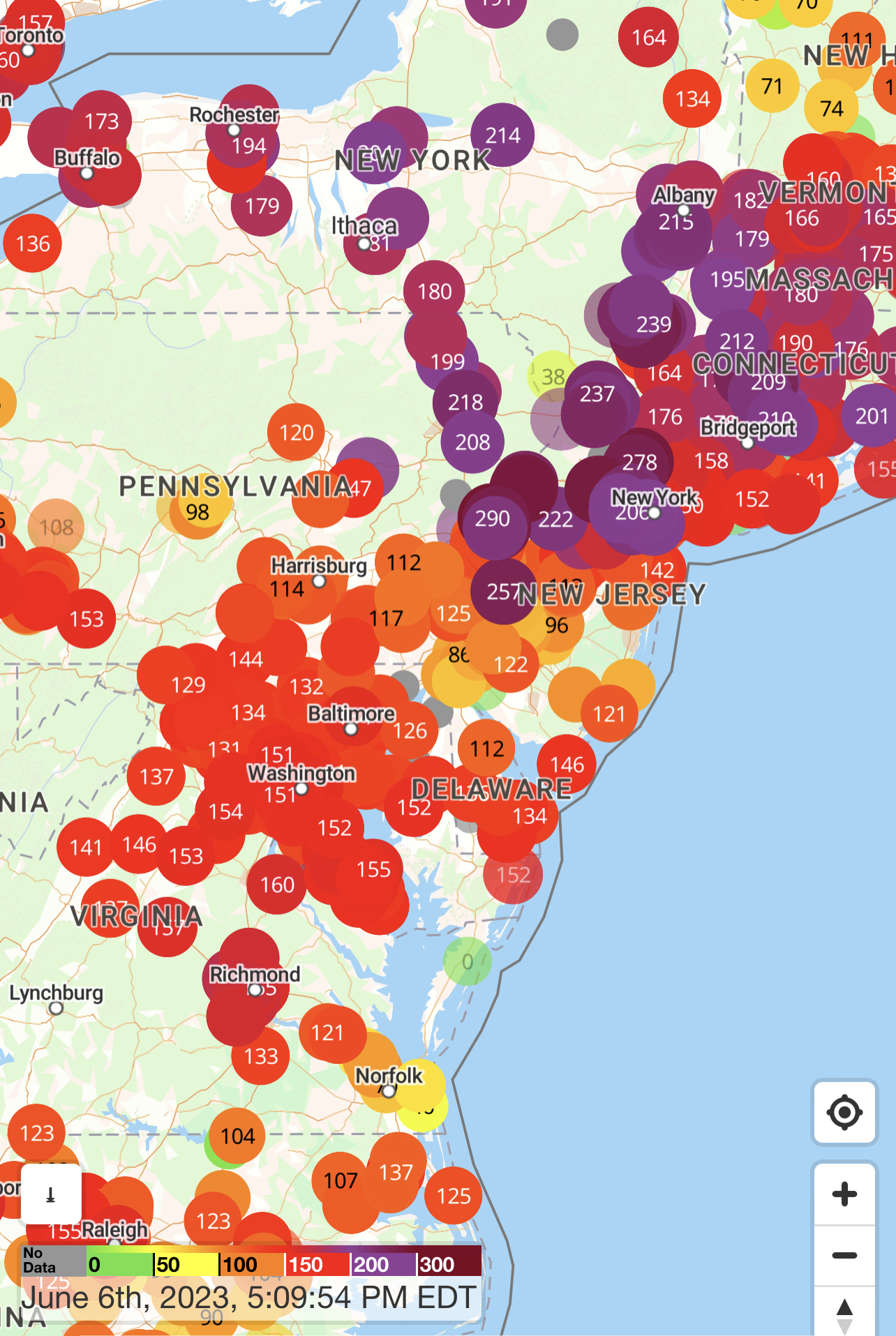
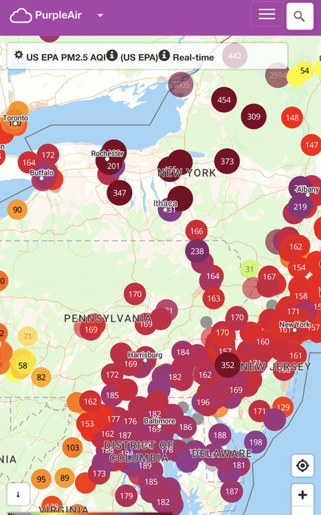
Direct link to the Purple Air map https://map.purpleair.com/1/mAQI/a10/p604800/cC0#9.56/38.8206/-77.1908
-
The only good news today for us is that the HRRR-Smoke model wants to shunt the absolute worst of the stuff in NY state right now off to our NE, affecting Philly and NYC.

-
I’ve seen a lot of people with masks, which makes sense. Driving into work felt like I was in 1970s LA.
-
It really just hits you immediately upon going outside. This is as bad as I can recall.
-
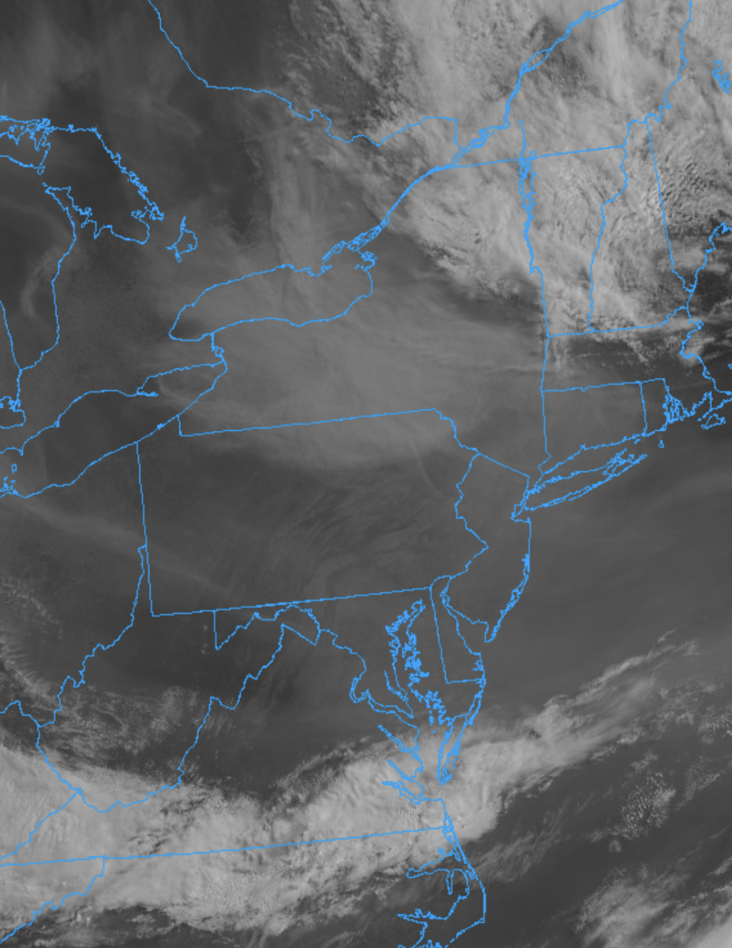
Keeps getting worse to our northeast
-
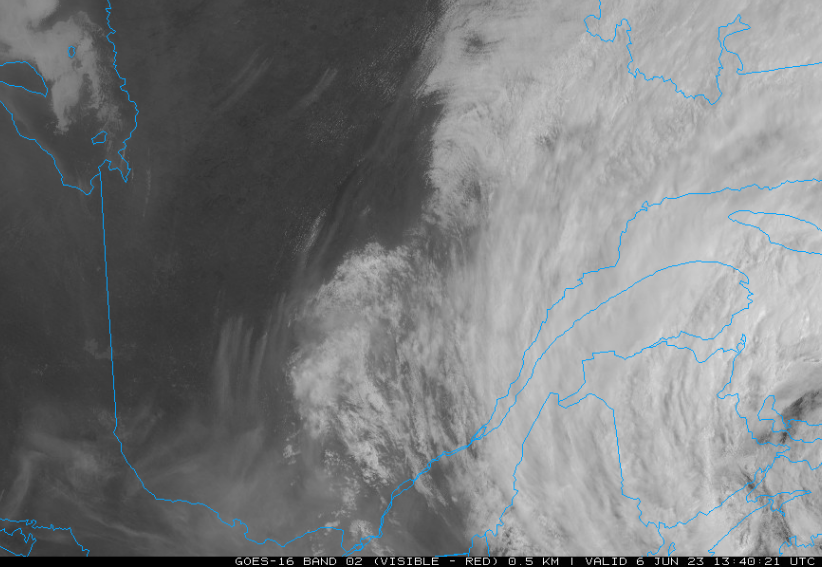
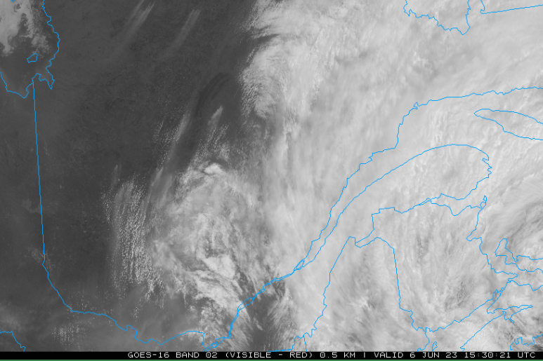
Here's some fun science for you. Top and bottom images below are from this morning in Quebec. You can clearly see the fires to the west of the cloud cover in the top image. Two hours later you can see that a field of small cumulus clouds have developed only in the fresh smoky areas. It is very likely that the soot is acting as cloud condensation nuclei to help the cloud development. This is a different process from fire-related pyrocumulus which have the additional impact of the heat created by the fires.
-
At this time of year, the average precip at BWI is 0.14", so I'm sure Tom T was just waiting for the day where we finally fell behind. If he phrased the Tweet as simply year-to-date instead of a particular number of days, it wouldn't have seemed as arbitrary.
-
Yeah, getting gross out there.
-
You have too much invested in being anti-drought. The fact that it is the driest year to date at any point into the growing season is very notable.
-
One interesting thing about today will be high temps. The models are in the 81-84 range, but I wonder if we fall short because of the smoke.
-
No real response from the air quality sensors so it is very likely aloft tonight. Doesn’t mean that it will stay that way, however.
-
DCA 98 IAD 99 BWI 100 RIC 99
-
Back to 93 at the 6pm ob
-
Surprised at how murky it is out there. Down to 4mi vis at DCA.
-
1.09” total here. DCA moved from top-2 driest May to top-10.
-
it really pours if you get under one of these cells.
-
A very welcome 0.40”.
-
0.43” on the month at DCA. If we get less than .32” over the next few days, it’ll be the 2nd driest May on record. Currently -6” on the year.
-
Yeah, that is a good dousing on Monday. 2" through DC. Doesn't finally completely clear out until Thursday.