
Holston_River_Rambler
-
Posts
5,107 -
Joined
-
Last visited
Content Type
Profiles
Blogs
Forums
American Weather
Media Demo
Store
Gallery
Everything posted by Holston_River_Rambler
-

Spring/Summer 2018 Observations
Holston_River_Rambler replied to Carvers Gap's topic in Tennessee Valley
Backpacking overnighter from White Rocks, near Ewing, VA, back to Wilderness Road campground near Cumberland Gap. Late summer = a variety of conditions. Hot and muggy climbing up to White Rocks, but almost cool overnight near the Hensley Settlement. Rain early in the AM and then a dense fog settling over the ridge top. Fog + trees starting to lose leaves + those big spider webs we've all probably seen this time of year = Fall like feel on top, but still very much summer in the Powell Valley.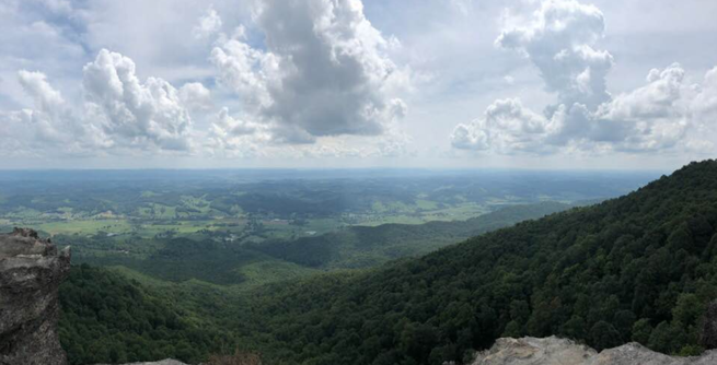
- 225 replies
-
- 2
-

-
- mountain snow
- thunderstorms
- (and 5 more)
-
How amazing would this phase be in winter??? https://imgur.com/a/BU2R83t Also, check out the crazy loop Florence is doing on the FV3 experimental GFS: https://imgur.com/a/KdQZjCD
-
Spring/Summer 2018 Mid to Long Term Discussion.
Holston_River_Rambler replied to John1122's topic in Tennessee Valley
I am 100% on board the recurve to bring down cooler air train! I've been hoping this hurricane, or a possible next one further south (if one materializes), could do something about the prognosis for the next month.- 279 replies
-
- 2
-
-
- tornado
- thunderstorm
- (and 5 more)
-
Spring/Summer 2018 Mid to Long Term Discussion.
Holston_River_Rambler replied to John1122's topic in Tennessee Valley
So what do we think about Florence at this point? It seemed like the model camps had begun to come into agreement yesterday as Euro went OTS. This AM though, both EURO and GFS are back to aiming her at SE/ MA coast, with CMC as a last minute recurve. EPS, GEFS, and GEPS have all trended more positive and slower with the 500 mb trough that could pull her OTS and sharper with a small feature in the mid Mississippi Valley that pumps up the ridge she's forced under. The decisive time as of now looks like Sunday night into Monday for the upper trough in the north Atlantic. Any potential hit is still a week out or more, but the features that seem to me that will govern her path are not so far off. Climatologically (defined here as me watching storms on this trajectory in my life) it seems to me a recurve is more likely with a path aimed at the Carolinas (obviously, "likely" isn't always reality and there are examples of hits). If she does (if if if if if if and only if, not trying to hype anything here) run west into the Carolinas, we could be dealing with at least some rain from her. https://imgur.com/a/mVIrzFI (Gif showing the trends over 10 runs of GEFS of both the trough and feature in mid Mississippi Valley); EPS version of same gif: https://imgur.com/a/voj5rQ3 Sorry still can't figure out how to get these to embed. Also, thought about asking what BOHICA meant, but decided to try and look it up first... More heat = sad face- 279 replies
-
- 2
-

-
-
- tornado
- thunderstorm
- (and 5 more)
-
Spring/Summer 2018 Observations
Holston_River_Rambler replied to Carvers Gap's topic in Tennessee Valley
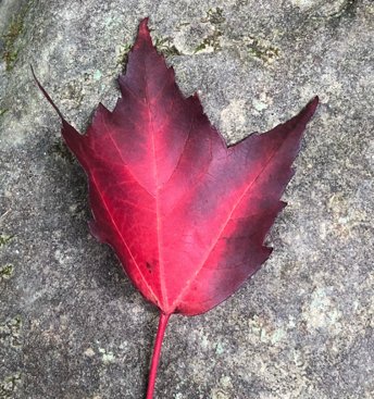
Hiked up to Rocky Top and Thunderhead Mts. today. Got a video of the elusive terrain driven convection as it formed. SE flow above, but at the ridgetop, the upward motion was awesome. https://imgur.com/a/VUoIpKf Some nice leaf action beginning as well. Taste of Fall above 5000 ft.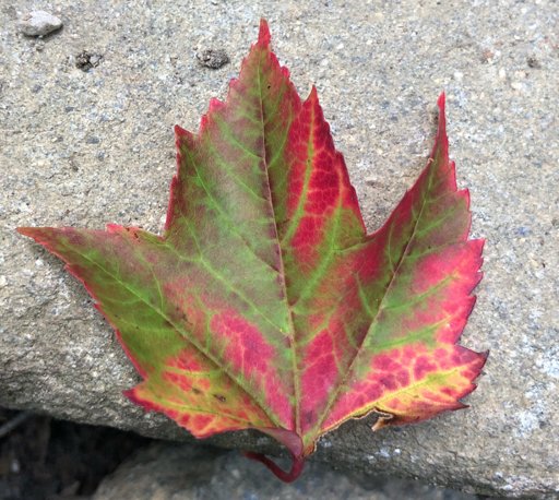
- 225 replies
-
- 3
-
-
- mountain snow
- thunderstorms
- (and 5 more)
-
Found an interesting site from the University of Wisconsin with some non operation GOES 17 imagery: http://realearth.ssec.wisc.edu/?products=G17-ABI-FD-BAND01 Also, thanks to all for the good conversation lately (esp. Fall-Winter spec.), have been wanting to participate more, but swamped with work at this time. Although just catching up it looks like boring heat is the optimal word for now.
-
Spring/Summer 2018 Observations
Holston_River_Rambler replied to Carvers Gap's topic in Tennessee Valley
Interesting convection pattern today on the lee side of High Knob and Roan Mountain. Maybe some sort of leeward confluence? https://imgur.com/a/04lPeDz- 225 replies
-
- 1
-
-
- mountain snow
- thunderstorms
- (and 5 more)
-
Found on the twitter webs
-
Weird. WBIR specifically reported this AM that Vulcan materials said they did no blasting at the time of the boom. And actually, a little bit later in this story, they ask Vulcan materials: "Carl VanHoozier, Community Relations Manager at Vulcan Materials Company, a quarry in Blount County, called WVLT News Friday night. On Friday night, he said, 'The USGS is absolutely incorrect. There was no quarry blast today, or anytime this week. A 2.1 earthquake is pretty extreme. Our blasts are controlled and small. It's an earthquake, it's not a quarry blast.' However, early Saturday morning, VanHoozier contacted WVLT to report that there had been a blast during the week, but it was on Tuesday, not on Friday." I think the mystery is still there and I like your dome collapses idea. E TN is cave country after all.
-
Much storm. Such Pink.

-
Spring/Summer 2018 Observations
Holston_River_Rambler replied to Carvers Gap's topic in Tennessee Valley
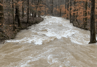
Well there goes my call. Raining in Knoxville. Low level flow is NW, but upper is still SW. And the clouds don't look to be getting any smaller.- 225 replies
-
- 1
-

-
- mountain snow
- thunderstorms
- (and 5 more)
-
Spring/Summer 2018 Observations
Holston_River_Rambler replied to Carvers Gap's topic in Tennessee Valley
Skies are finally clearing out here in Knox, flow is now from the NW, and the last of these shortwaves is cruising on through NC, and I bet we get at least two dry days from here south and west. I hope so anyway, hate mowing with the yard wet. Wow at the 15.3 inches!- 225 replies
-
- 1
-
-
- mountain snow
- thunderstorms
- (and 5 more)
-
Spring/Summer 2018 Mid to Long Term Discussion.
Holston_River_Rambler replied to John1122's topic in Tennessee Valley
I was looking at some of the short range models (RGEM/ NAM 12k) and it almost looks like we're under the deformation zone of a coastal heading up through GA with these rains coming up Wed night into Thursday. No idea if it is such meteorologically. Not sure how/ if the entrance/ exit regions (although I feel the left exit region is mentioned more with a deformation zone) correspond to one of those either. There is some energy and swirling at 850 mb over the next 48 hours from S. GA up through the Carolinas, but most of the energy at 500mb looks like it gets strung out to the south only to swing through piecemeal or stays north. I guess the reason I'm posting anything, since I'm not really adding much to the discussion on rains, is that looking at N. Hemisphere at 500 mb today, this looks like a somewhat favorable patter (if it was mid January)for snow, at least for some of us, and I am always interested in seeing what set ups can lead that way. -
Beautiful, but not something I hope to ever seen near me. Question though, what are the "fan-out" cirrus looking clouds toward the tops of the cloud? I've seen these on thunderstorms, but never been able to get a good enough pic to ask.
-
Spring/Summer 2018 Observations
Holston_River_Rambler replied to Carvers Gap's topic in Tennessee Valley
T-storm rolling north. Looking SW from Bays Mt / Sullivan Gardens area in Kingsport yesterday.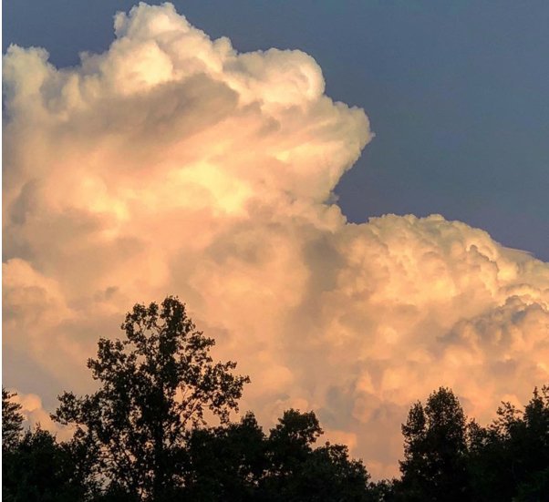
- 225 replies
-
- 1
-
-
- mountain snow
- thunderstorms
- (and 5 more)
-
Spring/Summer 2018 Observations
Holston_River_Rambler replied to Carvers Gap's topic in Tennessee Valley
Really nice shelf cloud in Knoxville this PM, but no camera. While waiting out the good old gulley warsher that followed saw there was a GOES 16 meso floater over the SE show the upper low and the storm dropping in. https://i.imgur.com/k8R04A9.gif- 225 replies
-
- 1
-
-
- mountain snow
- thunderstorms
- (and 5 more)
-
Spring/Summer 2018 Observations
Holston_River_Rambler replied to Carvers Gap's topic in Tennessee Valley
Took a trip up to High Knob and Devil's Bathtub yesterday. Bathtub was very crowded so couldn't get a good picture of it. Great temperature and breeze on top of High Knob, some nice pictures, and a time lapse of some convection https://imgur.com/gallery/hMy7uHP Convection time lapse is looking NE Picture one is looking SE and Picture two is looking WSW
- 225 replies
-
- 3
-
-
- mountain snow
- thunderstorms
- (and 5 more)
-
Spring/Summer 2018 Mid to Long Term Discussion.
Holston_River_Rambler replied to John1122's topic in Tennessee Valley
This whole pattern seems so unusual for late July. At 500mb, it looks like a weird Miller B setup, low dropping in from the NW and then transferring to the coast, but in this case the coastal energy gets sucked back into the upper flow to the north and the parent upper low drops into a position south of the TN Valley. Ensembles showing (8-10 days out) a -NAO and a possible Gulf low. Probably not good for severe weather folks, but hopefully it can bring some more cooling. Fall's coming and I say gimme rain. Longer term, maybe this is evidence of the turning of the tide so to speak on the overall N. Hemisphere pattern? Pretty blocky pattern in across northern Canada right now for what can be the hottest part of summer. Not to say that it won't swing back to warm or hot again, but maybe a sign the ENSO balance is starting to shift. I don't mean to sound like I have some weird theory for this because I don't. But we have been talking about this transition to El Nino for a while and maybe this is evidence that is finally starting to happen.- 279 replies
-
- 1
-
-
- tornado
- thunderstorm
- (and 5 more)
-
Spring/Summer 2018 Observations
Holston_River_Rambler replied to Carvers Gap's topic in Tennessee Valley
Thunder almost all night here in Knoxville and some of the longest individual rumbles I can remember. Got a call from my parents in Kingsport and my father was actually blocked from driving home this AM by a tree that fell down in a gust of wind while he was out getting coffee. -
Looks like it's all trying to consolidate into a line now over the upper Cumberland plateau. Hopefully that puts and end to most of the tornado threat for those folks. No disrespect meant to any chasers in any way.
-
Cell in Monroe county, KY looks to be developing a hook. https://imgur.com/jomk03r
-
Spring/Summer 2018 Observations
Holston_River_Rambler replied to Carvers Gap's topic in Tennessee Valley
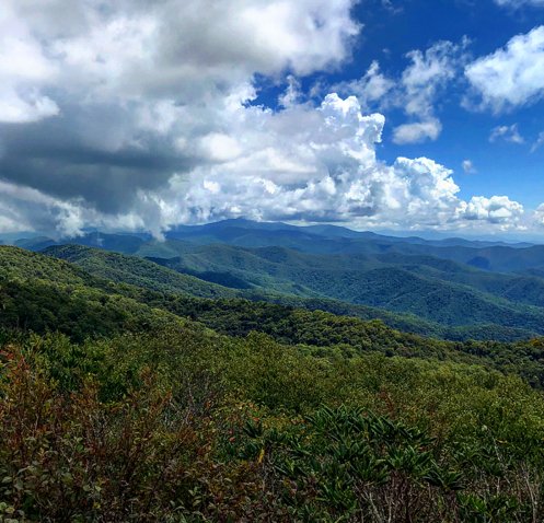
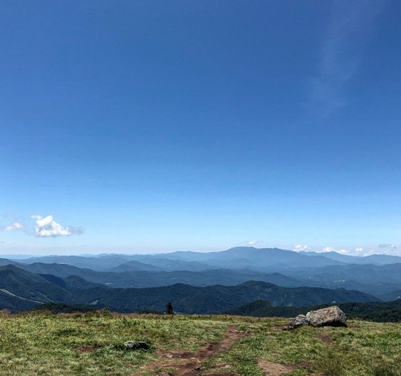
Looking north from Mt. Mitchell towards Roan Mt. (so it sort of counts as our area).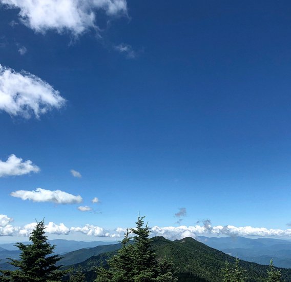
- 225 replies
-
- 5
-
-
- mountain snow
- thunderstorms
- (and 5 more)
-
Spring/Summer 2018 Observations
Holston_River_Rambler replied to Carvers Gap's topic in Tennessee Valley
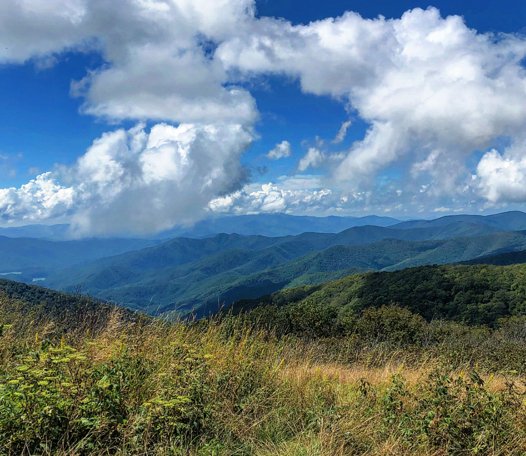
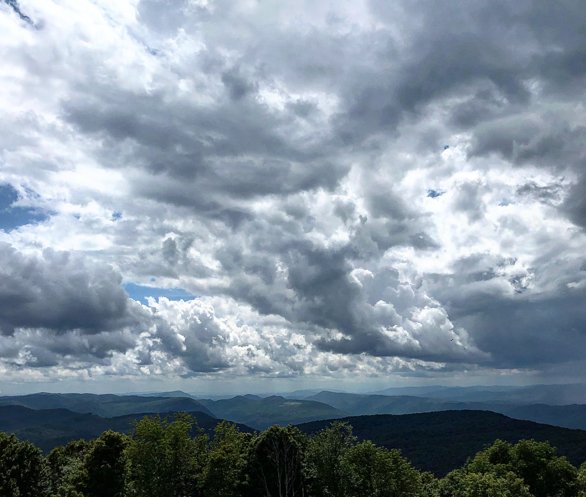
It has been beautiful! Got some great pics from the higher elevations (some of the best visibility I've ever experienced in the summer) yesterday and Midnight Hole in the Smokies was running at just the right level for some fun. Camped at Big Creek and the air felt amazing for early July. The top pic is Midnight Hole and the bottom one is Roan Mt. looking toward Mt. Mitchell.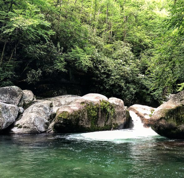
- 225 replies
-
- 5
-
-
- mountain snow
- thunderstorms
- (and 5 more)
-
Spring/Summer 2018 Observations
Holston_River_Rambler replied to Carvers Gap's topic in Tennessee Valley
A NW flow seems to be hitting a E flow in the middle of the eastern valley today and creating a little boundary. Hopefully this can help pop a few storms and bring some of us a little cooling rain as the day wears on. Downsloping off the plateau and Smokies probably isn't helping this, but still will be interested to see if it produces anything: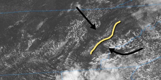
- 225 replies
-
- 1
-
-
- mountain snow
- thunderstorms
- (and 5 more)
-
Spring/Summer 2018 Mid to Long Term Discussion.
Holston_River_Rambler replied to John1122's topic in Tennessee Valley
Nice MRX discussion this morning for something I'm pretty interested in: T-storms developing and rolling into the eastern valley off the mts. Maybe I don't read these enough in the summer, but usually I think we get just a "higher terrain focus" or something like it for these type of storms, but this AM the forecaster was mentioning things like a "mid-level deformation axis" over the mts. and different steering influences. Really enjoy learning more about any local processes. Long story short for today, as the forecaster mentioned: "In other words, that`s a really long winded way of saying storms will likely be peppered across the forecast area by this afternoon, though the scattered nature of the storms precludes going higher than about a 30-40 percent chance of rain." Although this person could have just said the above, I'm glad they didn't since I can now look for all the other influences they mentioned. Education and fun (ok, that's a relative term). We haz em.