midatlanticweather
-
Posts
4,926 -
Joined
-
Last visited
Content Type
Profiles
Blogs
Forums
American Weather
Media Demo
Store
Gallery
Everything posted by midatlanticweather
-
2003 I was robbed of the 3 feet of snow in eastern Loudoun due to a change to heavy sleet! Can't forget the anniversary of PD2 - The February 15-18 (President's Day) 2003 Snow Storm Pictures
-

February Medium/Long Range Thread
midatlanticweather replied to stormtracker's topic in Mid Atlantic
I would not worry unless you have something in NC based on recent trends! LOL! -
February Medium/Long Range Thread
midatlanticweather replied to stormtracker's topic in Mid Atlantic
Another chance to fail! LOL! -
Late 1990s there was a storm that the Nam showed 11 inches falling in the Reston area of Virginia. Snow. Was forecast by other models but nothing like that. And boom.. It happened. It was a fluke but maybe it found a nut this time.. Lol.. Weenieism philosophy
-
This was wild
-
-
Nope!
-
Wow.. This one beat us all down. Sheesh. A whiff to the south and east is not what I expected.. And this is a huge miss south and east. Crazy.
-
I will rent a yacht to go chase! And Fish!! I mean.. make the most of it!
-
You know some weather weenie in NE NC that has the 14 inches in his backyard just went nuts in excitement! LOL!
-
Thankful for the power back.
-
Power was immediately knocked out. Winds are howling.
-
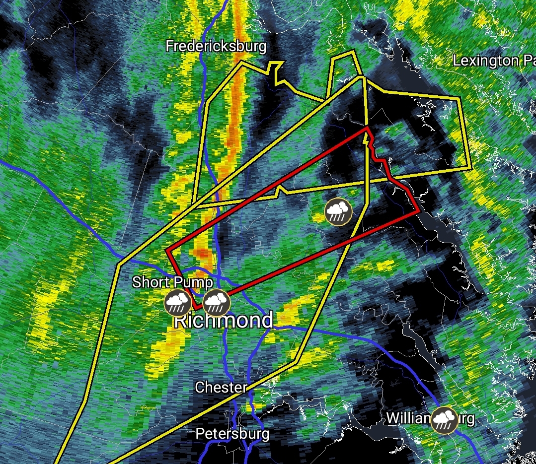
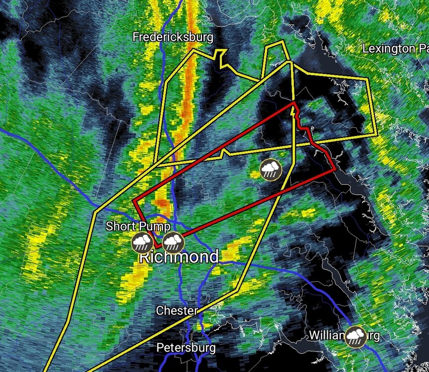
Wild seeing tornado warning for Richmond area
-
How we doing on the wind threat? Models tend to overdue winds a bit, but the NAM and HRRR were quite impressive.
-
February Medium/Long Range Thread
midatlanticweather replied to stormtracker's topic in Mid Atlantic
Consistently sucks -
February Medium/Long Range Thread
midatlanticweather replied to stormtracker's topic in Mid Atlantic
A car that old will probably change the local climate and turn it too warm to snow due to CO2 emissions -
February Medium/Long Range Thread
midatlanticweather replied to stormtracker's topic in Mid Atlantic
Ya. Doesn’t look great -
February Medium/Long Range Thread
midatlanticweather replied to stormtracker's topic in Mid Atlantic
Fringed in the 2 foot potential. -
February Medium/Long Range Thread
midatlanticweather replied to stormtracker's topic in Mid Atlantic
We cannot afford any downward trends. We have got to HOLD on Euro or improve.. GFS and other models bounce a lot. Euro needs to lock. -
February Medium/Long Range Thread
midatlanticweather replied to stormtracker's topic in Mid Atlantic
Especially for you all
-
February Medium/Long Range Thread
midatlanticweather replied to stormtracker's topic in Mid Atlantic
Serious snow loving from the models this Valentine’s Day -
February Medium/Long Range Thread
midatlanticweather replied to stormtracker's topic in Mid Atlantic
Dr no has been pretty good on location of heavy snow. This far off I would expect it to waffle a lot though. -
Icy snowballs can be made now! And they hurt
-
February Medium/Long Range Thread
midatlanticweather replied to stormtracker's topic in Mid Atlantic
AI is so resource-intensive! Need some more hamsters on wheels in the basement. -
February Medium/Long Range Thread
midatlanticweather replied to stormtracker's topic in Mid Atlantic
@Heisy Cool! AI will keep getting better.