HeadInTheClouds
-
Posts
1,691 -
Joined
-
Last visited
Content Type
Profiles
Blogs
Forums
American Weather
Media Demo
Store
Gallery
Everything posted by HeadInTheClouds
-
Yup, you would think it's been tropical from the talk. It's been an average December up here in MHV. Yesterday's high was 37 with snow showers. Last night went down to 22 and today's high was 35. After a mild weekend most of next week will be close to 40 for daytime highs. Not planting any palm trees here.
-
36 and mostly snow here in Dutchess, coating on cars and grass.
-
 There are plenty of spots that have reported 7-8 inches so far and it's not over yet.
 -
55 with some light rain still. 3.10 in the bucket.
-
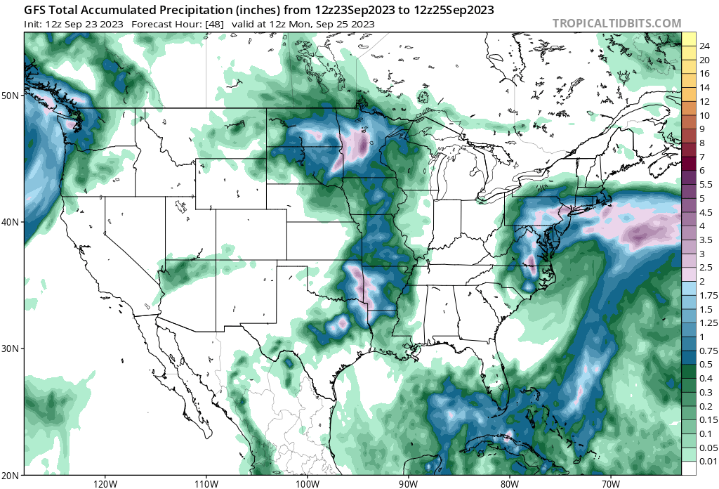
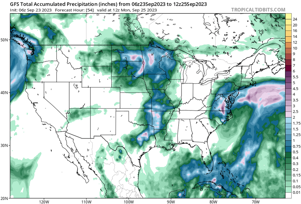
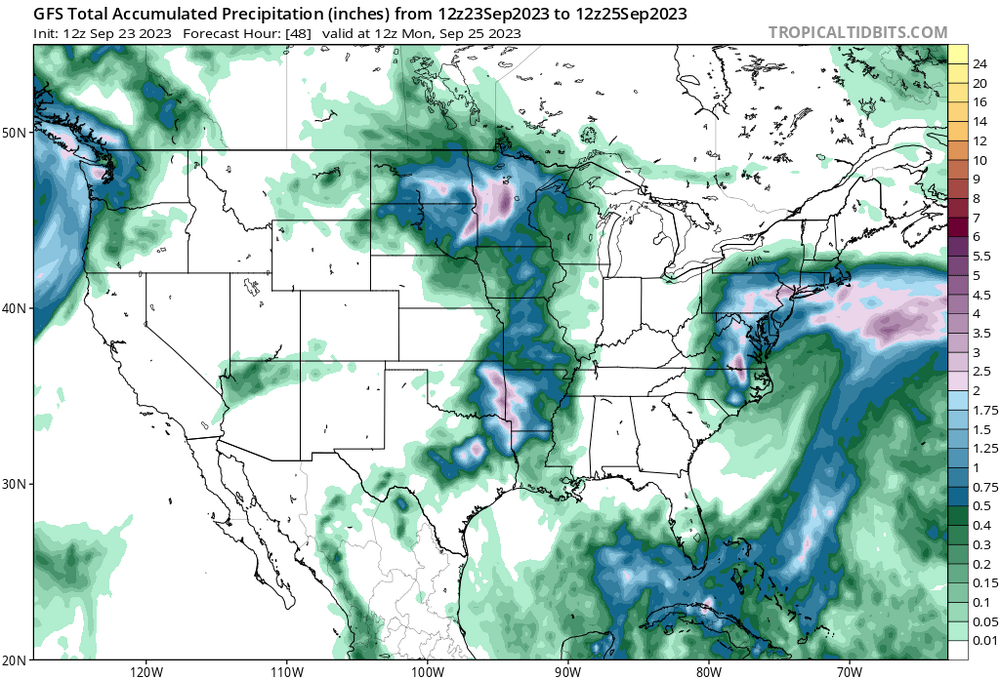
And most models have shown for 2 days now that the most significant impacts will be from the remnant low on Sunday and Sunday night except for the GFS (until 12z) which you continued to hug.
-
Are you going to post the 12z GFS?
-
Perfect late afternoon/evening in HV.
-
july 9th widespread flooding event
HeadInTheClouds replied to forkyfork's topic in New York City Metro
That's a lot of rain especially with what has fallen in the past month. Dutchess county east of the taconic had some big amounts. Had 3.15 here in Hyde Park. -
july 9th widespread flooding event
HeadInTheClouds replied to forkyfork's topic in New York City Metro
I know, probably going to get worse unfortunately. -
july 9th widespread flooding event
HeadInTheClouds replied to forkyfork's topic in New York City Metro
I still can't believe how hard and for how long it has been raining in the Bear Mountain area around 9W. It's going to be a disaster in that area. -
You have to go up to I90 to be near average. I'm 20 miles north of 84 and have 26.5 this year which is still well below average.
-
Hit 54 today, snow melting quickly.
-
Every model basically sucked with this storm and the RGEM/CMC were no exception. Besides being bad for areas well north and west, some parts of Long Island had snow which I don't think they had correct either. They are consistently too warm and dry.
-
Every model was really bad this storm.
-
They aren't done yet. NWS Albany talking about a pivoting band and Mohawk Convergence which may add to totals later today and this evening.
-
35 and just some light rain now. Finished with just under 9 inches. 26.5 for the season.
-
Yes, this is true. I have family there and I know topography plays a role in Capitol District snowfall as it does in MHV. I did see a number of reports of reports of a foot or more.
-
33 and ripping snow.
-
I think you basically had to be I90 on north to have close to an average winter. I'm 20 miles north of I84 and this storm should get me to over 25 for the season but still well below normal.
-
Even with only a foot it's still close enough compared to pathetic lack of snow other areas have had.
-
Albany area getting crushed. They will be at average snowfall after this storm.
-
The truth was always going to be in the middle. Heavy snow now.
-
32 with moderate snow, eyeballing 7-8 inches OTG. Power outages all over the place.
-
32 with moderate/heavy snow, about 2 inches.
-
Yea, I would say it's way overdone. 1 ft is possible but 2, nah.