HeadInTheClouds
-
Posts
1,691 -
Joined
-
Last visited
Content Type
Profiles
Blogs
Forums
American Weather
Media Demo
Store
Gallery
Everything posted by HeadInTheClouds
-
35 and light snow
-
She's terrible.
-
The Ukie is another joke of a model.
-
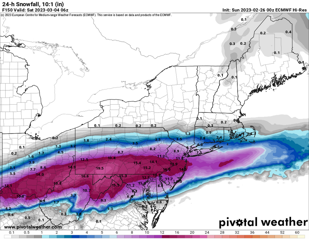
Euro snowfall for next weekend.
-
Yes, they are good trends.
-
Not really. All other models came north and show precip into metro area when before they were OTS.
-
I wouldn't be overanalyzing what the shitty Nam shows, especially in it's longer range.
-
19 moderate snow, about 1/2 inch
-
33 with moderate snow. Sticking to colder surfaces.
-
Had a high of 58 around noon, now 31.
-
I wouldn't lose too much sleep. All of that fantasy snow comes in the extended range of the GFS. You probably have a better shot at winning powerball.
-
64 here in HV.
-
I saw a wasp flying around today, lol.
-
CMC and GFS also showing something to watch around the 23rd-24th
-
Bottomed out at -8, now -2.
-
-1, north winds at 15
-
7 with a forecast low of -4, winds NW 18G38.
-
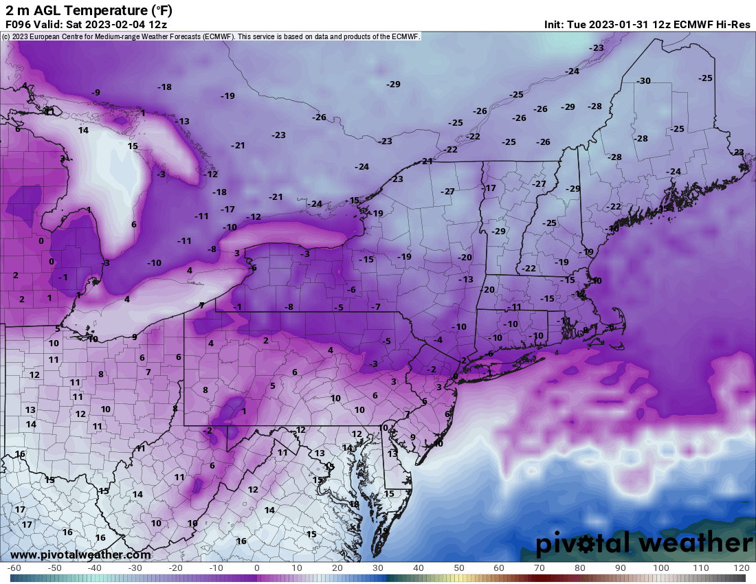
Short lived but pretty damn cold.
.thumb.png.ddcf0af8e8ee578c632a317c1b6f30f7.png)
-
That's some serious cold in the NE. NWS Albany talking about wind chills of -25 to -50 Friday night/Saturday morning.

-
11.3 degrees above normal. Yikes.
-
Picked up a 1/2 inch last night. Schools had 2 hour delay. 31 and sunny.
-
93-94 was an amazing winter in the mid HV for cold and snow lovers. I just remember it being sold damn cold and it never stopped snowing. I remember battling ice dams on my roof because of the snow and cold. I got as cold as -22 that winter.
-
Picked up a half inch yesterday, big whoop, brings me to 7 for the season. Again, big whoop.
-
4 days actually. I think it's Jan 29th.
-
I'm 10 miles north of Poughkeepsie in Dutchess county and we got maybe a half inch on colder surfaces. A big nothing burger.


.png.2858fe33911bd233e7dabb90417c954d.png)