Chinook
-
Posts
10,674 -
Joined
-
Last visited
Content Type
Profiles
Blogs
Forums
American Weather
Media Demo
Store
Gallery
Everything posted by Chinook
-

Severe Weather 3-23-23 through 3-26-23
Chinook replied to cheese007's topic in Central/Western States
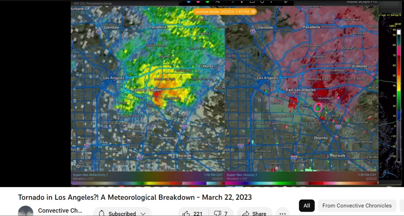
This radar image from Montebello/Los Angeles tornado from a youtube video from channel "Convective Chronicles" (I recently found this excellent channel)
-
Severe Weather 3-23-23 through 3-26-23
Chinook replied to cheese007's topic in Central/Western States
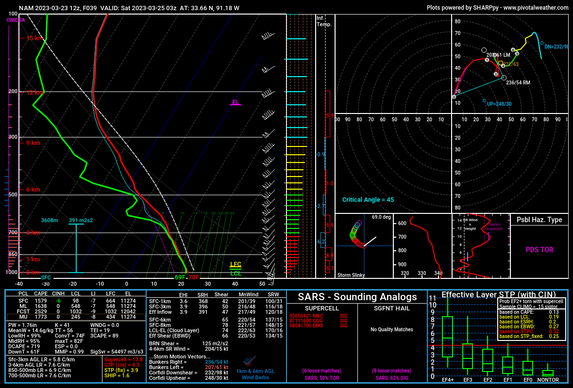
Here is the NAM forecast sounding for eastern Arkansas for 03z (tomorrow night), with effective STP of 4.3. Some odd things going on in the hodograph at 3km above ground, but I'm not sure too much to talk about, given the fact that the rest of the hodograph is excellent for tornadoes. The 3km NAM (not shown here) has up to 490 m2/s2 of 3km SRH at the Arkansas/Louisiana border. HRRR for 03z tomorrow night
.thumb.png.f60fea6880e62583c5994e8934b1293d.png)
-
new loop http://www.greatlakes.salsite.com/Jan_5_2014_SfcRadar_loop.html
-
Texas/Oklahoma Discussion & Obs Thread 2022
Chinook replied to It's Always Sunny's topic in Central/Western States
I think this a new product by College of Dupage, Ensemble CAPE for the event that's now 96hr+ in the future, so it's not on the 3-day outlook.png.ef49ea494dcaa80e4e30cc75bcc5d17d.png)
-
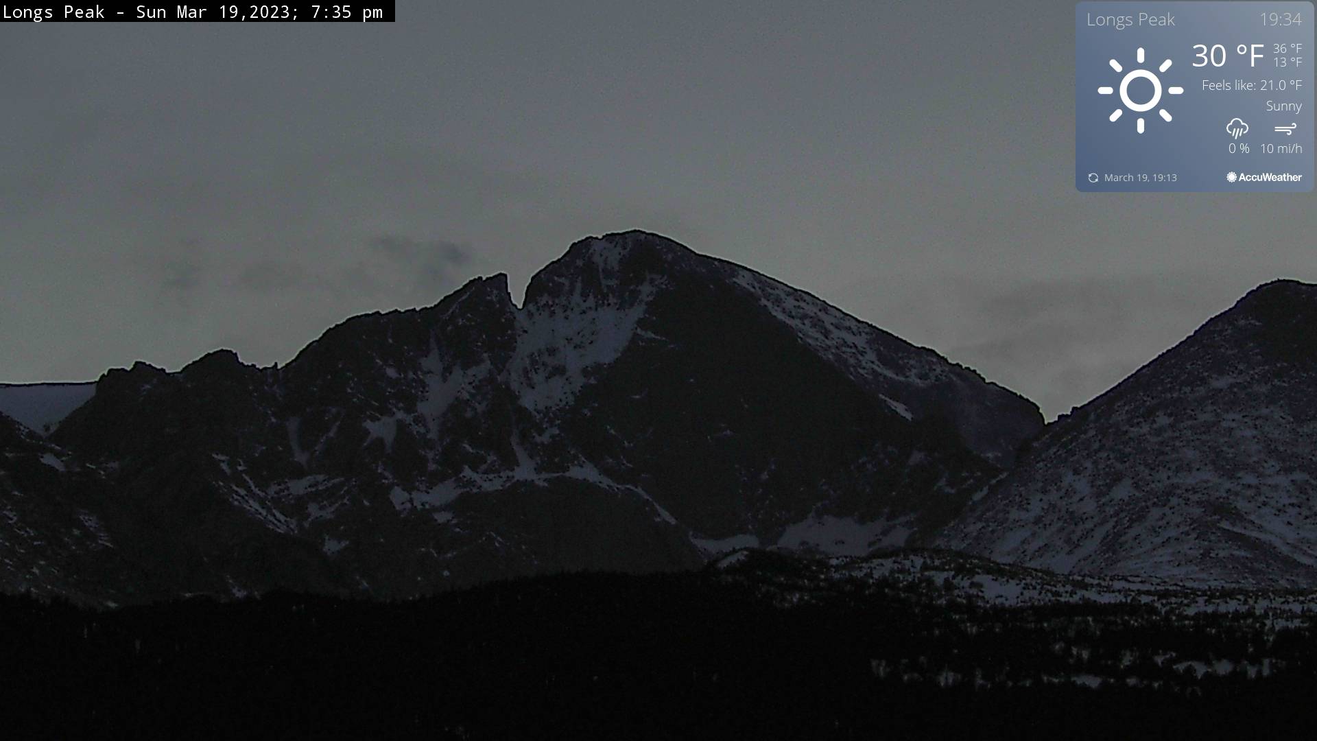
near sunset

-
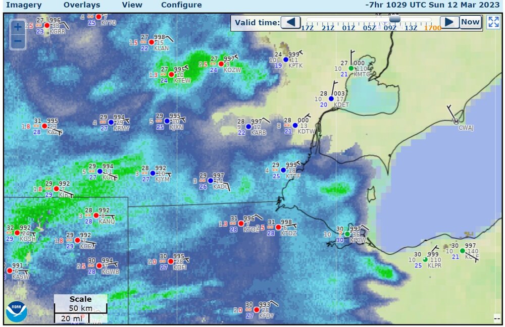
Yesterday (Saturday) Toledo was 22 degrees with a wind chill of 8 degrees before midnight. It's kind of rough considering there had been a lot of warmer temperatures in February and so many days without snow. Toledo had a high of 33 and a low 22 which was -16 for the high and -8 for the low.
-
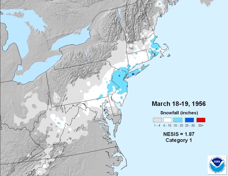
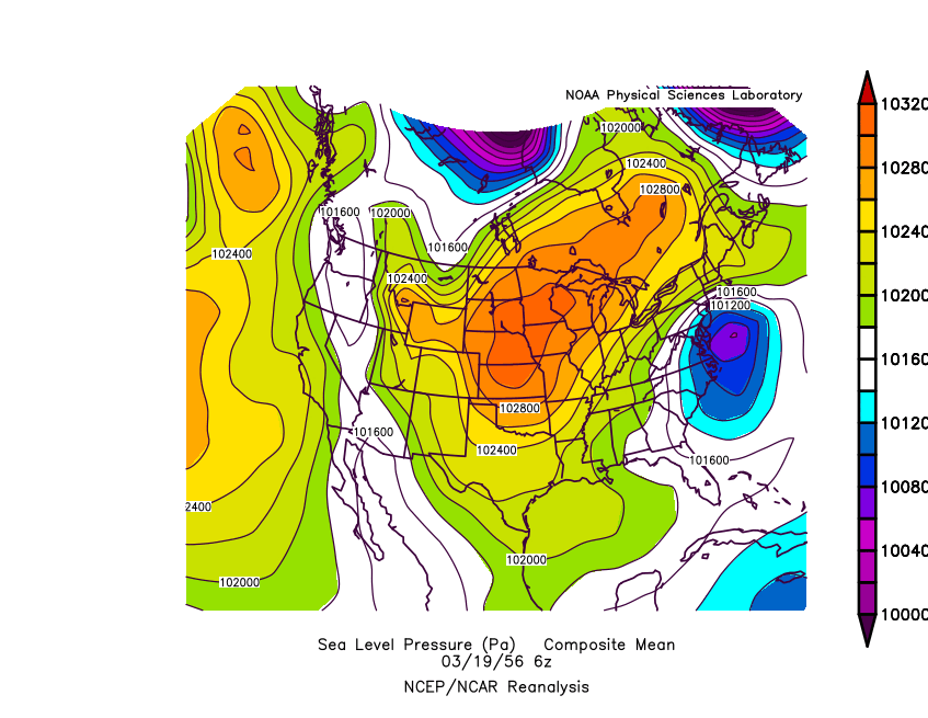
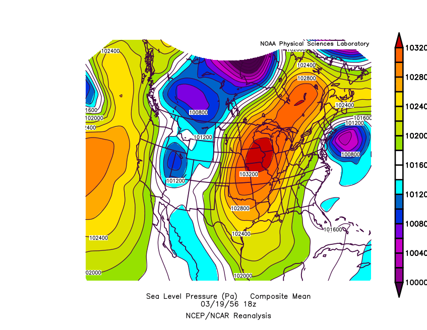
I believe once Weathafella said that he remembered this heavy NY snow storm, which happened almost on St. Patrick's Day 1956
-
I will call this the winter of A.R.N. Another Rainy Night.
-
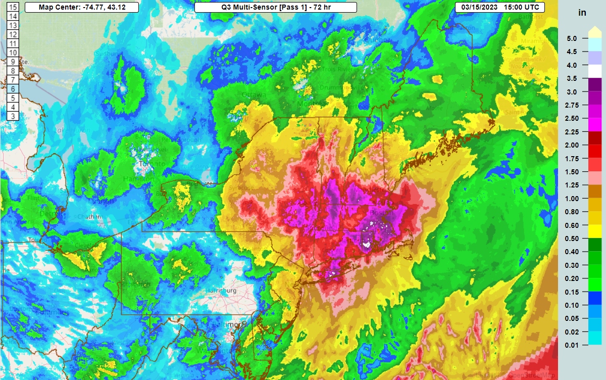
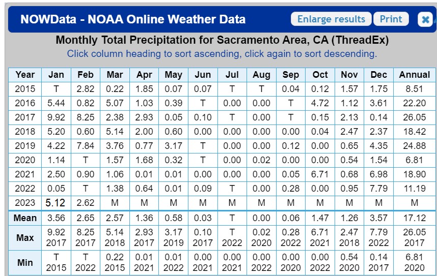
California has gone from flood to drought to flood. Sacramento had apparently 5.12" of precipitation in January. (I added this. The NOWDATA info said the data was missing) and already 2.98" between March 1 and March 15, making for 19.46" of precipitation since November 1st. That's almost 3x higher than the 2020 calendar year.
-
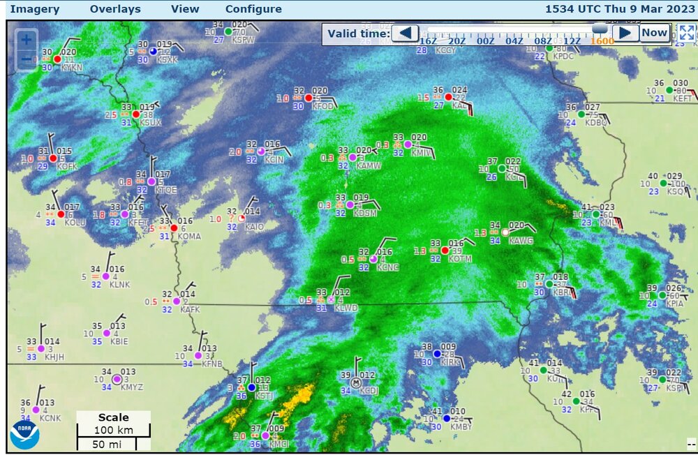
radar/rain gauge adjusted MRMS precipitation for the last 72 hours

-
As a non-northesterner, I still gotta say, this is quite a thing

-
hence the Six States. Yes it's weird, I remember tracking it. the storm was quite washed out by the Michigan state line. but hey. Six States. Now, with the time change, we have to wait until 10:15 PM or 10:30 PM Eastern Daylight to get the 00z 3km-NAM and similar products. Boo.
-
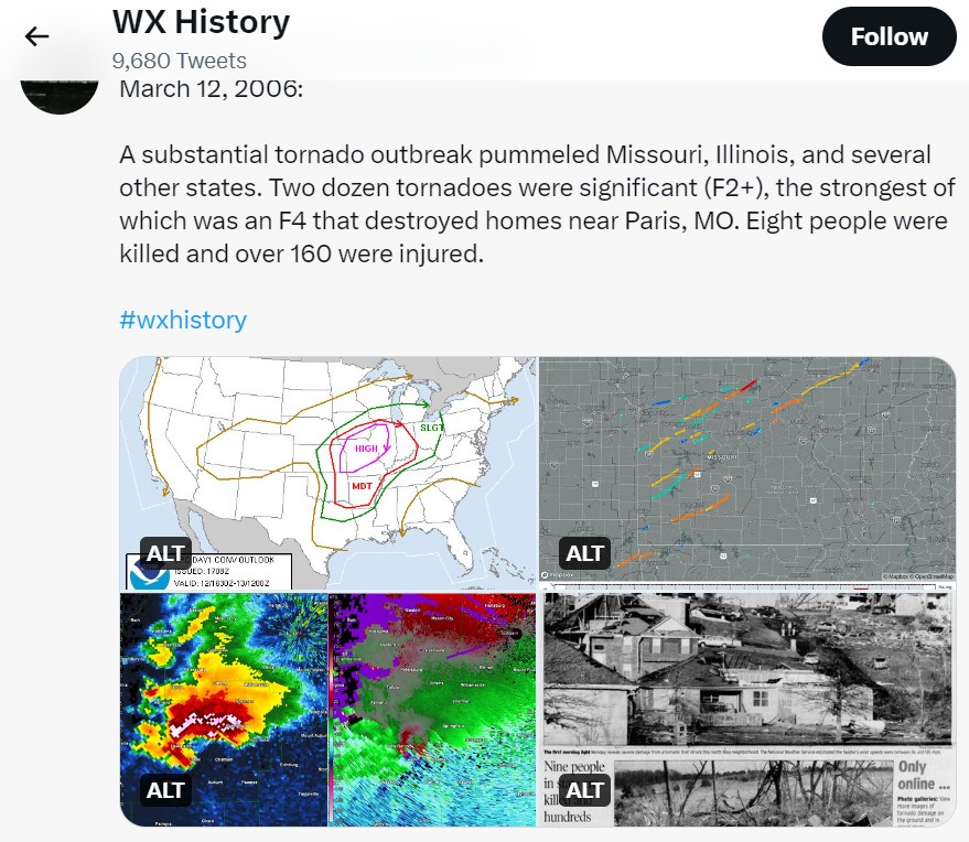
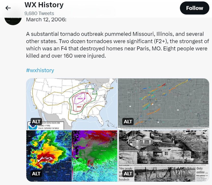
On this day in 2006, major tornado outbreak and the "Six-State Supercell," the supercell that brought the 66-mile tornado track that damaged Springfield IL (EF2). According to Wikipedia, 99 tornadoes confirmed from March 9 to March 13.
-
It has been two years since the Big One.
-
I got about 1" which was kind of generally expected. The overall situation was much like Friday, with the snow melting on pavement. northern Minnie today
-
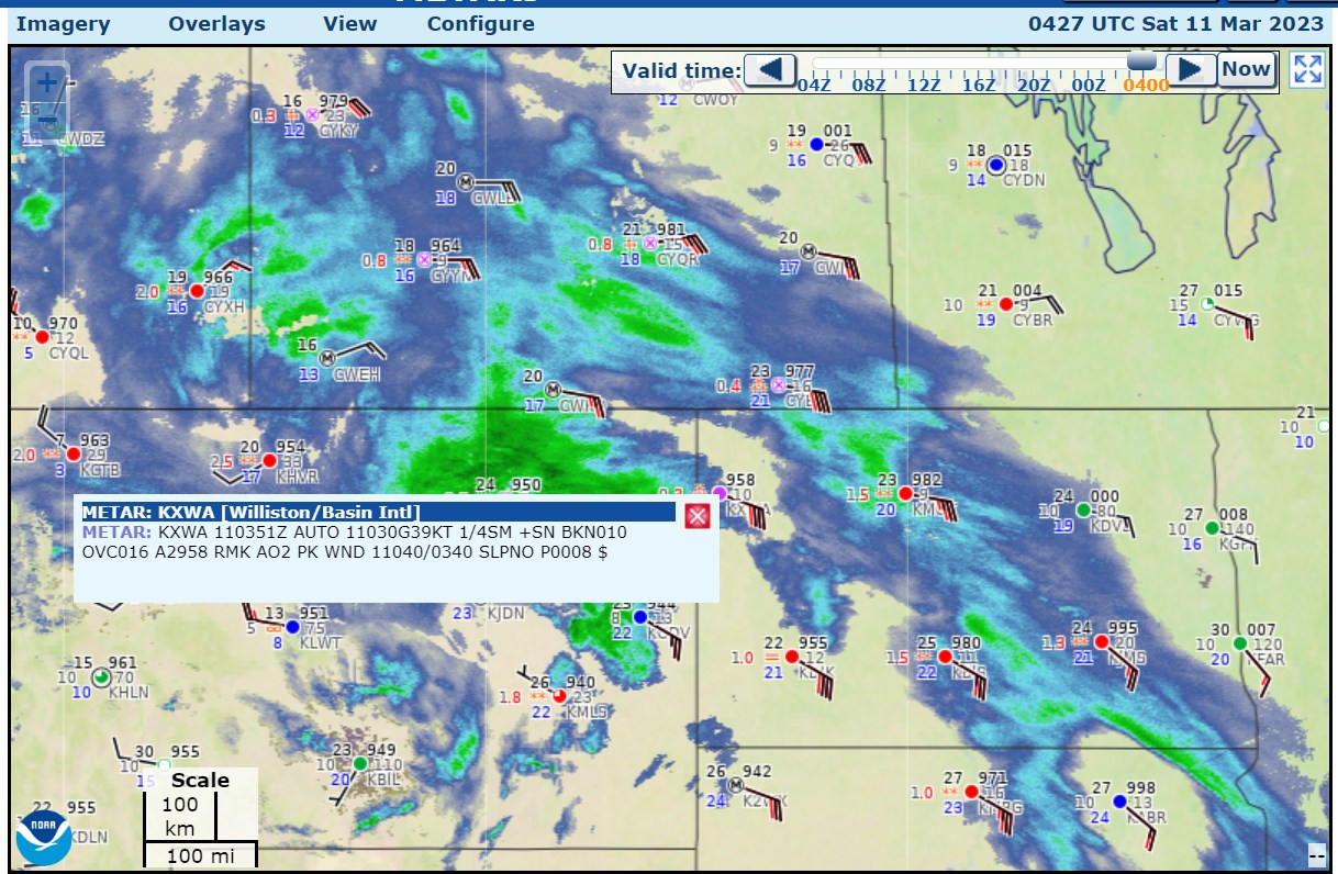
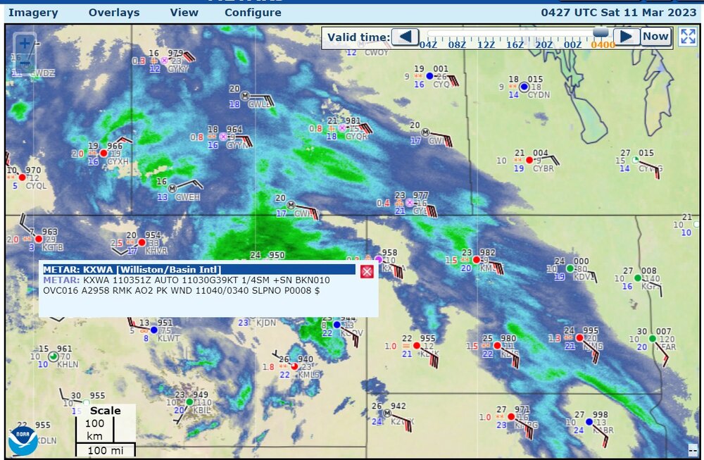
Blizzard (1/4 mile visibility, snow, peak wind gusts to 40kt at this moment) with easterlies. Hard to do with easterlies.
-
This winter compared to my 80" Loveland winters. November: 1" and dusting? maybe more December 1" and ground blizzard, maybe 1" more after Christmas. January: 7.5" February: 1" March: 2" (Today... super wet at 33 degrees) total 13.5"
-
This winter sucks. There is about 1" to 2" on grass and no snow on pavement because it was so warm.
-
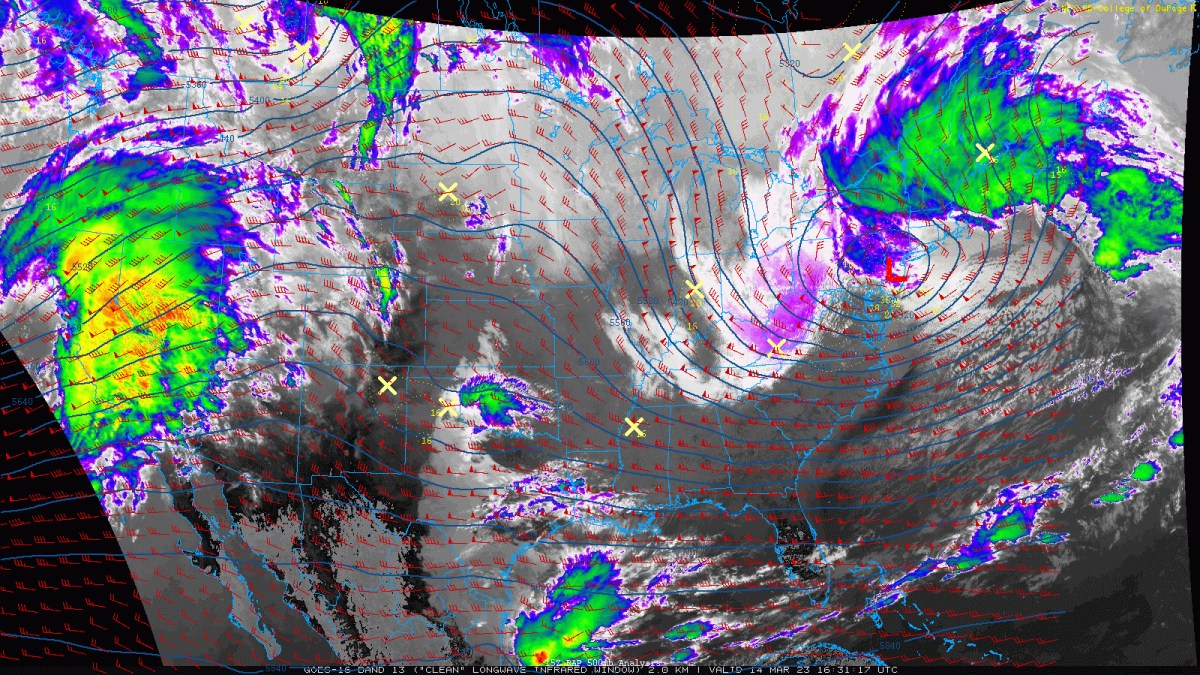
current radar and storm reports
-
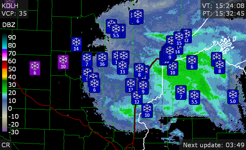
the storm is raging in Iowa. Des Moines, 1/4 mile visibility
-
70's and then snow is normal for Colorado in Oct/Nov and April.
-
This is one of the first times my place has had a north/northeasterly wind flow for a long time. Also note my area was 6 degrees above normal in February.
-
I may finally have to shovel more snow than I did in January.
-
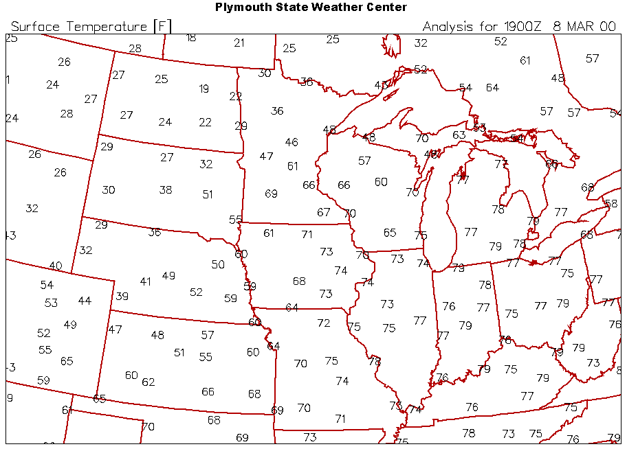
March 8, 2000? Weird. it checks out
-
Loveland Co-op, close to where I lived in Loveland: 40.1", also much better than Fort Collins. (I don't know what street that was on.)

.png.aebce121bd63233d4168aae8eddf8bf2.png)