Chinook
-
Posts
10,674 -
Joined
-
Last visited
Content Type
Profiles
Blogs
Forums
American Weather
Media Demo
Store
Gallery
Everything posted by Chinook
-
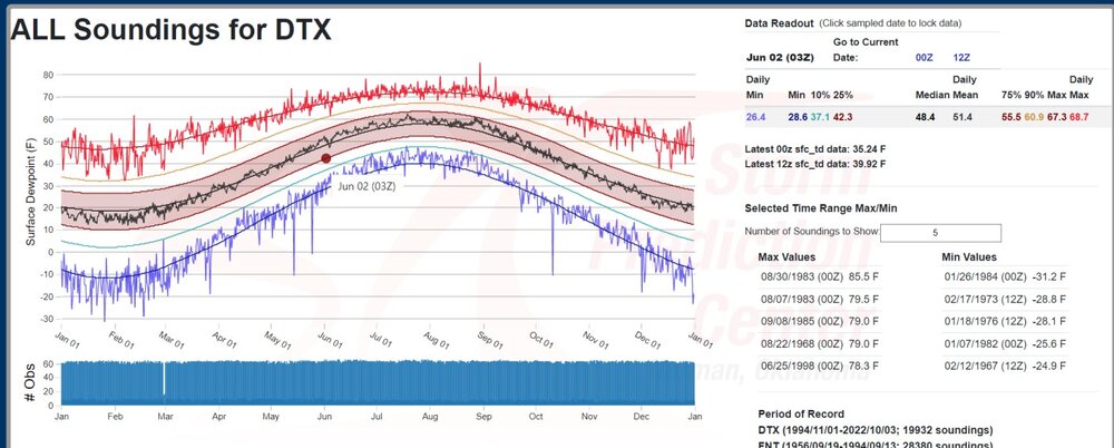
I don't think I've seen a 36 dew point in Toledo in June, other than today. And what a firey day it is, with higher surface smoke concentrations. It does appear that dew points of upper 20's to lower 30's have happened at a combination of FNT and DTX sounding locations at some past time
-
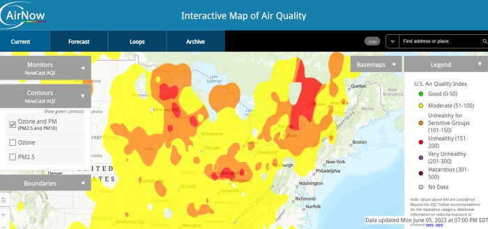
This map says it's unhealthy for sensitive groups in Wisconsin, Ohio, Iowa
-
Today was some of the haziest weather I have seen without being close to a wildfire. I drove to work after sunrise and the sun was red. I smelled smoke briefly yesterday, I think a couple of times. When I lived out West, I smelled smoke from -distant- fires on several days over the course of several years. And then there were the close wild fires in Colorado, and that is not necessarily something I need to compare to weather today in Ohio. Finally, the HRRR shows integrated smoke density and surface smoke density correctly. Both values are very high over my area. I'm not sure what happened at NCEP before but it didn't correctly have these variables over a week ago.
-
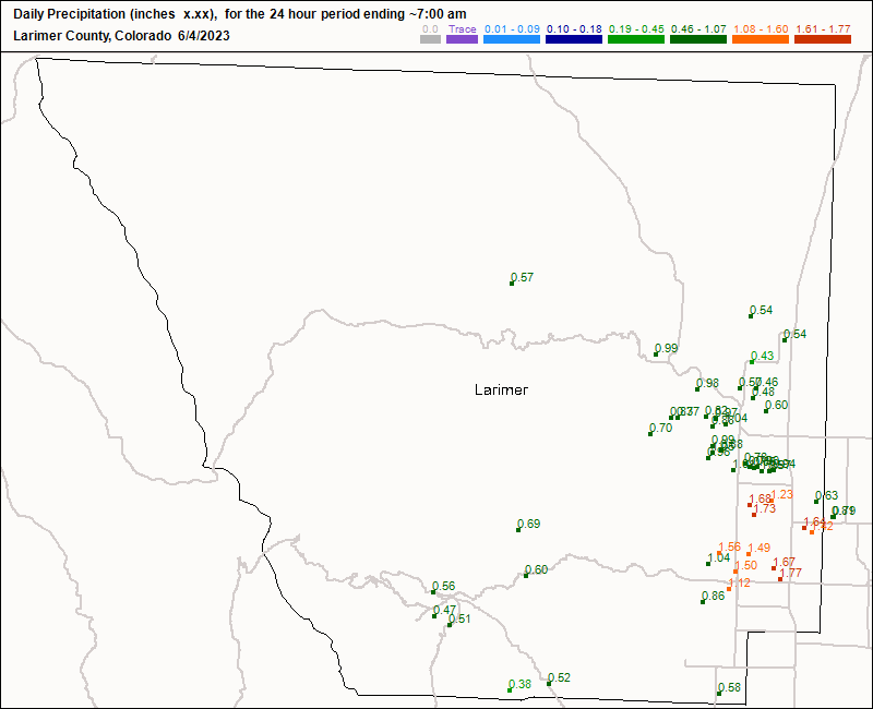
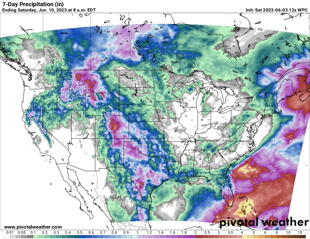
My place in Ohio could badly use the 1" that fell on Loveland.
-
I forgot what westerly winds feel like. There haven't seen a westerly winds for a week. And honestly it was kind of nice. 90 degrees with dew point of 50 or degrees even lower reminds me of Denver. But then again, the grass in everybody's front yard is starting to look like the prairie grass. The natural prairie grass in Colorado dries out as soon as you hit 90 or 95 on the high plain.
-
hey this is fun

-
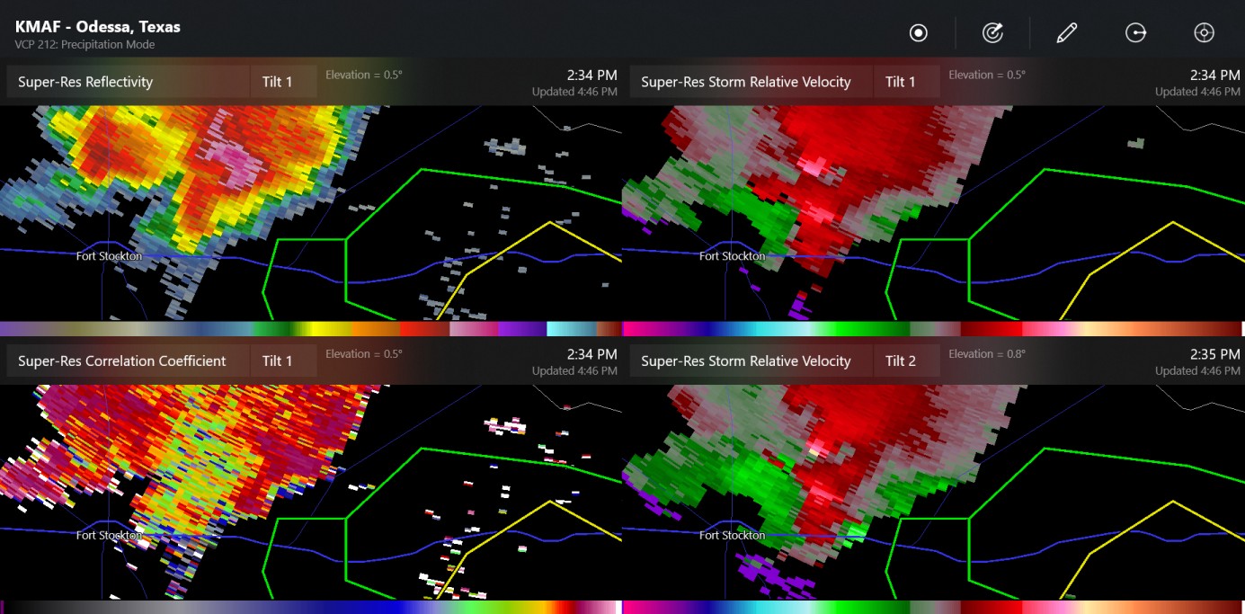
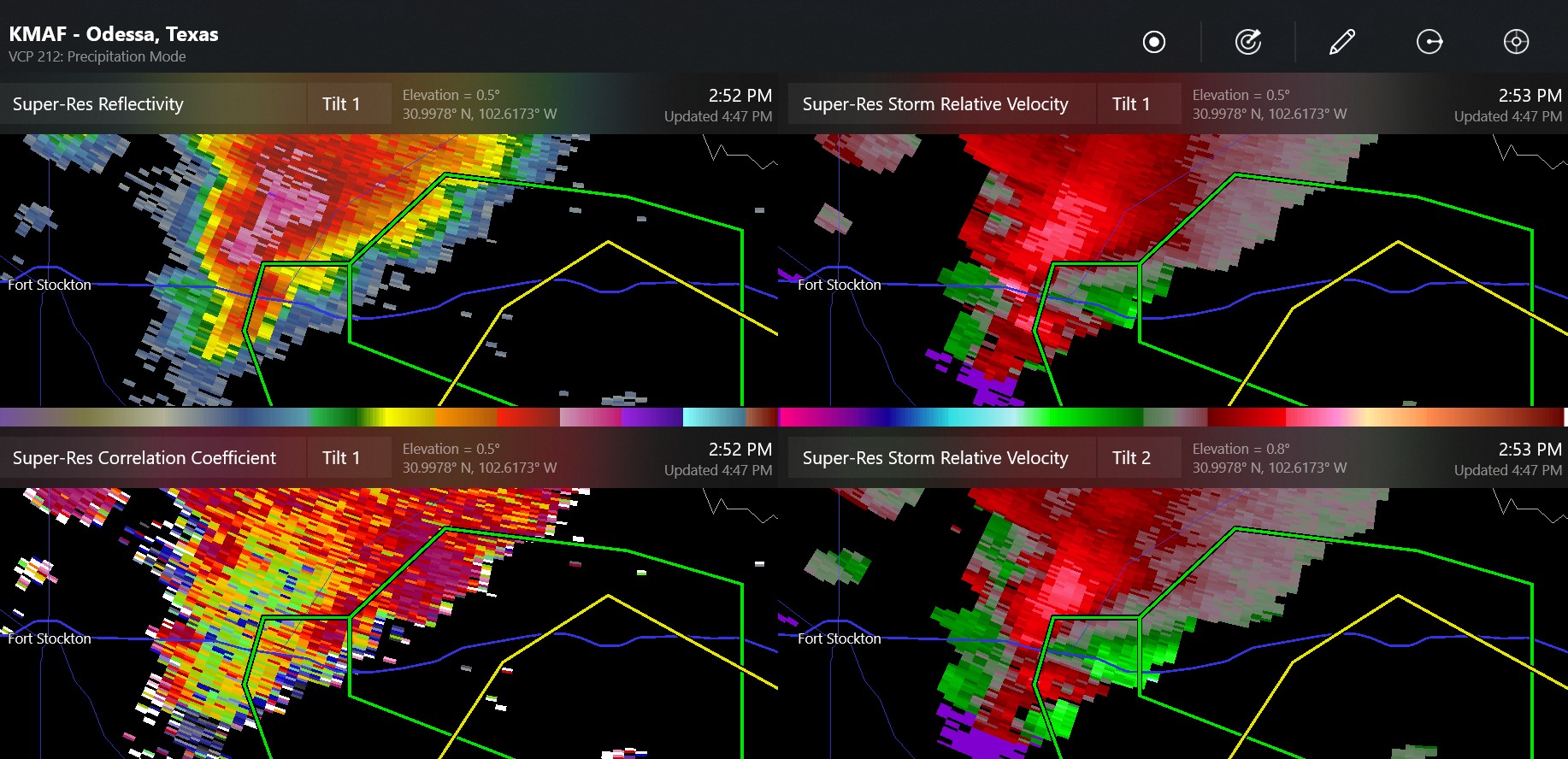
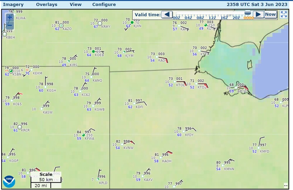
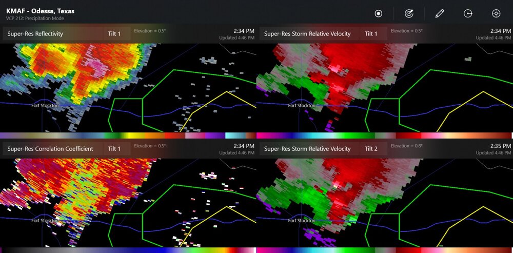
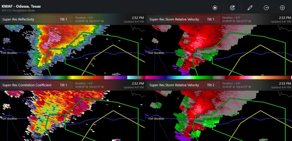
There were tornado(es) reported north and east of Fort Stockton and also a confirmed warning existed a while ago, in the range of 25-35 miles SE of Fort Stockton.
-
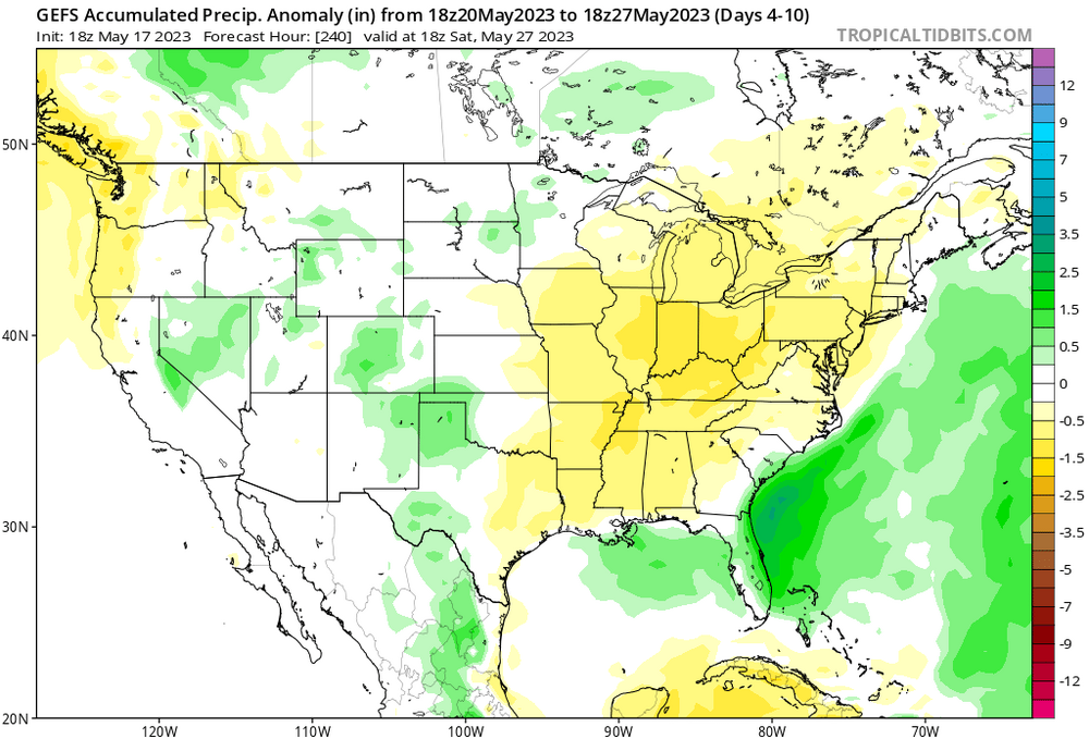
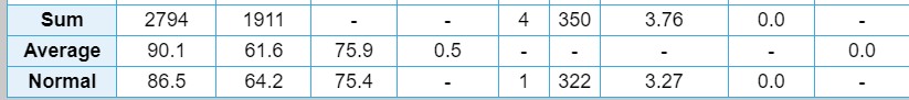
New thought here. The map from ESRL-PSD says the northwest Ohio division was possibly +2.5 to +3.0 degrees F for July (not sure about the colors) Let's look at some numbers that are the specific observations at the airport. Toledo had an average temperature 75.9 which is listed in this table as 0.5 degrees above average as seen here. The 1991-2020 current 30yr average July is 73.8 degrees. The 1951-1980 average July temperature was 72.1 degrees. so 75.9 would have been +2.1 based on the recent data but it would have been +3.8 based off the data up to 1980. So I'm confused.
-
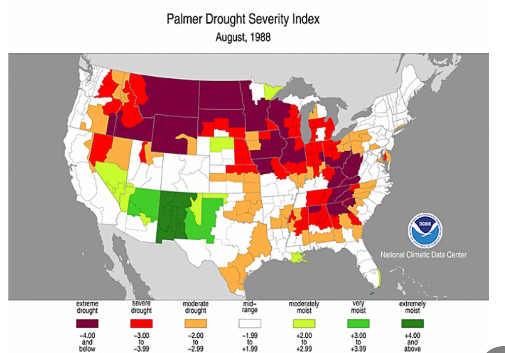
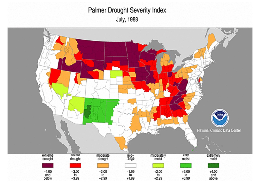
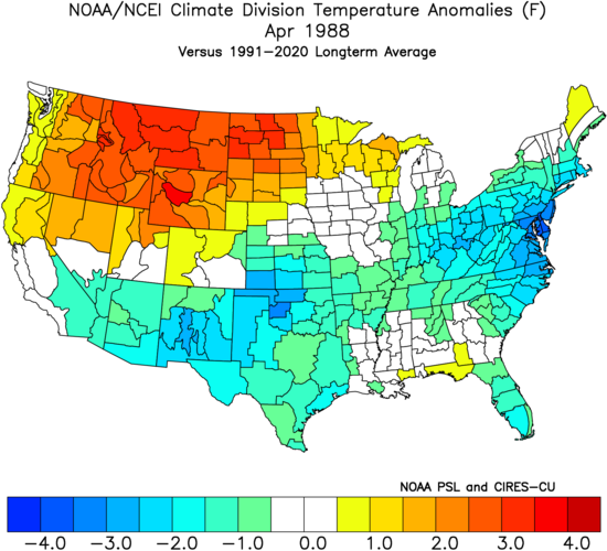
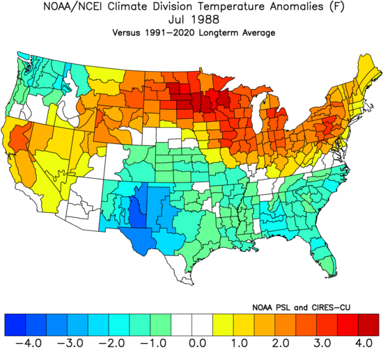
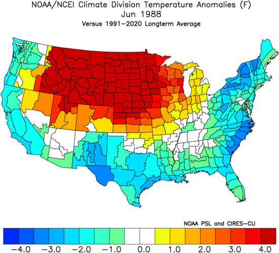
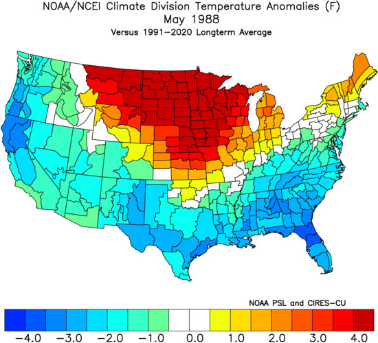
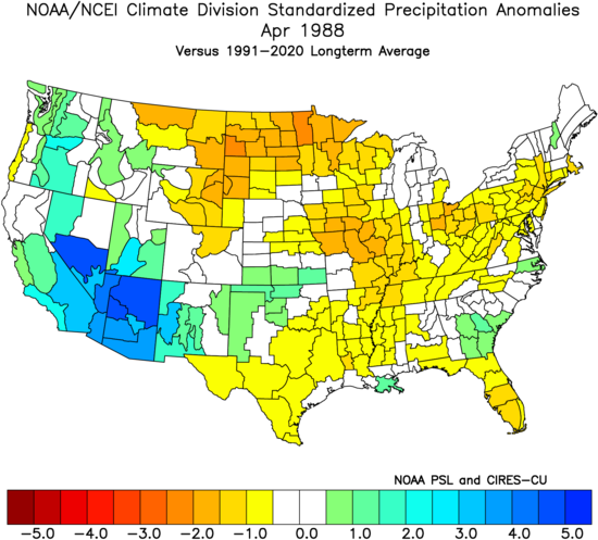
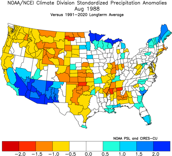
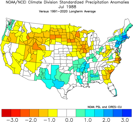
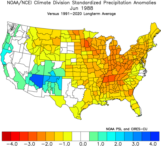
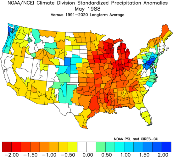
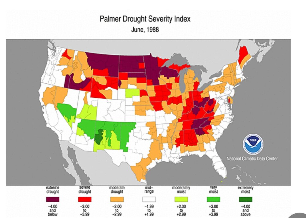
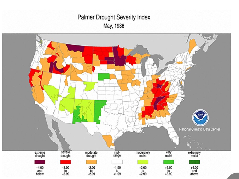
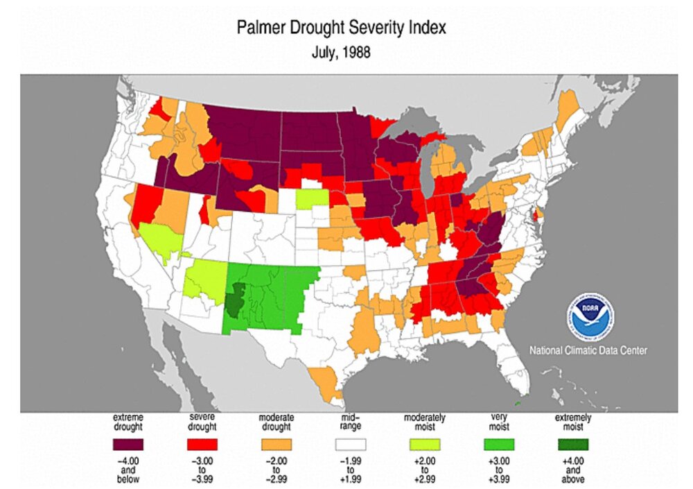
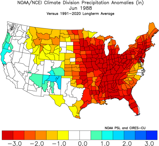
This summer is looking bad already as a blocking pattern has made the rainfall go away for the last 3 weeks here. Let's look at a historical d***ght of 1988. It stunk. I remember it. Up to that point in my life I had never heard a weatherman say it was 104 degrees outside. The development really happened in April as the temperatures over southern Canada and the northern Midwest and Rockies were very high. Then, May and June got very dry and then also very hot over a lot of the central to eastern US. The core of the driest weather moved eastward in June. The monthly precipitation plot shows that the precipitation departure was -3 inches over the entire eastern USA. Considering the entire month of July, northwest Ohio had normal precipitation but was still suffering from the effects of drought. The Palmer Drought Index showed a continued drought into September here. In August, the Palmer Drought Index showed extreme drought in the Appalachians, Illinois, and also the northern tier of the US. Some Toledo stats. On June 25, Toledo hit 104 degrees. Then, on July 1st there was a low temperature of 40 degrees, which is nearly unthinkable for mid-summer. Then on July 6th-8th, it was 100, 103, and 100. That's such a crazy change of temperature that is indicative of low soil moisture. This was some of the worst soil moisture that NW Ohio has ever had, as the July Palmer Drought Index was -4 (see plot). Toledo had only minor rainfall until July 18th, but then more rain. July 1988 had a monthly temperature near normal and precipitation above normal at Toledo. The heavy rainfall occurred in between July 30th to the end of August. PRECIPITATION, standardized departure, as calculated by the ESRL-PSD web site June 1988 precipitation departure, in INCHES

-
It looks like some lake-breeze convergence helped kick off the storms near Chicago. I wish that would happen here.
-
At my current location in Ohio at 41.5 degrees north, sunrise is 6:03AM and sunset is 9:01PM. At Fort Collins it is 5:32AM and 8:24PM. The sunset time is a difference of 37 minutes, plus extras due to the mountains. For an equivalent location with latitude of 41.5 in Wyoming, directly north of Fort Collins, it would be 5:29 and 8:27.
-
Denver has a chance of rain for 7 days. This storm was very loaded with rain and hail for several minutes
-
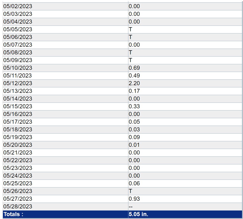
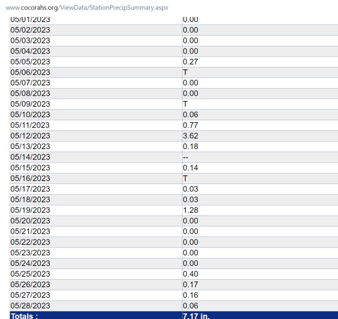
Lochbuie CoCoRAHS spotter near the Airport got 7.17" of precip. That's like more than half a year of precip for a bunch of areas, considering 14" per year.
-
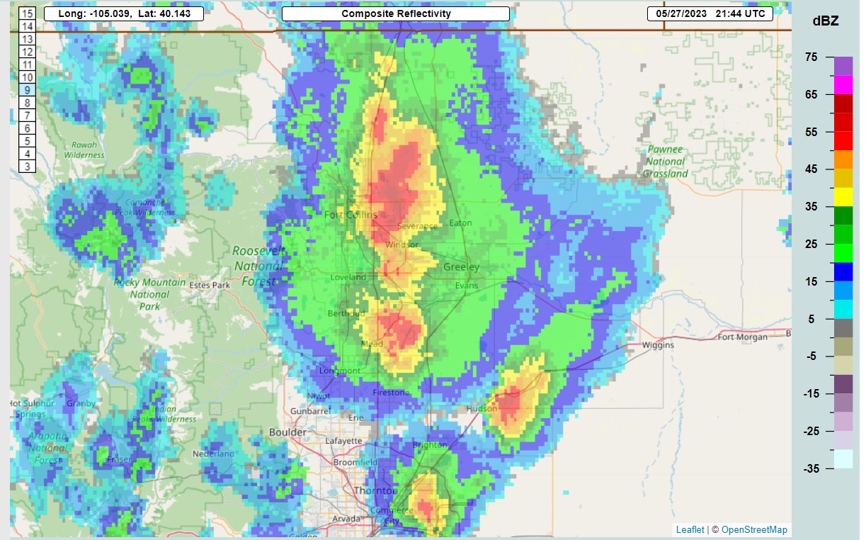
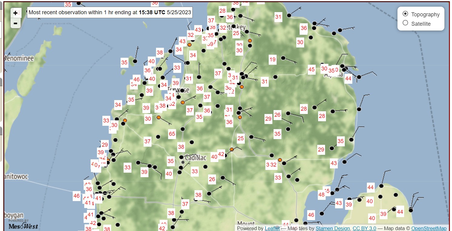
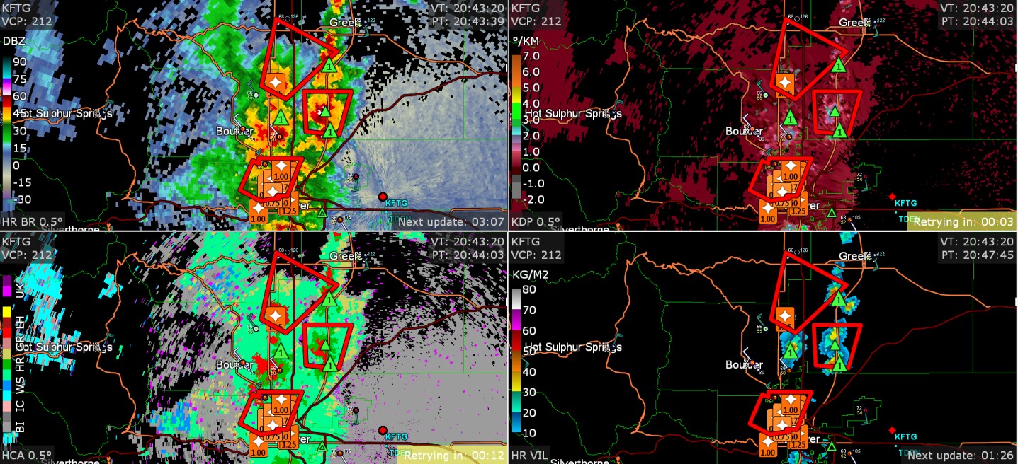
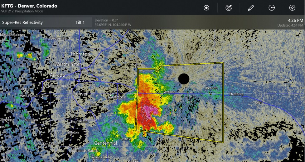
New upslope storms have formed at Boulder and near Denver. I'm not sure if these could stall and produce a flash flood. this was at 3:44 Greley precipitation this month (CoCoRAHS)

-
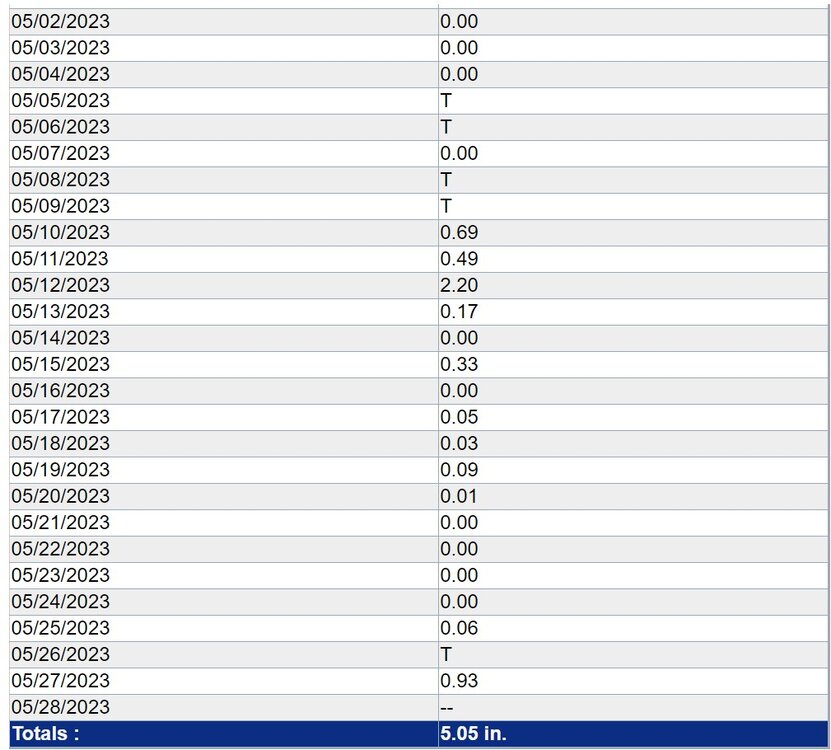
Pellston MI, the Ice Box, was 29 degrees, yesterday. That's pretty bad for May. I guess it's known as being the ice box for being just far enough away from Lake Michigan to get away from the moderating effect of the water, and far enough north to be under the colder temperatures aloft.
-
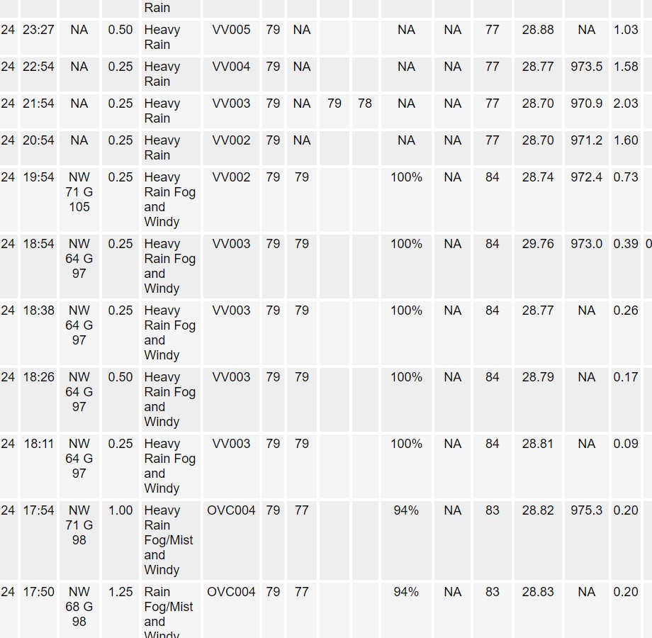
this one would have annoyed me as the heavy rain just avoided Loveland. There was up to 1.25" hail in downtown/north metro at rush hour on the Friday before Memorial Day! Traffic got kind of slammed I'm sure.

-
1" hail reported at Englewood and Centennial
-
It looks like the forest fire smoke went away today. I hope it stays away. Probably not. I think it got pushed west, just to get pushed east later.
-
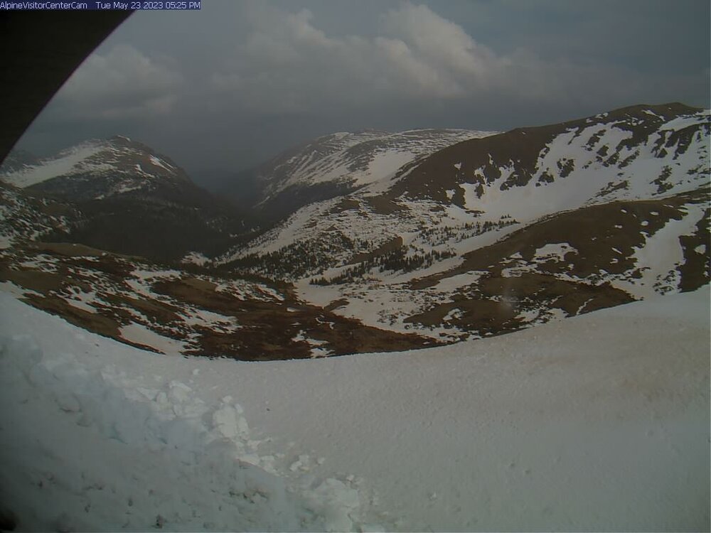
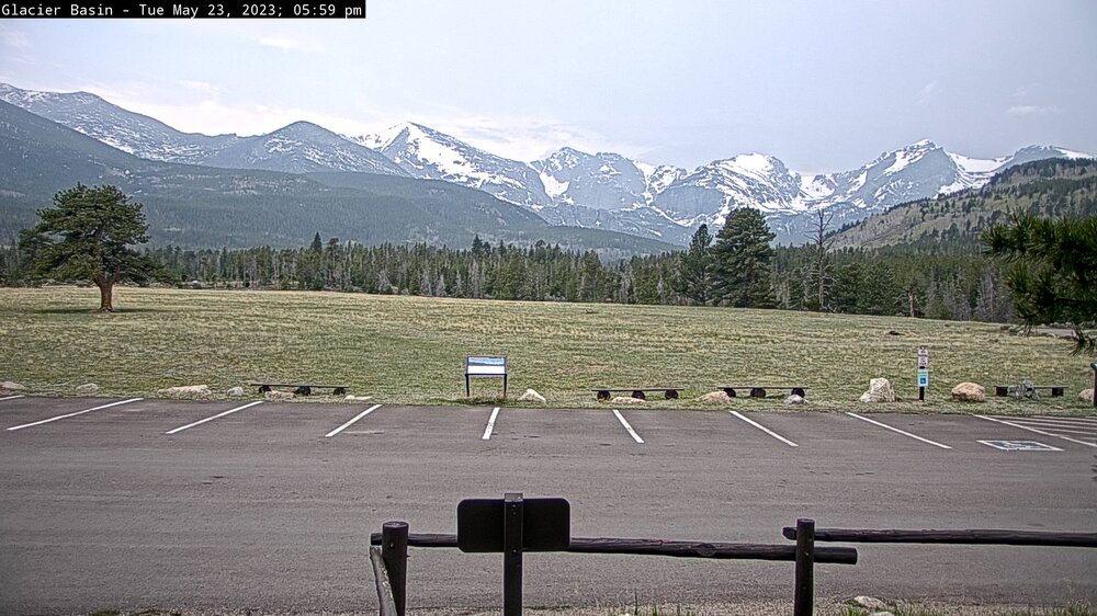
From what I can tell, the forest fire smoke has been above Colorado, as well as most of the Midwest. For my area, I noticed it a week ago, but I don't know if the smoke was over Colorado for all this time. Here are RMNP web cams haze other haze
-
I want some thunderstorms to track in the Midwest.
-
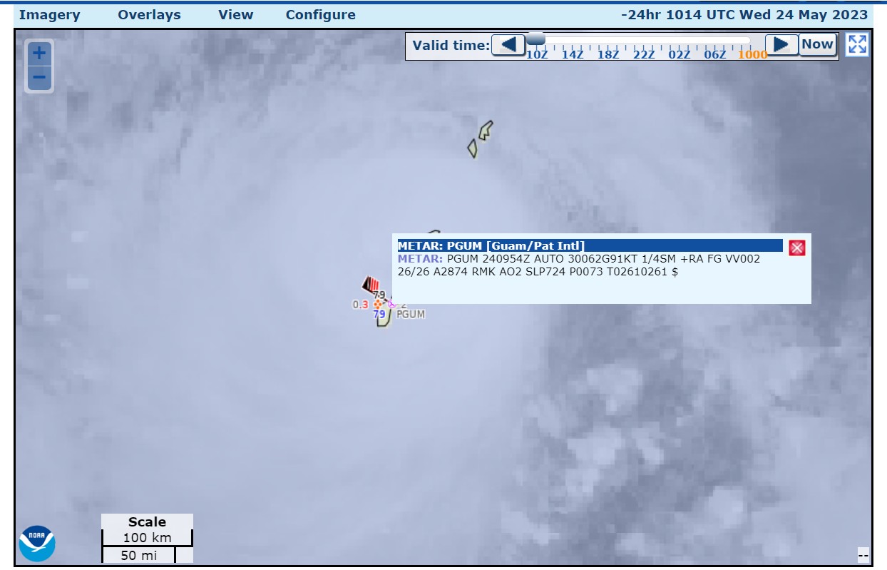
 Global models have this storm going over Rota Island, Northern Mariana Islands, part of the USA.
 -
Hello, Newman.
-
Excellent sunset photo
-
I need to turn on my thunder magnet.