cheese007
-
Posts
1,637 -
Joined
-
Last visited
Content Type
Profiles
Blogs
Forums
American Weather
Media Demo
Store
Gallery
Everything posted by cheese007
-
Looking at Google maps traffic data and the damage pics seems like it was a brief but powerful tornado.
-
TDS in Arlington!
-
Had a brief tor warning up in Denton. Can't say I saw that coming on a marginal risk day
-
40% blob now where the lemon was this morning. Unreal
-
Can't have climate change when you ignore the existence of the climate
-
So with 3 Atlantic majors in October-November for the first time in recorded history, and with more activity likely in the weeks ahead, does anyone still think this season is a "bust?"
-
30s and cold rain coming for DFW Sunday night into Monday. Aka the closest thing we ever see to wintery weather since 2015
-
MO/KS/AR/OK 2020-2021 "Winter" Discussion
cheese007 replied to JoMo's topic in Central/Western States
No -
*yawn* Wake me when severe season rolls around (I'm not naieve enough to even consider being optimistic about winter snow)
-
Watch this thing make landfall as a tropical storm just to mess with people. Haven't had too many TC forecasts bust low this year!
-
More than decent chance we will have a Greek letter Cat 5 storm in the next 24 hours. What a year
-
If you cancel the season every week, eventually you will be right!
-
I don't trust these gulf systems one bit
-
La Nina winter. Bleh
-
56 IMBY. Cold front fame through after all!
-
Didn't the NWS get the message that the season was over? Hard to avoid if you check this forum on a regular basis!
-
King Euro has highs in the mid to upper 80s for DFW come Wednesday. Hopefully not a preview of winter being a repeat of the last 5 ehere nearly every setup falls apart at the last second
-
Lows in the mid 50s during summer in DFW. 2020 continues to be full of surprises
-
People will be screaming BUST if those end up a bunch of fish storms because of course they will
-
Laura continues to track south of model guidance. Got a bad feeling about this...
-
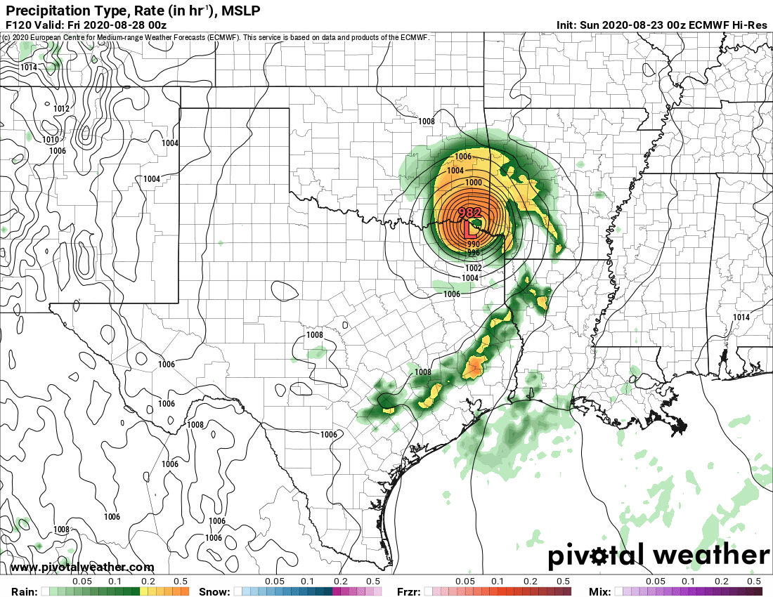
Someone posted an image of the Euro bringing this thing into OK as a full-on hurricane and, while intensity/track this far out is a crapshoot, it's hard to overstate how devestating that would be. Especially so if that track shifts west towards DFW...

-
Getting some pop up storms in DFW/east TX with a cell over Rockwall dropping decent hail. Given CAPE in the area anything that pops up might go severe quick
-
Healthy reminder that marginal != 0
-
They're also probably more than a little gun-shy due to the string of high-risk busts they've had over the past 6-ish years
-
Multiple severe thunderstorm warnings over the DFW area. More active afternoon than most of chasing season