All Activity
- Past hour
-

E PA/NJ/DE Summer 2025 Obs/Discussion
KamuSnow replied to Hurricane Agnes's topic in Philadelphia Region
Hope you get dumped on, but 2 hours max. Is that reasonable? -
Picked up .06" today.
- Yesterday
-

July 2025 Discussion-OBS - seasonable summer variability
LongBeachSurfFreak replied to wdrag's topic in New York City Metro
When the sea breeze is minimal and we have a another focusing mechanism we can get heavy rain right to the beaches. Weekend looks like a perfect summer weekend. -

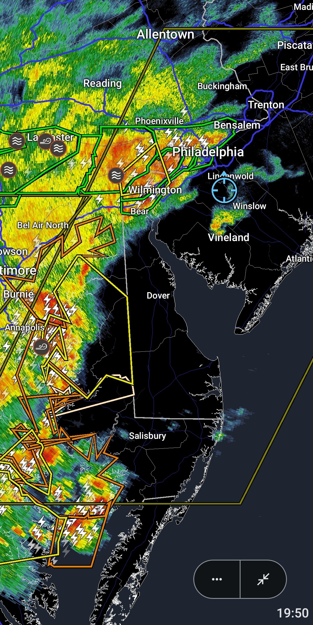
E PA/NJ/DE Summer 2025 Obs/Discussion
Hurricane Agnes replied to Hurricane Agnes's topic in Philadelphia Region
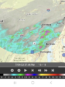
It got pitch black here and rain is starting, coming up from the SW. Temp is 83 with dp 74 and getting thunder and some lightning.
-

E PA/NJ/DE Summer 2025 Obs/Discussion
BBasile replied to Hurricane Agnes's topic in Philadelphia Region
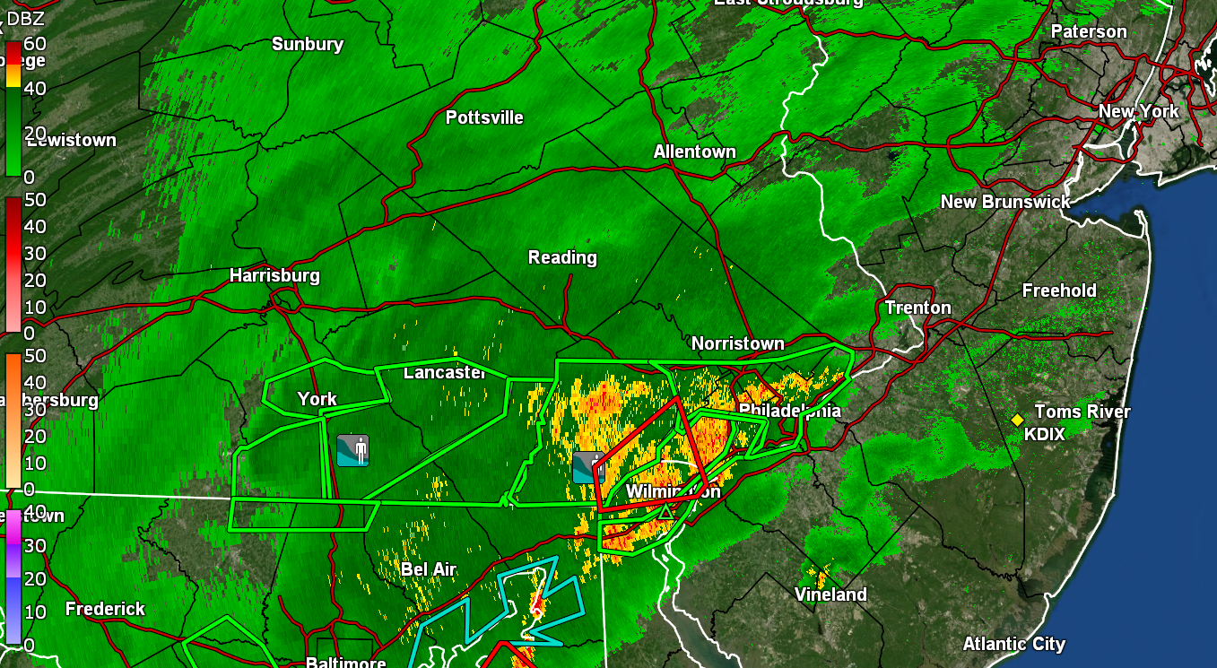
Good stuff! It does look like it's intensifying into Jersey. Regardless, the whole line is looking pretty damn good. I want mayhem, but I'm okay with beneficial rainfall, too. Lol
-

July 2025 Discussion-OBS - seasonable summer variability
Wannabehippie replied to wdrag's topic in New York City Metro
Note I am a supporter of nuclear energy. Indian Point Nuclear Power plant was commissioned between 1962, and 1976. The oldest of the three was decommissioned in 1976 due to poor design and operational issues. The other two licenses were set to expire in 2013, 2015. Those two had a history of issues dating back from 2000. Any shot at getting their licenses extended was blown to hell when the operator, Entergy, refused to build a new closed-cycle cooling towers system at the cost of $1 bil. That was key due to environmental impacts on the Hudson River from the water taken, and returned to it. The licenses for nuclear power plants last 40 years. In NYC, LI, and at least in my area of NJ, you can buy your power from 3rd party providers. Example buy your power from Superelectric company rather than ConEd. Coned still provides the transmission of the power. This is because you cannot have a million different transmission lines from each power company. Same goes for gas service. ConEd in particular has had ever increasing profits the last few years. A lot of that money is given back to shareholders with dividends. Coned pays $3.40 a share, and that rate has consistently gone up year over year. -
DCA was reporting 1.1" so far, while the Four Mile Run USGS gauge claimed about 1.4".
-

July 2025 Obs/Disco ... possible historic month for heat
powderfreak replied to Typhoon Tip's topic in New England
It’s true, if you see a bear video on social media from a black bear doing something funny, it’s like either from VT or CT. Theres a ton of bear content coming out of CT, mostly higher population and all with cameras now. But yeah, I do notice it’s either VT or CT it seems like, and especially western CT into adjacent NY (like Columbia and Dutchess Counties). I wish I could post videos on here. My buddy has one of a bear a couple weeks ago chewing on his Amazon package on his ring camera… another one has a bear rolling his grill off his deck. -
E PA/NJ/DE Summer 2025 Obs/Discussion
KamuSnow replied to Hurricane Agnes's topic in Philadelphia Region
Thanks, we're sitting on the porch, watching the rain. 2.25" so far. Looks like it wants to expand across the river, maybe you'll "get some"? -
-

July 2025 Obs/Disco ... possible historic month for heat
cleetussnow replied to Typhoon Tip's topic in New England
We are having regular bear appearances down here to the point where it’s not even news - they are on peoples ring cameras every day. We lock up because of thieves so no bear fridge raiders thus far. In fact, they seem to stay out of the trash, too. Must be some good natural vittles around. Bobcats, bears, coyotes (millions of those). Every day I see one of these on someones ring in my small town. Yet to see a bear in person tho. The others all the time. And the rabbits, holy shit the rabbits. Theres a million people in this county and somehow we have an explosion of wildlife thriving. I’m cool with it. Coyote fucked up a neighbors dog and chewed the guy up a little bit. That was on my block in the winter. People carry because of the coyotes now. -
Had very loud thunder and plenty of lightning earlier. Still some activity going on but nothing like an hour ago. Enjoyed it.
-
So far nothing interesting. Line kind of died out as it headed my way. Still rain incoming though.
-

July 2025 Obs/Disco ... possible historic month for heat
Modfan2 replied to Typhoon Tip's topic in New England
Decent looking cell, 53dbz; not much lightning -
Going to end up around 0.9”. Solid event, mostly for the long duration. No major deluge here, missed north and south. But around 3” for July already so no complaints.
-

July 2025 Obs/Disco ... possible historic month for heat
metagraphica replied to Typhoon Tip's topic in New England
Time sensitive. Anyone have a better radar app to look at the storm heading into Salem CT -
July 2025 Obs/Disco ... possible historic month for heat
Modfan2 replied to Typhoon Tip's topic in New England
Looks like some decent rotation with those storms out by the Brookfields -
I feel like @EastCoast NPZ today. Thunderstorms all around and not much in the bucket. North,south East and west all getting it today.
-
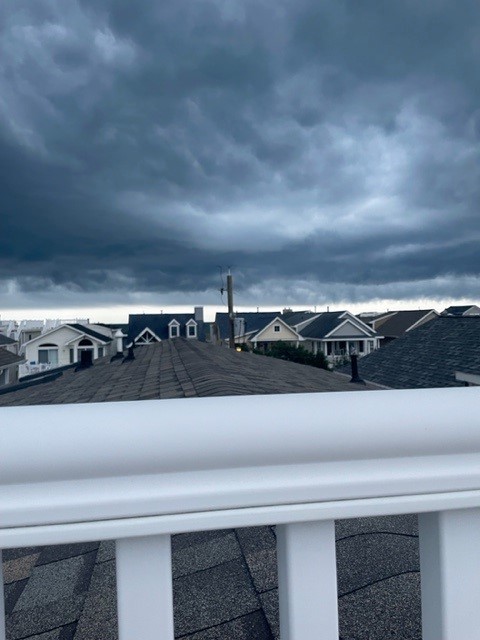
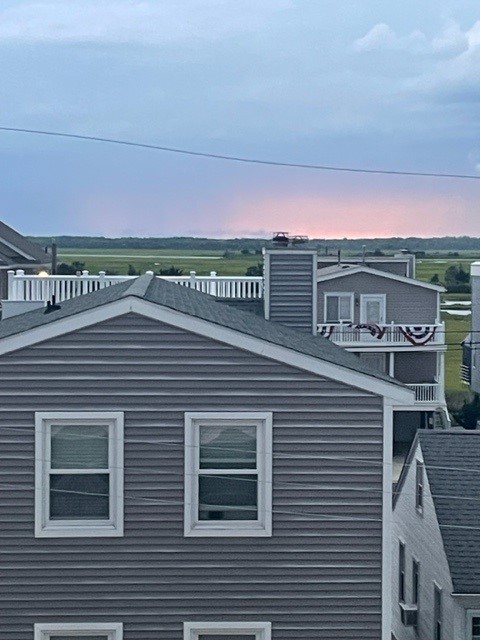
Storms rolling in last night to Ocean City NJ on the rooftop deck. Was crazy. Back in Clarks Green.
-

July 2025 Discussion-OBS - seasonable summer variability
Dark Star replied to wdrag's topic in New York City Metro
Exactly. The problem is that utilities are protected, because we need water and electricity to meet our basic needs. These utilities are "regulated", in other words protected, to insure there will always be enough supply for our demand. Therefore, capitalism cannot be counted on to keep costs down, since they are exempt from competition. So, a power company has to pay for their overhead, and are guaranteed to make a profit. Every time we buy a more energy efficient refrigerator, HVAC, washer and dryer and utilize led lights, the rates must increase to offset losses in revenue. Sort of counter intuitive. Doesn't matter if the energy sources are renewable or not. The only way to beat the system is to totally go off the grid, which I don't think is possible yet, unless you own a ranch with enough space to supply enough wind, solar and geothermal power and store it? -
Flood warning up my way
-

July 2025 Obs/Disco ... possible historic month for heat
kdxken replied to Typhoon Tip's topic in New England
Can already hear that line of thunderstorms out by Worcester. Hoping it just misses me to the north. -
E PA/NJ/DE Summer 2025 Obs/Discussion
BBasile replied to Hurricane Agnes's topic in Philadelphia Region
Yes! I'm jealous as hell. Just don't get flooded... Or struck. -
July 2025 Obs/Disco ... possible historic month for heat
kdxken replied to Typhoon Tip's topic in New England
I tried to tell folks. -

July 2025 Discussion-OBS - seasonable summer variability
Sundog replied to wdrag's topic in New York City Metro
It's not just ConEd's fault. They are taking advantage of our infinitely stupid government. "Let's shut down 20% of NYC's electricity supply that is already clean and immune to global price shocks with nothing in place to replace it!" That's just one example.


.thumb.jpg.6a4895b2a43f87359e4e7d04a6fa0d14.jpg)


