All Activity
- Past hour
-

Central PA Winter 25/26 Discussion and Obs
Itstrainingtime replied to MAG5035's topic in Upstate New York/Pennsylvania
I was thinking about this yesterday- this has been the longest stretch of prolonged cold that I can remember in years. I feel like we've lived in the teens and 20s for weeks. And yet my lowest temp for the entire winter may end up as 5 degrees. Just the way it worked out with wind and clouds at night. -
When you're running the coldest stretch of chilly high temps in over a hundred years it's a low bar to say the worst is likely over (after a few more cold days w/snow)
-
Re-visit August 8th when cold bozos "SuMMeR BaCk IS BrOkeN" which is also true
-
(002).thumb.png.6e3d9d46bca5fe41aab7a74871dd8af8.png)
Central PA Winter 25/26 Discussion and Obs
ChescoWx replied to MAG5035's topic in Upstate New York/Pennsylvania
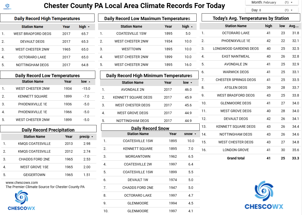
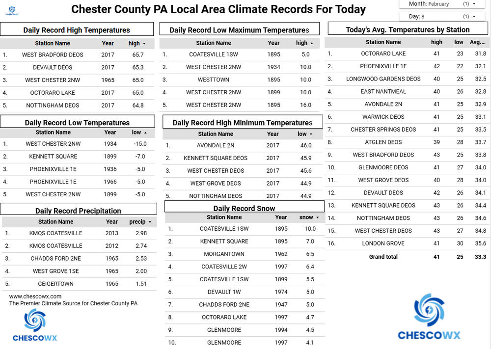
East Nantmeal looks like it had the coldest reading this morning with a low of 2.5 above zero. Of note Atglen DEOS, KMQS Coatesville Airport and the West Grove DEOS stations all will tie the County record for most consecutive days below freezing high days today at 16 straight days set way back in 1961! They are on track to set a new consecutive record of 17 days tomorrow. It looks like all spots will finally get above freezing on both Tuesday and Wednesday before falling back below freezing for max temps on both Thursday and Friday. The week looks pretty dry with only a slight chance of some precipitation toward Wednesday.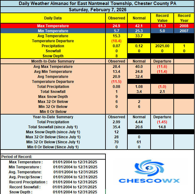
-
Can't wait for mud, potholes, water main breaks and maybe even ice jams. I just hope the warm up is gradual to minimize all that.
-
E PA/NJ/DE Winter 2025-26 Obs/Discussion
ChescoWx replied to LVblizzard's topic in Philadelphia Region
East Nantmeal looks like it had the coldest reading this morning with a low of 2.5 above zero. Of note Atglen DEOS, KMQS Coatesville Airport and the West Grove DEOS stations all will tie the County record for most consecutive days below freezing high days today at 16 straight days set way back in 1961! They are on track to set a new consecutive record of 17 days tomorrow. It looks like all spots will finally get above freezing on both Tuesday and Wednesday before falling back below freezing for max temps on both Thursday and Friday. The week looks pretty dry with only a slight chance of some precipitation toward Wednesday.
-
The answer that always works for climate alarmists....
-
Yep. Maybe we get a couple cutters or rainers and that’s the beginning of the pack disintegrating but at this point, might as well roll the dice with a milder but more active pattern and try to increase the snow pack with some juicier events. I don’t need highs of 24F and stein watching it sublimate. That would remind me of the 3 weeks after Mid-Feb 2014. That was painful watching such a monster pack just slowly sublimate in the late winter sun every day even though it stayed very cold.
-
it's broken
-
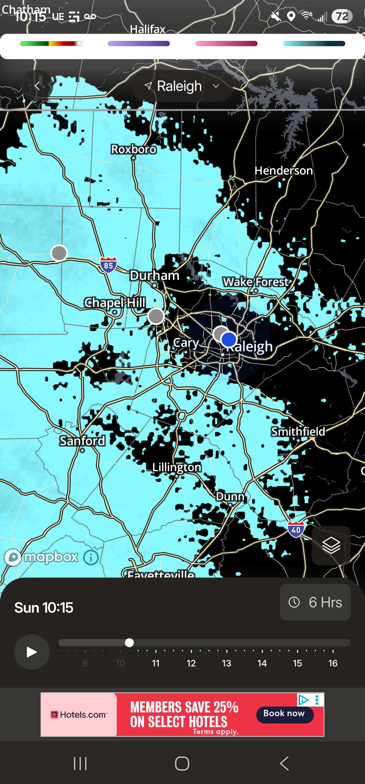
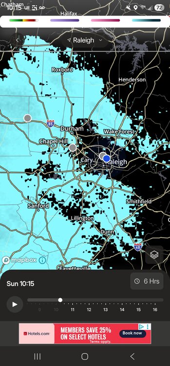
Even virga blanks Raleigh lol you cant make this shit up
-
Back isn’t broken but it’s Larry Bird laying on his stomach on the parquet with a towel.

-

Winter cancelled/uncancelled banter 25/26
North and West replied to Rjay's topic in New York City Metro
. -
I honestly had to look up who the person was. Was all over the media as if everyone knew who she is.
-
It hasn’t been talked about, but we’ve had stein for awhile. Yes we had that big storm that had significant QPF but Steiny overall. Seems like maybe we can break that later this month. I hope anyways.
-
Yeah hard to get CAA below 0F temps into SNE after mid February. But I honestly couldn’t care less about that crap….unless it’s really high end where records are threatened. I’ll take moderate temps with lots of chances over deep layer CAA and stein.
-

Is we back? February discussion thread
Damage In Tolland replied to mahk_webstah's topic in New England
It’s like you were in my head and typing on my phone -
BOS harbor 38. Not sure when the last time was they touched that.
-

E PA/NJ/DE Winter 2025-26 Obs/Discussion
Chief83 replied to LVblizzard's topic in Philadelphia Region
Same happened to me. Ran out of oil. In my case my oil delivery guy did the bleed. It took about 2 minutes. I was going to do it. You tube video shows it . Not hard to do. -
For the deep cold and feel I think we’re done. That’s what I meant. Threats look to return after any moderation.
-
 Really no wind to speak of here.
 -
Cold me now Warm my heart?
-
And that includes ensembles. Literally 2 cycles ago we had a ton of hits on ensembles for next week and most of them evaporate within a run or two. Conversely, we have seen some events come back after losing them (1/18-19 did…AI remained more enthused and was correct)
-
I know lol. Been a tough stretch for Torch Tiger.
-
If we’re really headed to a warm/rainy pattern, nothing I hate more than rain to dry cold. Let it really warm up then.
-
There’s this weird pendulum in here where one group tries to push “end of winter”, “back broken”, etc etc…and then another group that pushes deep winter until 4/1. Let’s just call it what it is…moderation on temps (Second half of February does this most years) but 90% of this forum only cares about snow…so what about snow? Well, next week maybe a light event mid-week and then the weekend remains in limbo. If model performance since late January is any indication, I wouldn’t feel comfortable about saying anything beyond D5-6 right now. It’s been really bad consistency.