All Activity
- Past hour
-

February 2026 OBS & Discussion
CPcantmeasuresnow replied to Stormlover74's topic in New York City Metro
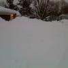
Was 1.4 inches the final total for Central Park this morning? -

Is we back? February discussion thread
40/70 Benchmark replied to mahk_webstah's topic in New England
Alrighty, then. -
can't blame him
-

Clipper Fires In Wednesday Feb 25 Disco/ Obs
ORH_wxman replied to Damage In Tolland's topic in New England
Can’t remember the last time we had this many C-2” type events. I’ll have to run the numbers but it feels like the highest this decade at min. -

Clipper Fires In Wednesday Feb 25 Disco/ Obs
weatherwiz replied to Damage In Tolland's topic in New England
I got just over 1.5" -
GEFS still a SECS for the metro
-
I'm just stating what it shows. Wish Canadian has a clue, but probably doesn't.
-
Uh... @weatherwiz?? https://6abc.com/post/pennsylvania-man-set-fires-kill-spiders-igniting-blaze-damaged-homes-police/18646148/
-
The SWFE that everybody wants...the one that the GFS and Canadian have looks south, but then high slips offshore and we get a rain or mix here, snow for you on north.
-

Clipper Fires In Wednesday Feb 25 Disco/ Obs
Great Snow 1717 replied to Damage In Tolland's topic in New England
How much snow fell? -
I think the accurate cocorahs guys are around 60”
-
Back to dejected Scooter, a broad brush of meh. Bummer…
-
I haven't been keeping track very well. What are you at? I'm probaly 5" behind you.
-
not for tuesday wednesday? that nails all of of new england though I don't know temps
-
Clipper Fires In Wednesday Feb 25 Disco/ Obs
weatherwiz replied to Damage In Tolland's topic in New England
What fell this morning essentially has melted already with additional melting. Good...get the streets all clear -

Outta gas and Outta Time: Early March Winter Storm finale
clskinsfan replied to Ji's topic in Mid Atlantic
Yeah. The AIGFS would be nice I think. Just going off 6 hour QPF panels and the upper air temps. -
Anyone have any ENS data for next week to share?
-

Clipper Fires In Wednesday Feb 25 Disco/ Obs
Chrisrotary12 replied to Damage In Tolland's topic in New England
We’re pretty consistent in getting 1/3 of the forecast. Monday: forecast 15”. Actual 6” Wednesday: forecast 3”. Actual 1”. At least cleanup will be easy. -

Outta gas and Outta Time: Early March Winter Storm finale
somecallmetim replied to Ji's topic in Mid Atlantic
Yes, but my humor is dry. You can blame me for the drought. Just a bit of sarcasm given the similar sun angle. -

Outta gas and Outta Time: Early March Winter Storm finale
Wxdood replied to Ji's topic in Mid Atlantic
It’s happened plenty of times. -
Outta gas and Outta Time: Early March Winter Storm finale
Grothar of Herndon replied to Ji's topic in Mid Atlantic
Don't fight it! You know you are already in. Just admit you have a problem and live with it! -
At this point I think it’d be funny to finish BN while they crush it down there.
-
Yeah. Actually gets some precip up to us. Maybe another step at 18Z?
-

Outta gas and Outta Time: Early March Winter Storm finale
NorthArlington101 replied to Ji's topic in Mid Atlantic
AIFS stubbornly south - nada for us; little bit for Central VA -

Outta gas and Outta Time: Early March Winter Storm finale
Cobalt replied to Ji's topic in Mid Atlantic
because it's rain?


