All Activity
- Past hour
-
6z Euro and bit west of 0z 6z EPS also a bit west through hr144. I get that chances are slim but you guys give up way to easy..
-
Hmm, yesterday 91* dp 54* HI 88. What a way to run a heat wave
-
To my fellow acatt crew. Summa almost done

-
 Erica? Isn’t the next named system Erin in the Atlantic.
 -
Dew…..dew hast…..dew hast ACATT….
-
Du du .. Du hast
-
you of all people? no way!
-
What a stretch coming up. Summerstein.
-
Some records lows were set in PA last week...no?
-
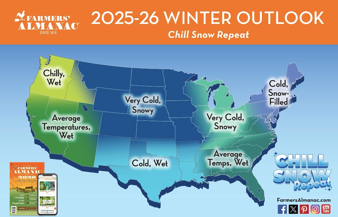
I don’t know anything about Direct Weather but since they are predicting a weenie winter, I’ll also put this in banter.
-
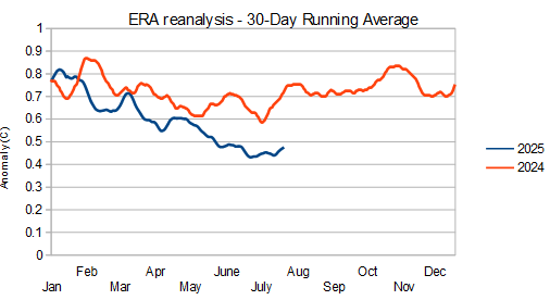
As the year has progressed, 2025 has cooled at an increasing rate vs 2024. Remember that 2025 stayed stubbornly warm as the el nino waned. My take is that some of the typical post-nino cooling was delayed until this year. We are still warm vs pre-nino conditions but not gobsmacking.
-
Gosh what boring weather, not even a good T-storm, cane etc. "Dog Days of Summer", Nashua Public schools open Aug. 26th, a private school Aug.20th Last minute vacations, many ways the Summer has gone by, my college worker said his last day is this Friday. Current 68/65
-
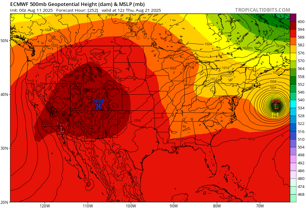
The hurricane passes in about 9 days or so, then.....

- Today
-
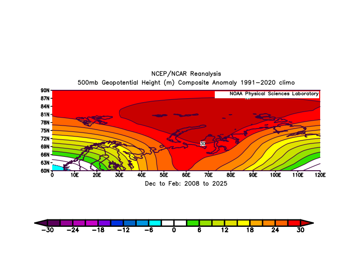
This Kara-Barents or Urals ridge has become the most impressive Arctic 500mb height anomaly since the sea ice shift to much lower in 2007 with a new lowest maximum in March 2025.
-
I’ll keep this in banter.

-
Chattanooga, is a good example! We sit in a bowl while the mtns around us get snow! I've seen this many times. Also, Chattanooga is concrete, concrete everywhere too! Finally, we've added two more lanes of paved freeway around the 75/24 split that runs all through Chattanooga. I'm sure that will insolate even more heat in the years to come!
-
Never had a chance
-
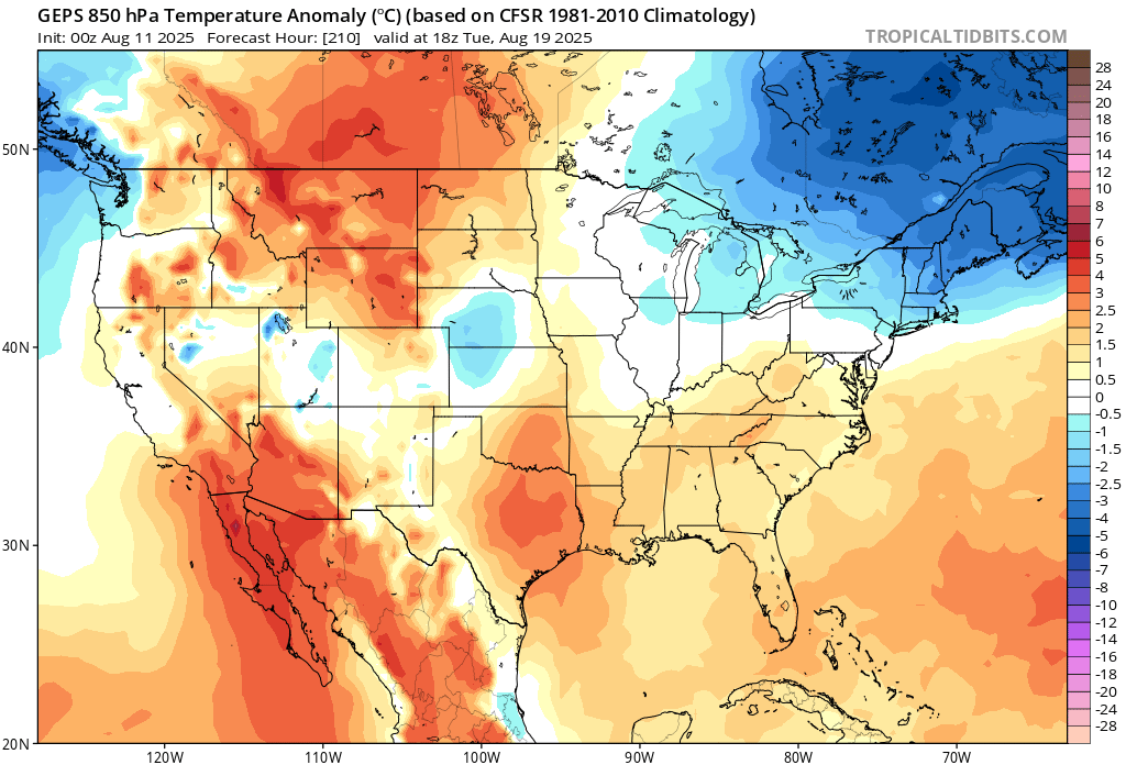
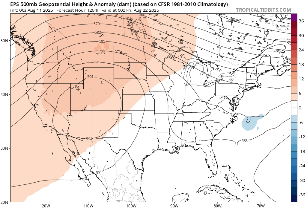
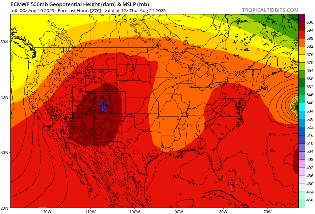
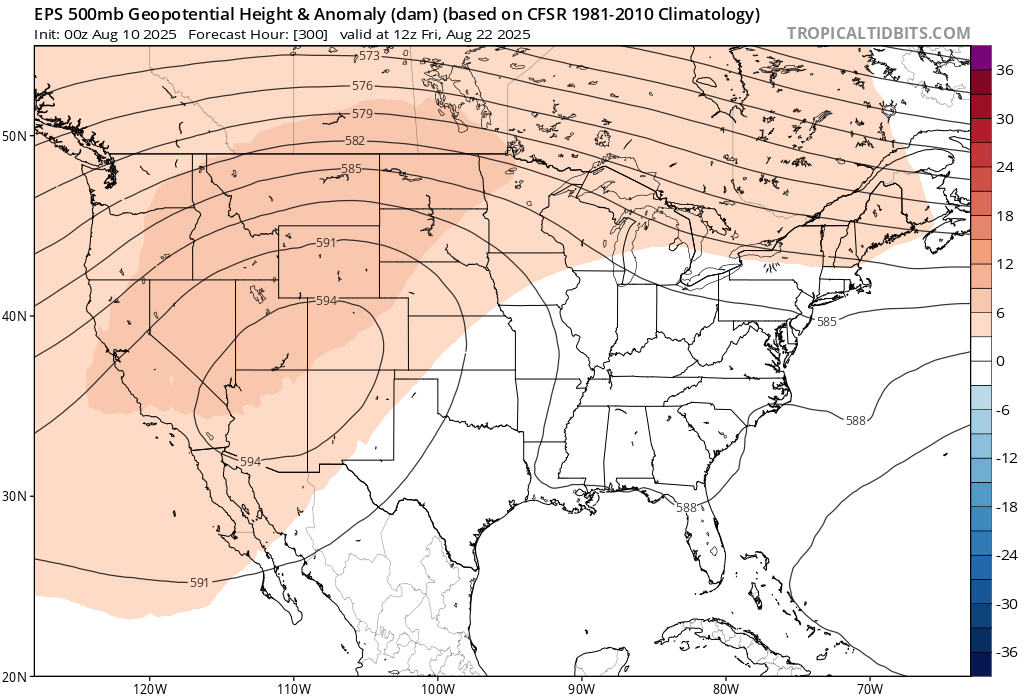
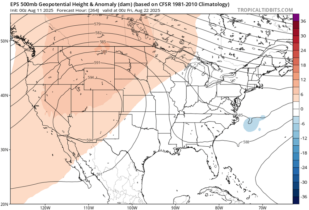
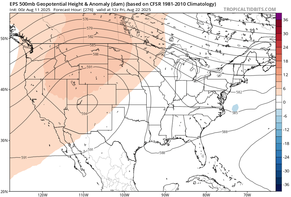
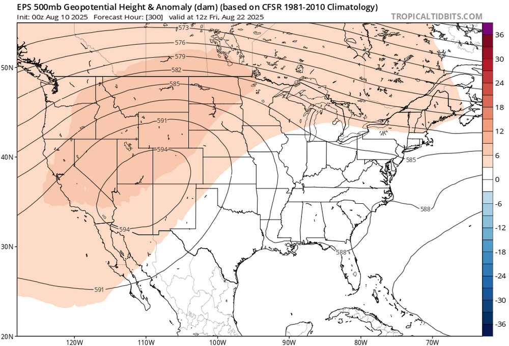
 Nice improvements in the temperature department on the 0z runs. The models get Erin back to near 70W off the Carolinas. So it erodes the ridge and lowers the 500mb heights. This causes the current warm pattern to end by early next week. Tropical systems are often the wild card for us after mid-August heatwaves. They can stay offshore like the current guidance shows and still weaken the WAR or Southeast Ridge. The new runs now have lower heights in the East in just 12 hours. So we need later runs to get the storm back near 70W for the relaxation of the heat to continue. Remember, the long range pattern all summer has been to build heights higher than the original forecasts. But it often takes a tropical system to disrupt heat patterns along the East Coast this time of year. New runs have Erica weakening the ridge into the long range Old run kept the heat going into next week Late August ridge weakened in just one run. Will it hold for later runs? Stay tuned… New run Old run
-
13-14 was not driven by ENSO IMO. It was driven by a Victoria mode PDO (pseudo +PDO) on its way to becoming the very strong +PDO of 14-15. There was also no -IOD in 13-14. I 100% believe we see a weak La Niña this season, given the SOI, MEI, -PDO, -PMM, -IOD, easterly wind bursts, RONI, subsurface
-

Central PA Summer 2025
TheClimateChanger replied to Voyager's topic in Upstate New York/Pennsylvania
Record high of 86 yesterday at Bradford. -
54 degrees this morning for the low. Mow #21 in yesterday it was 10 days in between mows this time. We really could use some rain.
-
Will be interesting to see how high it can get at Caribou, Maine. Point-click forecast has 94, 1F shy of August monthly record and 2F shy of the all-time record set most recently on June 19 of last year, and previously on June 29, 1944 & May 22, 1977.
-
it’s over dude
-
-