All Activity
- Past hour
-
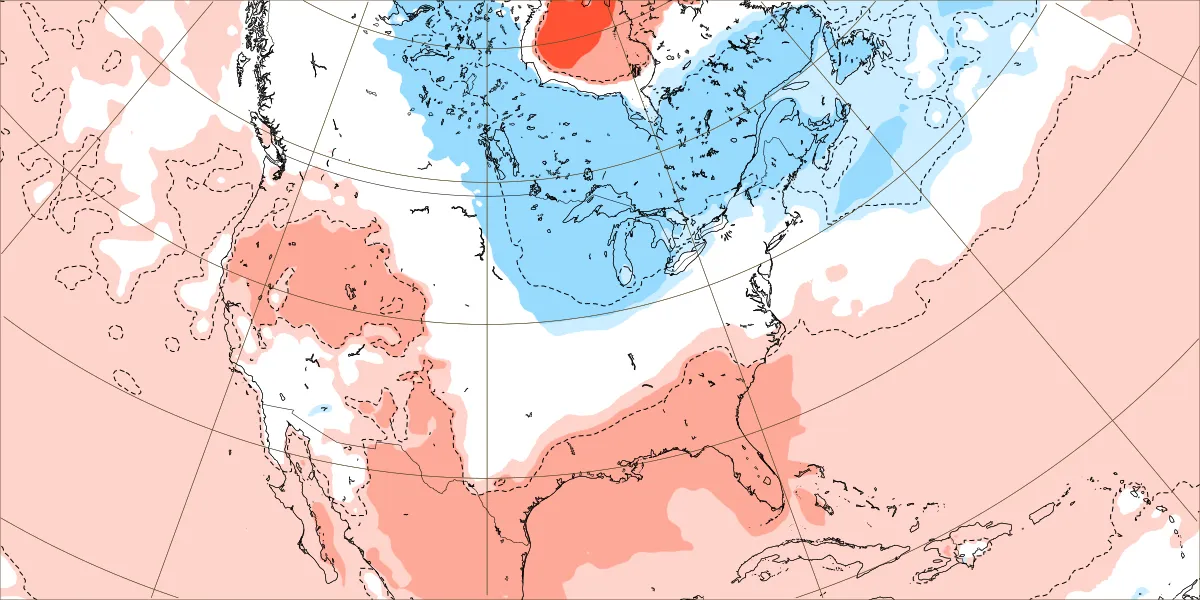
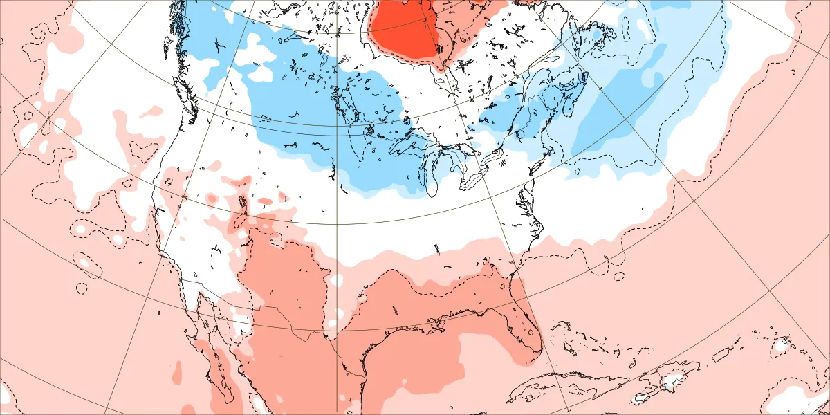
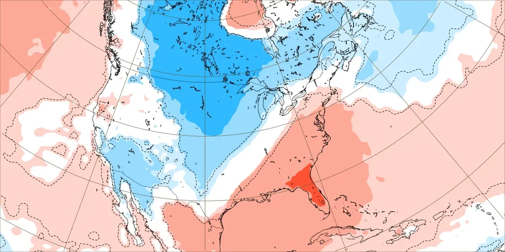
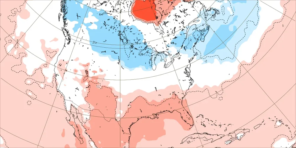
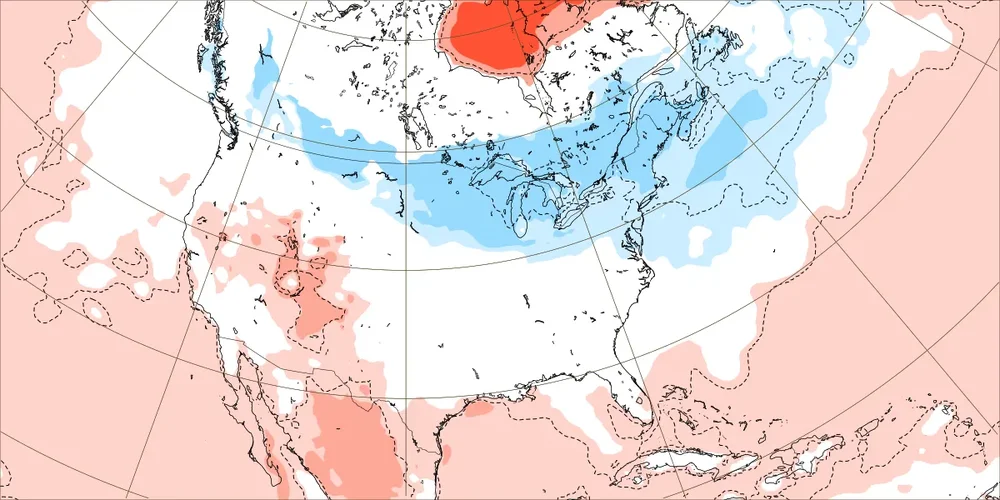
Today’s Euro Weekly 2m temp anomalies vs yesterday’s run: Dec 1-7: ~same Dec 8-14: similar for most/slightly stronger cold in Lakes region Dec 15-21: similar for most/slightly colder NNE Dec 22-28: similar for most/slightly colder NE/slightly less cold Lakes region:

-

November 2025 general discussions and probable topic derailings ...
Typhoon Tip replied to Typhoon Tip's topic in New England
But again ... it's may be splitting hairs. If there's -WPO/-EPO through other means, you're ending up in the same consequence. -
November 2025 general discussions and probable topic derailings ...
Typhoon Tip replied to Typhoon Tip's topic in New England
That's about right.... it takes about 20 days ( three weeks)... I've shown this before but here. This example was 2004. Text back high altitude intrusion event, then nodal mass down welling with 3 or so week lag prior to AO forcing/'blocking' This example actually first became evident over Xmas week prior to Jan 1 ... and the AO crashed by the 20th.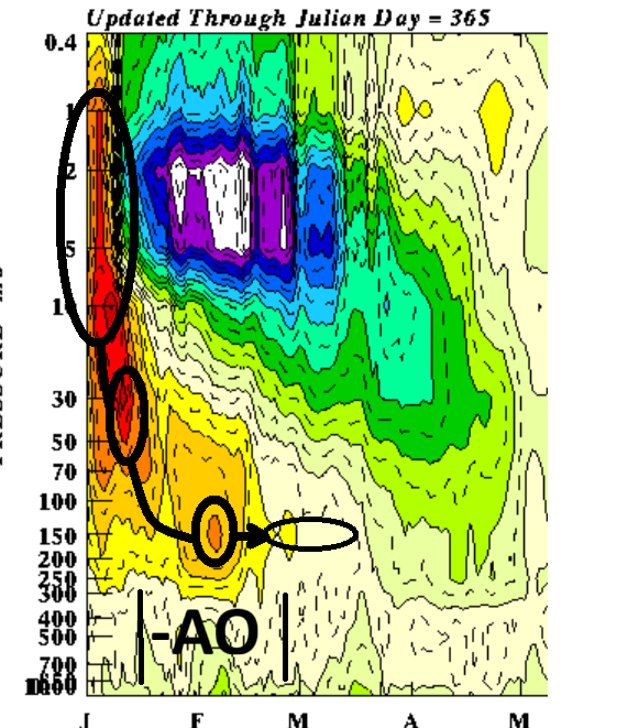
-
Now that stations around my area are starting to update for November, some snow totals from them per NOAA co-op station data. Newcomb, which is about 8 miles from me but at lower elevation, 2 inches of snow, Oneida 1.5 inches of snow, Tazewell 1.5 inches of snow. The Southeast KY stations near me haven't reported yet, nor have Norris and Maynardville which are just south of my area. That's fairly impressive for early November.
-

November 2025 general discussions and probable topic derailings ...
WinterWolf replied to Typhoon Tip's topic in New England
Mid December I’d think… -
Youngins
-
He is a smart guy but he has been wrong in the past.
-
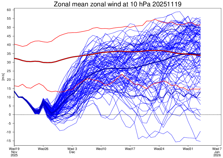
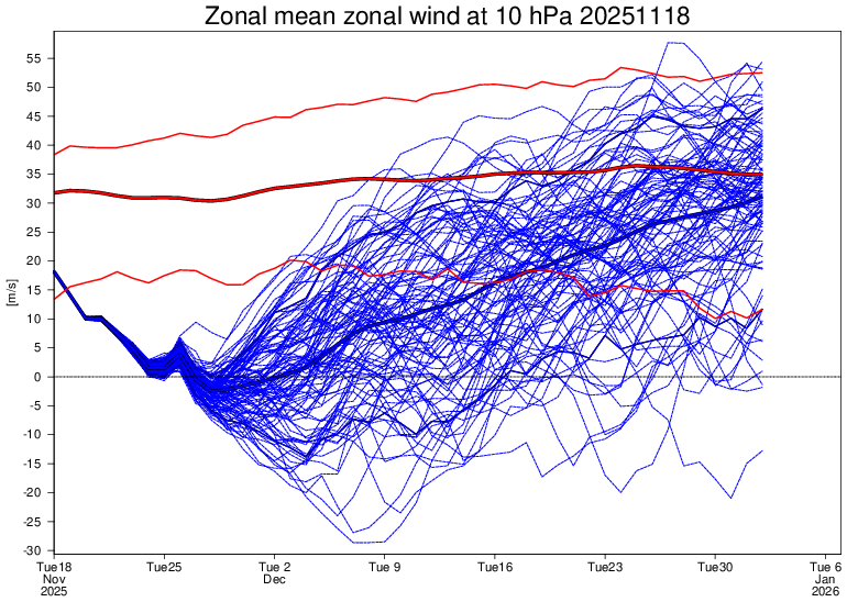
Today’s Euro Weeklies 10 mb 60N mean zonal wind isn’t as weak as recent runs: Today’s run (11/19): Yesterday’s (11/18): Does anyone else see what I’m referring to? I’m not just talking about whether it actually reverses. I’m talking more about the period afterward.
-

November 2025 general discussions and probable topic derailings ...
weatherwiz replied to Typhoon Tip's topic in New England
So essentially, (let's say it is occurring now or in the beginning phases), we probably wouldn't see that troposphere respond probably until late December? -
I’m not sure we can be confident on a west coast ridge for mid-late December. Paul Roundy has been vehemently disagreeing and thinks the subseasonal forcing supports -PNA/SE ridge after early December. When he talks you have to listen, the guy basically wrote the book on the book on the MJO (Roundy MJO plots)
-
November 2025 general discussions and probable topic derailings ...
Typhoon Tip replied to Typhoon Tip's topic in New England
the other clue ... if this pattern change, which we're at t-minus 6 or 7 days from actively reconstructing, was preceded and ultimately coupled to a canonical SSW, the latter would have taken place by the first week of the month. There was nothing... -
One of the biggest caveats to the first week or two of December is the SE Ridge setting up as the cold slowly propagates eastward. While I do think it gets beat down as we head through the month, would likely hinder our chances for a bit. Hoping for a repeat of last year with the ridge amplification being grossly overstated in the long range routinely.
-
Little ol' Wachusett in MA is opening Saturday Nov 22. 6 days earlier than usual (they shoot for Black Friday) If anyone wants to save $10 per season pass (a drop in the bucket) message me
-
looks like we're waiting until past tday before any system of note looks likely to impact the region snow chances still naso great imby climatologically speaking but we're not far off now
-
Atleast Elias can't use Rodriguez as an excuse now to not sign a front line starting pitcher. I could just imagine Elias saying "we didn't sign anyone because when Grayson is back we'll have a 3 headed monster at the top of the rotation with Rogers and Braddish" Ni excuses now for Elias
-
November 2025 general discussions and probable topic derailings ...
weatherwiz replied to Typhoon Tip's topic in New England
I thought there was a weak signal up around 10 hpa which strengthened down around 30 hpa and especially 50 hpa? But I may have diagnosed incorrectly - Today
-
What else will I do at 7am on a Saturday?
-
November 2025 general discussions and probable topic derailings ...
Typhoon Tip replied to Typhoon Tip's topic in New England
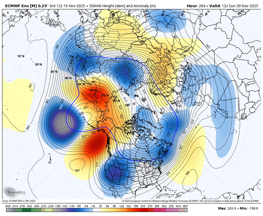
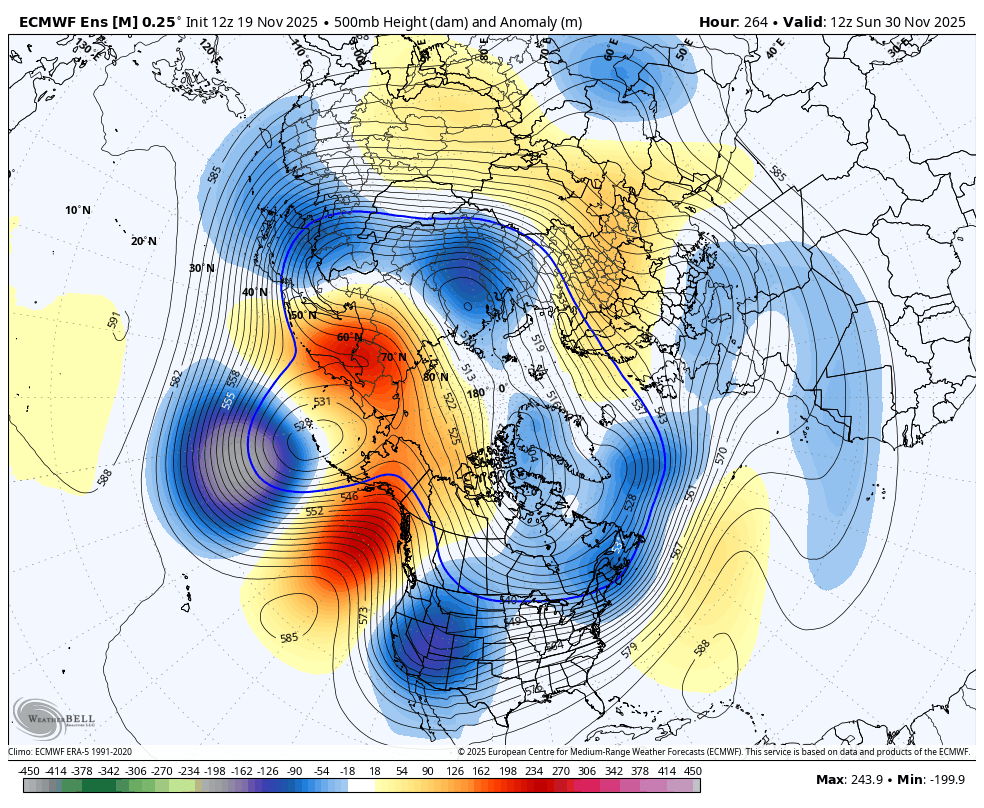
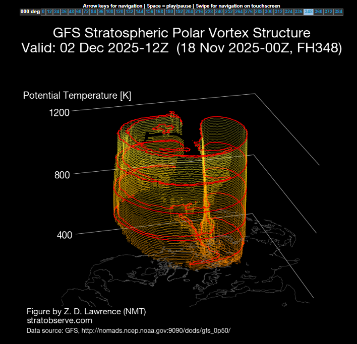
I don't like the fact that it isn't (first) emergent in the 10 hpa ... This appear to be up-welling from a very strong constructive interference at mid and upper level troposphere between Asia and the N. Pacific. I'm not sure it matters? ha. I mean, whether it's a SSW --> down-welling in the canonical sense and total behavior, or... some sort of fantastic ridge resonance that's bulging the disk from the bottom, the end result may end up with the same consequence... You get blocking and jet distributions S of normal PV latitudes ...and that in this case (sometimes it affects/offloads in Europe/Eurasia preferentially) modeled to favor our side of the hemisphere for a cold mass delivery/jet. It's an interesting question... but if you look at the GFS's 10hpa, no clue there's a warming event. All SSWs in the monitoring history going back to the late 1970s start between 1 and 10hpa, and then down well. This appears to be a "bulging" event. Similar to what Kevin lacks on his anniversary nights... -
I realize you are propagating out past this, but looking at the raw data presented here, I'll be damned if the Southwest US oriented trof doesn't seem like a recurring background state past several years.
-
ready 2 b buried
-
Nothing wrong with that. That would be ideal with the daily average highs being lower by mid-month. NYC's average high on Dec 1 is still 49 I believe.
-
November 2025 general discussions and probable topic derailings ...
weatherwiz replied to Typhoon Tip's topic in New England
We definitely want to watch the progression of the progression of the stratosphere too. The good news is, we already have a warming event ongoing and across the Canadian Arctic If you were to follow this progression on Dr. Lawrence's site, its a longer duration event too with the peak occurring somewhere in the 300 hr time frame This is important (when the peak occurs) because this would likely result in a PV split, which begins to occur towards the end of the run Getting a PV split will be critical because the main PV looks like it could end up over Europe, but if it splits, then we could get PV displacement onto our side of the hemisphere.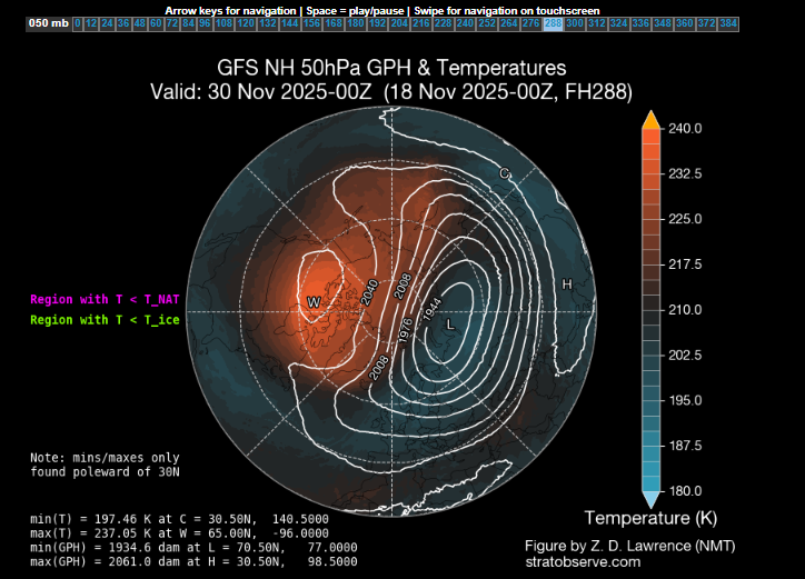
-
This is a good post imho and mirrors my general thinking:
-
November 2025 general discussions and probable topic derailings ...
Typhoon Tip replied to Typhoon Tip's topic in New England
I've noted the two pulse -EPO behavior in the ensembles. The operation Euro is an amplified outlier with the warm-roll back in between those episodes/-EPO bursts. I'm not inclined to believe it is necessarily correct. The other aspect I'd keep in mind that the models (all of them) tend to go a bit too amplified in the mid-sized spatial events. Not sure that dependable bias expresses as coherently at hemispheric scale ... just something to keep an eye on. -

2025-2026 ENSO
brooklynwx99 replied to 40/70 Benchmark's topic in Weather Forecasting and Discussion
can pretty easily see the N ATL trough feeding back on the Scandi ridge, which then increases heights in the NAO region... this elongates and presses the TPV south