All Activity
- Past hour
-

January 2026 regional war/obs/disco thread
CoastalWx replied to Baroclinic Zone's topic in New England
Let’s get a 1-3” event -
Looks like we can score some goods on storm 1. Cool cool. Let’s reel in that appetizer. Storm 2 though—at the end of the 0z Euro—can’t say I’ve ever seen anything like it. Weenie dreams!! Holy F!
-
what about the 6Z euro
-

January 2026 regional war/obs/disco thread
Damage In Tolland replied to Baroclinic Zone's topic in New England
She gonna come just not big -
A 1 county sized jackpot zone surrounded by a 1-3” region the size of Delaware lol
-
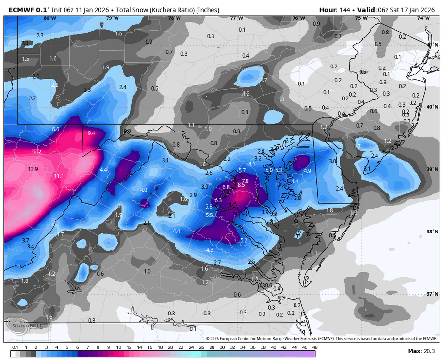
1.91 storm total. Over night runs still lead me to think options are on the table. The official WPC guidance has one day that is mentioned on Friday for the northern mountains. Like WNC-fort said, by early to mid week we should know. But looking like a cake job to our west in the mountains right now.
-
WB 6Z EURO (rain limits accumulations)

-
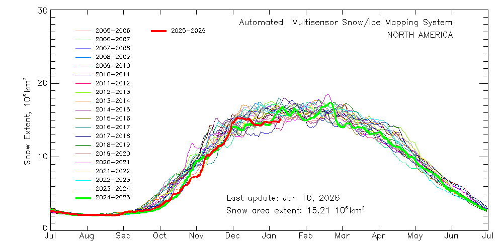
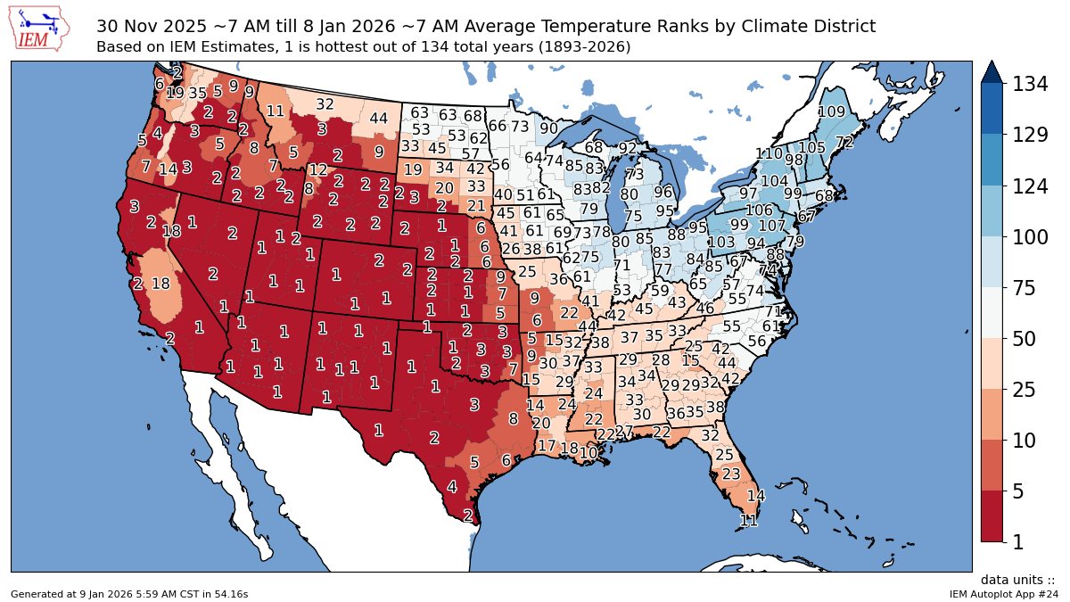
The best snow cover extent relative to the means so far this winter was back in late November and early December prior to the big warm up for much of the CONUS outside the Northeast and Great Lakes.

-
January 2026 regional war/obs/disco thread
CoastalWx replied to Baroclinic Zone's topic in New England
Yep. It’s going to be hard to get a siggy event I think. -

January 2026 regional war/obs/disco thread
Kitz Craver replied to Baroclinic Zone's topic in New England
GFS too -
January 2026 regional war/obs/disco thread
CoastalWx replied to Baroclinic Zone's topic in New England
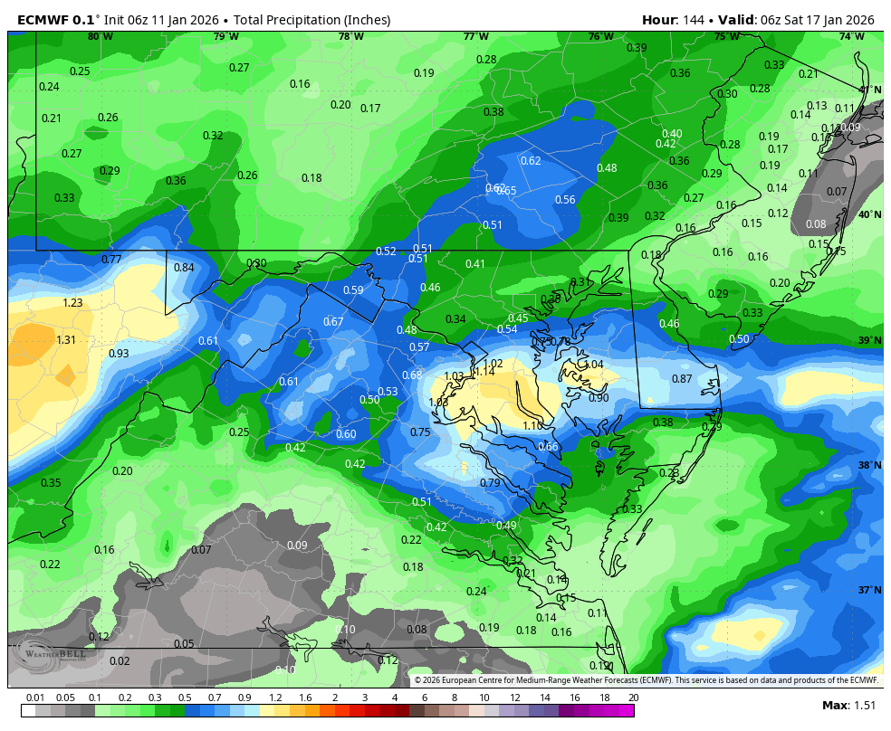
I think the one thing that concerns me the most is that all the good moisture that this thing needs to wrap in is way offshore. That’s why the euro is fairly meager with precip. It’s straining to get anything into the conveyor belts and dump precip. That I don’t like. -
WB 6Z GEFS is a little better....

-

Winter 2025-26 Medium/Long Range Discussion
A-L-E-K replied to michsnowfreak's topic in Lakes/Ohio Valley
Duster days are here again -
0.6 on the board. combo of sleet snow and rain.
-
I'm bumping this because the Euro did pretty damn well with the H5 look at this range. Yes I was told the surface was barely cool but this is really a good indicator from the Euro at nearly 10 days out and beyond. Surface was too warm at this range but that's been the problem for a lot of the season with these cold fronts. Now starting today we are well below normal and possibly looking at multiple snow threats. Some people talk shit and some people know their shit...
.thumb.jpg.fe440d2e4ac6dc5661e4519ef7f5ffa2.jpg)
.thumb.jpg.d347ac395ec06a728afaa3776177c3a8.jpg)
.thumb.jpg.3af67a2a2465562810457aa3fa22cd95.jpg)
-
I feel bad for the mid Atlantic ski resorts. It's becoming one of those years. I guess i better go ahead and head to the Adirondacks in a couple weeks. No winter in sight here.
- Today
-
I’m going to wait until Tuesday/Wednesday to make up my mind. I love snow in my backyard but if McDowell is fringe at best… I might just book a cabin in Banner Elk and have some fun.
-
I agree "it doesn't want to snow here". It's one of those years. We had a nice snow pack by Eagles Mere PA but now with the warmth and rain. It's pretty much all gone. They have some snow showers and mix precipitation in the forecast for next week.
-
That was the most accurate 168 hr Euro control run of all time. https://www.weather.gov/okx/Blizzard_Jan42018
-
Gefs continues to improve
-
Gefs continues to improve
-
Posting of fantasy storm thats so far out. Current systems being tracked can't make it within 3 days. The current system wasn't model to hit the area around the 16th and seems to be holding. Which is good for me as I'm driving to the farm by Eagles Mere PA.
-
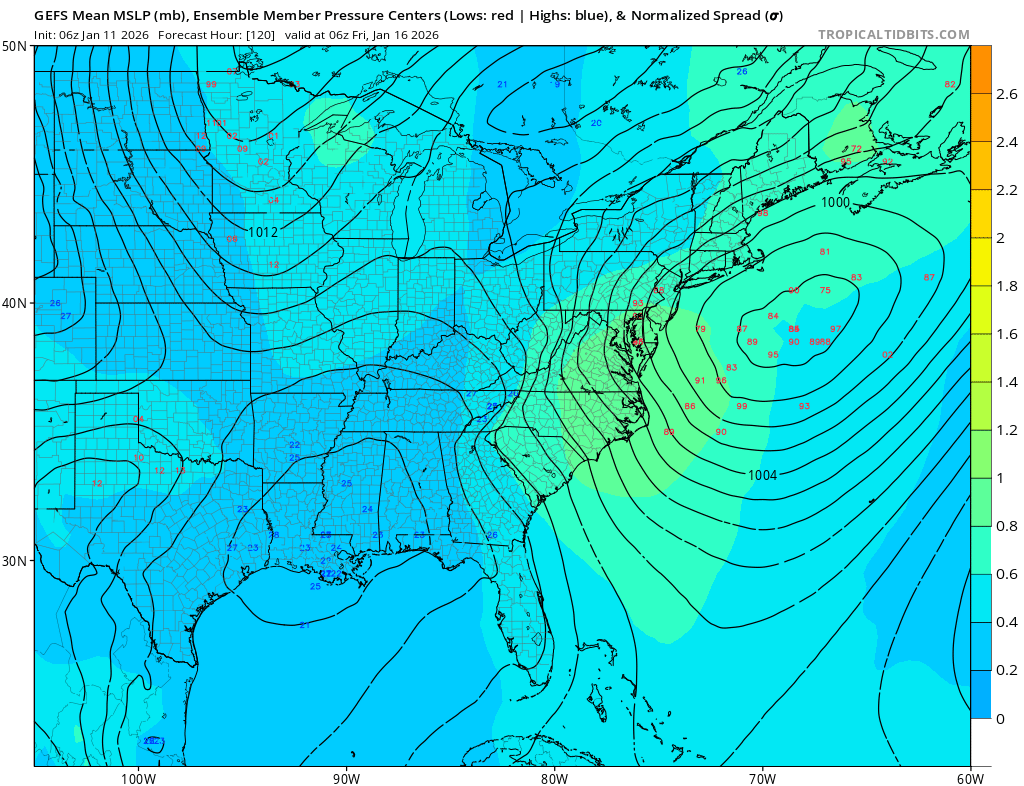
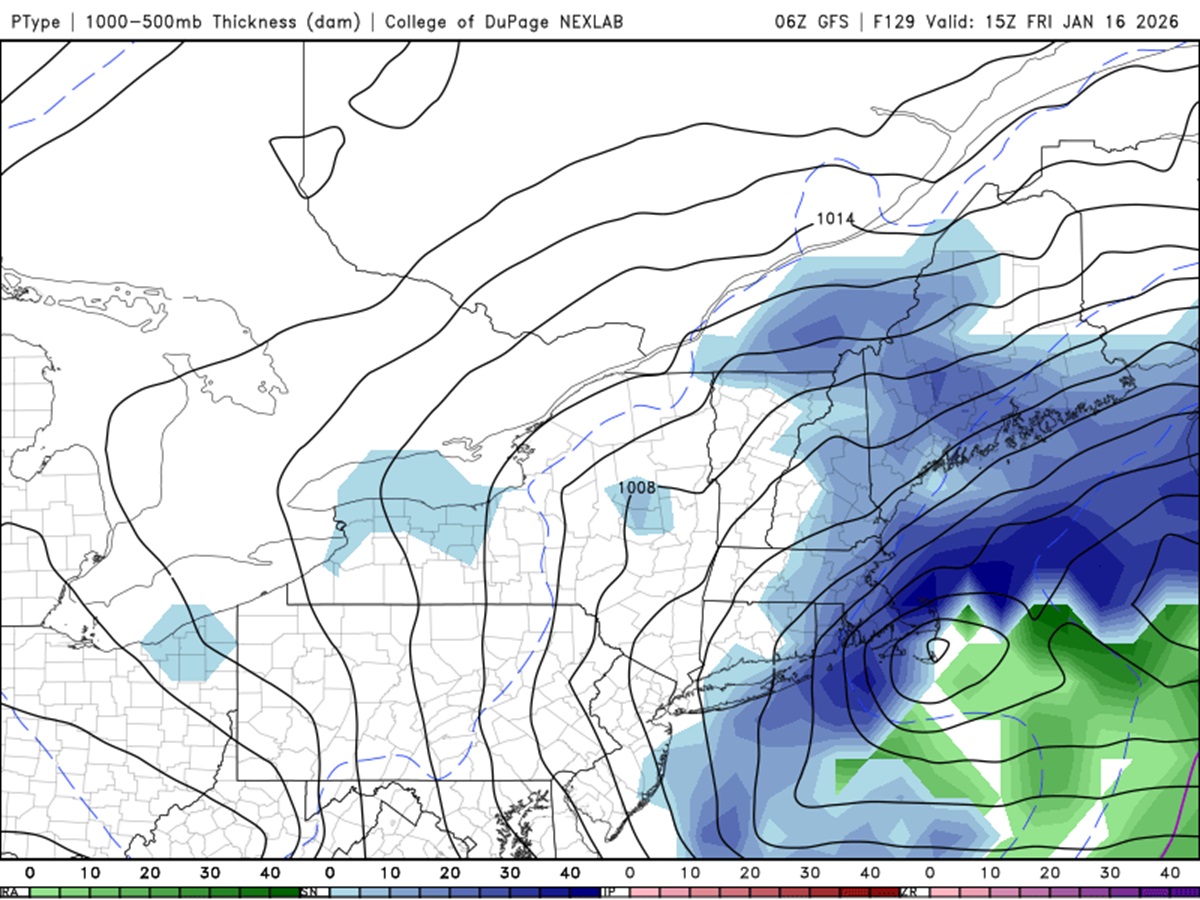
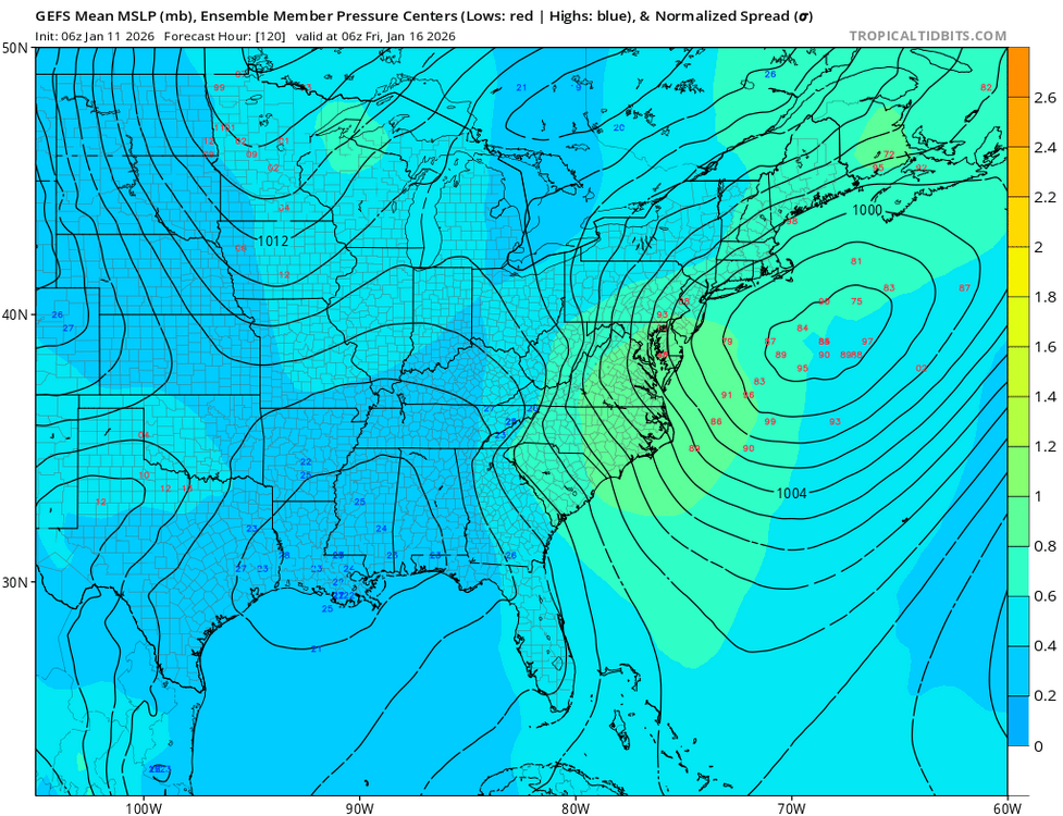
06z GFS a bit odd. Fcst 15z Jan 16, it shows a nicely tucked back deep sfc low near ACK, yet the heavy snow area is surprisingly limited to the NW. 500 low is significantly stronger and still closed off one contour as it passes just S of the region.

-

January 2026 regional war/obs/disco thread
The 4 Seasons replied to Baroclinic Zone's topic in New England
yea AIENS as well, after we get this first turd out of the way, 6Z GFS was pretty sweet in clown range -

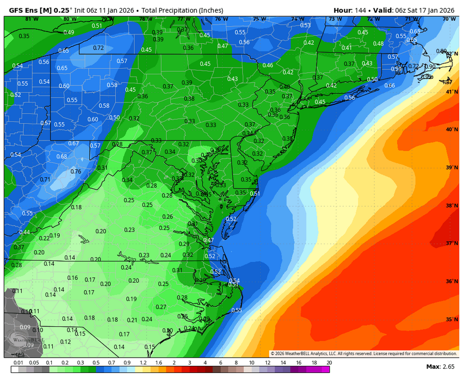
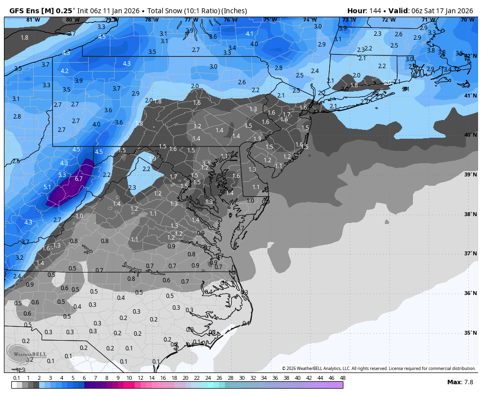
E PA/NJ/DE Winter 2025-26 Obs/Discussion
Newman replied to LVblizzard's topic in Philadelphia Region
Overnight models showing a pretty reasonable "fail mode" in the fast flow we're in... 1. All of the PVA escapes east of the low and 2. The trough struggles to turn negative and fully consolidate due to the kicker system. In the end, it just turns into a paltry ULL passage with light snows. Even if a coastal low does pop, it's so far removed from any moisture. That's not to say the current OP runs are horrible, if the "floor" is a light 2-3" event with jacks to 6, that's fine. But some of the bigger solutions will only pan out if we can get this more consolidated.


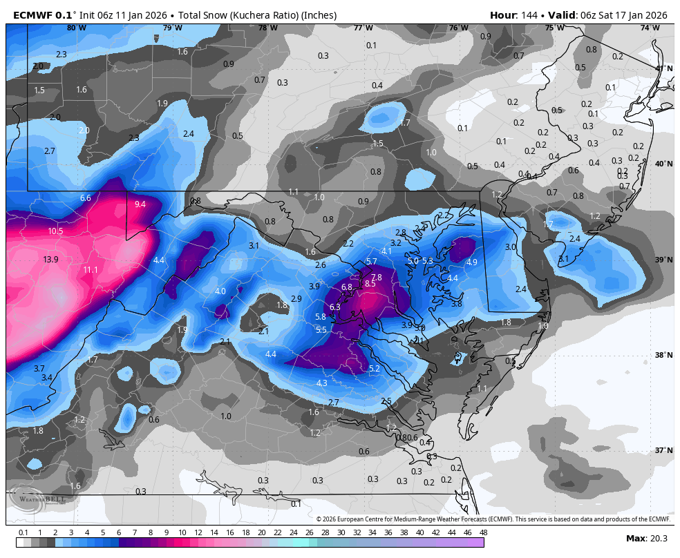


.jpg.a800ed741693447ad14a66c8cad86051.jpg)
.jpg.a95906e66ba4824a2a2bbd23317ef994.jpg)
.jpg.c3ba2de998b768de099f303a26bfdb11.jpg)