All Activity
- Past hour
-
Full tank of gas, no stops and almost no traffic after the Lincoln Tunnel helped. NYC had a period of moderate snow Sat morning - the leftovers of what came through the WMA. Hope our MA crew can get something from the next round to take the edge off. Folks are getting desperate. Radar seems to be further NW than forecast. (or maybe that's just me hopecasting...)
-
.thumb.jpg.6a4895b2a43f87359e4e7d04a6fa0d14.jpg)
Central PA Winter 25/26 Discussion and Obs
Yardstickgozinya replied to MAG5035's topic in Upstate New York/Pennsylvania
Good luck tonight, fellas. You might want to look outside before you browse your phone this morning. -
Central PA Winter 25/26 Discussion and Obs
Yardstickgozinya replied to MAG5035's topic in Upstate New York/Pennsylvania
It's pukeing snow here at the moment fellows.I've already surpassed anything I've received yesterday morning. I'm not surprised by the start of sleet here. In the pictures I posted yesterday morning you can clearly see that almost all the precipitation I received in my area was graupel while others not far away had much better flake quality. Obviously rates were an issue in my area, but thermals were suspect also here. -
Don’t worry i won’t tell anyone.
-

Another Coating of Snow Saturday - "It's all we Got"
The 4 Seasons replied to Sey-Mour Snow's topic in New England
Just to help with placement, are you closer to Haverhill or Dracut or more towards the center of Methuen? -
Not THAT fast, but traffic was moving along at a good clip...
-

Central PA Winter 25/26 Discussion and Obs
MAG5035 replied to MAG5035's topic in Upstate New York/Pennsylvania
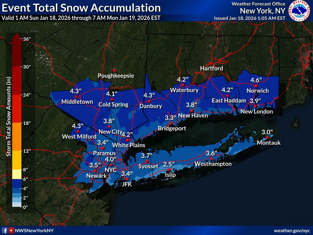
Steady light to moderate snow here with a fresh coating, 29ºF. This has turned into an outright accumulating event for some folks that it really wasn’t in the forecast for. US 322 corridor from State College to Lewistown showing a lot of snow covered roads on the cameras. -
Now I'm invested.
-
How about the other models?
-
Central PA Winter 25/26 Discussion and Obs
Yardstickgozinya replied to MAG5035's topic in Upstate New York/Pennsylvania
I don't believe I got the initial shot of snow at my house,but I have received around 1/8" of sleet, and I'm finally transitioning to snow here.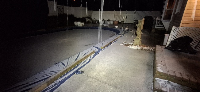
-

-
You had to be going between 90-95 MPH to do that.
-

Central PA Winter 25/26 Discussion and Obs
Ruin replied to MAG5035's topic in Upstate New York/Pennsylvania
started off as light snow around 1 am earlier then forecasted but turned to sleet fast no sleet was in the forecast as far as I saw. -
Central PA Winter 25/26 Discussion and Obs
Yardstickgozinya replied to MAG5035's topic in Upstate New York/Pennsylvania
Moderate sleet here in New Cumberland for the last 45 minutes.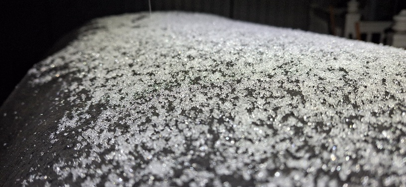
-
Just drove home from NYC. It's 33 and light sleet here atm. It's nice to drive I-95 with hardly anyone on the road. 3-1/2 hours from upper west side in NYC to Vienna. Not bad...
-

January 2026 regional war/obs/disco thread
WxWatcher007 replied to Baroclinic Zone's topic in New England
00z isn't out yet, but the 12z EPS had six consecutive days with a high below 20 at BDL between 1/25 and 1/30. Probably won't happen, but if it did, we'd be in rarified air. The last comparable cold snap with such highs was 12/28/17 - 1/1/18 at five days. The record is 9 days in 1961, followed by 6 days in 1979 and 5 in the period I mentioned. We've had four consecutive days six times, with most recent prior to 2017 blowing through it being 1989. -

January 18th Back Door NW Trend Snow OBS Thread
RedSky replied to Mikeymac5306's topic in Philadelphia Region
Radar looks great -
I started at Bill Evans then Tri State then here. Over 20 years doing this now lol.
-

First Legit Storm Potential of the Season Upon Us
WinterWolf replied to 40/70 Benchmark's topic in New England
Radar looks healthy down to the SW…blossoming in PA. -
This is my territory
-

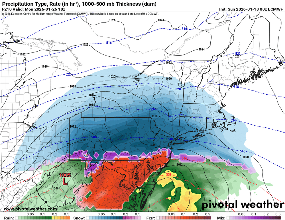
First Legit Storm Potential of the Season Upon Us
Ginx snewx replied to 40/70 Benchmark's topic in New England
Snowy Euro! -
First Legit Storm Potential of the Season Upon Us
WinterWolf replied to 40/70 Benchmark's topic in New England
Good map imo. Seems about right to me. -
Sprinkles in hagerstown.
- Today
-
January 2026 regional war/obs/disco thread
WinterWolf replied to Baroclinic Zone's topic in New England
You’re not saying it’s terrible…? You just said it blows a few posts back lmao. You’re all over the map for god sakes…seriously, take a break. Please. -

Pittsburgh/Western PA WINTER ‘25/‘26
colonel717 replied to Burghblizz's topic in Upstate New York/Pennsylvania