All Activity
- Past hour
-
You don't change your underwear every day?
-
Hazardous Weather Outlook National Weather Service State College PA 457 AM EDT Sun Aug 24 2025 PAZ006-012-018-019-026>028-035>037-041-042-045-046-049>053-056>058- 063-250900- Potter-Northern Clinton-Northern Centre-Southern Centre-Huntingdon- Mifflin-Juniata-Fulton-Franklin-Tioga-Northern Lycoming-Sullivan- Southern Clinton-Southern Lycoming-Union-Snyder-Montour- Northumberland-Columbia-Perry-Dauphin-Schuylkill-Cumberland- 457 AM EDT Sun Aug 24 2025 This Hazardous Weather Outlook is for central Pennsylvania. .DAY ONE...Today and tonight. Strong to severe thunderstorms with gusty winds and small hail are possible late this afternoon into early tonight. Thunderstorms with very heavy rain are possible as well. .DAYS TWO THROUGH SEVEN...Monday through Saturday. The probability for widespread hazardous weather is low. .SPOTTER INFORMATION STATEMENT... Spotter activation is not expected at this time. $$
-
Why would anyone take out AC in Augdewst? All that work un and then installing again as it gets hot next month
-
Yes they change more than I change my underwear. We'll have to wait to see what happens. And tally it up to see if it verified.
-

Mid to long range discussion- 2025
WinstonSalemArlington replied to wncsnow's topic in Southeastern States
-
Probably a piss weak gabs then innit
-
Yeah she was a daredevil nonce innit
-
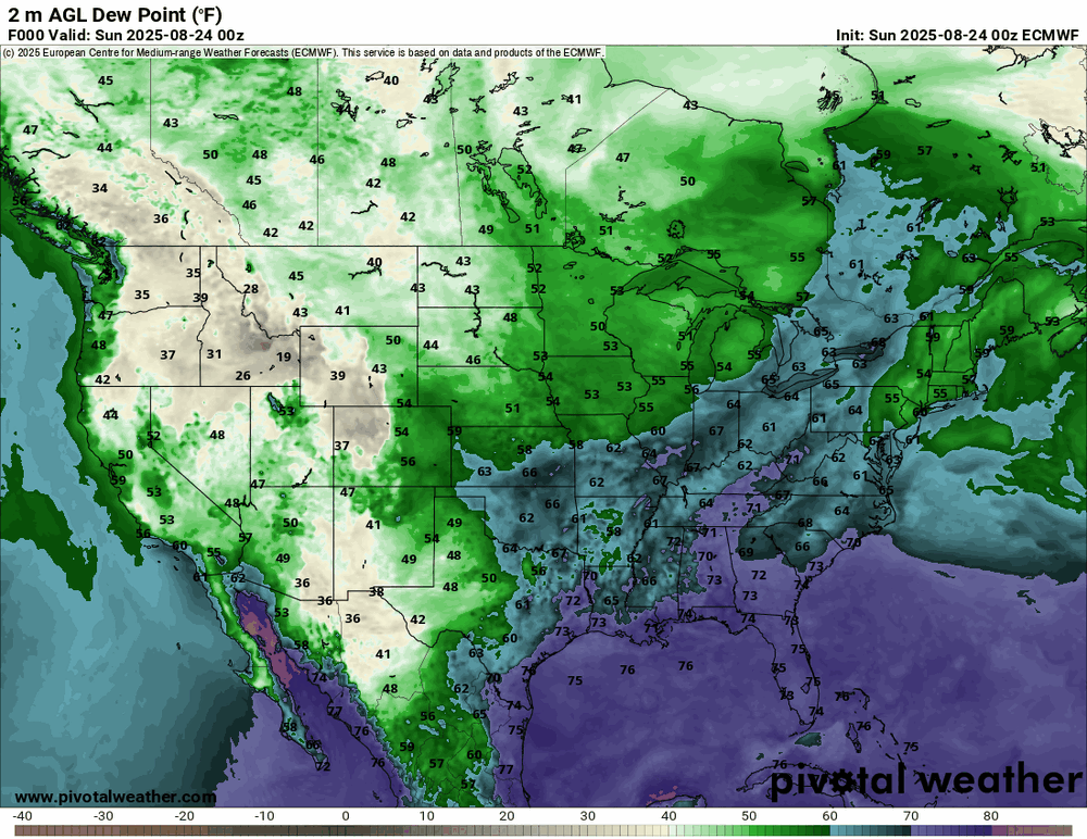
And this is before the Big Beautiful Front comes through tomorrow! This morning, GSO is at 64 with a 62 dewpoint, after a high of 79 yesterday. This is going to be a wonderful last week of August!
-
And save money on A/C. Pull them out of the windows and open up.
-
Just Stein and droughts and burning and wells drying, . Take dews away.. take rain away
-
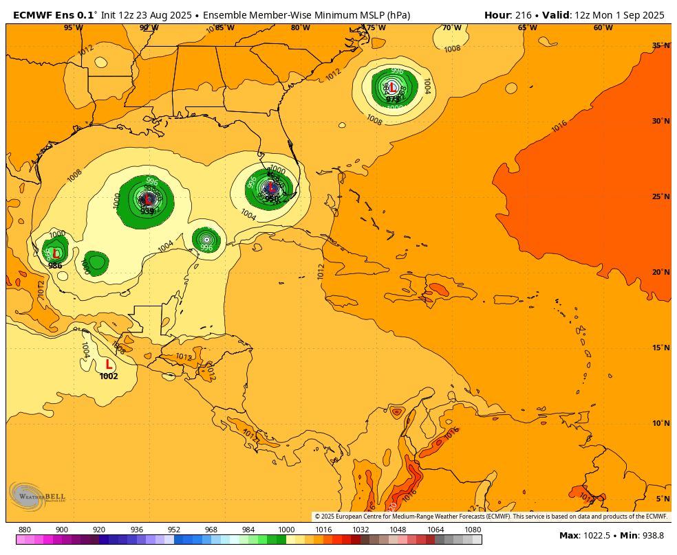
Keep in mind that those probability maps don't predict actual temps, just the likelihood of above or below normal. The Euro weeklies, of course, do...for what they're worth since they change every day. Lol https://charts.ecmwf.int/products/extended-anomaly-2t?base_time=202508230000&projection=opencharts_north_america&valid_time=202509010000
-
COC k s on fire
-
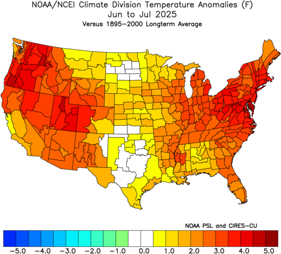
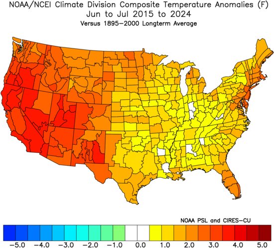
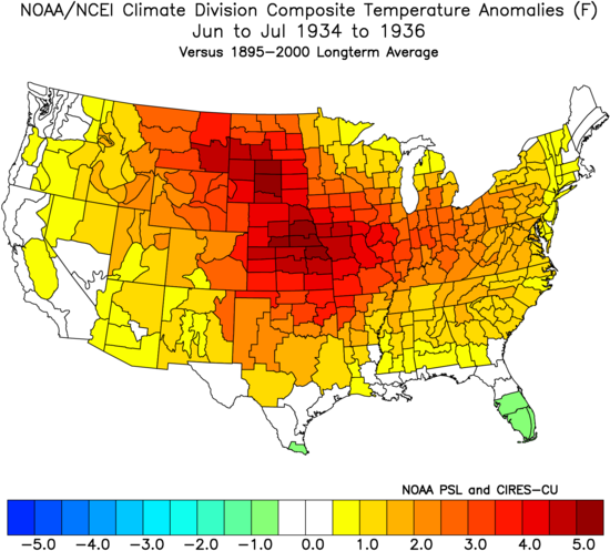
Yeah, this has been the opposite of the Dust Bowl pattern over the last decade. Record summer warmth in the West and East with less warm over the middle section of the CONUS. The Dust Bowl pattern had the record summer heat in the middle and cooler along both coasts.
-
Consistently more humid up near Hudson Bay than New England.
-
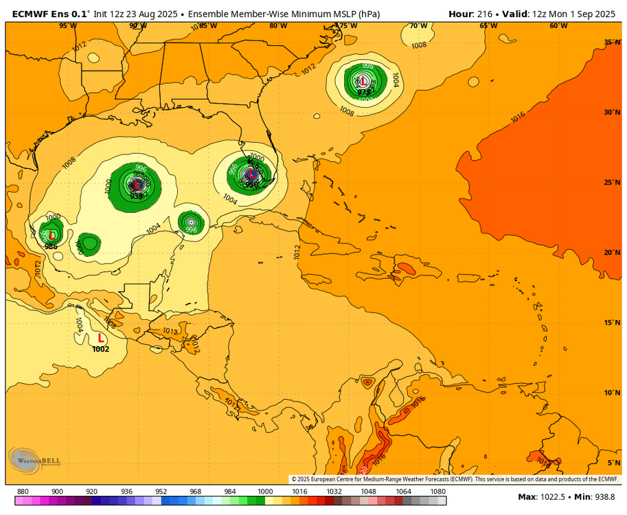
However, the 0Z Euro ens wasn’t nearly as active as the 12Z EE. The 6Z GEFS by my eyeballing has 5 (17%) TS+ members. So, not dead by any means but not all that active either.
-
Literally no one talking about 99L. Lol
-
Shut your mouth. lol Yes, we will pay[emoji3517] .
-
It’s over. The really soupy stuff has been shunted south for awhile now. Next 15 days it can’t even escape the gulf coast.
- Today
-
You'll get a little but it won't be long-lived.
-
Surprise little shower line coming in. Had to rush out and cover the deck furniture. Had not used it for awhile but yesterday was glorious.
-
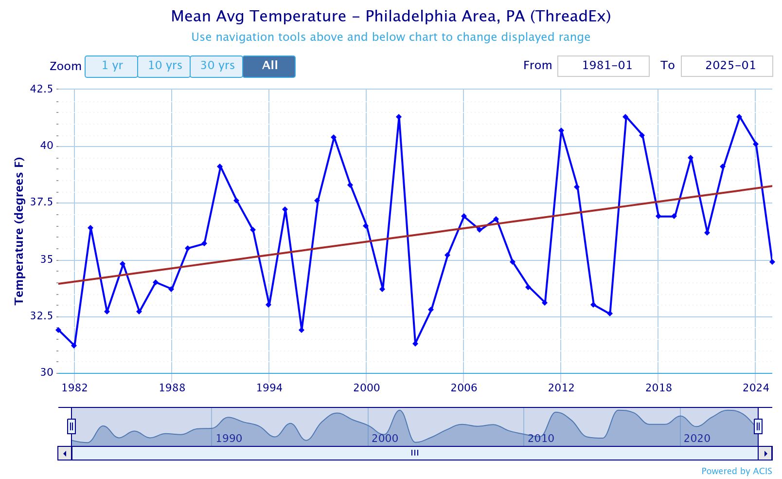
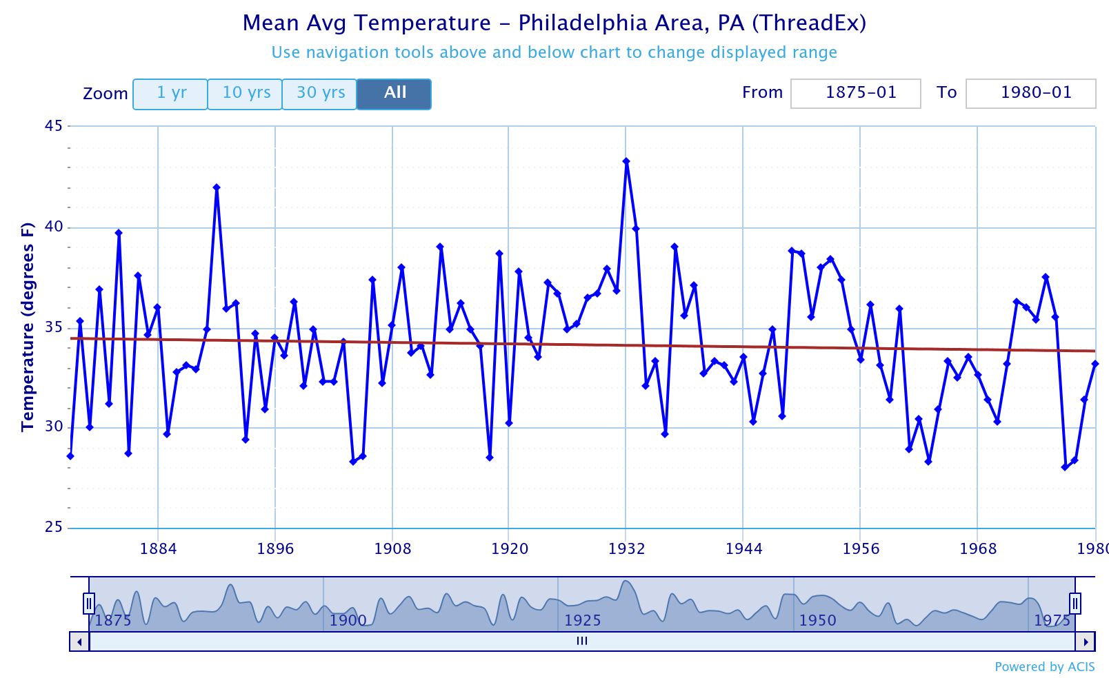
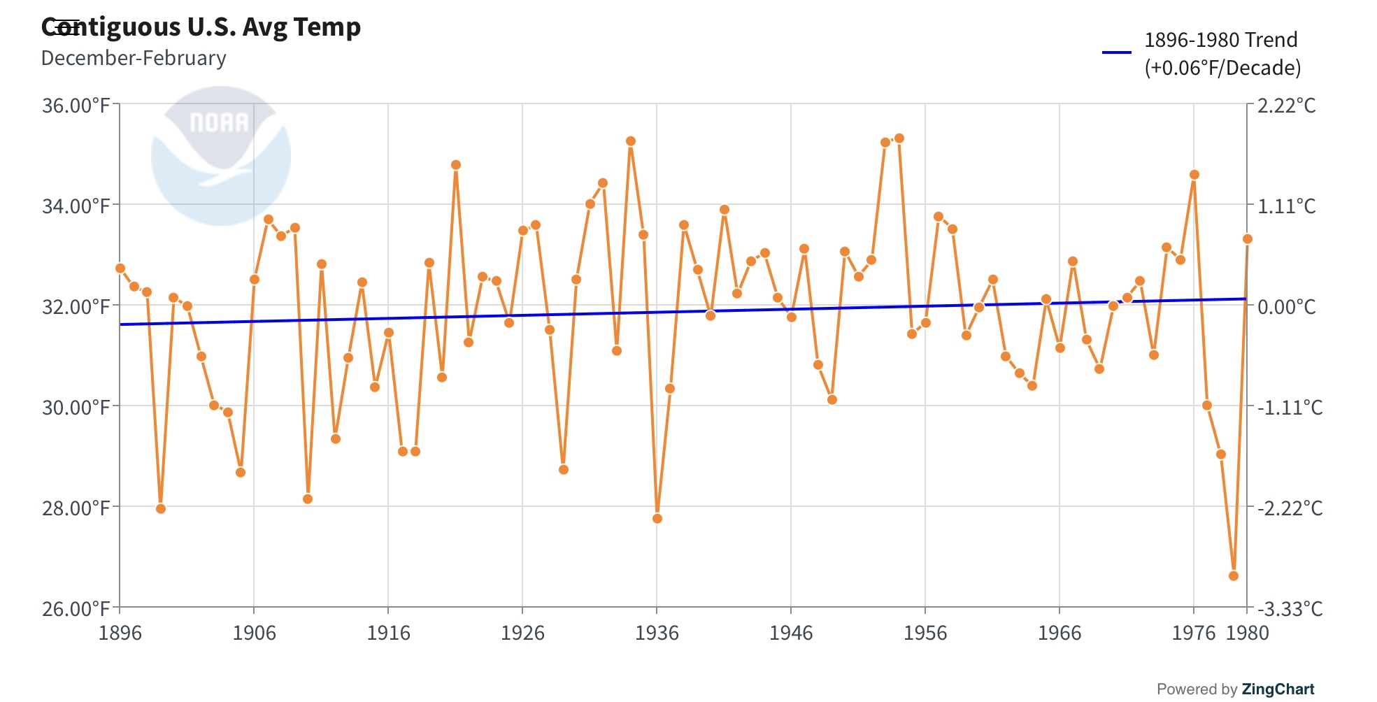
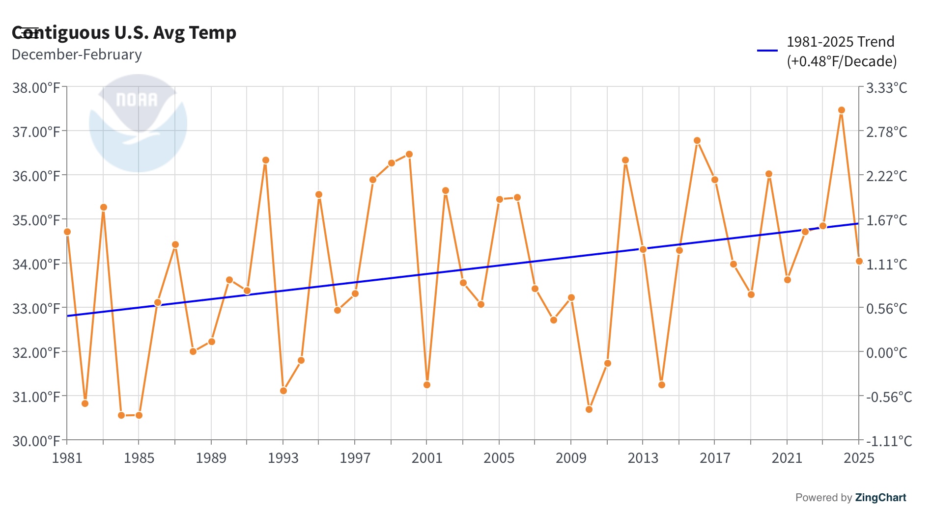
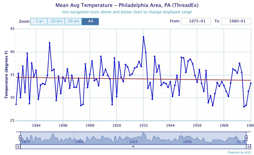
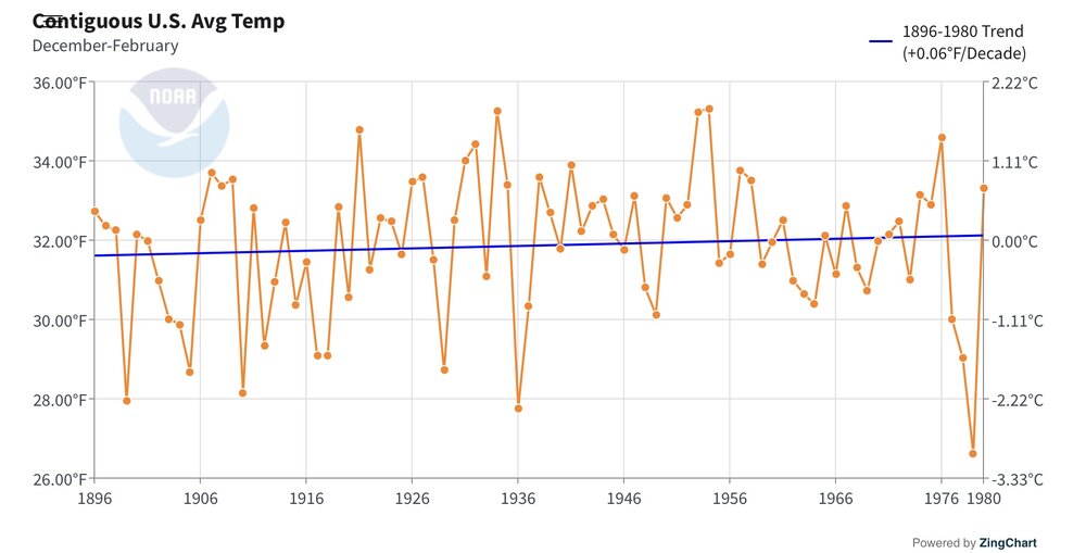
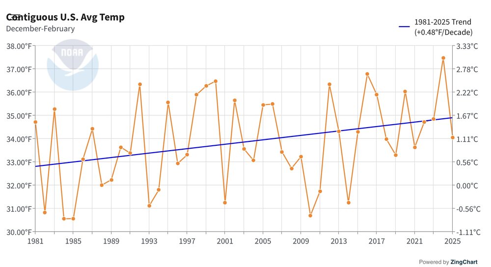
Yeah, all the warming at Philly has been since 1981. The climate from 1875 to 1980 was very stable like the rest of the world and the U.S. There was a slight -0.6° decline in winter temperatures over this period. Since 1981 Philly is up +4.3° during the winters. This is the main reason the U.S. hasn’t seen a top 10 coldest winter since the 1970s.

-
Yeah give me dews and instability so we can at least pop some convection. This sucks.
-
62 here this morning
-
They want COC, they’ll get fires.
-
That was a pretty perfect Saturday for August weather. Headed to the Fair this AM - looks like another nice day ahead. Warmer start to things - 67 in Fallston.