All Activity
- Past hour
-

Winter cancelled/uncancelled banter 25/26
WeatherGeek2025 replied to Rjay's topic in New York City Metro
and i'm making the next thread cause im the thread good luck and you can't take that from me! -

First Legit Storm Potential of the Season Upon Us
HoarfrostHubb replied to 40/70 Benchmark's topic in New England
4” on top of today’s 5” would be nice. -
Or maybe they are trying to cover in case what happened this morning happens again tomorrow?
-

Winter cancelled/uncancelled banter 25/26
WeatherGeek2025 replied to Rjay's topic in New York City Metro
@snowman19 and @katz1234 need to sit down now. -
Storm potential January 17th-18th
SnowGoose69 replied to WeatherGeek2025's topic in New York City Metro
RhodyRick was my favorite poster on Eastern, he would just troll saying every storm would be rain -

First Legit Storm Potential of the Season Upon Us
moneypitmike replied to 40/70 Benchmark's topic in New England
It looks like you have yourself in the 3-6 zone. Good luck! -
Dude, you're the one who posts your 10-day forecast on your weather app. Come on now...
-
Lol, i highly doubt that they didn’t check.
-

Winter 2025-2026 Offers Return to Normalcy
40/70 Benchmark replied to 40/70 Benchmark's topic in New England
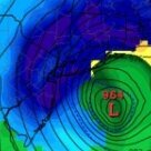
Significant Snowfall Likely Sunday Night Into Early Sunday Light To Moderate Totals Region Wide Winter Finally Picks Up The Pace The pace of winter storms has picked up past the halfway point of the month, as advertised last fall. Indeed, the final flakes from today's snowfall are still fluttering to the surface, yet the arrival of the next storm is already within 12 hours. Synoptic Overview It is a subtle variation of the orientation of the Western CONUS ridge that is allowing the incoming system to track closer to the coast than advertised by the consensus, as outlined last week. Note the positive tilt of the ridge as the system on Friday departed. Versus the orientation of said ridge this weekend. This will allow for more amplification and thus a closer track than the Friday wave, however, yet another incoming system dropping into the midwest on it's heels will limit just how much it can amplify in this fast, progressive flow. There was a brief period last night where it seemed as though this "kicker" would exert enough of an influence to prevent much of a storm at all, despite said amplification and the eventual negative tilt of the trough. However, it is now clear the original idea of a light to moderate snowfall will indeed materialize. That being said, there is not much of a ceiling for higher amounts due to the presence of the aforementioned "kicker" system upstream. This will ensure that our storm on Sunday night will remain progressive enough to ensure that the low will not close off in the mid levels of the atmosphere until it passed our latitude and approaching the Canadian Maritimes. This will limit moisture flow and thus limit heavier banding, which means that amounts of 6"+ will be scarce if existent at all. Expected Storm Evolution Snow will break out around dawn on Sunday over southwestern Connecticut. Light Snowfall will then overspread the rest of the region throughout the balance of the morning, with the focus being over central areas, as a lead finger of lift approaches ahead of the main system. Light and spotty mixed precipitation likely over the cape and islands at this time. There may be somewhat of a lull during the afternoon on Sunday as the initial lift weakens in advance of the main storm. Snow will then become steadier and pick up in intensity again over tall but far western Massachusetts, as the coastal storm approaches and begins to intensify on Sunday evening, at which point mixed precipitation transitions to rain on the outer cape and Nantucket island. The storm will begin to pull by midnight, as precipitation slowly lightens from west to east, and any residual mixed precipitation or rainfall over the cape and islands transitions back to snow. This is where the majority of accumulation will take place over the outer cape and Nantucket Island. Snow should be ending by shortly after dawn on Monday, although snow showers may perhaps be protracted a bit over eastern locales, as upper level energy feeds into the offshore storm. Final Call: -
I guess they just disregarded or didn’t even check the latest models that went warmer and cut back on snow accums. Or maybe they didn’t think the new runs were correct.
-
Storm potential January 17th-18th
Winterweatherlover replied to WeatherGeek2025's topic in New York City Metro
HRRR and NAM look decent, RGEM is meh. Don't really know what to expect tomorrow but probably the range is like 1 to 5 inches. -

First Legit Storm Potential of the Season Upon Us
40/70 Benchmark replied to 40/70 Benchmark's topic in New England
Best shot at tomorrow....man, just get this over....what a PIA. https://easternmassweather.blogspot.com/2026/01/significant-snowfall-likely-sunday.html Final Call: -
Yup, that’s what they just said on the Fox halftime show.
-
nwohweather started following Winter 2025-26 Short Range Discussion
-
lol are you serious? damn they were just trying to line up the FG. Wow.
-

First Legit Storm Potential of the Season Upon Us
moneypitmike replied to 40/70 Benchmark's topic in New England
RGEM is a little less exciting -

Storm potential January 17th-18th
CPcantmeasuresnow replied to WeatherGeek2025's topic in New York City Metro
I remeber you as snowman88? On the NJstrong weather forum. -
Last time Denver won a SB they didn't have a real QB. Their defense carried them. Payton Manning had a noodle arm and could barely throw at that point.
-
I was a refugee from eastern that washed up on the shore of wunderground. Some guy named HeavySnow was jeblike from DC and the accordion guy from New England was there.
-
Central PA Winter 25/26 Discussion and Obs
Summit Snow replied to MAG5035's topic in Upstate New York/Pennsylvania
Crazy today. Left Clarks Summit with snow on the ground and mood flakes and drove to Mt Pocono to pick up a car. Once I passed Gouldsboro on 380 it was like I drove into a bad winter storm. Cars off the road everywhere and 4-5'' of heavy snow. Got back and we might have go 2" but in Mt Pocono they were close to 6". -
First Legit Storm Potential of the Season Upon Us
Typhoon Tip replied to 40/70 Benchmark's topic in New England
yeah, Vortex95 mentioned that earlier… I asked if that had any norlun signature in the sounding to it … Not an exact match, but did kind of look that way. No answer, but I haven’t gone to look myself. -
Second to last play of the OT when he scrambled left. It didn’t look like anything.
-
-

Storm potential January 17th-18th
CPcantmeasuresnow replied to WeatherGeek2025's topic in New York City Metro
Yeah I liked him too a good guy. R Jay and I used to chat with him about some of the ridiculous measurements at Central Park when the zookeeper was taking them. He said at the time he thought the average in central Park should be about 5 inches higher than what was recorded because of so many egregious under measurements. -
Thanks, Michelle and Tim. Unfortunately but not surprisingly, those many runs of especially the King suite ended up just being imaginary for this and other parts of SE GA. The typical NW correction was delayed on that model, but reality finally took over, which is consistent with the very tough SE GA climo. That also takes out Metal’s hometown of Waycross. I’m also pulling especially for the middle GA folks like Shack that rarely get any. I’m hoping that it will stick not too far west of here (say, Metter to Vidalia area), which would mean a worthwhile 1-1.5 hour Sunday afternoon drive to see it on the ground. But with so much NW trend, I’m thinking the closest sticking will probably be further west. Good luck, all!


