All Activity
- Past hour
-
Please stay warm for a while.
-

September 2025 OBS-Discussion centered NYC subforum
steve392 replied to wdrag's topic in New York City Metro
Gorgeous out! 70 in Dumont, nj. Not a cloud in sight. -

2025-2026 ENSO
Daniel Boone replied to 40/70 Benchmark's topic in Weather Forecasting and Discussion
Enso is always their main source for their Seasonals, as we all know. -
I’m not sure there’s going to be much color.
-

September 2025 OBS-Discussion centered NYC subforum
nycwinter replied to wdrag's topic in New York City Metro
could not have asked for a more beautiful day this time of year cool nice breeze dry air lots of people were out enjoying the day.. -
lol that’s awesome. The trees still look largely green.

-

2025-2026 Fall/Winter Mountain Thread
Maggie Valley Steve replied to Buckethead's topic in Southeastern States
We will need to keep an eye on mid to late next week. The models are coming together suggesting the possibility of a rather potent upper low swinging in from the NW and cutting off in our neck of the woods. While it is far too soon to know the details, the potential is there for flooding concerns right around the 1 year Anniversary of Helene. -

2025 Atlantic Hurricane Season
WEATHER53 replied to BarryStantonGBP's topic in Tropical Headquarters
I’m wondering if the generally far better tropical forecasts have now fallen victim to the winter storms micro management that just does not work -

September 2025 OBS-Discussion centered NYC subforum
WestBabylonWeather replied to wdrag's topic in New York City Metro
Perfect day of the year -
Running out of time. Here in north Florida it has been very dry and less humid compared to September last year. Feels more like October than September. If nothing happens in the next couple of weeks it is probably time to turn the page on this season.
-
-
SAL is absolutely an existing problem for large sections of the east coast and parts of the Gulf. There is currently a milky white haze here in north Florida. Hard to get anything going in this dry and dusty environment. https://tropic.ssec.wisc.edu/real-time/sal/salmain.php?&prod=split&time=
-
Storm clouds are already building.
-
Looking at the ENSO thread that east pacific blob that’s usually given us epic winters tried to form and failed. There is talk that we may get a Niña pattern that has the PNW get pounded by cold and snow while the rest of the country roasts.
-
-
-
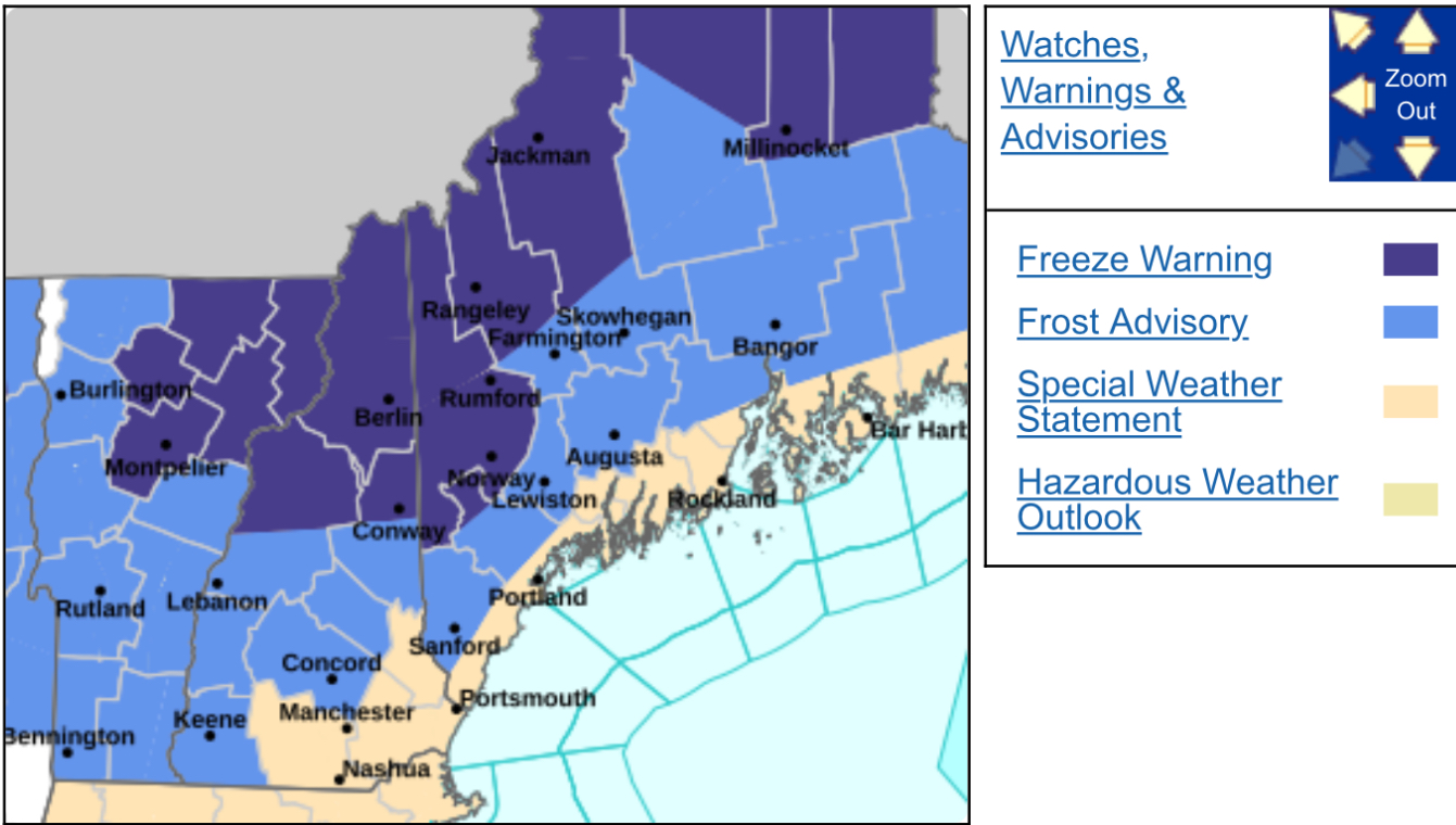
Frost advisory hath been giveth

-
Shhh. The Pacific has absolutely killed us for most of the past 6 or 7 winters. If we can get a +PNA most of the winter, I will take my chances
-
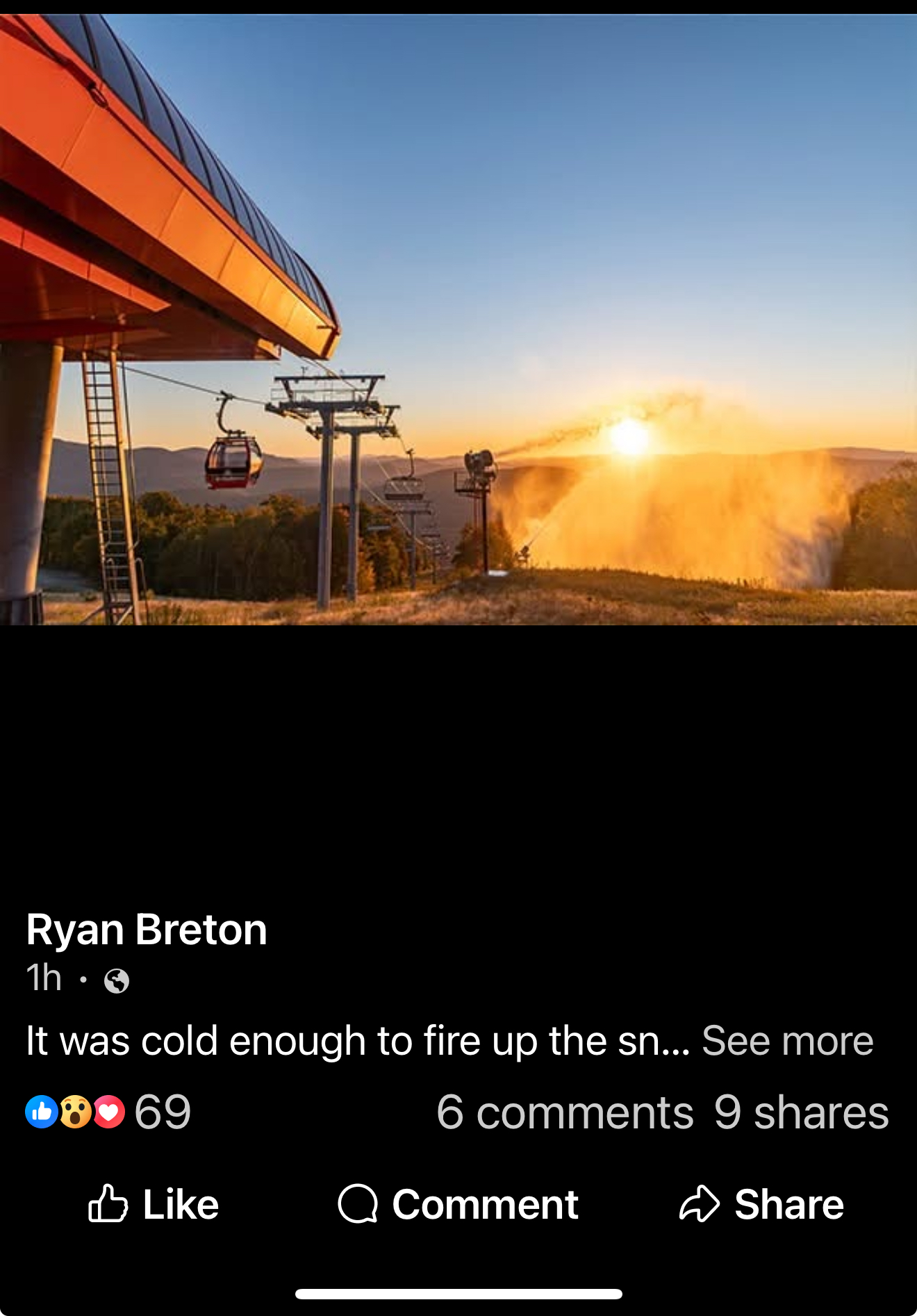
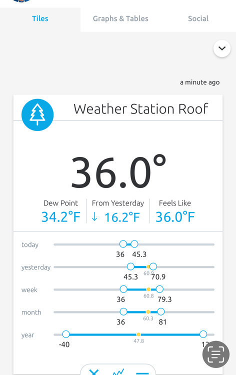
This mornings lows
-
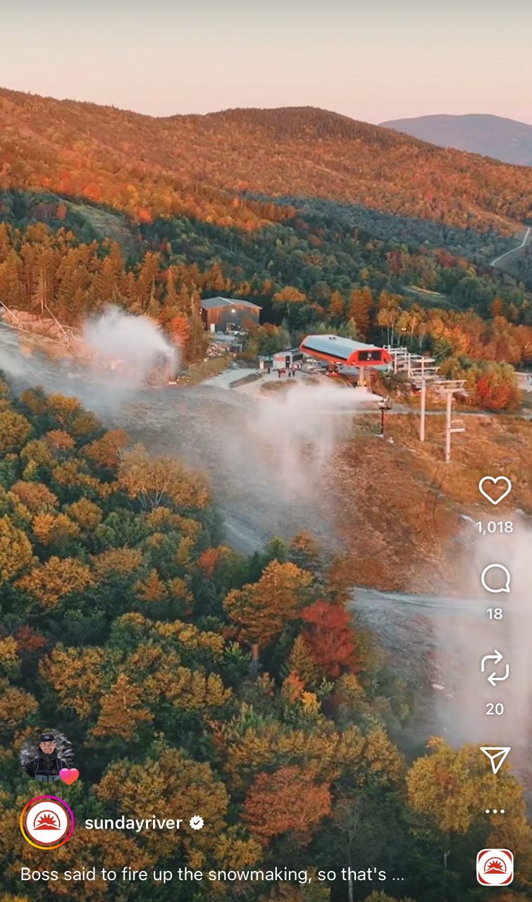
Blowing out the mice! It’s coming!

-
they always predict a very cold PNW if it's a nina. Also it is impressive how little orange they used!
- Today
-
Funny, sort of, that I read that just now, right after reading the SWS for here. I was not online yesterday, so: Special Weather Statement National Weather Service Boston/Norton MA 610 PM EDT Fri Sep 19 2025 ...ELEVATED RISK FOR FIRE SPREAD AGAIN SATURDAY... A prolonged period of dry weather and dry fuels will result in elevated fire weather conditions later Saturday morning through Saturday afternoon. Although winds will be rather light from the north at 5-10 mph with a few 20+ mph gusts confined to mainly to the Cape and Islands...the relative humidity will be lower than what we observed today. Minimum relative humidity values will drop to between 25 and 40 percent along and northwest of I-95 and between 40 and 55 percent towards the Cape and Islands. Exercise caution handling any potential ignition sources, including machinery, cigarettes, and matches. Any fires that ignite will have potential to spread quickly. This forecast considers meteorological, fuel, and land conditions and has been developed in coordination with state fire and land management officials. $$ Frank
-
Although the chances are now pretty low, we still don’t know for sure that ACE won’t get to near the 30 yr 122 avg especially based on 2024, 2020, 2016, and 2005, but also on 1894, 1893, and 1878. However, all of these very active Oct+ years were more active through Sept though 2016 and 1894 not by that much.
-
Yep, I can almost smell the late phase coming that cashes in everyone east of I-77.
-
BTV upgraded to a freeze warning for tonight with upper 20s. Seeing as we got to 32F last night, does tonight end the growing season? I'd think if we get to 28F or so that'll lead to a much harder and widespread frost/freeze.