All Activity
- Past hour
-
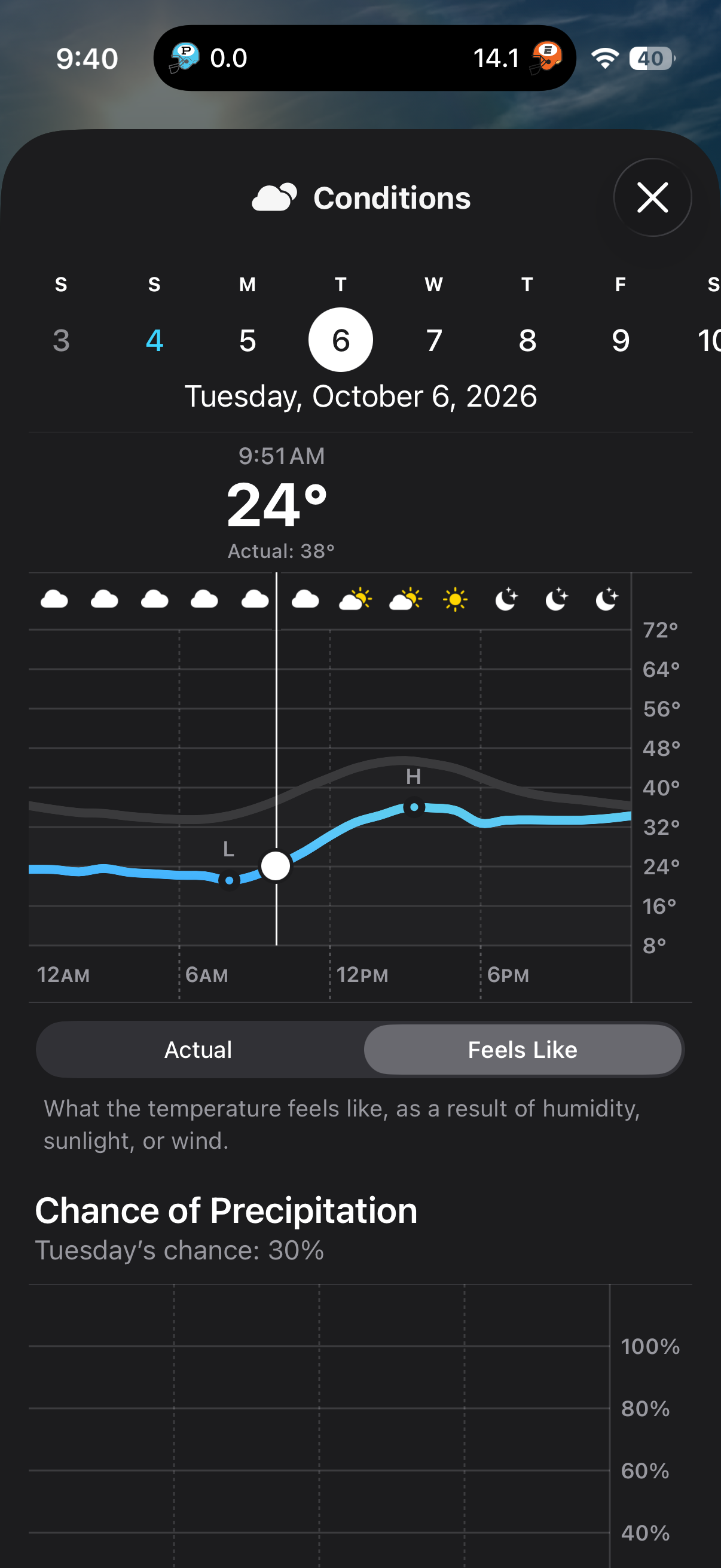
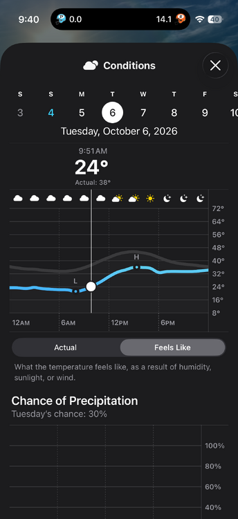
This is my tee time on Tuesday. Da fuq am I supposed to do with that?
-
October 4 2005: Widespread heavy rain falls in Minnesota. 4.61 inches of rain falls in the Minneapolis area, 3.42 inches is recorded in St. Cloud, 2.28 inches in Redwood Falls, 2.98 inches in New London, and 3.23 inches in Buffalo. 1939: A storm dumps 2.16 inches of rain at Fairmont. 1922: A record high of 89 is set in Minneapolis. For Sunday, October 4, 2026 1777 - The Battle of Germantown was fought in a morning fog that grew more dense with the smoke of battle, causing great confusion. Americans firing at each other contributed to the loss of the battle. (David Ludlum) 1869 - A great storm struck New England. The storm reportedly was predicted twelve months in advance by a British officer named Saxby. Heavy rains and high floods plagued all of New England, with strong winds and high tides over New Hampshire and Maine. Canton CT was deluged with 12.35 inches of rain. (David Ludlum) 1969 - Denver, CO, received 9.6 inches of snow. October of that year proved to be the coldest and snowiest of record for Denver, with a total snowfall for the month of 31.2 inches. (Weather Channel) 1986 - Excessive flooding was reported along the Mississippi River and all over the Midwest, from Ohio to the Milk River in Montana. In some places it was the worst flooding of record. (Sandra and TI Richard Sanders - 1987) 1987 - A storm brought record snows to the northeastern U.S. Snowfall totals ranged up to 21 inches at North Springfield VT. It was the earliest snow of record for some locations. The storm claimed 17 lives in central New York State, injured 332 persons, and in Vermont caused seventeen million dollars damage. The six inch snow at Albany NY was their earliest measurable snow in 117 years of records. (The National Weather Summary) (Storm Data) (The Weather Channel) 1987 - Southern California continued to "shake and bake". An earthquake was reported during the morning, the second in a matter of days, and during the afternoon temperatures soared well above 100 degrees. Highs of 100 degrees at San Francisco, and 108 degrees at Los Angeles and Santa Maria, were October records. San Luis Obispo was the hot spot in the nation with an afternoon high of 111 degrees. (The National Weather Summary). 1988 - Temperatures dipped below freezing in the north central U.S. Five cities in North Dakota and Nebraska reported record low temperatures for the date, including Bismarck ND with a reading of 17 degrees above zero. Low pressure brought snow and sleet to parts of Upper Michigan. (The National Weather Summary) 1989 - Unseasonably cold weather continued in the north central U.S., with freezing temperatures reported across much of the area from eastern North Dakota to Michigan and northwest Ohio. Thirteen cities reported record low temperatures for the date, including Saint Cloud MN, which was the cold spot in the nation with a morning low of 19 degrees. (The National Weather Summary) Observances: 4 Sun National Taco Day 4 Sun National Vodka Day 4 Sun National Golf Lovers Day 4 Sun Feast of St Francis of Assisi 4 Sun National Cinnamon Roll Day 4 Sun World Space Week 4 Sun World Animal Day 4 Sun Kindness to Animal Day 4 Sun National Improve Your Office Day 4 Sun National Truckers Day 4 Sun St. Francis of Assisi Feast Day
-
So sorry to hear. sending lots of positive vibes your way
-
0.36" of rain yesterday with a general 1/2" around the head of the Lake. N WI really needed it with a D3-4 ongoing.
-
57 and cloudy; quite the turnaround from yesterday.
-
 cheap synthroid 50 mcg and purchase generic synthroid online buy synthroid 125 mcg http://images.google.cz/url?q=https://thyrowellrx.com buy levothyroxine online pharmacyand https://act2day.eu/profile/prmurjnzpk/ buy synthroid 125 mcg [url=https://www.google.com.mt/url?sa=t&url=https://thyrowellrx.com]cheap synthroid 90 day supply[/url] levothyroxine sodium 50 mcg buyor [url=http://la-maison-des-amis.com/user/hqgzyxrukn/]cheap synthroid 50 mcg[/url] mail order levothyroxine
 -
Yeah it seems like in SoMD pretty much everything is better in a nina other than drought. I still miss a good noreaster even if it if mostly white rain. But not this never ending gloom shit.
-
So sorry to hear that @RickinBaltimore. My condolences to you and your family
-
zithromax 500 mg lowest price online [url=https://rapidzithrodirect.shop/#]rapidzithrodirect[/url] zithromax for sale cheap
-
I knew the worst drought areas around the triad were trending down in precipitation but literally to get 0.00” over a large area after a forecast of a widespread 1”+ totals just a couple days out stinks. We have had some rain here but likely ending up <0.40” for the weekend
-
Hi everyone. If you can, please think some good thoughts for me and my family right now. Dad passed away yesterday afternoon after a series of back and forth trips to the hospital. His lungs just finally stopped working. He fought like hell that is for sure to keep going, but his body was finished. It's an odd feeling right now, after Ravens games I'd give him a call to talk about the game. Today, I'm going to the funeral home to plan his viewing and service. Rest well Dad. And give Mom all my love.
-
https://dutashielddirect.shop/# how to buy generic avodart without a prescription
- Today
-

2026 Atlantic Hurricane Season
NorthHillsWx replied to Stormchaserchuck1's topic in Tropical Headquarters
Whatever develops (or doesn’t) in the gulf late week will be the last chance at a hurricane this season -
Chilly morning, low of 54
-
Miller Ass Miller BS Just give me a bunch of nice safe SWFEs where I don’t have to worry about deform bands, screw zones, downsloping, etc.
-
Talking about Southern New England, though not the mid Atlantic. Don’t care about MEHSIS
-
Soaker in the southeast / Gulf this week othwise the sw deserts dry out and the rest of the nation dries out, should start seeing wetter weather into California after their record heat this weekend and coming week.
-
Not sure if it was just this morning drizzle or also the rain yesterday and Friday. They also don’t try too hard for fall baseball I’ve learned.
-
Records: Highs: EWR: 89 (2013) NYC: 88 (1941) LGA: 86 (2013) JFK: 84 (1967) Lows: EWR: 33 (1945) NYC: 37 (1888) LGA: 38 (1945) JFK 39 (1996) Historical: 1679: New England from the 4th to the 5th: The Great Northeastern Rainstorm and Flood of October 1869 dumps 7.15 inches of rain in 24 hours on Middletown, Connecticut, most coming the morning of the 4th. Northeastern coastal Maine takes the full brunt of the hurricane as the storm surge produces tremendous tides. At the entrance to the Bay of Fundy, the islands of Deer, Grand Manan, and Campobello all sustain severe damage from wind and tide, as did the communities of Eastport and Calais, Maine . (Ref. WxDoctor) 1777 - The Battle of Germantown was fought in a morning fog that grew more dense with the smoke of battle, causing great confusion. Americans firing at each other contributed to the loss of the battle. (David Ludlum) 1867: Galveston, TX has a track record of severe hurricanes. Almost 30 years to the day after the famous Racer's Hurricane struck the island city; another major hurricane brought violent winds and inundation. All of the wharves in Galveston were reportedly destroyed. (Ref. Wilson Wx. History) 1869 - A great storm struck New England. The storm reportedly was predicted twelve months in advance by a British officer named Saxby. Heavy rains and high floods plagued all of New England, with strong winds and high tides over New Hampshire and Maine. Canton CT was deluged with 12.35 inches of rain. (David Ludlum) 1877: Washington, DC set a new 24-hour rainfall record for the month of October when 3.98" fell on the 4th. (Ref. Rainfall record as of the year 1877) 1957: The world's first artificial satellite, Sputnik, was launched on October 4th, 1857 by the Soviet Union. Sputnik was about the size of a beach ball and weighed 183.9 pounds. It took about 98 minutes to orbit Earth on an elliptical path. 1963: Hurricane Flora spent 11 days wreaking havoc along her path through the Caribbean. The storm brought 170 mph winds and an 11 foot storm surge to Haiti, killing 5,000 people, making it the island nation's most destructive hurricane. The slow moving storm brought 15 - 20 inches of rain in 72 hours to parts of Cuba. The floods and mudslides killed 1,300 people in that island nation. Castro refused the United States' offer of help. (Ref. Wilson Wx. History) 1969 - Denver, CO, received 9.6 inches of snow. October of that year proved to be the coldest and snowiest of record for Denver, with a total snowfall for the month of 31.2 inches. (Weather Channel) 1974: Killing frost on 3rd and 4th in suburbs National Airport had a low of 34°F on the 4th. (Washington Weather Records - KDCA) (Ref. Many Additional Temperatures Listed On This Link) 1986 - Excessive flooding was reported along the Mississippi River and all over the Midwest, from Ohio to the Milk River in Montana. In some places it was the worst flooding of record. (Sandra and TI Richard Sanders - 1987) 1987 - A storm brought record snows to the northeastern U.S. Snowfall totals ranged up to 21 inches at North Springfield VT. It was the earliest snow of record for some locations. The storm claimed 17 lives in central New York State, injured 332 persons, and in Vermont caused seventeen million dollars damage. The six inch snow at Albany NY was their earliest measurable snow in 117 years of records. (The National Weather Summary) (Storm Data) (The Weather Channel) 1987 - Southern California continued to "shake and bake". An earthquake was reported during the morning, the second in a matter of days, and during the afternoon temperatures soared well above 100 degrees. Highs of 100 degrees at San Francisco, and 108 degrees at Los Angeles and Santa Maria, were October records. San Luis Obispo was the hot spot in the nation with an afternoon high of 111 degrees. (The National Weather Summary). 1987: A storm brought record snows to the northeastern U.S. Snowfall totals ranged up to 21 inches at North Springfield, VT. It was the earliest snow of record for some locations. The storm claimed 17 lives in central New York State, injured 332 persons, and in Vermont caused seventeen million dollars damage. The six-inch snow at Albany, NY, was their earliest measurable snow in 117 years of records. 1988 - Temperatures dipped below freezing in the north central U.S. Five cities in North Dakota and Nebraska reported record low temperatures for the date, including Bismarck ND with a reading of 17 degrees above zero. Low pressure brought snow and sleet to parts of Upper Michigan. (The National Weather Summary) 1989 - Unseasonably cold weather continued in the north central U.S., with freezing temperatures reported across much of the area from eastern North Dakota to Michigan and northwest Ohio. Thirteen cities reported record low temperatures for the date, including Saint Cloud MN, which was the cold spot in the nation with a morning low of 19 degrees. (The National Weather Summary) 1995: Opal became a hurricane on October 2. Opal continued to strengthen, and a period of rapid strengthening late of the 3rd and early on the 4th made it a Category 4 hurricane. Opal weaken on the 4th, and Opal was a Category 3 hurricane when it made landfall near Pensacola Beach, Florida late on the 4th. Opal continued quickly north-northeastward and became extratropical over the Ohio Valley on the 5th. Hurlbert Field, Florida reported sustained winds of 84 mph with a peak gust of 144 mph, and gusts to 70 mph occurred as far inland as northwest Georgia. However, the main impact from Opal was from storm surge. A combination of storm surge and breaking waves inundated portions of the western Florida Panhandle coast to a depth of 10 to 20 ft. The surge was responsible for the bulk of the $3 billion in damage attributed to Opal in the United States. Opal was responsible for 9 deaths in the United States, including 8 from falling trees and one from a tornado. Opal was responsible for 50 deaths in Mexico and Guatemala due to flooding caused by heavy rains.(Ref. Additional Information At This Link) (Ref. AccWeather Weather History) 1998: Two rounds of thunderstorms at Kansas City, MO produced flash floods that killed 12 people. Most people died after driving their automobiles into rushing water. Over 100 water rescues were required during the event. 7 people died when their cars became stranded on a single bridge over Brush Creek. The National Weather Service received a commendation for their excellent warnings during the event. The first of numerous flash flood warnings had a lead time of over 30 minutes. Total damage exceeded $50 million dollars. (Ref. Wilson Wx. History) Oklahoma: 27 tornadoes touch down across Oklahoma establishing the national record for tornadoes in any state on a single October day. (Ref. WxDoctor) On the backside of this storm, an early season blizzard struck much of Converse and Niobrara Counties in Wyoming. 8 to 12 inches of heavy, wet snow fell from late on the 4th into the 5th over many areas. This combined with 40 mph winds snapped about 200 power poles and left about 4,000 people without power in Lusk and Manville for up to 5 days.(Ref. Wilson Wx. History) (Ref. AccWeather Weather History) 2005: Hurricane Stan made landfall along the Mexican coastline southeast of Veracruz. Torrential rains of 10 to 15 inches caused extensive flooding and loss of life across Central America. Death tolls reached 23 in Mexico, Nicaragua and Honduras, and 62 in El Salvador, but the greatest loss of life came in Guatemala, where as many as 2,000 people were killed in rain-related flooding and landslides. (Ref. Wilson Wx. History) Calendar day lows across much of the Midwest were 20 to 30 degrees warmer than normal. October 4th record-high minimum temperatures: 74 degrees (Lincoln, NE); 73 (Omaha, NE); 72 (Moline, IL); 71 (Rochester, MN and Waterloo, IA) ; 70 (Green Bay, WI). (Ref. Weather Guide Calendar with Phenomenal Weather Events 2011 Accord Pub. 2010, USA) 2006: Shoshone, Idaho: A rare October tornado touches down near Shoshone, Idaho community but causes no significant damage. NWS reports this is only the second recorded October tornado in the state. The previous occurred in October 1984 in Ada County.(Ref. WxDoctor) 2013: While western South Dakota was dealing with a crippling blizzard, the tri-state region of Nebraska, South Dakota, and Iowa saw several tornadoes, including an EF-4. This violent tornado started 2 miles southwest of Climbing Hill, Iowa, flattening corn crops and snapping tree trunks. As the tornado moved northeast, it intensified and struck a farmstead approximately 5 miles west-northwest of Correctionville, Iowa. Sheds and other buildings were severely damaged or destroyed, with the residence being severely damaged. The tornado continued to increase in both size and magnitude as it continued on its trek northeast. The tornado reached its maximum intensity 2.5 miles south of Pierson, Iowa, when this mile-wide tornado struck two farmsteads. Numerous outbuildings and barns were destroyed, with farm equipment being tossed over 400 yards. It was here that the tornado was rated EF-4. The tornado stayed southeast of Pierson, Iowa, and to the west of Washta, Iowa. Before lifting, the tornado produced more tree damage and downed power poles and lines 2 miles west of Washta, Iowa.
-
62 / 53 mostly cloudy. Scattered showers upper 60s to low 70s not too much rain today or over the next 5 days. 10/5 - 10/8 overall near to below normal first 40s since may in the coastal/city areas perhaps a few 30s inland coolest since later sep and / or late May. 10/8 - 10/12 overall above normal and chance of 80 in the warmer spots 1 or 2 days in there. Beyond there we'll see if we turn wetter and deal with a more southerly flow and any late season tropical remnants of the gulf.
-
Is there a good radar that picks up drizzle. How can fields be closed from mist?
-
the garage is not wide enough, so it needs to be super orderly to fit 2 cars. I built shelving and hanging points for stuff so 2 cars (barely) fit. keeping a bunch of next to worthless junk occupying a garage space when a 20 or $30K vehicle sits in the driveway getting pummeled by the weather is a mindset I don't understand currently 50/50F, off a morning low of 47
-
Got 32F here. Third frost of the season.
-

Pittsburgh Area Fall 2026
ChalkHillSnowNut replied to Ahoff's topic in Upstate New York/Pennsylvania
Also-I’ve been reading the ENSO discussions about super El Niño and wondering how this is going to affect our winter…. -
Overall for the E Coast for the top positions, Miller As rule on the NESIS. Bliz of 93 #1 Bliz of 96 #2 https://micromet.psu.edu/ewall/NARR/1996/us0107.php Mar 2-5, 1960 #3 https://www.ncei.noaa.gov/monitoring-content/snow-and-ice/rsi/nesis/19600302-19600305-8.77.jpg Bliz of 1899 was Miller A and was on par w/ the Bliz of 93 https://www.woodtv.com/wp-content/uploads/sites/51/2023/02/1899-Weather-Map-Feb.-12-1899.jpg And best snowstorm BOS ob ever and highest gust w/ a snowstorm is from the Bliz of 93! BOS RS 2250 W0 X 0TS+BS 875/31/31/0647G62/916/R04RVR06-V06 TB50 SW MOVG N OCNL LTGIC DRFTG SNW PK WND 0670/33 PRESFR SNOINCR 3/11/12 If you had snowfall measurements done consistency and right back in the day, BOS top 10s would not be what they are currently as prior to the 1990s. Snowfall practices then resulted in too low totals. But Don't be a @CoastalWx and act IMBY only!