All Activity
- Past hour
-

Rise of the Machines: January 18-19 Winter Storm Obs Thread
codfishsnowman replied to WxWatcher007's topic in New England
I bet that's a sight out there! Congrats man! -

Rise of the Machines: January 18-19 Winter Storm Obs Thread
CoastalWx replied to WxWatcher007's topic in New England
Looks like that was east of me -

January 18th Back Door NW Trend Snow OBS Thread
wkd replied to Mikeymac5306's topic in Philadelphia Region
4.5" yesterday, 7.75" total for the last two days. -
Man I want to believe. Give me this 84 hours before, and I will bite. It's just so hard these days in the NC Piedmont.
-

Rise of the Machines: January 18-19 Winter Storm Obs Thread
powderfreak replied to WxWatcher007's topic in New England
Congrats man. Long time coming. -

First Legit Storm Potential of the Season Upon Us
TheSnowman replied to 40/70 Benchmark's topic in New England
This was Spot On in Both Statements. And I’m Just West of Attleboro and 200’ higher. I’m going to end with at least 6.5” in an Overachieving Happy Storm. Been Big Flake Fluff since 6pm. -
My neck of the Lake Norman woods got all cold rain today. Just over an inch total. Banking on next week to make it right.
-

Rise of the Machines: January 18-19 Winter Storm Obs Thread
dendrite replied to WxWatcher007's topic in New England
Were you in that OES enhancement for awhile?
-
Rise of the Machines: January 18-19 Winter Storm Obs Thread
CoastalWx replied to WxWatcher007's topic in New England
Wow what a scene. Might be near 6” -

Rise of the Machines: January 18-19 Winter Storm Obs Thread
40/70 Benchmark replied to WxWatcher007's topic in New England
6.25" depth. -
All rain today from 9 AM to 8 PM. 44-38 degrees. Currently 27.2, forecasted low is 24.
-
Rise of the Machines: January 18-19 Winter Storm Obs Thread
TheSnowman replied to WxWatcher007's topic in New England
6.25” and still going!! CORY HAS FINALLY SEEN A 6” Snowstorm Again!! Honestly I’m close to JACKING this thing! Jeez! Almost Keeping up with Plymouth! -
LWX talks about upcoming storm... They are kinda taking it seriously By the end of the week and especially heading into the weekend, the upper-level pattern becomes quite active in both the northern and southern branches of the jet stream. Model guidance is still very much all over the place in regards to exactly what comes of this, but there is growing consensus for an area of low pressure developing across the south-central/southeastern CONUS. Depending on when and where that area of low pressure develops, as well as where it goes after it does develop, there could be significant wintry precipitation across our area sometime next weekend. Uncertainty remains with this system, as there is some potential that strong Arctic high pressure could suppress the system south. However, that high (~1040 mb Arctic high) is also a source of very cold air; this likely remains in place due to a favorable -AO/-NAO blocking pattern. Meanwhile, there are an increasing amount of ensemble members that bring significant wintry precipitation to the region due to an amplified southern stream influence - something we have seen very little of so far this winter (typical of La Nina). The low may not escape as easily out to sea given the -NAO block. The nearby steady source of very cold air and the amplified southern stream occurring in tandem are what raise some red flags for significant wintry precipitation potential this weekend. The latest ensemble guidance is certainly on the upward trend in that regard, but that doesn`t mean it can`t swing back in the other direction. It will be key to monitor this threat closely in the coming days as the different parts of the system become better sampled by surface and upper air obs. Current model spread indicates an axis of significant snow/ice could be as far north as Upstate New York, or as far south as the Carolinas
- Today
-
Rise of the Machines: January 18-19 Winter Storm Obs Thread
codfishsnowman replied to WxWatcher007's topic in New England
Nice currier and ives past couple hours. At least an inch new. Cleaned up Saturdays stuff which got a little messy looking yesterday in the afternoon -

January 2026 regional war/obs/disco thread
ineedsnow replied to Baroclinic Zone's topic in New England
Euro AI came North.. Euro close Ukie a hit.. enjoy it -
.thumb.jpg.6a4895b2a43f87359e4e7d04a6fa0d14.jpg)
Central PA Winter 25/26 Discussion and Obs
Yardstickgozinya replied to MAG5035's topic in Upstate New York/Pennsylvania
I'm calling next weekend early. I'm predicting somewhere between the 0 and 30" and I hope to god that i'm way off. -
Goes completely against the other discussion lol .
-
-
Weather/Hazards Highlights... Another day of lake effect snow is likely across the Great Lakes Thursday, with potentially heavy amounts piling up downwind of Lake Ontario after a snowy short range period too. Meanwhile, some light to moderate rain is forecast across the Southeast Thursday, while the low aloft could help produce some precipitation across southern California. Then precipitation is forecast to spread across parts of the Southwest, the southern/central Rockies, and across much of the southeastern U.S. into Friday. With the cold air in place, ice and snow are likely across much of the southern tier in likely a notable winter storm. The precipitation, including snow and ice, is forecast to spread east into the Carolinas and Mid-Atlantic on Saturday, lasting until Sunday and potentially spreading north into the Northeast. Model guidance has converged on the potential for an impactful storm, but it will take additional time to refine the details of precipitation amounts and type, so continue to monitor forecasts. Elsewhere, precipitation could increase across the Pacific Northwest and northern Rockies this weekend as shortwaves move through. -NWS .
-

January 2026 Short/Medium Range Thread
Weatheriscool replied to John1122's topic in Tennessee Valley
My weather chanel app went from 1 to 3 inches Friday night 1 to 3 Saturday and 1 to 3 Saturday night to now it say 1 to 3 Friday night 5 to 8 Saturday and 1 to 3 Saturday night that would shut nashvegas for few days lol -

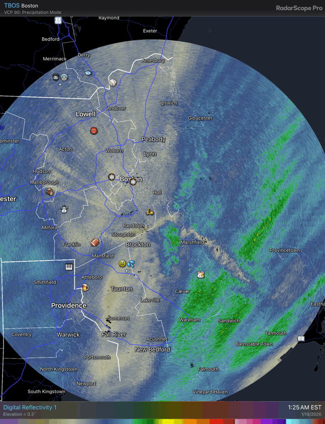
Rise of the Machines: January 18-19 Winter Storm Obs Thread
SouthCoastMA replied to WxWatcher007's topic in New England
some compaction/melt going on at 33.1°. But measured 5.25" at 230am -
Nice to be able to track something.
-
Rise of the Machines: January 18-19 Winter Storm Obs Thread
40/70 Benchmark replied to WxWatcher007's topic in New England
3.75" 7" on the weekend. -
2025-2026 ENSO
40/70 Benchmark replied to 40/70 Benchmark's topic in Weather Forecasting and Discussion
https://easternmassweather.blogspot.com/2026/01/anatomy-of-very-wintry-latter-january.html -
Winter 2025-2026 Offers Return to Normalcy
40/70 Benchmark replied to 40/70 Benchmark's topic in New England
Anatomy Of A Very Wintry Latter January Development of Expected +TNH Pattern Promises Bouts Of Bitter Cold & Potential for Succession of Snow Storms Recent January Thaw Comes With A Price Meteorology is like anything else in life in that things are not always as they appear, and thus reality often manifests in a rather cruel twist of irony. Exhibit number one being the latter stages of the ongoing snowfall, which ostensibly speaking, represents a reprieve for those eager to resume the day-to-day routines that comprise the structure of their lives. However, what the majority may not realize is that fast on the heels of this departing storm will be the very worst that winter has to offer. Indeed, the polar vortex is poised to sink southward in the wake of this system and pave the way for bitter cold weather to infiltrate the region for the vast majority of the balance of the month of January. This should sound familiar to those of you who took the time to read the Eastern Mass Weather Winter Outlook last fall, which advertised that the mild, mid-month Pacific Trough Regime responsible for our January thaw would also serve as the precursor pattern to the development of what is referred to as a stratospheric reflection event. Recent Stratospheric Reflection Event Key To Potentially Bitter Latter January Society's understanding of the stratosphere and the role that it plays in modulating our weather is very rudimentary to say the least. The basic conceptualization is that a weak polar polar vortex makes the mid latitudes more prone to cold outbreaks, and while that is true, the method of delivery for cold to North America is multifarious in that it is not relegated to a weak polar vortex/-NAO pattern. In fact, the coldest outbreaks in the CONUS are actually triggered by a strong polar vortex and +NAO regime in what is referred to as a "stratospheric reflection event". During these stratospheric reflection events, heat is transferred upward by a Rosby wave (kink in the jet stream) over Siberia and reflects back downward of off the PV into Canada via the reflective surface posed by negative vertical wind shear in the stratosphere. ( Lee et al 2019). The study notes that these reflection events are most common during the month of January. There is one reflection event on average each season, so they are by no means rare events. Reflective events are declared when the reflection index (RI), which denotes the difference in anomalous poleward eddy heat fluxes in the lower stratosphere between Siberia and Canada, exceeds 1 for 10 or more consecutive days (Lee et al 2019). Reflective events are unique occurrences in that the PV is undisturbed and initially remains strong, before being stretched by the development of Alaskan and Aleutian ridging and returning to normal strength. It is the stretching that delivers the cold south and eastward into the CONUS, as depicted in the "end of event" graphic above. This type of stratospheric phenomenon differs from the SSW events, in which heat propagates upward in waves that converge in the stratosphere, thus weakening the PV by decelerating and even reversing the zonal westerly winds that are ordinarily prevalent in the polar stratosphere. Reflection events also differ from SSW in that they are more favored during the westerly phase of the QBO, with 30/44 events since 1980 having occurred during a +QBO. While this ostensibly rendered such an occurrence unlikely this winter given the very strong easterly QBO that is nearing peak, the analog events of January 16, 2001 through February 18, 2001, and January 13, 2018 through February 2, 2018 were weighted heavily in the seasonal forecast given their strength as general analog seasons due to considerations discussed last fall, such as polar, ENSO and solar considerations. This is also why these two seasons are considered superior SSW analogs later in the season. Here is a list provided by Lee at al (2019) of the most prominent reflection events of the past 45 years, including the primary analogs of 2001 and 2018. Courtesy Lee et al 2019 Note that the mean length of the process is 20 days, with 10 days being the minimum, and 60 days the maximum, per Lee et al (2019). The length of the 2001 (33 days) and 2018 (20) events were considered in the forecast for a reflection event to begin between approximately January 13th and 16th 2026, and end between about February 2 and 18th, which is consistent with the climatologically favored time frame per the research that was referenced previously. It is clear that this has indeed taken place given the latest feed back from Judah Cohen. "And as I have been routinely doing, looking at the wave diagnostics in Figure iv continues to display wave reflection over the weekend and into late January. For both periods shown, wave energy goes up and east over Asia, reflects off the stratospheric PV and then heads down and east over North America where the energy is re-absorbed and could potentially amplify the standing wave over North America and deliver cold air from the Arctic south, east of the Rockies. There is westward wave tilt with height over Asia and an eastward wave tilt with height over North America that is a classic signature of wave reflection. Though the eastward tilt is more pronounced in the first period compared to the second period". In order to better understand how the PV interacts with North American weather, Lee at al identified four distinct weather regimes and listed their respective frequency of occurrence between the months of November and March, from 1979 through 2017, since they last longer than synoptic scale patterns and thus provide an opportunity for longer range prediction. Pacific Trough Pattern Precursor for Reflection Events Pattern recognition is paramount in the analysis and diagnosis of reflection events because the behavior of the polar vortex has predictive value on each of these regimes at both seasonal, and sub-seasonal leads, which is roughly 15-60 day in advance. "The PV strength significantly affects the occurrence and persistence of each regime and transition between regimes" (Lee at al 2019). Research by Kretschmer et al (2018) illustrated the importance of planetary wave reflection for anomalous cold across North America. This expounded on earlier work by Kordera et al (2016) that found that wave reflection born of Pacific blocking tele-connected to a down stream trough over North America. Thus the implication here is that the Alaskan ridge pattern, which is not at all connected to the PV and is actually accompanied by a +NAO, as alluded to earlier, is most conducive to reflection events and is this correlated to the most severe arctic outbreaks in the US. Lee et al (2019) refers to this type of pattern as the "Alaskan Ridge Regime" , which is similar to the positive phase of the Tropical/Hemisphere Pattern (+TNH). The +TNH pattern is marked by higher heights over the Gulf of Alaska, the Gulf of Mexico and over the southeastern US and into the western Atlantic. Below average heights are normally anchored over southeastern Canada in association with a vortex buoyed between the Great Lakes and Hudson Bay, which is precisely what is modeled for much of the upcoming week and essentially the rest of January. This has been the most common vehicle for cold delivery over the past decade given the increased tendency for +NAO during the winter season, so it is important to remain mindful of the fact that climate change is certainly not prohibitive to severe cold outbreaks. It does, however, decrease residence time due to the enhanced Pacific jet keeping the flow more progressive. Here is a composite of seasons that fit this +TNH description over the past decade or so. Note the similarity to the -EPO predominate extra tropical Pacific pattern that was favored this winter season. The implication here is that there was an increased likelihood for both anomalous cold outbreaks, and deviation from the predominate MC regime of the past decade during winter 2025-2026, which was outlined last fall. Here are the four regimes as defined by Lee, accompanied by the spacial pattern of the temperature anomalies that accompany them. The Pacific trough regime (31.6%) is the most frequent, followed by the Alaskan ridge pattern (25.1%). Note the strong resemblance between the Alaskan ridge pattern and the -EPO style extra tropical Pacific pattern expected to be predominate this winter season. Below is the composite for the Pacific trough regime, which is akin to the extra tropical Pacific +EPO regime that was previously discussed. This composite contains the Eastern Mass Weather extra tropical Pacific analogs of 1950-1951 and 2001-2002, as well as the La Nina analog of 2005-2006. Note the similarity to the mild pattern this past week. This portion of the seasonal forecast evolution was predicated upon research by Lee et al (2019), which identified the transition from this Pacific trough regime to the Alaskan ridge regime as most conducive to the type of wave propagation needed to trigger a reflection event. This is what renders the Pacific trough regime the precursor to the stratospheric reflection necessary to trigger the +TNH pattern that is about to deliver an absolutely brutal stretch of winter to the region. This proved to be a remarkable extended forecasting tool given the expectation for a mid January onset of a reflection event that coincided with an influx of mild Pacific air. Note that the pattern begins to reverse in earnest approximately 5 days after the event onset. Simulateneously, the anonymously strong PV reverts to normal strength, and begins to stretch due to the building Alaskan and Aleutian ridging that retrogrades from North America. In addition to the return to climo strength, the stretching of the PV during the coming week is acutely evident. This behavior of the stratospheric vortex is precisely why it is very mild at the onset of these reflection events, during the antecedent Pacific trough pattern, but by ten days post reflection the pattern has reversed and is characteristic of an Alaskan ridge regime (bottom right above). Winter 2025-2026 represents a splendid illustration of why seasonal forecasting is a much more feasible endeavor when a proper diagnosis of the stratosphere is made given it's tendency to lead the configuration of the pattern on a hemispheric scale. The general public is now poised to learn just how costly that January thaw will be, as not only our heating costs going to rise precipitously for the balance of January, but there also exists the potential for heavy snows. Storm Potential Looms During Latter January The expectation last fall was that not only would it turn colder beyond mind January, but the threat for winter storms would also increase, and it appears that there are a couple of major winter storm threats on the horizon. The first threat period is signaled for next weekend by cross ensemble consensus. This period is also flagged by teleconector convergence denoted by mass hemispheric flux as the North Pacific block begins to neutralize. The next period of interest around the 30th of January is also evident in both the European (left) and GFS (right) ensemble packages, respectively. More storm updates to come this week.