All Activity
- Past hour
-

Strong Nor'Easter/Hybrid Storm Late September 2026
mob1 replied to Rjay's topic in New York City Metro
Big change
-

October Comes Early: Late September Multi-Hazard Hybrid Storm
CoastalWx replied to WxWatcher007's topic in New England
Convective models will go wild in these setups. -

Septorcher 2026 Discussion - Endless Summer
Typhoon Tip replied to Damage In Tolland's topic in New England
Yeah ...last night with a nearly missed frost here. 37 ping temp but it appeared to really hover around 38 ...whoosk. Chilly. Pretty sure this is ahead of schedule against conventional climatology, ... definitely is so against relative climo associated with CC! 58 now so explosive recovery I can already see the models festering in their schemes to create a snow chance in October ... before the compression of winter allows NINO to take over for whatever that's gonna entail ... Fun year for weather incoming. Doesn't say jack about whether that's coming with winter d-dripper's withdraw symptoms in mind, however -

2026 Atlantic Hurricane Season
olafminesaw replied to Stormchaserchuck1's topic in Tropical Headquarters
Not tropical, but perhaps the closest to a tropical impact we may see this year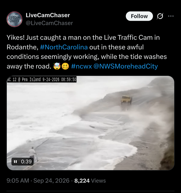
-

October Comes Early: Late September Multi-Hazard Hybrid Storm
Bostonseminole replied to WxWatcher007's topic in New England
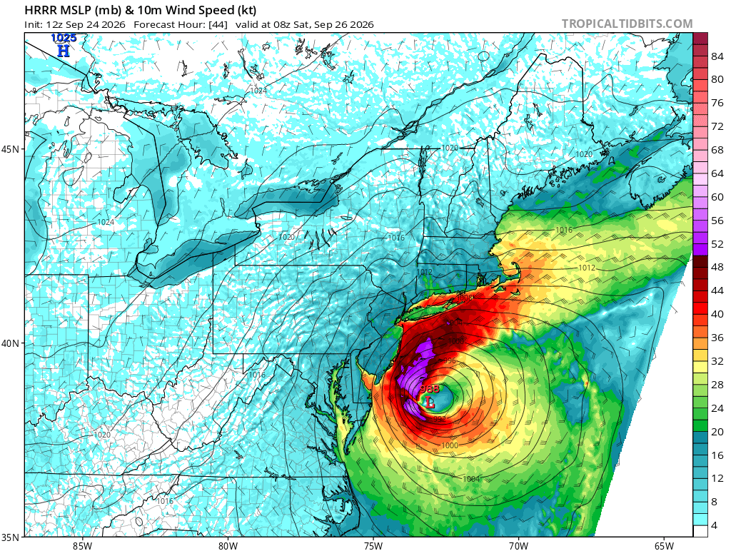
HRRR looks pretty cool, but HRRR at 48 hrs.. so idk -
Strong Nor'Easter/Hybrid Storm Late September 2026
mob1 replied to Rjay's topic in New York City Metro
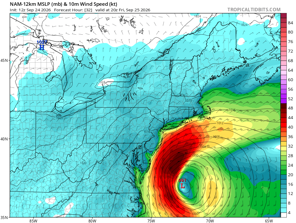
NAM is a fairly significant event for the coast -

Strong Nor'Easter/Hybrid Storm Late September 2026
MJO812 replied to Rjay's topic in New York City Metro
Yep much further west so far -

Strong Nor'Easter/Hybrid Storm Late September 2026
Brian5671 replied to Rjay's topic in New York City Metro
NAM looks west through about hour 20 -

October Comes Early: Late September Multi-Hazard Hybrid Storm
qg_omega replied to WxWatcher007's topic in New England
HRRRR gone wild -

October Comes Early: Late September Multi-Hazard Hybrid Storm
SouthCoastMA replied to WxWatcher007's topic in New England
Definitely part of it. Also, the game can be rescheduled. Not a huge deal -

October Comes Early: Late September Multi-Hazard Hybrid Storm
KTBFFH1905 replied to WxWatcher007's topic in New England
Last weekend our in town flag football program cancelled all games on Saturday afternoon, they play on Sunday morning. Yet, our soccer club got every game in. I completely agree on how soft society has gotten. I run our soccer club, when we have rain forecast I must get 5-8 emails / texts asking "it's wet out, are we really playing". Just go sign your kid up for Rubics cube classes. -
October Comes Early: Late September Multi-Hazard Hybrid Storm
SouthCoastMA replied to WxWatcher007's topic in New England
It's more about the travel to the venue. Seems kinda an unnecessary risk to take when the winds are 50-65mph. boomer take -

October Comes Early: Late September Multi-Hazard Hybrid Storm
Lava Rock replied to WxWatcher007's topic in New England
I know, but our sue-happy society has no limits Sent from my SM-S921U using Tapatalk -

Septorcher 2026 Discussion - Endless Summer
kdxken replied to Damage In Tolland's topic in New England
Yeah 57° with the wind feels a lot cooler. Looking and feeling like fall for sure.
-

Strong Nor'Easter/Hybrid Storm Late September 2026
Rjay replied to Rjay's topic in New York City Metro
Yup. I wouldn't have made a thread if there wasn't the potential for this to be a significant/damaging event in part of the sub. -

Strong Nor'Easter/Hybrid Storm Late September 2026
MANDA replied to Rjay's topic in New York City Metro
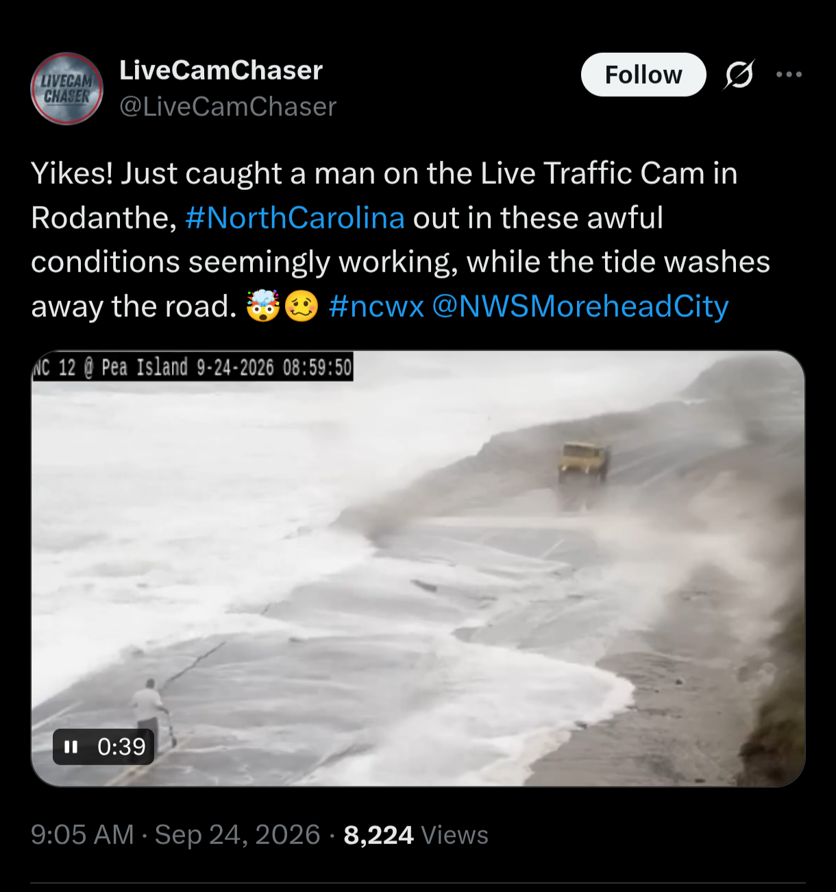
Winds along the NJ beaches currently gusting between 30 and 40 mph. Winds have been onshore for a few days and water has been piling up. With model trends over the last 12-24 hours I'd say the threat of major coastal impacts has ticked up. Minor to moderate coastal flooding / beach erosion seems like a given at this point. Wind gusts could reach 50 mph before all is said and done along NJ coast and Long Island. Eastern LI maybe higher. Jersey shore and LI Sound favored for most significant coastal impacts. Depending on wind trajectories this is one of those events where water could pile westward across LI Sound. Rainfall totals still an enigma as to what areas get the highest totals and how much that might be. -
October Comes Early: Late September Multi-Hazard Hybrid Storm
Brian5671 replied to WxWatcher007's topic in New England
NAM looks a bit further west at hour 18 -
October Comes Early: Late September Multi-Hazard Hybrid Storm
Brian5671 replied to WxWatcher007's topic in New England
Good luck-it's an act of God...you can't cancel school on every windy day -
A White Sox loss today means the Orioles made it to the final series of the season still in the playoff hunt. After the disaster this season was, I'll take it.
-

Strong Nor'Easter/Hybrid Storm Late September 2026
TriPol replied to Rjay's topic in New York City Metro
I "should?" I don't work for the NWS. I'm just someone who has obsessively watched every model run for the past few days. Trying to distract myself from work. -
BAM Wx winter forecast. Mainly average snowfall to slightly below in northern areas and slightly above in southern areas. But they put all of the forum in the highest chance to bust high for snowfall due to risk of a big 1 or 2 storms. (See starting 17:35 on video.) A little AN on temps.
-
October Comes Early: Late September Multi-Hazard Hybrid Storm
Lava Rock replied to WxWatcher007's topic in New England
Parents try to sue the school? Sent from my SM-S921U using Tapatalk -

2026 Atlantic Hurricane Season
WxWatcher007 replied to Stormchaserchuck1's topic in Tropical Headquarters
I’d appreciate, rather my peak season forecast would appreciate, another run at hurricane status -
Strong Nor'Easter/Hybrid Storm Late September 2026
mob1 replied to Rjay's topic in New York City Metro
While the HRRR is notoriously too amped and NW at this range, it's too far off of what the 0Z Euro had (though it's far tamer in its latest run) and if other models come in that tucked to the coast I could see this being a more significant wind event than what's currently expected.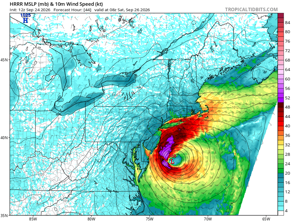
-

Strong Nor'Easter/Hybrid Storm Late September 2026
Neblizzard replied to Rjay's topic in New York City Metro
Should know more after the 12z suite.