All Activity
- Past hour
-

2026 Atlantic Hurricane Season
LoboLeader1 replied to Stormchaserchuck1's topic in Tropical Headquarters
I concur that it only takes one for a very bad season, it's just a matter of when in seeing a strong cane here in the northeast. -
My better half and her kids just needed two and a half hours to get through security at BWI - they got in line at 1: 15 and just now cleared. Luckily, they went way early for their 5:30 flight - glad they did.
-
I didn’t take it for trolling at all.
-
I'm going next month. Never been
-

Central PA Spring 2026 Discussion/Obs Thread
Voyager replied to Voyager's topic in Upstate New York/Pennsylvania
But then there's next Fridays forecast. Back down into the 40's... Thursday Night Showers likely. Mostly cloudy, with a low around 38. Chance of precipitation is 60%. Friday A chance of showers. Mostly cloudy, with a high near 48. Chance of precipitation is 50%. -
.thumb.jpg.6a4895b2a43f87359e4e7d04a6fa0d14.jpg)
Central PA Spring 2026 Discussion/Obs Thread
Yardstickgozinya replied to Voyager's topic in Upstate New York/Pennsylvania
Although, none of them we're detected, there was several strokes of lightning very close to my home over the course of a couple minutes last night. I believe that little area of deeper convection may have been the difference maker. -
Central PA Spring 2026 Discussion/Obs Thread
Yardstickgozinya replied to Voyager's topic in Upstate New York/Pennsylvania
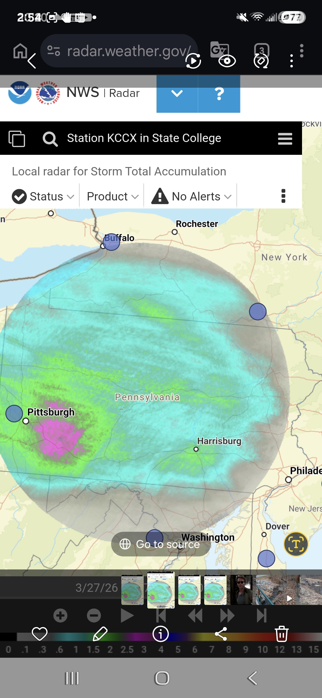
I finally got myself some rain gauges. I did quite well for this. My wor buckets, debris cans , rain gages and nws estimated storm total all align. Well over 1" here for me.
-
Flowers starting to bloom here. Crocuses a week or so ago. Spring is here.
- Today
-

It's time to grade Winter 2025-26(now that it's actually over)
clskinsfan replied to CAPE's topic in Mid Atlantic
D- here. Under 40% of climo snow. Only reason it's not an F is because it was cold. And the one storm we did get our here stuck around for a month. -

It's time to grade Winter 2025-26(now that it's actually over)
bncho replied to CAPE's topic in Mid Atlantic
McLean, VA Winter Rating: B Reasoning: McLean got exceptionally lucky with a local jackzone on multiple occasions this winter, allowing me to nickel and dime to climo. The snow/sleetfall from late-January stayed for a long, long time due to the severe cold in late-Jan to early-Feb, really helping this winter's case. There were lots of late nights just to see potential wasted for the DMV. March 12th's suprise snow saved this from being a B-. -
Wait until you miss your first HECS. You’ll feel differently.
-

Central PA Spring 2026 Discussion/Obs Thread
Itstrainingtime replied to Voyager's topic in Upstate New York/Pennsylvania
MU Weather adds this: (an actual preview of summer as we transition from March to April) A well-defined warm front will move through the Commonwealth from southwest-to-northeast Monday night and be accompanied by a few showers. Behind it, temperatures will likely be "off to the races" on Tuesday and Wednesday and soar back into the upper 70s to perhaps mid 80s. Record high temperatures on the last day of March and first day of April are generally in the low-to-mid 80s, so they may be challenged during the middle of next week with enough sunshine. Overnight lows will also be ridiculously high for this time of the year (50s/60s) and more typical of June. Temperature departures on Tuesday/Wednesday will be 20-25°F above normal. -
44 here under a cloudy sky.
-
currently on my flight back home from san diego. cant fathom not being in southern california weather. gonna miss the fall and some of winter but moving back to sd cant come soon enough. i seriously felt myself come back to life out here
-
Central PA Spring 2026 Discussion/Obs Thread
Yardstickgozinya replied to Voyager's topic in Upstate New York/Pennsylvania
Hope cherry picked from the nws forecast discussion . As we head into next week, all model signals point to aresurgence of Spring warmth to close out the month and kick off April. An anomalous ridge of high pressure will shift from the western US to the east coast and bring a prolonged stretch of southwesterly flow. This will support temperatures in the 60s and 70s for the middle of next week. As the western US ridge is replaced by a deep trough, severe weather chances will increase across the Plains. This will lead to a resurgence of moisture and a fairly active/rainy/stormy pattern in the Ohio Valley and Mid Atlantic through Easter weekend. Warm & wet looks like the theme for Central PA for the first couple weeks of April. Spring growth should commence with haste over the next few weeks. -
52 and cloudy here Taking the little one for a stroll.
-
Central PA Spring 2026 Discussion/Obs Thread
Voyager replied to Voyager's topic in Upstate New York/Pennsylvania
WTF.... It's only 38 in my Tamaqua backyard. Do we HAVE to get THIS cold the day after a 70+ reading? I'd be ok with 48-52, but really... -
Got just the email that my golf course is opening March 30th. Let’s go!!
-
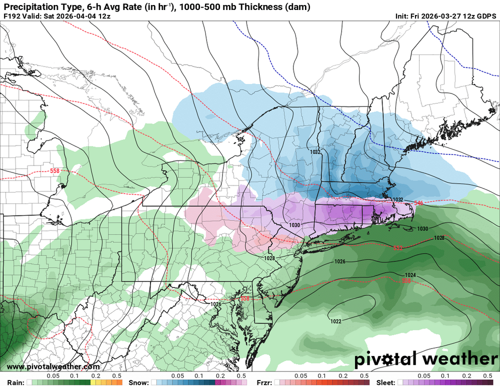
Euro AI also likes it
-
we next weekend.. timing a bit different but we take!
.thumb.png.2c32396392010865d97ad41343aca2fd.png)
-
No line here. Much more worried about Atlanta on Sunday morning
-

It's time to grade Winter 2025-26(now that it's actually over)
AdamHLG replied to CAPE's topic in Mid Atlantic
I'll go with a solid B for Baltimore County (north). The snow/sleet bomb and impressive cold afterwards saved the season and the overall grade given the impact that storm had across our region. Missing the NYC Blizzard dropped this from an A- right on through the B+ to arrive at the B. Solidifying the B was the fun we had with the "FOLKS" and the PBP when it counted - that was fun. -
Thanks.
-

E PA/NJ/DE Spring 2026 Obs/Discussion
JTA66 replied to PhiEaglesfan712's topic in Philadelphia Region
Put me down for biblical swarms of locust. -
No one is trolling


.png.d670504abb04b1e7a9f0adb45f2286de.png)


