All Activity
- Past hour
-
That's why im not even concerned about what the models have for placement of features for the upcoming weekend. Look how many times the state is in the bullseye a couple days prior only for repeated mcs over Milwaukee or Chicago moving se.
-
It sure does. You can be surrounded by trees too. I bet it feels really different though if you stand UNDERNEATH one instead of NEXT to one, right? Don't be a ball buster lol
-
63.5° -RADZ 0.66”
-

2025 Spring/Summer Mountain Thread
Met1985 replied to Maggie Valley Steve's topic in Southeastern States
Freaking amazing brother! -
GFS is trying, the thing is the models are going to struggle with that until the day of basically. Models love to push it along the jet, but in reality it usually dives into the instability.
-
Topped out at 92° at ORD and at MDW today. ...2025 90°+ Day Tally... 3 - ORD 3 - MDW 3 - RFD 3 - DPA 3 - PWK 3 - ARR 3 - LOT 2 - UGN
-
Sometimes we have no control over that lol. Checking in from cold Anchorage and missing the warm SE weather.
-
2025 Spring/Summer Mountain Thread
Met1985 replied to Maggie Valley Steve's topic in Southeastern States
Speaking of we've been issued a severe Thunderstorm warning down here in Transylvania County. Severe Thunderstorm Warning for... North central Elbert County in northeastern Georgia... Central Hart County in northeastern Georgia... Transylvania County in western North Carolina... Henderson County in western North Carolina... Southwestern Polk County in western North Carolina... Greenville County in Upstate South Carolina... Anderson County in Upstate South Carolina... Pickens County in Upstate South Carolina... Northwestern Abbeville County in Upstate South Carolina... Oconee County in Upstate South Carolina... * Until 915 PM EDT. * At 812 PM EDT, severe thunderstorms were located along a line extending from 14 miles north of Walhalla to 5 miles west of Pickens to 9 miles northeast of Elberton, moving northeast at 35 mph. HAZARD...60 mph wind gusts. -
Hoping for a right turning msc sometime Saturday before the lid is put on things for a few days.
-

2025 Spring/Summer Mountain Thread
Buckethead replied to Maggie Valley Steve's topic in Southeastern States
It was a perfect summer morning up on the At. Sent from my SM-S908U using Tapatalk -
2025 Spring/Summer Mountain Thread
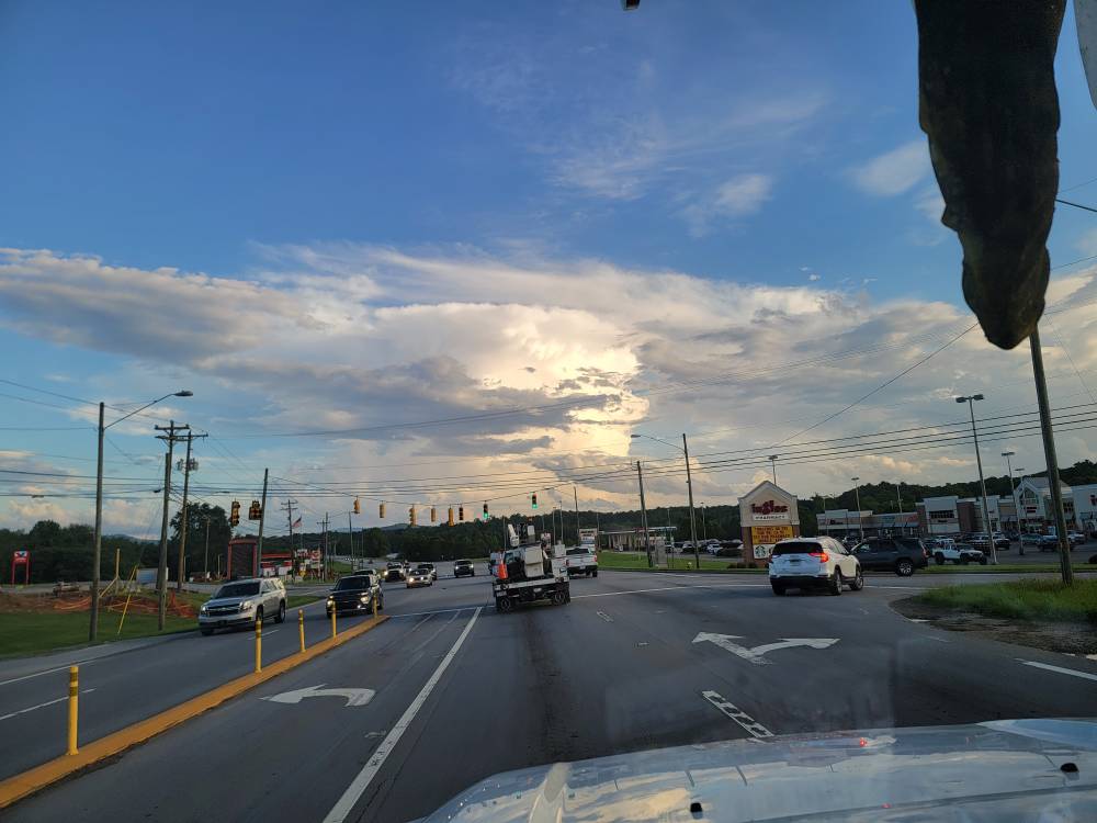
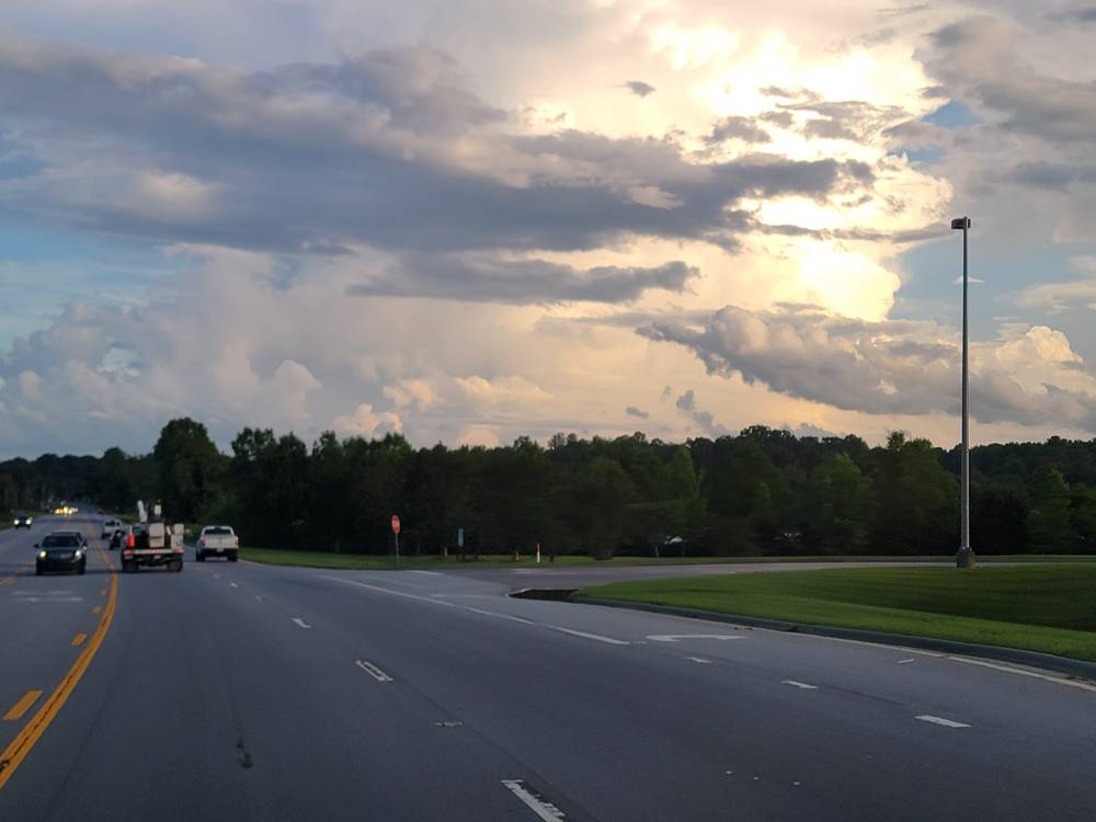
Met1985 replied to Maggie Valley Steve's topic in Southeastern States
I bet especially at your elevation. These clouds tops are beautiful. Big storms rolling in from SC. Im in Brevard tonight. -
Wow, nyc has trees around its station, never heard this mentioned before.
-
That's right Aldie man. Use your power to get us another major volcanic eruption... preferably at least a high-end VEI 6/ low-end VEI 7. I'll be checking the news throughout the evening.
-
2025 Spring/Summer Mountain Thread
Buckethead replied to Maggie Valley Steve's topic in Southeastern States
There's been some seriously impressive cnc's up here this week. Sent from my SM-S908U using Tapatalk -
The standing water in the garden finally disappeared yesterday evening. Now that it's raining again and I received .12 so far this evening, the water is standing in the garden again. That tells me the ground is totally saturated.
-
2025 Spring/Summer Mountain Thread
Met1985 replied to Maggie Valley Steve's topic in Southeastern States
Absolutely beautiful thunderstorm heads this evening. Sent from my SM-G998U using Tapatalk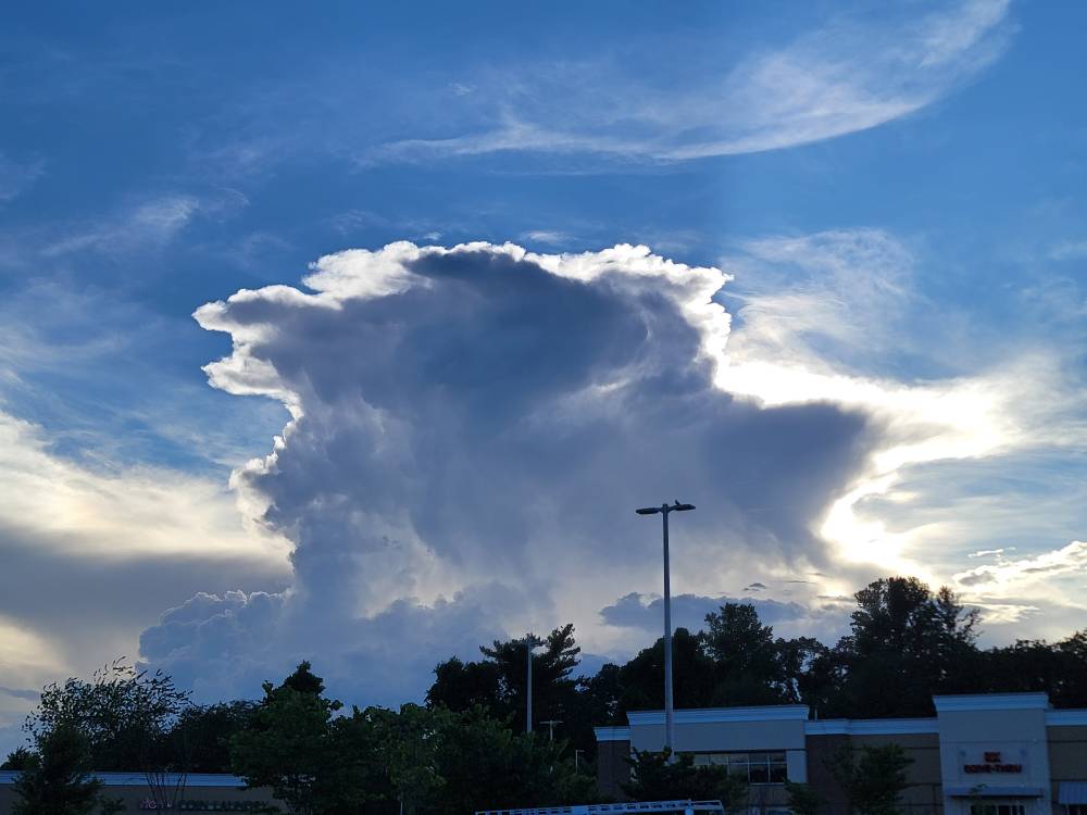
-
Point and click forecast starting Saturday here Saturday Mostly sunny, with a high near 92. Saturday Night Mostly clear, with a low around 74. Sunday Sunny and hot, with a high near 98. Sunday Night Mostly clear, with a low around 76. Monday Sunny and hot, with a high near 99. Monday Night Mostly clear, with a low around 77. Tuesday Mostly sunny and hot, with a high near 96. Pass
- Yesterday
-
It’s been sooo long since we’ve had one down here
-
Yeah. I'm a go big or go home weather guy. Give me a cane, a blizzard, a severe storm, or flooding rains. I hate the mundane. Send that up to Tamaqua please...
-
Looks like the GFS has some minor MCS into the area while the Euro has it into northern New England on Sunday.
-
Models still all over the place. GFS is pretty cool for Sunday with low to mid 80's, rains Sunday AM and clouds stick around; while the 18z Euro is now roasting hot Sunday with good offshore flow and temps in the mid 90's. Euro is still very hot Monday but places right along the coast have a sea breeze and therefore cooler. GFS has a good sea breeze for most on Monday, about 10 degrees cooler than the Euro.
-
Latest cold period Jun 14 EWR: 71 / 61 (-6) 0.31 NYC: 68 / 59 (-8) 0.23 LGA: 67 / 59 (-10) 0.13 JFK: 66 / 60 (-7) 1.00 Jun 15: EWR: 65 / 59 (-11) 0.19 NYC: 64 / 59 (-10) .03 LGA: 65 / 59 (-11) 0.03 JFK: 63 / 59 (-9) 0.07 Jun 16: EWR: 69 / 62 (-7) 0.03 NYC: 69 / 60 (-7) LGA: 68 / 60 (-10) JFK: 70 / 60 ( -5) Jun 17: EWR: 71 / 63 (-6) NYC: 67 / 62 (-8) LGA: 67 / 62 (-9) JFK: 66 / 64 (-4)
-
.1” here
-
Up to .85" with light rain
-
I still would watch for a mid weekend MCS it seems there’s a noncommittal warm frontogenesis on the leading edge of the arriving torch synoptics. An eruption along then turning SE out of lower Ontario is climo favored and the operational models already can’t seem to resist - could be a severe risk for derecho followed by a heat burst pattern. Somewhat rare sequence for our region.


