All Activity
- Past hour
-
85/55 this aftrn as the wind switched from a Lake breeze to a NW wind. Very nice summer day.
-

2026-2027 Record-breaking El Nino
LakePaste25 replied to Stormchaserchuck1's topic in Weather Forecasting and Discussion
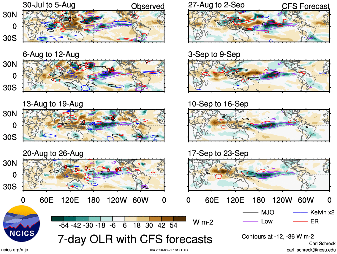
OLR is solidly El Niño. Deepest convective anomalies are forecasted to be around 150-160W. Will need to keep an eye out for a N Pac low as we get into September.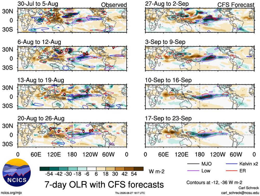
-
 Check this out: Nolvadex guide. Good luck!
 -
Gotta be over 0.5” here. Another drencher.
-
^+QBO/east-based El Nino/-PDO history says could be quite warm in Dec. That type of H5 over Greenland and Alaska would be a record-breaking warm pattern in the NE in this day and age if it verifies (we haven't actually seen that pattern much in the cold season over the past few years, it's a 01-02 pattern).
-

Central PA Summer 2026 Discussion/Obs Thread
Voyager replied to Voyager's topic in Upstate New York/Pennsylvania
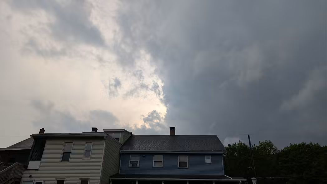
Pop up storm from my backyard. It is, however, in the wrong quadrant. Right is north in the photo, so it's moving away from us. Got a few raindrops out of it.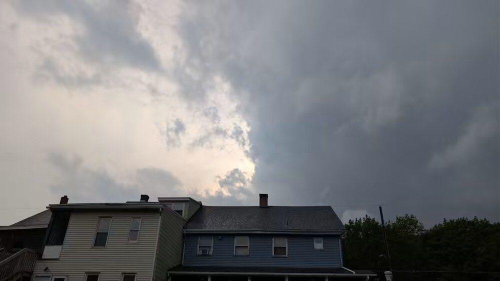
-
Storm just hit. Rain and the lights keep flickering.
-
-
Glad you made it home safely. Seeing photos on social media of streets all around that end of town that are under water.
-
Just light rain now....almost .75 for the storm. Windiest storm here this year so far.
-
My point is that if mitchnick is saying the El Nino is not yet effecting the pattern, then you can say that no La Nina has effected the pattern ever.
-
Yeah I don't know many people that like 95 degrees and humid. Most people complain when it's that hot. I think most summer lovers want 85 degrees with low humidity.
-

E PA/NJ/DE Summer 2026 Obs/Discussion
Hurricane Agnes replied to PhiEaglesfan712's topic in Philadelphia Region
Been finally getting some heavier returns but no gully washers and lots of convection picked up by my lightning detector the past couple hours. Mainly scattered cells. Currently have 3/4"/hr rates and 0.62" in the bucket. Temp 67/dp 66. -
E PA/NJ/DE Summer 2026 Obs/Discussion
SouthernNJ replied to PhiEaglesfan712's topic in Philadelphia Region
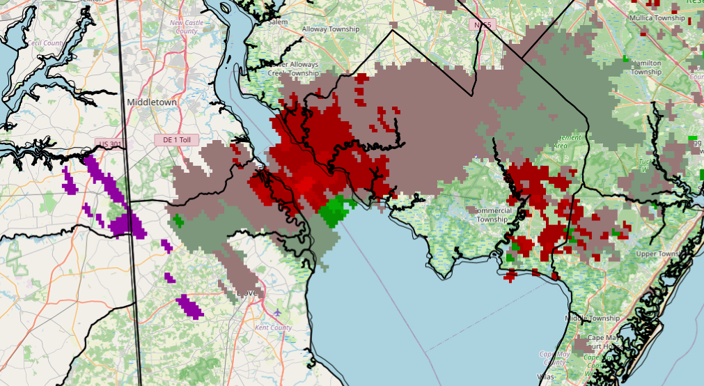
Should be a Marine Warning for the Bay west of Cumberland county for a possible waterspout. KDIX 6:36 PM: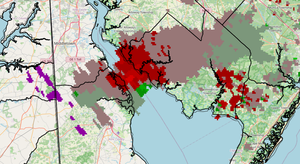
-
The stuff that was coming in from the west really fizzled out. It appears that we're done. It ended up being pretty early activity today.
-
Central PA Summer 2026 Discussion/Obs Thread
Voyager replied to Voyager's topic in Upstate New York/Pennsylvania
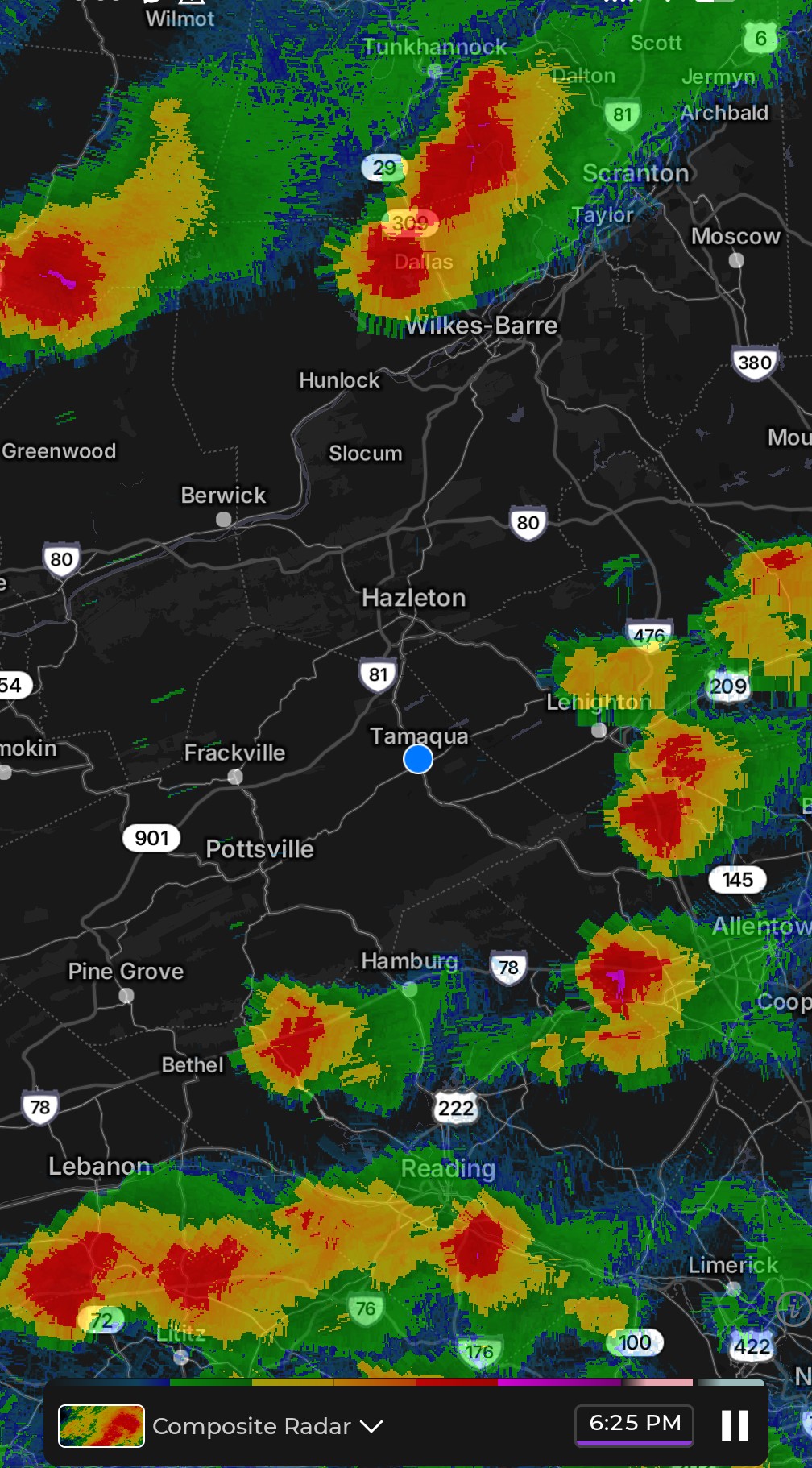
With all the storms around, north, east, and south, I'm going to somehow end up in a stabilized atmosphere with only a few rain showers. Seen it too many times not to believe it to be true. -
This is fewer and farther between so far. That one storm was crazy. Starting to rain here now.
-
Torrential rain with wind continues. .56 so far.
-
Do not like that. That storm back in July that had the violent lightning with it is what fried our garage door opener. We have a whole house surge protector on our panel but we think because my daughter was opening the door when the lightning was crazy is what did it.
-
Central PA Summer 2026 Discussion/Obs Thread
Voyager replied to Voyager's topic in Upstate New York/Pennsylvania
I fell in...to a burning ring of fire...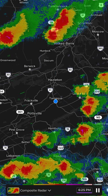
-

Augdewst 2026: Summer's Last Stand
rhodywakefield replied to Prismshine Productions's topic in New England
dont be naive -
This storm has some violent lightning associated with it.
-
The wetter climate leading to all these summer flash flood warmings has made it more challenging to sustain extended 90° day counts like in 1988 without clouds or rain interrupting. The most severe droughts in recent times have been focused out West. In the old days droughts were often from the Plains into the East. Plus stronger sea breezes due to summer circulation changes also interrupt the 90° day runs. But overall 90° day counts have been increasing just inland from the sea breeze fronts.
-
Syracuse will now get America affect snow.
-
Shield mostly held but had a couple hours of light rain. 0.15” brings MTD to 1.51”