All Activity
- Past hour
-
I would love for that HRRR to verify
-
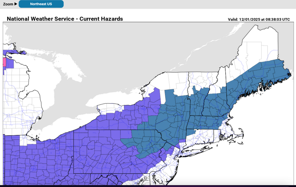
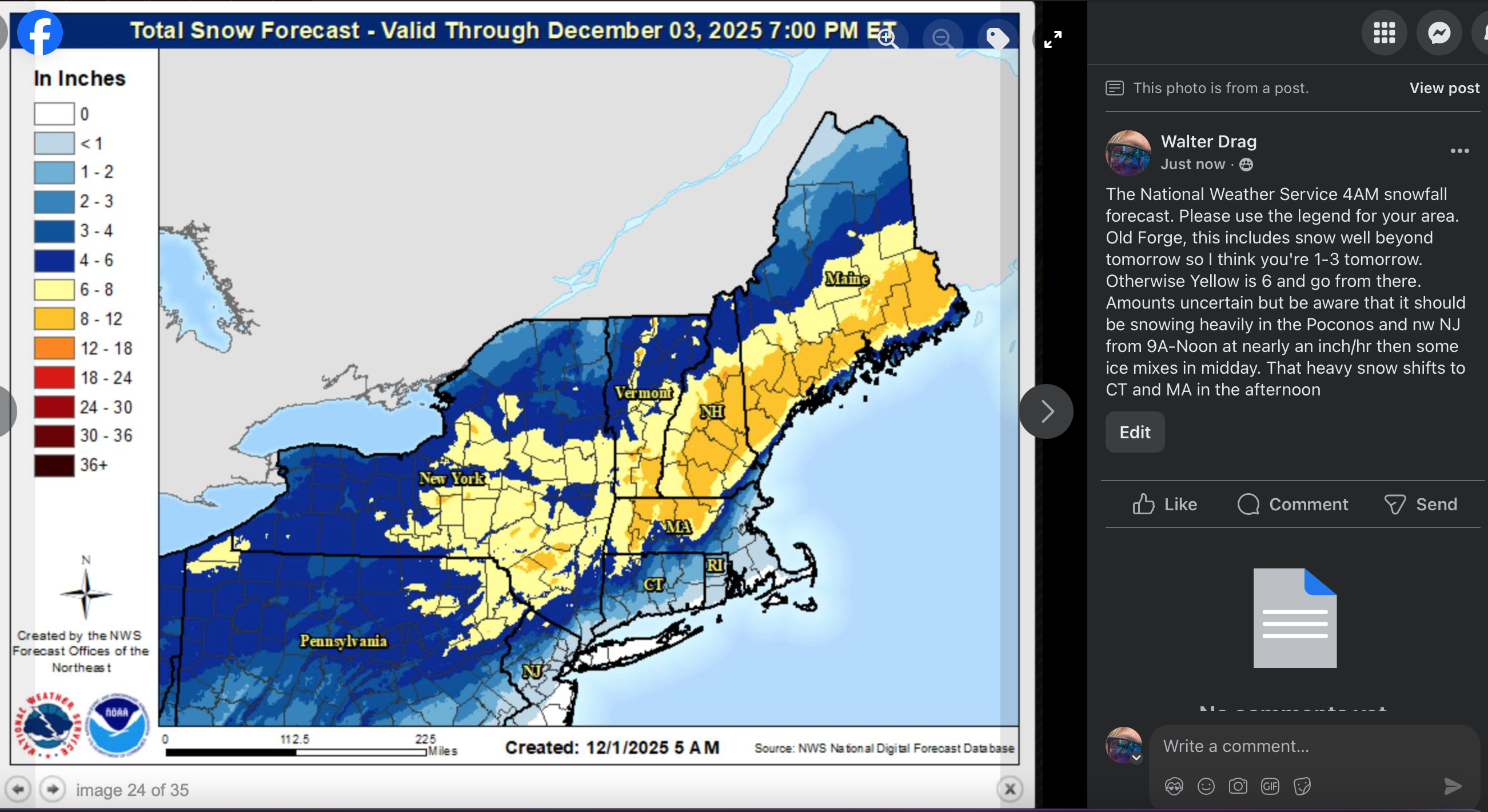
 Added the NWS snowman that weren't into the 4AM forecasts, and the side bar notes are my opinion. Will check back at 5P.
-

First Winter Storm to kickoff 2025-26 Winter season
moneypitmike replied to Baroclinic Zone's topic in New England
Off-topic: It's incredibly icy out there this morning. Be careful out there! -
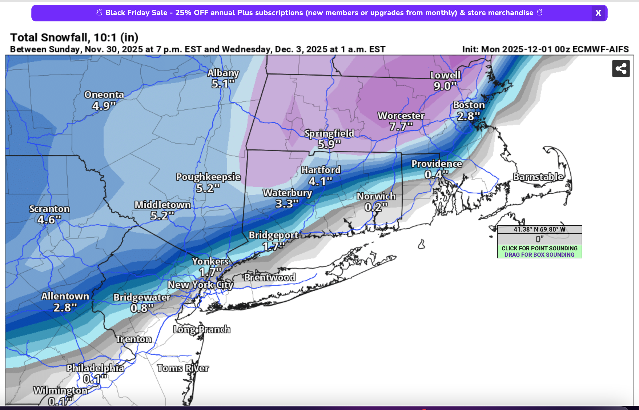
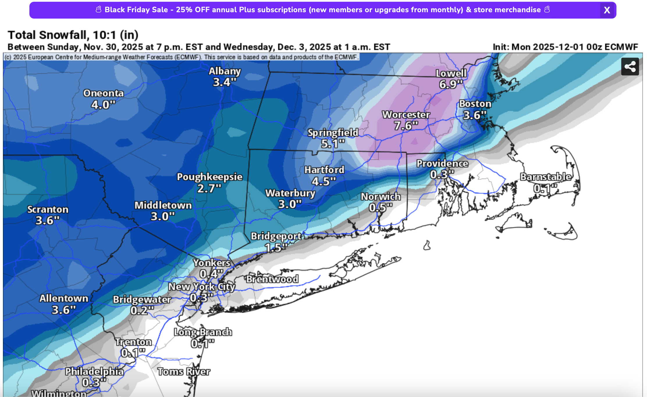
Euro agrees. AI still has a light event though and kinda breaks it into 2 parts, one Friday and then more Saturday as a coastal gets going.
-
Current temp of 26. This week looks interesting.
-

First Winter Storm to kickoff 2025-26 Winter season
UnitedWx replied to Baroclinic Zone's topic in New England
Reminds me, someday I need to draw a rain/snow line map for my area that better explains it. Models and local forecasts just never get the area right. Heavy smoothing on the maps -
Interesting how the basic signature of the precip shield is very similar to the Gfs, but the Gfs is just heavier.
-
Environmental impacts are a cost to society. Fossil fuels have been and largely still are getting a free ride on CO2 emissions. The typical coal or gas-fired power plant doesn't pay for its CO2 emissions. A big subsidy.
-
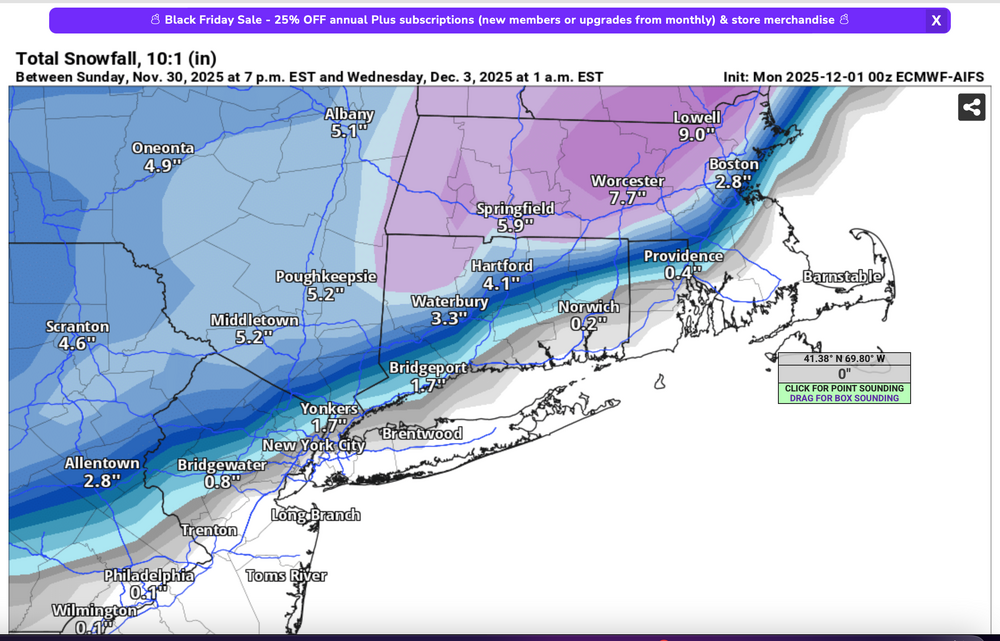
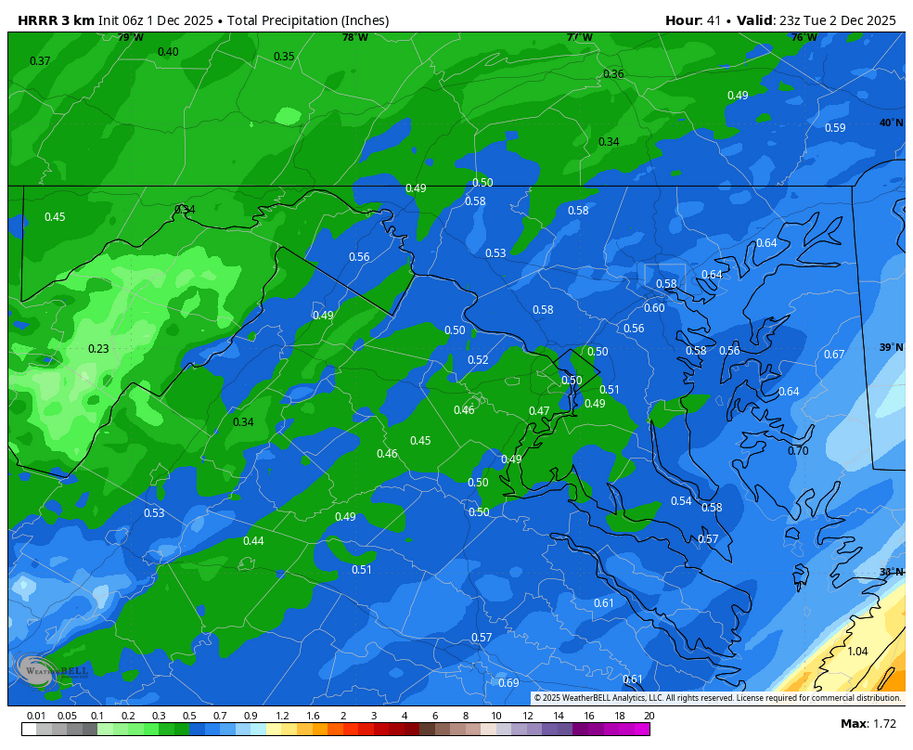
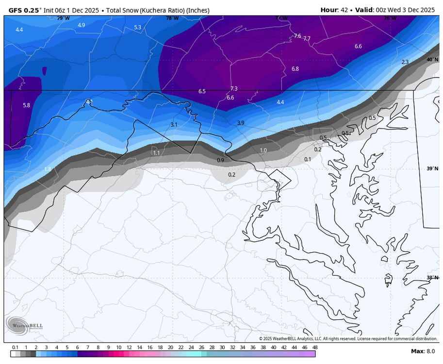
Regarding the NAM: I've no idea what will replace it or will it have a FOUS? That said... the NAM is a bit whacked. First it had very little south of I84 min earlier cycles, now its gone ballistic Poconos to BOS. I've not used this in my personal briefing. I do add for your interest, something that we can all evaluate with the Wed morning CoCoRaHs data. imo, play the numbers conservative. I do think 1"/hr snowfall rates from just north of KABE into nw NJ tomorrow morning 9A-Noon, then rain or mixed. mPing may be of value for NYC. 4AM advisory and watches in purple and blue. Then various model outputs from the 00z/1 cycle.


-
First Winter Storm to kickoff 2025-26 Winter season
UnitedWx replied to Baroclinic Zone's topic in New England
You knew that was bound to happen... or rains to northern VT -
 Advisory for 3 to 5 inches here I don’t see that happening.
 -
I've noted the adverse comments on storm interest. I'll review any MODERATOR impression on value added for this thread. This has been accurately portrayed in advance, I think, and the thread still looks pretty good as of 5AM today. Moderator just tell me if you dont want a headline for the forum on an event like this. Thanks... Walt
-

12/3 Snow/Sleet/Mix Bag of Everything Discussion/OBS
penndotguy replied to Mikeymac5306's topic in Philadelphia Region
After reading Mt Hollys AFD last night it’s plausible that rain snow line pushes even further NW almost to I 80. Elevation is going to be key 1000’ and above out there should get a good pasting. Also mentioned the start time might be earlier that previously thought which give us Far NW Burbs a shot at 3-5, but going with 1-3 with a periods of heavy snow before the changeover. -

First Winter Storm to kickoff 2025-26 Winter season
CoastalWx replied to Baroclinic Zone's topic in New England
Euro one of the warmer models. Shoot the horse, send it to the glue factory, and then light the factory on fire. -

First Winter Storm to kickoff 2025-26 Winter season
Modfan2 replied to Baroclinic Zone's topic in New England
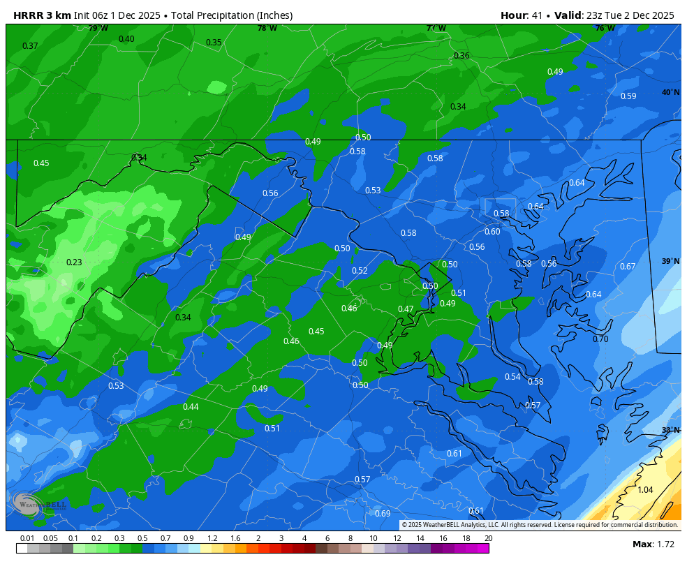
How much rain are we getting? .50-.75”? -
First Winter Storm to kickoff 2025-26 Winter season
moneypitmike replied to Baroclinic Zone's topic in New England
Jeff and Lava are reading this with much interest. In addition to ensemble spread in QPF, other points of uncertainty exist around the development of a quasi-stationary mesoscale snow band and the inland penetration of the coastal front. A mesoscale snowband acts to rob moisture from the northwest side of the band creating a tight gradient in snowfall while areas under the band could see up to a foot of snow. -
WB 6Z HRRR

-
WB 6Z GFS
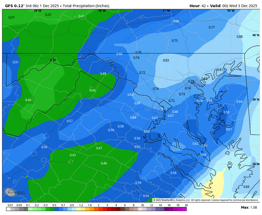
- Today
-

First Winter Storm to kickoff 2025-26 Winter season
ineedsnow replied to Baroclinic Zone's topic in New England
.thumb.png.19abb954e3091f7fab0e70d77426c23b.png)
-
First Winter Storm to kickoff 2025-26 Winter season
ineedsnow replied to Baroclinic Zone's topic in New England
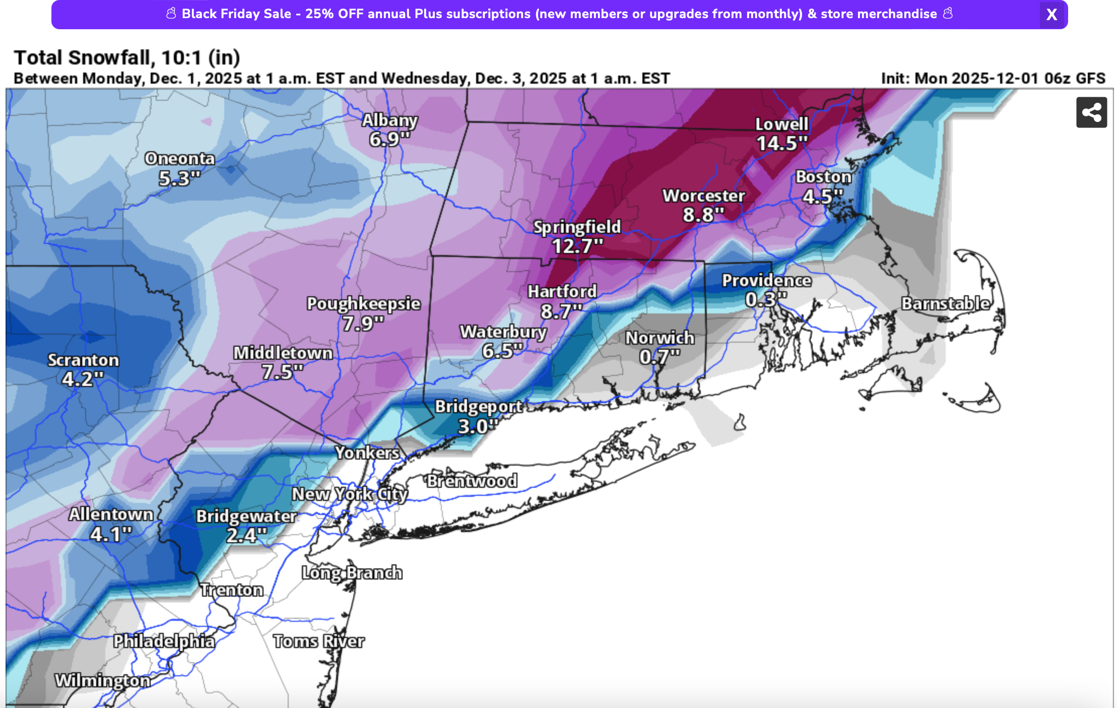
6z GFS not backing down maybe a slight shift south -
First Winter Storm to kickoff 2025-26 Winter season
moneypitmike replied to Baroclinic Zone's topic in New England
Tossing NAM's, this looks increasingly like it will be a pretty minor event in Maine unless we can get some type of enhancements. -

First Winter Storm to kickoff 2025-26 Winter season
Snowcrazed71 replied to Baroclinic Zone's topic in New England
Shoot.. even into my knees of the woods just west of Hartford brings a healthy amount of Snow. -
First Winter Storm to kickoff 2025-26 Winter season
Snowcrazed71 replied to Baroclinic Zone's topic in New England
Well... That is a big change! ( And It is within its wheelhouse as far as the start time ). Curious how the other models follow suite this morning. -
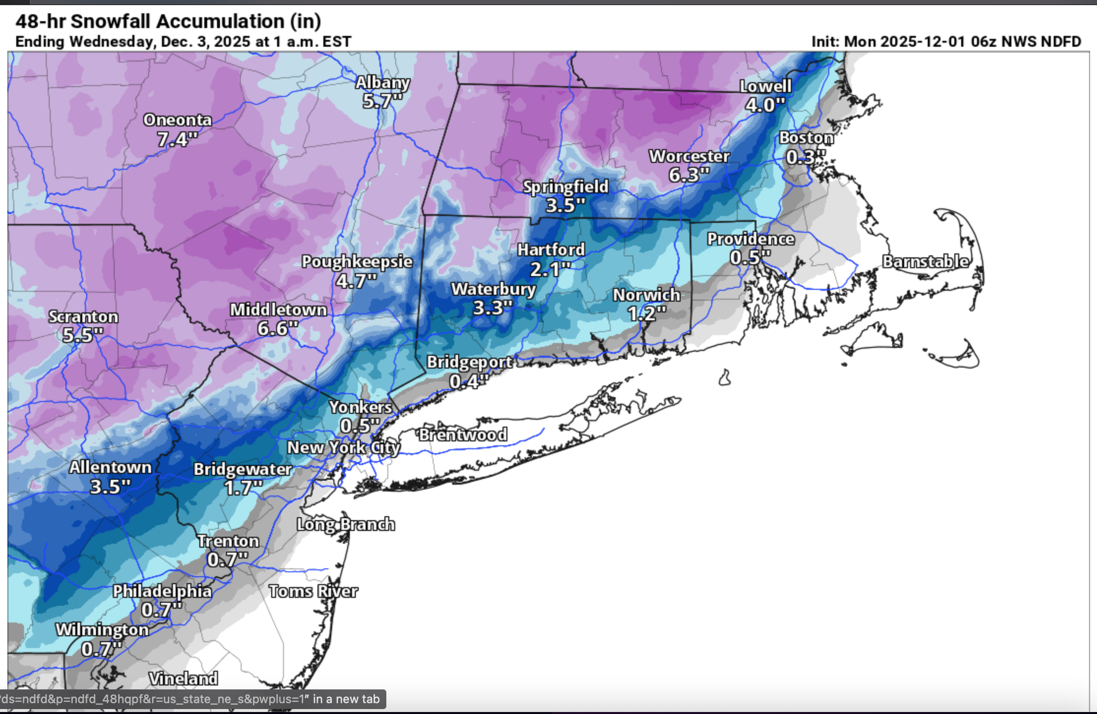
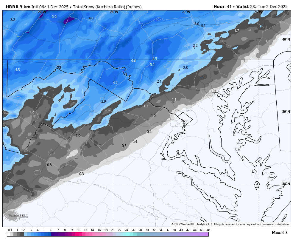
6z hrrr and Nam look decent for north crew. Nam finally folded.
-
First Winter Storm to kickoff 2025-26 Winter season
ineedsnow replied to Baroclinic Zone's topic in New England
Thinking 6 to 9 of heavy wet snow here.. maybe break 10 if im lucky


.png.d9cd44cee1defd7f75f8410fd3c77320.png)
