All Activity
- Past hour
-
Tuesday sets the table. Friday we eat.
-

First Winter Storm to kickoff 2025-26 Winter season
WinterWolf replied to Baroclinic Zone's topic in New England
C’mon, we were told that it’s better than it used to be lol. If it is…you may be in for 12 plus. Has 4-6” for me…? -

E PA/NJ/DE Winter 2025-26 Obs/Discussion
RedSky replied to LVblizzard's topic in Philadelphia Region
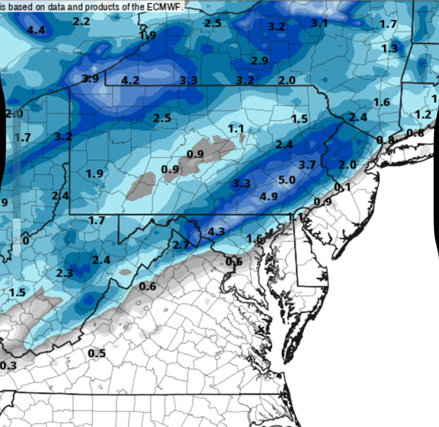
Like small nw shift but still I take -

First Winter Storm to kickoff 2025-26 Winter season
dendrite replied to Baroclinic Zone's topic in New England
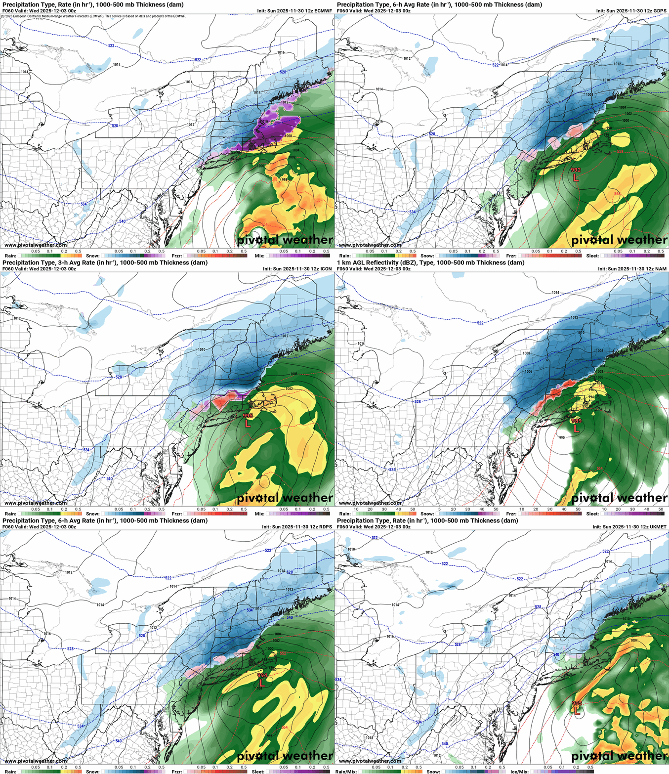
It’s been trying to make that convective low on the front be the primary low. None of the other models are doing that. -
First Winter Storm to kickoff 2025-26 Winter season
Bryan63 replied to Baroclinic Zone's topic in New England
Looks good to me, not sure what y'all are fussing about. -
Some bad posting going on right now in the Tuesday thread ...
-

First Winter Storm to kickoff 2025-26 Winter season
HoarfrostHubb replied to Baroclinic Zone's topic in New England
PVD 10”+. Yeah. Right -
Fields27 started following E PA/NJ/DE Winter 2025-26 Obs/Discussion
-

E PA/NJ/DE Winter 2025-26 Obs/Discussion
Fields27 replied to LVblizzard's topic in Philadelphia Region
Berks county jackpot. Sent from my SM-S938U using Tapatalk -
Seems like models settling in to the route 31 special
-

First Winter Storm to kickoff 2025-26 Winter season
TauntonBlizzard2013 replied to Baroclinic Zone's topic in New England
It’s definitely wrong, but its insistence on holding onto these solutions make it even worse. The eventual cave will be bad -

First Winter Storm to kickoff 2025-26 Winter season
TauntonBlizzard2013 replied to Baroclinic Zone's topic in New England
This event is 48 hours away and the euro has a foot for areas that no other model has snow for. -
First Winter Storm to kickoff 2025-26 Winter season
dryslot replied to Baroclinic Zone's topic in New England
But it did here, Went from .30" to .50" but you want to beware of those snow totals in SE MA and RI, 925 looked a bit warm. -

First Winter Storm to kickoff 2025-26 Winter season
CoastalWx replied to Baroclinic Zone's topic in New England
So tossed -

E PA/NJ/DE Winter 2025-26 Obs/Discussion
RedSky replied to LVblizzard's topic in Philadelphia Region
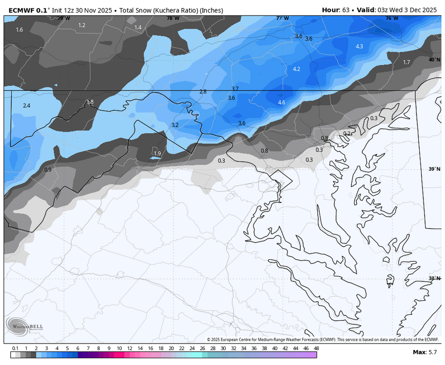
The 12z euro no changes wow -

First Winter Storm to kickoff 2025-26 Winter season
TauntonBlizzard2013 replied to Baroclinic Zone's topic in New England
Congrats Middleboro/lakeville on the euro -
-

First Winter Storm to kickoff 2025-26 Winter season
Damage In Tolland replied to Baroclinic Zone's topic in New England
Will always says we never see big moves on Euro. Time is running out . Only so much farther it’ll go. Maybe another small bump NW then Messenger shuffle -

First Winter Storm to kickoff 2025-26 Winter season
WinterWolf replied to Baroclinic Zone's topic in New England
We take our 4” and enjoy. A great start for December. -
-
Nov 28-30th Post Turkey Day Winter Storm
andyhb replied to Chicago Storm's topic in Lakes/Ohio Valley
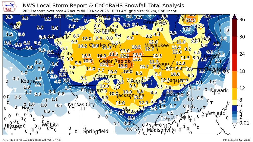
Jackpots of over 16” in central IA and S WI with this, seems like many areas got over 10” by the end of it. -
28.2F Light snow. Maybe 1/3" of dry snow
-
First Winter Storm to kickoff 2025-26 Winter season
Kitz Craver replied to Baroclinic Zone's topic in New England
Agree, not much of a cave there -
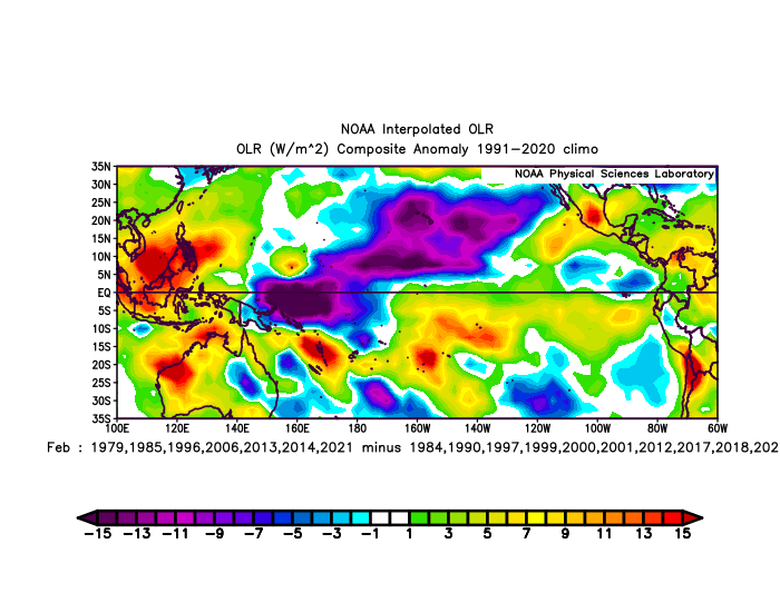
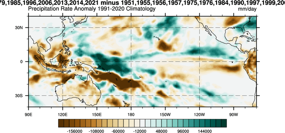
Eric Webb @webberweather 54m One key to this winter having a chance to break the -ENSO stereotype of a warm Feb in the E US is to nudge the IPWP eastward enough to focus convection just west of the Dateline in the Eq. Pacific Tropical Pacific OLR & Precip differences for cold vs warm -ENSO Febs in theE US:
-
.thumb.png.4150b06c63a21f61052e47a612bf1818.png)
December 2025 regional war/obs/disco thread
HIPPYVALLEY replied to Torch Tiger's topic in New England
Light snow here too. I’ll try to stay very safe. -

First Winter Storm to kickoff 2025-26 Winter season
WinterWolf replied to Baroclinic Zone's topic in New England
But it usually didn’t do that back in the day for the most part…that’s the point. That’s all.

