All Activity
- Past hour
-
my high today was 42. impressive.
-
It doesn't take effect right away. You know this. It is a seesaw pattern as of now, with long range showing cooler once again after the return to more normal temps for a few days.
-
 Received 0.3 inches here. Nice start to the season.
 -
 This was from early this morning at sunrise. I posted it 8 hours ago on page 1. It was pretty treacherous out there this morning in parts of the area. The sticking snow surprised many.
 -

November 2025 general discussions and probable topic derailings ...
Layman replied to Typhoon Tip's topic in New England
Where are we at? 1 2 3 4 5 6 7 8 9 10 Meh Exciting -
Good to see. It’s only November.
-
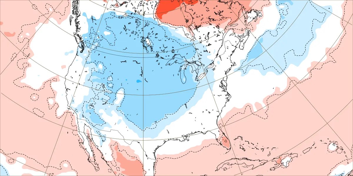
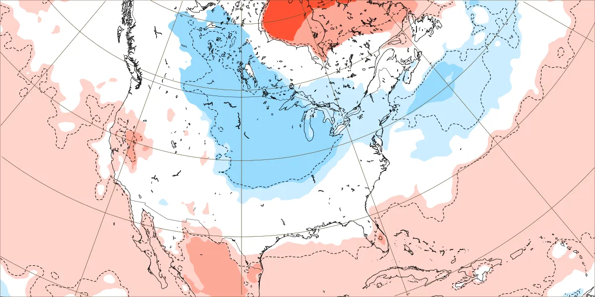
Thanks for these. I'll take anything that has normal and slightly below normal at this point in the winter season. Anything else, especially early in the season, in my head in my location still means more of a chance of rain over wintry precip with the average highs still being well over freezing.
-
 This was posted around lunchtime. Stockholm, nj
-
Crazy to think we may have a record SSWE and we are talking above normal temperatures
-
No schools were not closed
-
 May need to start watching the system late this weekend. Could be wintry precip even in SNE
 -
 Snow has stopped as of 3:30pm. Most accurate measurement I could get on unpaved sheltered wood surface was 1.25" Currently 31.3°
 -
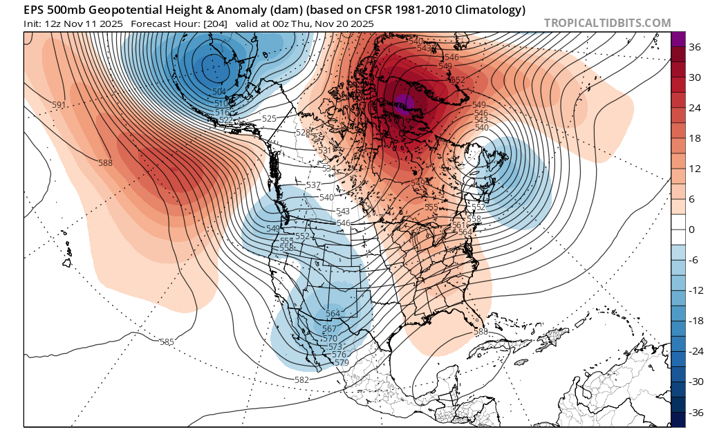
Latest Euro weeklies appear to have us below normal temps for the vast majority of December, with no Christmas torch! //fingers crossed//
-
Eye-thanks, I did see it and why I included the wide view.
-
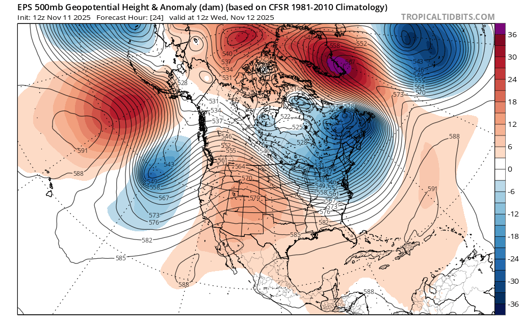
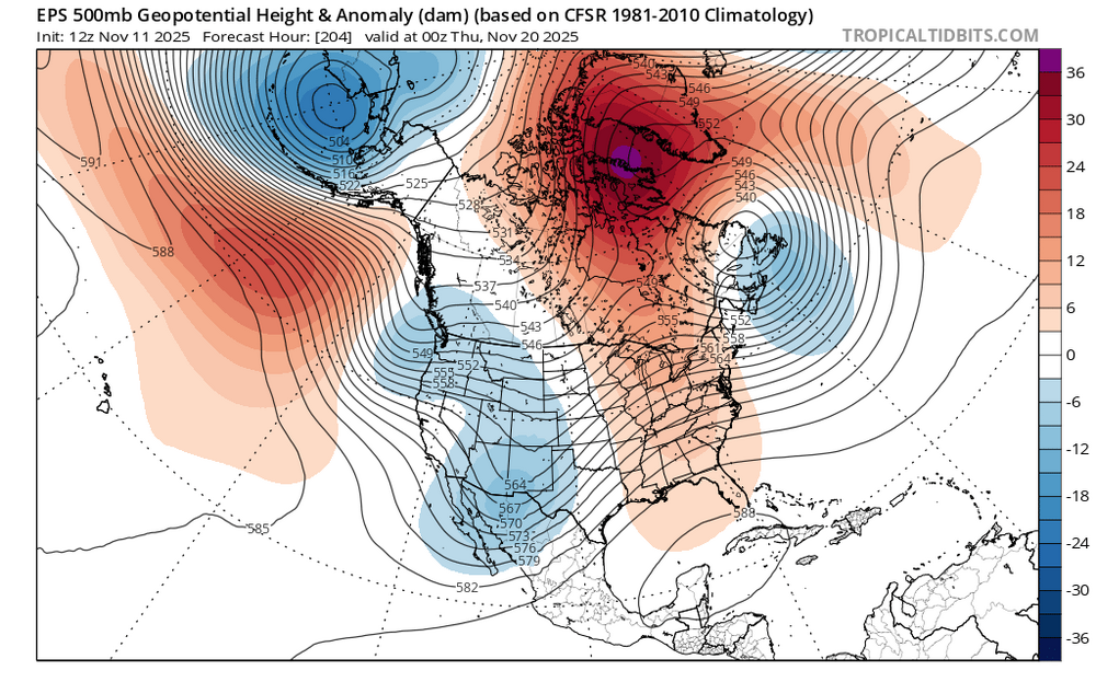
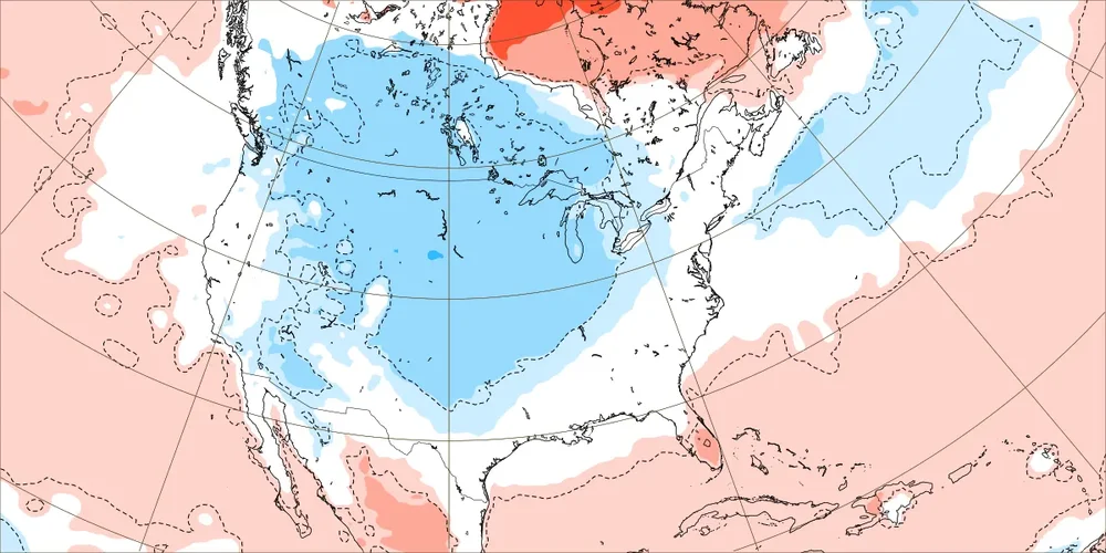
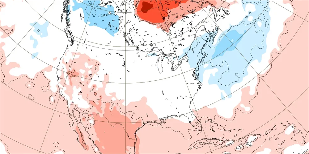
Familiar pattern of the Greenland block eventually linking up with the Southeast ridge again leading to a warm up following this brief cooldown.

-
3 x-flares with 3 CME's coming together for what could be another event similar to May of last yr.
-
-
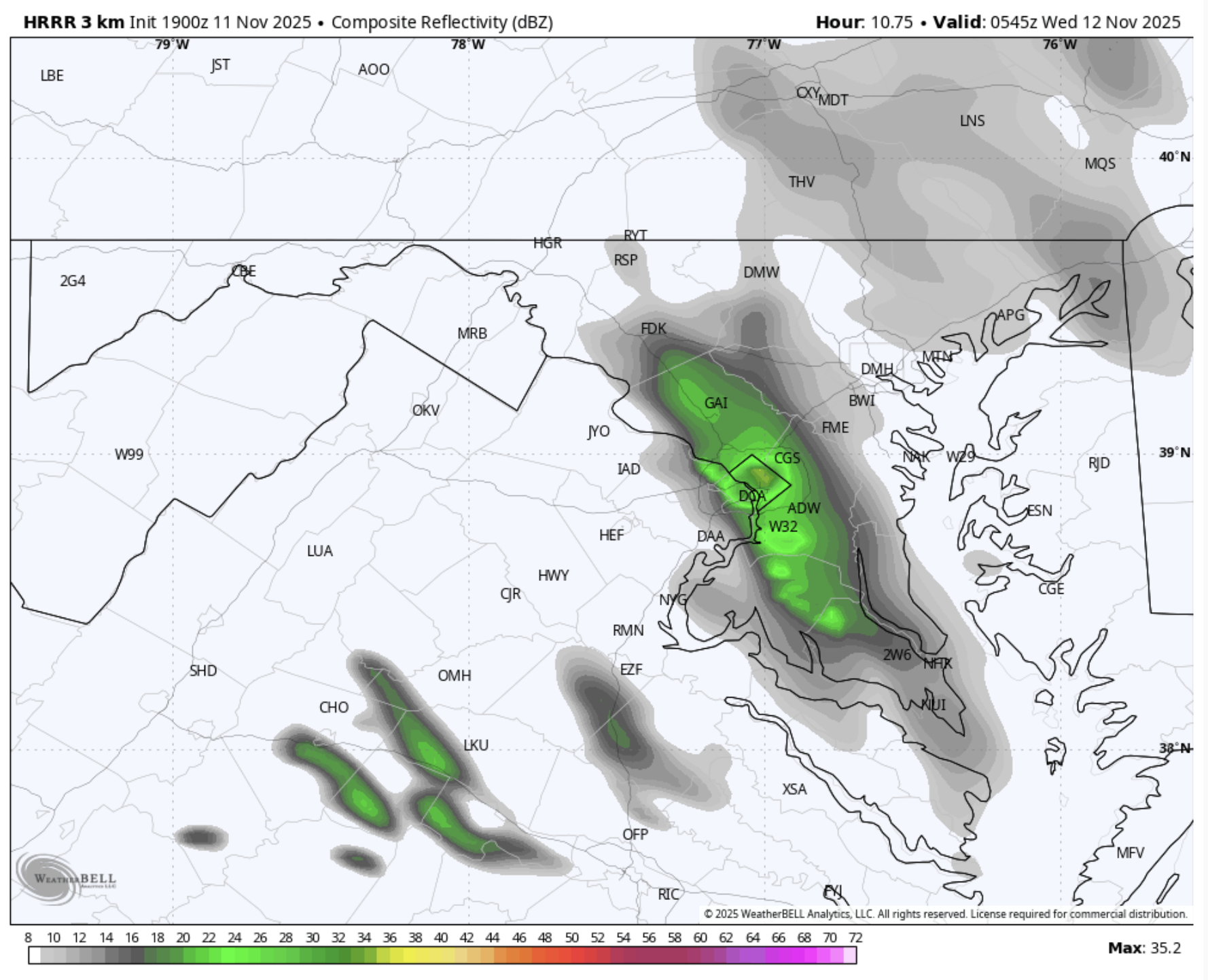
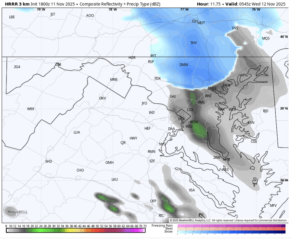
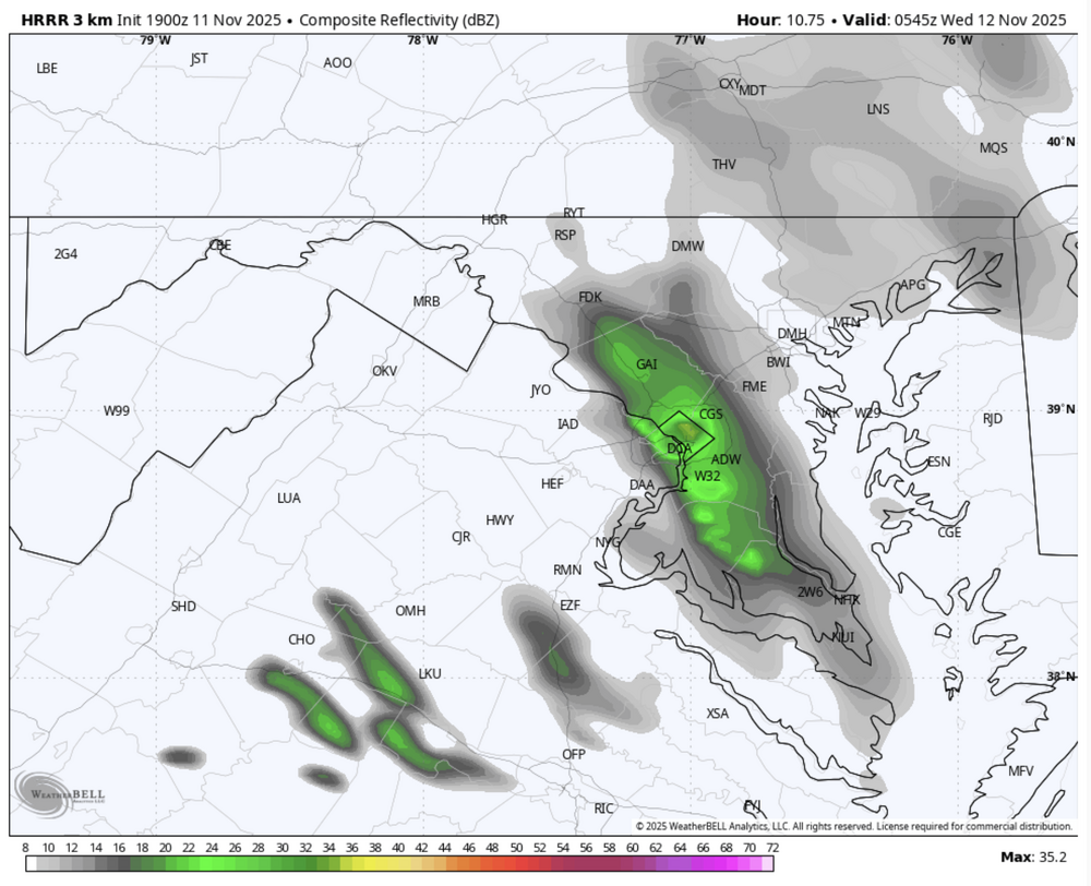
HRRR 15 min shows some not so insignificant radar returns around 12 AM. Are we staying up for this 10% chance of rain/snow, folks? Temperatures are around 35 @ DC.
-
Hey bruh you gettin' too close to Baltimore--back it up! Keep that shield within a 20 mile radius please (or maybe you moving away from the Hertford Zone will reverse the trend )
-
I think it's right with the Thanksgiving or thereabouts Threat of Snow and Cold. The weak PV is going to help enforce blocking. The MJO in Warm ph is probably starting to exert some influence as it will probably help cause the Trough to spill west and fight against the Block prior to the MJO advancement into colder phases. May even try to spin up a SER that may try to connect to said Block. It is still possible to get a shot or two of cooler air before the End of Month Real Deal as that block still may force heights South in the East somewhat.
-
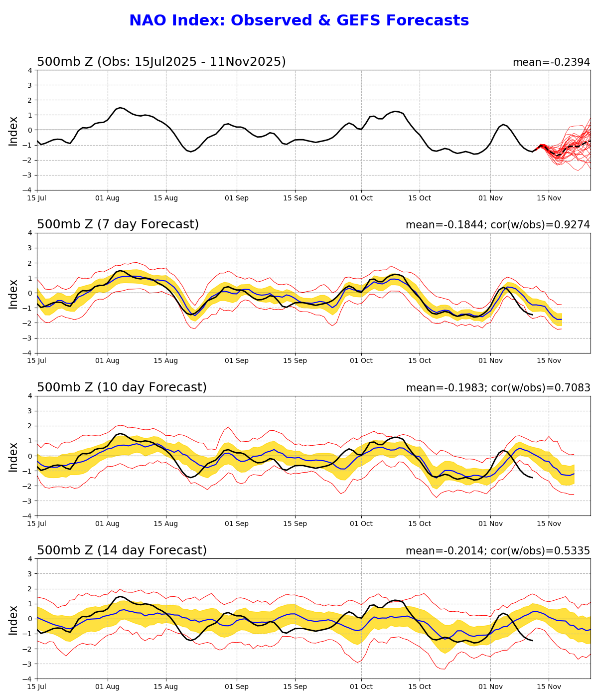
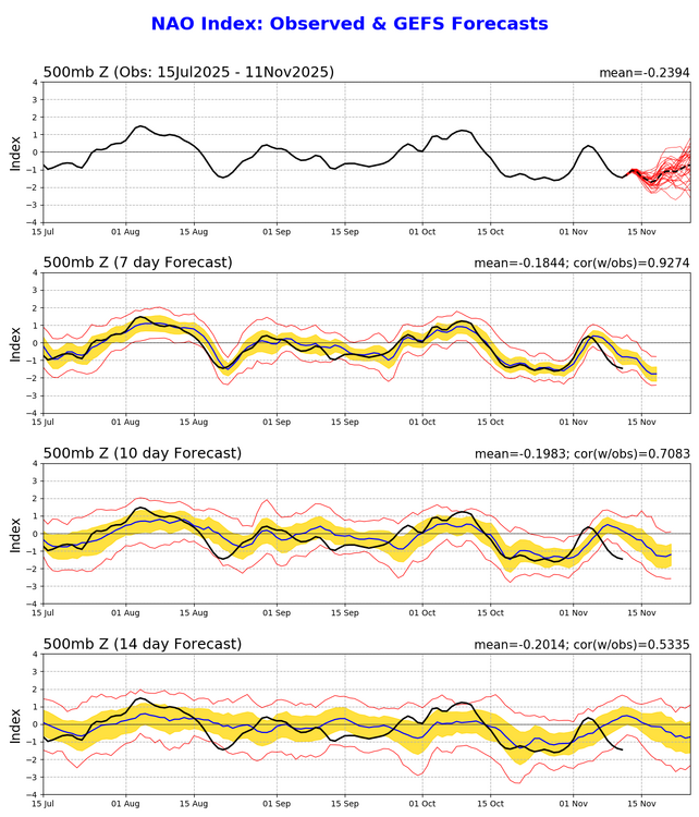
Fun NAO stat. The last 2 Ninas that had a monthly Nov NAO reading below -1.0 were 95 and 2010. Hard to say if we notch a -1.0 reading this year but off to a good start anyways. Also, the speed and magnitude of the current AO and NAO drops were missed by the gefs D7 progs and they missed by quite a bit. That's unusual as the 7 day forecasts are usually pretty close. We'll see how it goes but early signs continue to point towards the potential for the front side of winter to be pretty blocky
-
Wishing you the very best friend!
-
Thanks. This is what I was looking at directly from ECMWF rather than from WxBell and also this is strictly for Dec 1-21: still no prevailing +PNA Dec 1-7: coldest MW to Rockies vs mainly NN NE/SE Dec 8-14: coldest MW to N Rockies; slightly cold NE; NN SE Dec 15-21: slightly cold NE, NN SE

-
 Currently using 35658 observations from 5253 unique global stations over the past 3 hours. Last Updated: Tue Nov 11 20:31:19 UTC 2025 0 stations reporting wind gusts 70kt or stronger0 stations reporting wind gusts 60-69kt2 stations reporting wind gusts 50-59kt KISP: Islip, Long Island Mac Arthur Airport, NY, United States [51kt, 26m/s] 35 stations reporting wind gusts 40-49kt since Noon today. KACY: Atlantic City, Atlantic City Intl Arpt, NJ, United States [40kt, 21m/s] KAOO: Altoona, Altoona-Blair County Airport, PA, United States [45kt, 23m/s] KBWI: Baltimore, MD, United States [42kt, 22m/s] KFRG: Farmingdale, Republic Airport, NY, United States [44kt, 23m/s] KHPN: White Plains, NY, United States [46kt, 24m/s] KILG: Wilmington, New Castle County Airport, DE, United States [41kt, 21m/s] KISP: Islip, Long Island Mac Arthur Airport, NY, United States [42kt, 22m/s] KJFK: JFK Intl Arpt, NY, United States [40kt, 21m/s] KJRB: Manhattan/Wall Street Heliport, NY, United States [40kt, 21m/s] KLGA: New York, La Guardia Airport, NY, United States [42kt, 22m/s] KLNS: Lancaster, Lancaster Airport, PA, United States [42kt, 22m/s] KMIV: Millville, Millville Municipal Airport, NJ, United States [40kt, 21m/s] KMTP: Montauk, Montauk Airport, NY, United States [41kt, 21m/s] KORH: Worcester, Worcester Regional Airport, MA, United States [49kt, 25m/s] KPHL: Philadelphia, Philadelphia Intl Arpt, PA, United States [41kt, 21m/s] KPNE: NE Philadelphia, PA, United States [46kt, 24m/s] KPVD: Providence, RI, United States [40kt, 21m/s] KRSP: Campd David, MD, United States [43kt, 22m/s]