All Activity
- Past hour
-
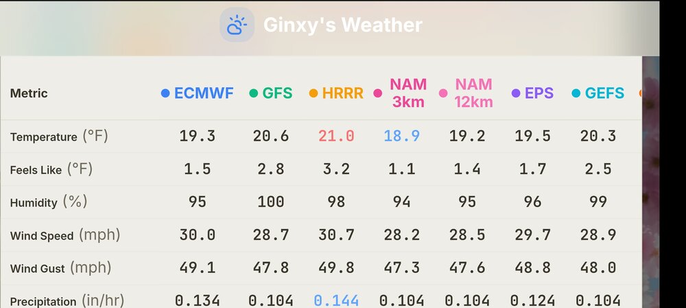
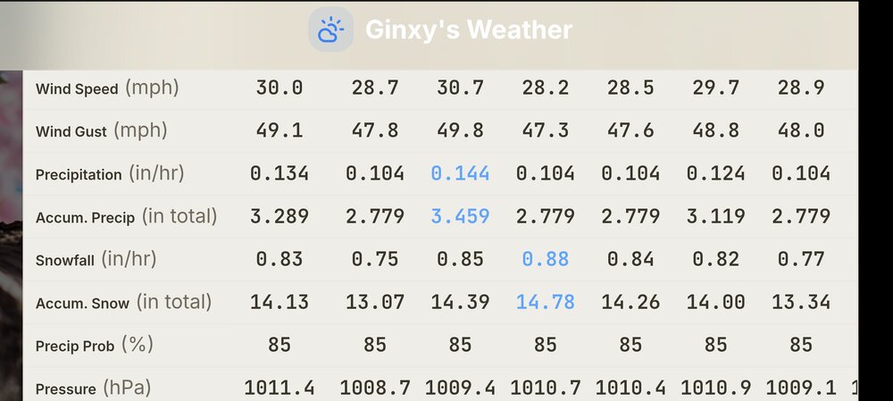
Mt Washington
-
Sure some will. Difference between top 5 and top 15 are tenths in some cases
-

Anomalous Late Spring storm May 30 2026
Damage In Tolland replied to HoarfrostHubb's topic in New England
Partly sunny SW of ORH from late morning ion with the jet screaming at 6,000 feet . There’ll be 40-50 mph gusts inland with mixing where sun pops -
Tolland
-

Chester County PA - Analytical Battle of Actual vs. Altered Climate Data
chubbs replied to ChescoWx's topic in Climate Change
I knew you would find some reason to dismiss. My stability assessment is based on comparing Coatesville to NCEI and other regional stations without station changes. Coatesville tracks NCEI closely. Yes there are three stations; but, the three stations are well matched for annual average temperatures; and, there are no major station changes. You would get the same answer if you used NCEI instead of Coatesville.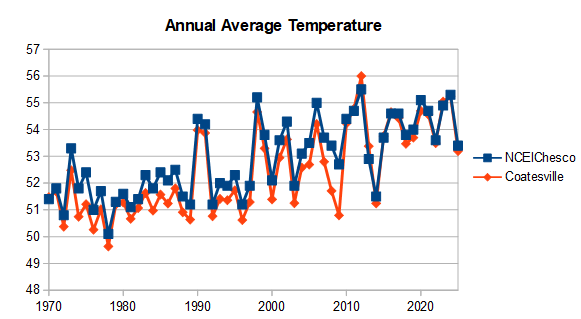
-
(002).thumb.png.6e3d9d46bca5fe41aab7a74871dd8af8.png) Because it is where I live....LOL!
Because it is where I live....LOL! -
 why does chester county matter so much
 -
llvl lapse rates may be steep enough to support gusts 35-40 mph inland. Also, the lack of rain farther inland and even potential for some cloud breaks may allow better than expected mixing (evident by the steep llvl lapse rates)
-
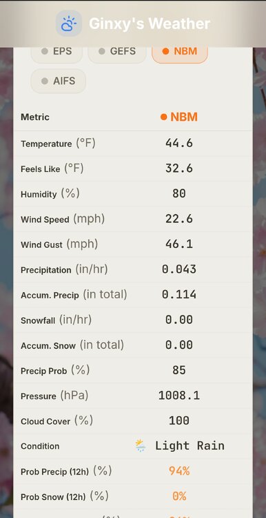
All models give you at least. .11
-
Some of the modeling has 35-40mph gusts down there in ORH county. But this is obviously anomalous and dynamic for this time of year. It does give me 2013 sensible wx vibes for NNE though…albeit a different evolution.
-
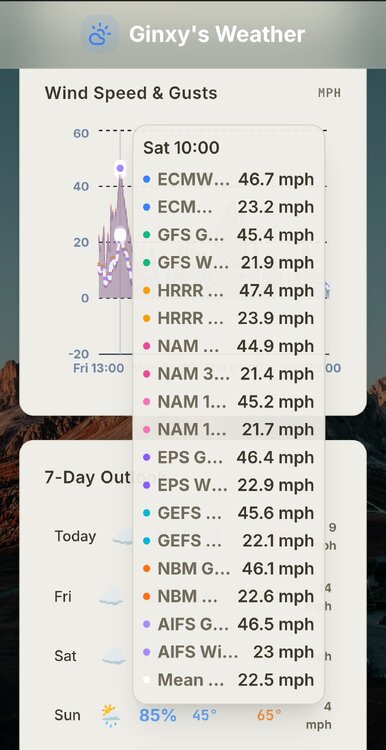
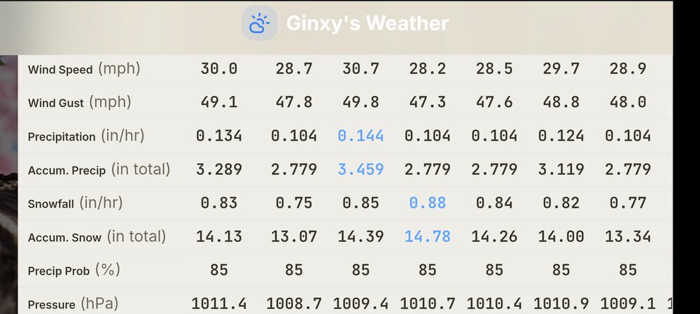
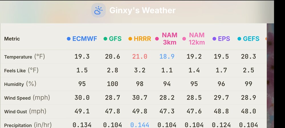
MT Washington
-
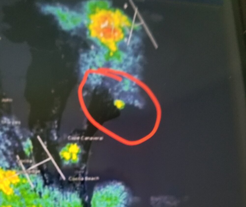
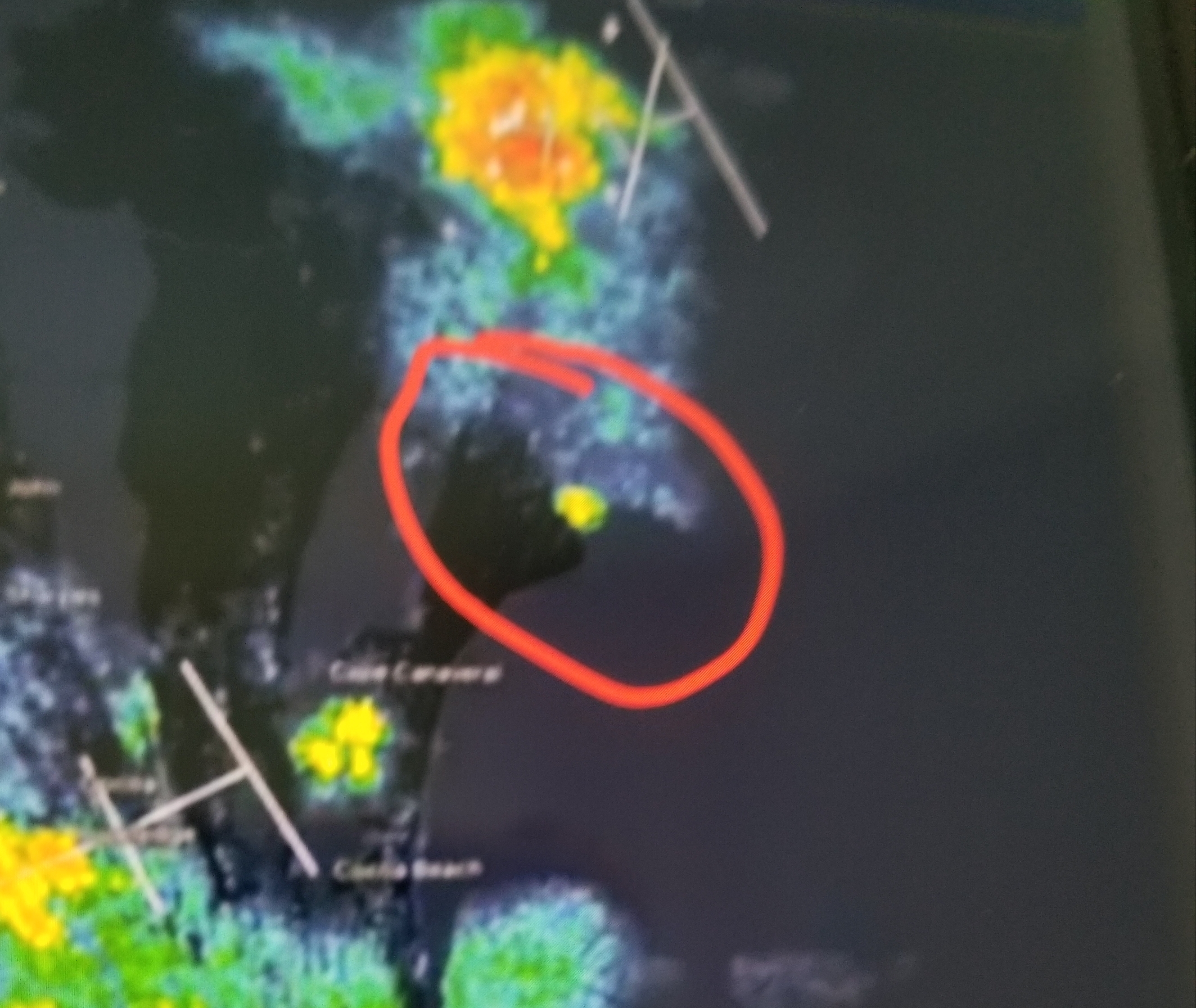
Last night's Blue Origin Rocket explosion on KMLB Radar between thunderstorm complexes to north and southwest.
-

2026-2027 Strong/Super El Nino
snowman19 replied to Stormchaserchuck1's topic in Weather Forecasting and Discussion
-

Anomalous Late Spring storm May 30 2026
HoarfrostHubb replied to HoarfrostHubb's topic in New England
I'm not expecting much for winds in central Mass... breezy sure, but nothing super unusual... further east (esp coastal NH and ME) could be fun -

2026-2027 Strong/Super El Nino
Stormchaserchuck1 replied to Stormchaserchuck1's topic in Weather Forecasting and Discussion
I think it would favor more -NAO events going forward (decadally). Be careful that you are calling the -AMO right now is not from a lot of +NAO/+AO, especially in the warm season. Immediate term the central-south Atlantic has -0.3 to -0.4 SSTA correlation with +NAO conditions. I know, correlated immediately, inverse in the long term. -
montrose clears
-
I will be spending 10 days in June with a much colder view...going to Alaska June 7-17! Bucket list trip.
-
Diurnal range today is going to be off the charts here.
-
We will torch late summer into fall/winter
-
i’ll kick it off with a current view…
-

2026-2027 Strong/Super El Nino
40/70 Benchmark replied to Stormchaserchuck1's topic in Weather Forecasting and Discussion
Well, it's all connected...sure, the RONI only measures the oceans, but I think the warming oceans are somewhat connected to the more pronounced 500MB ridges....I think there is an element of feedback at play. Bottom line is there is more heat, which is being reflected in the ocean and the atmosphere, but it just so happens that the RONI only measures the former...so technically, yes...it certainly goes beyond the RONI. - Today
-

Summer 2026 Med/Long Range Discussion
SchaumburgStormer replied to Brian D's topic in Lakes/Ohio Valley
Yep, if it’s going to be dry and boring, may as well be 80 and dry/boring -

2026-2027 Strong/Super El Nino
bluewave replied to Stormchaserchuck1's topic in Weather Forecasting and Discussion
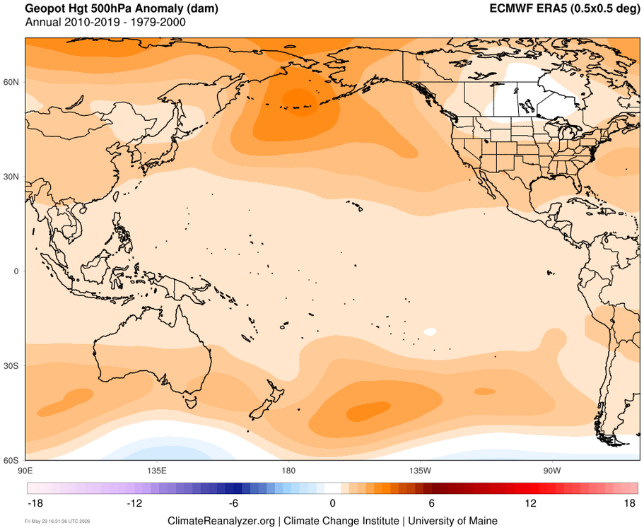
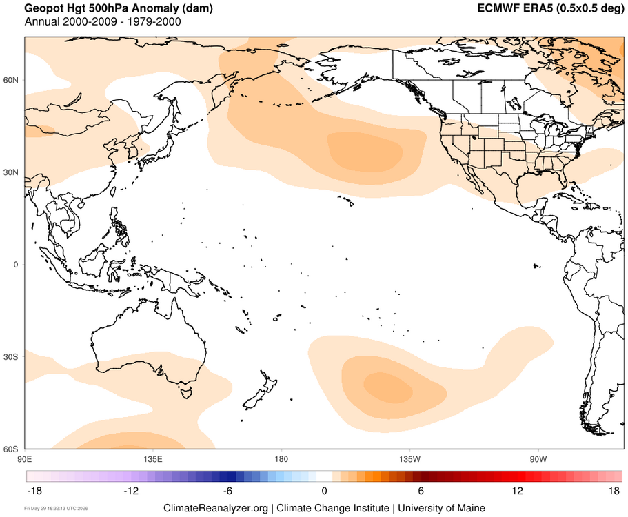
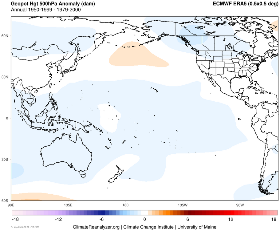
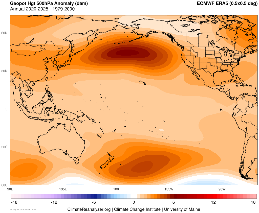
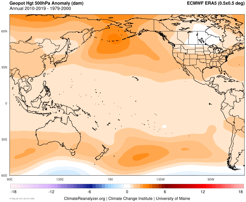
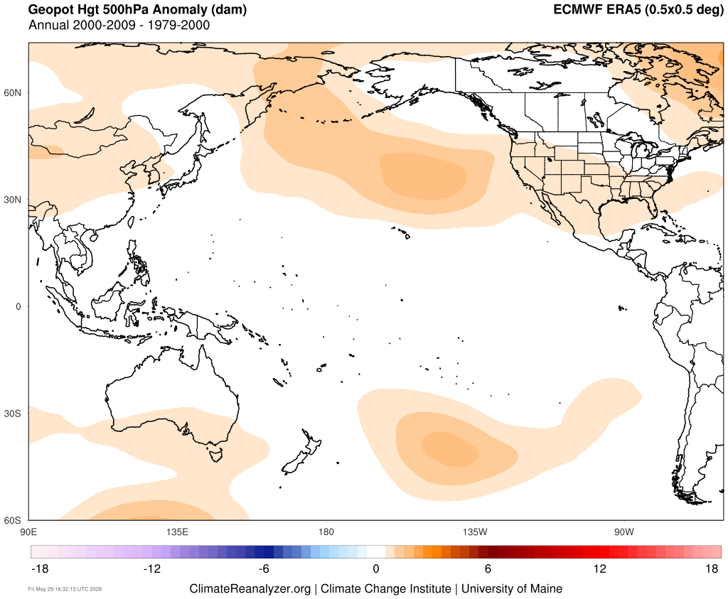
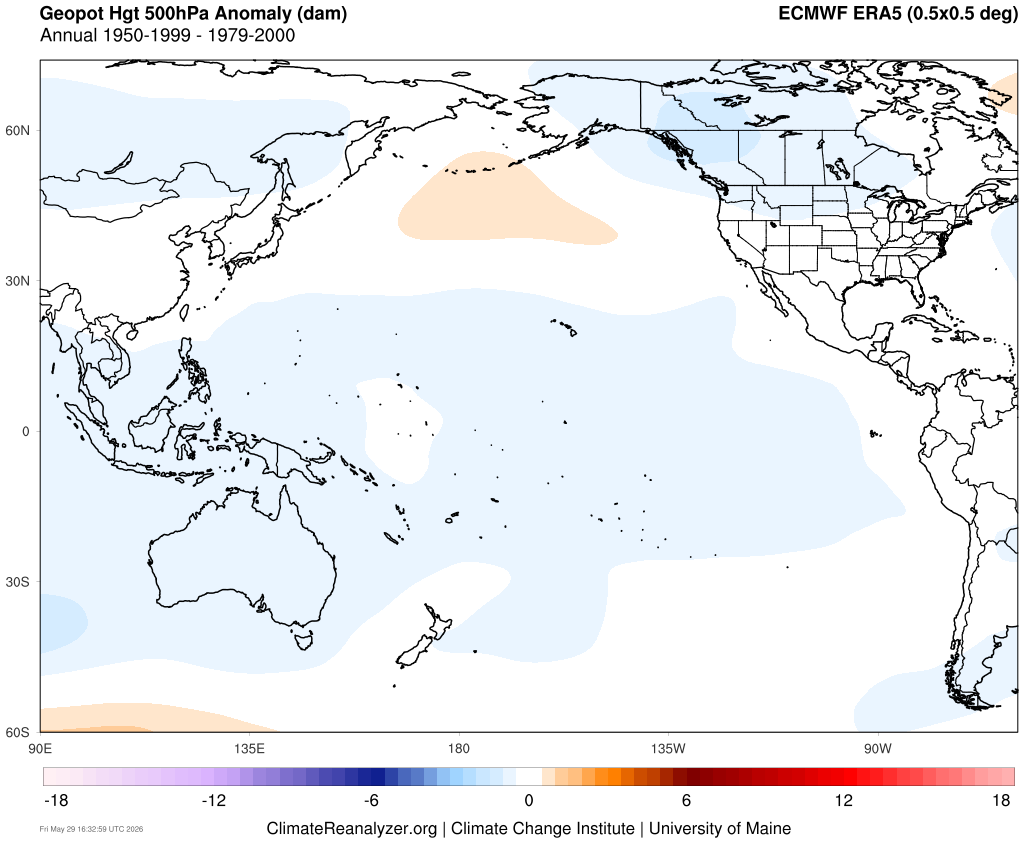
I think that it could also go beyond the RONI in that the 500 mb ridges are expanding in the mid-latitudes outside the tropical oceans which RONI measures. The 500 mb ridge across the North Pacific from east of Japan to south of the Aleutians has been unprecedented during the 2020s. Also note the slightly weaker mirroring of the pattern in the South Pacific to the east of New Zealand. So it’s been warming the SSTs underneath the ridge causing the -PDO to remain negative. In the old days ,the -PDO was more a function of colder SSTs off of California rather than the extensive warm pool from east of Japan to south of the Aleutians that we have today.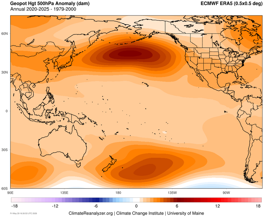
-

2026-2027 Strong/Super El Nino
so_whats_happening replied to Stormchaserchuck1's topic in Weather Forecasting and Discussion
.thumb.gif.1b9b32772878231a11b7b4b60eae9bf4.gif)
-
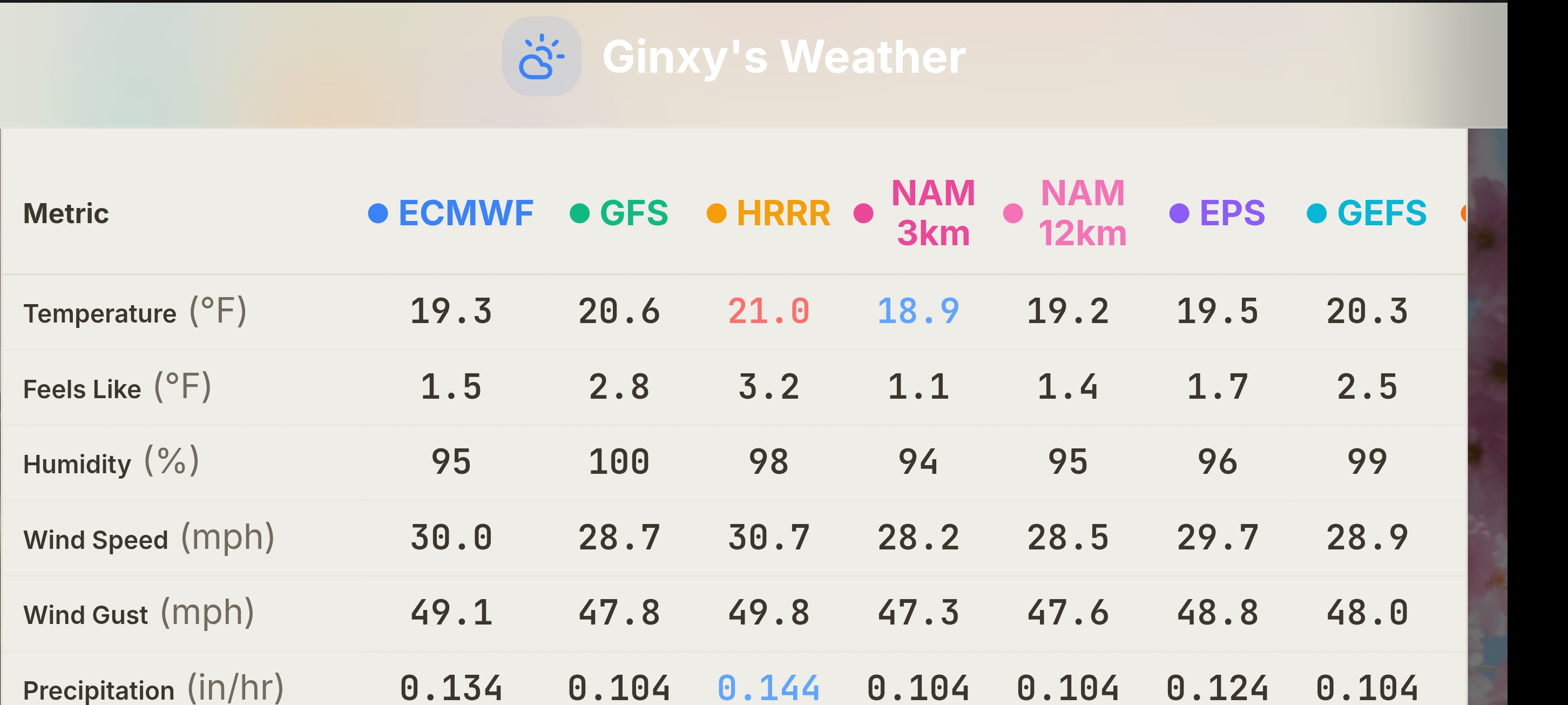
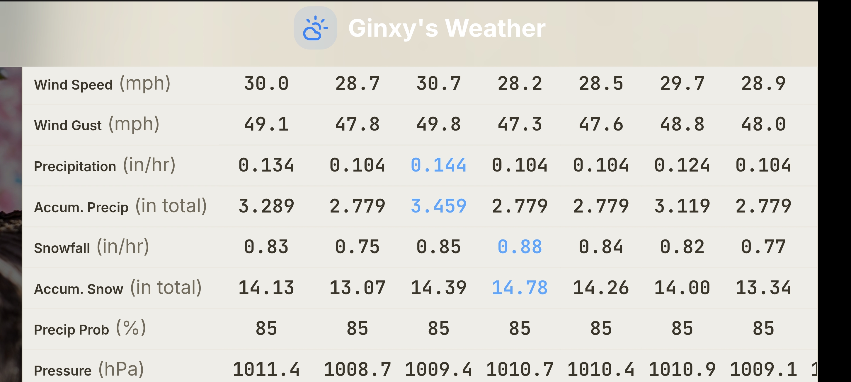
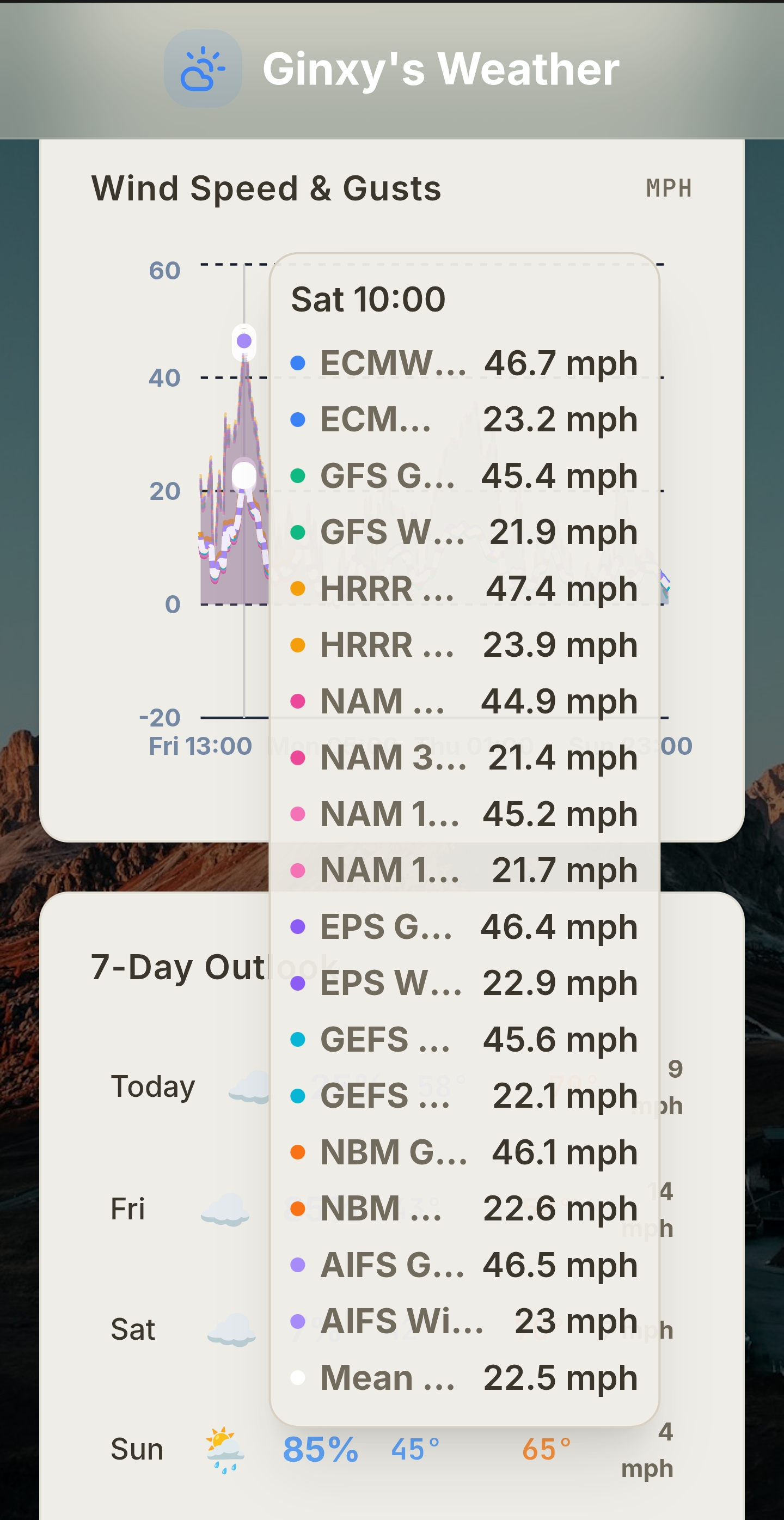
So what does that look like in terms of surface winds? I'm in central MA and trying to figure out if I need to protect the veggie garden plants.










.gif.2dd73b68ef712a1afcc9b692cfdbcf5f.gif)