All Activity
- Past hour
-

February 2026 OBS & Discussion
WeatherGeek2025 replied to Stormlover74's topic in New York City Metro
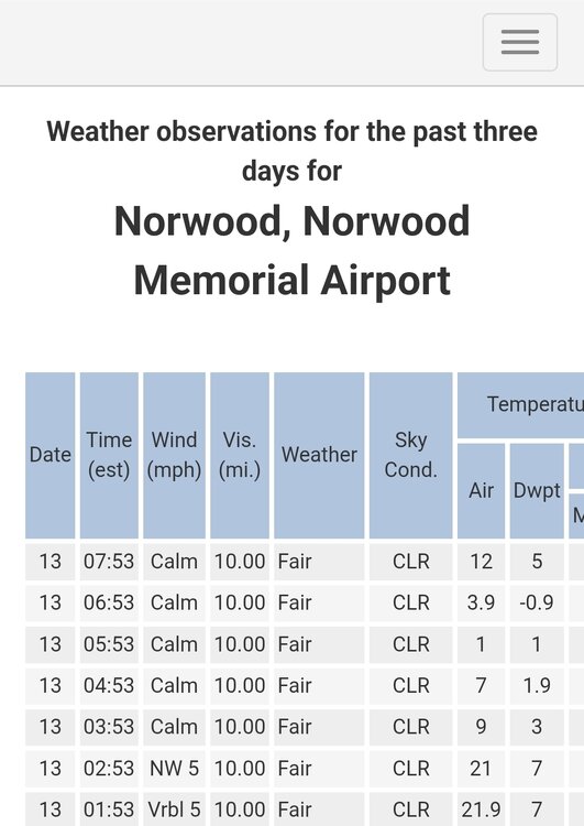
cold morning 24 now -
1918...yikes! That must have been absolutely brutal. .
-

Is we back? February discussion thread
codfishsnowman replied to mahk_webstah's topic in New England
I feel like this has been so difficult even in the slightly better winters. I'm still optimistic we will get there. I just wonder if the long-term average is really closer to low to mid 40s rather than 50 inches. -
Yes, it looks like we go on another run starting sometime later next week. If it plays out well, the snow pack could be pretty crazy up here. We’re around 2 feet right now and I don’t think we’re gonna lose that much given the cold nights, so we’ll probably have 18 to 20 when it starts piling back on top.
-
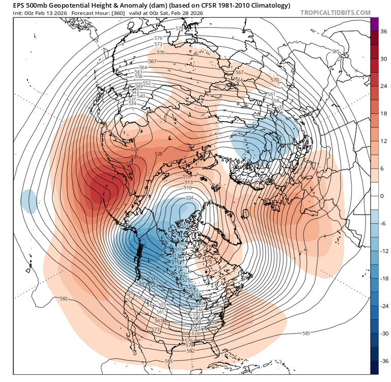
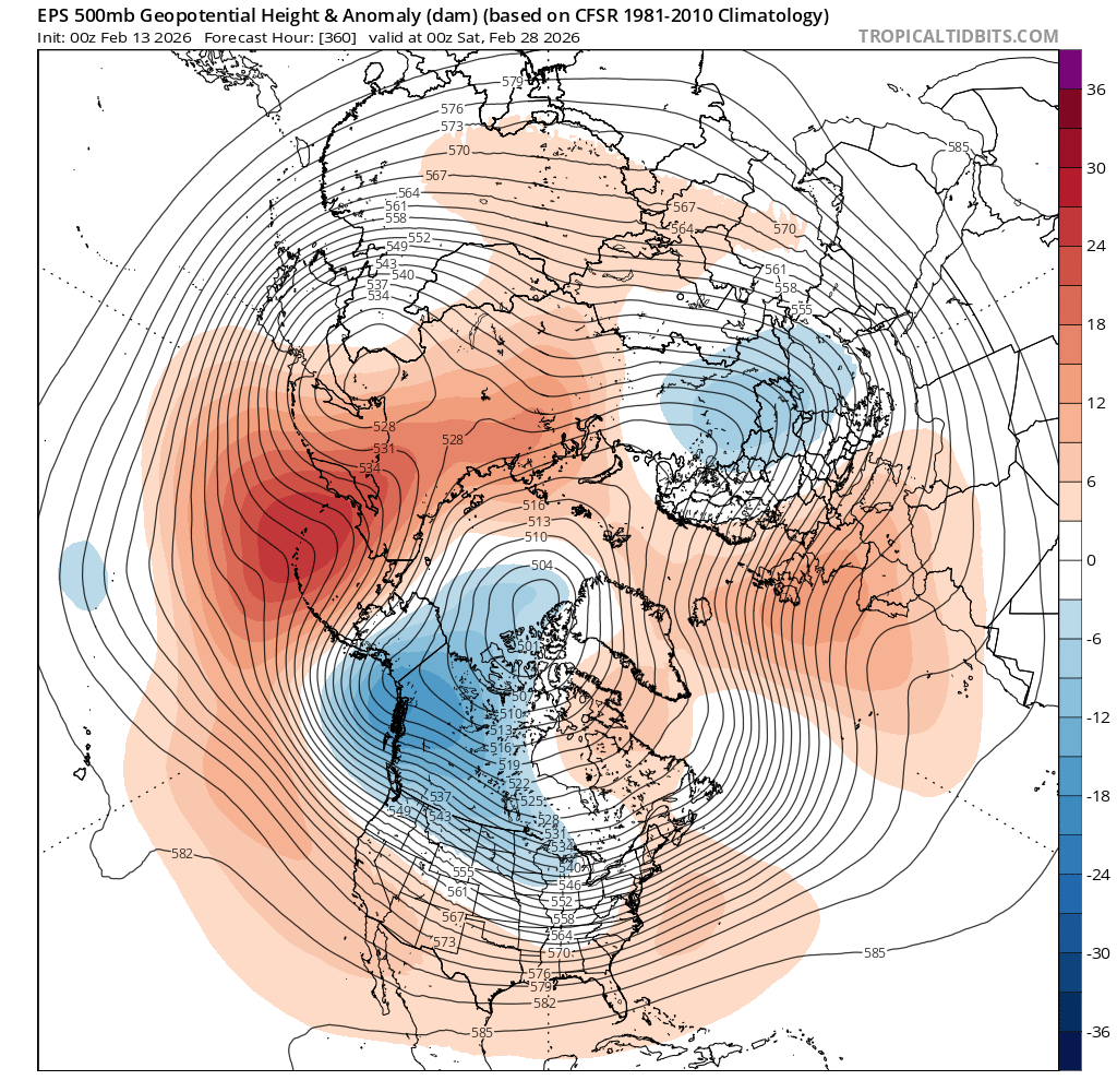
Looks like the PNA starting to improve at the end of the run. Likely a bit early as we would be in phase 6 however this should start to take form during the first week of March. This is NOT too late for snowfall for NYC.
-
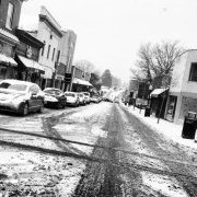
Another beautiful winter morning. What an amazing winter it has been here in the lowlands. I'm going to miss these blue bird mornings by next week when it's back to cloudy, humid, and damp every morning. I just need a couple inches of slop at some point to make it to climo for the third winter in a row. This is my 3rd winter in a row with a solid period of snowcover and deep winter conditions. Next winter I'm going to be a resident of the upper Tug, in the Montague area. My climo will increase by around 300" a year lol
-
Next week seems to be trending cooler outside of a couple mildish days. But to your point, late Feb 2018 hit 75F+, then look what happened in March.
-

February 2026 OBS & Discussion
donsutherland1 replied to Stormlover74's topic in New York City Metro
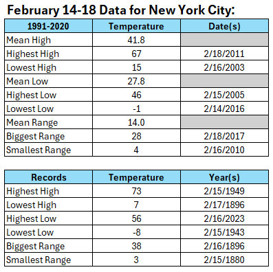
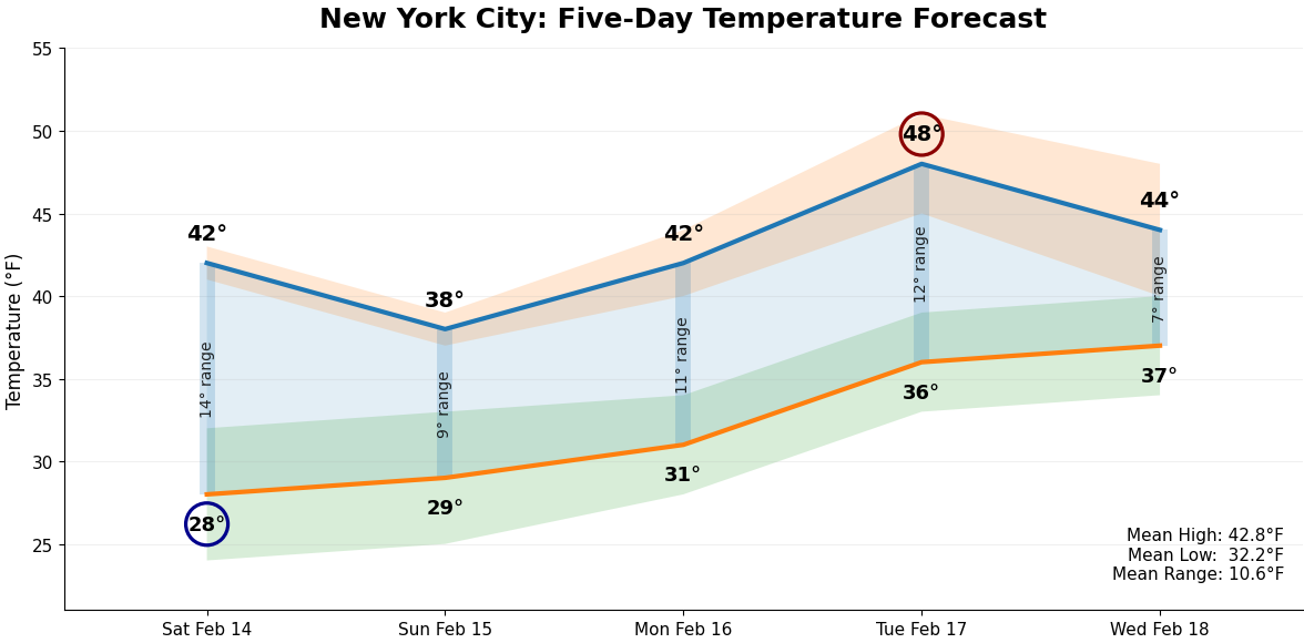
The big weather story for the New York City area this weekend through the middle of next week will be the combination of a February thaw and relatively quiet weather. A weak system will likely pass to the south Sunday night and Monday perhaps bringing some light precipitation for a time, mainly to the south of New York City. Temperatures during any precipitation will likely be mainly near or above freezing. The thaw could crest on Tuesday with the high reaching the upper 40s and possibly 50° in Central Park. Beyond the five-day period, some showers or periods of rain could be possible on Wednesday or Thursday with the temperature remaining above freezing for the duration of the event. The five-day figures from the NBM: For context, the forecast averages are somewhat more range-bound and somewhat milder than the values for the overall 1991-2020 climate reference period. Exceptional warmth remains unlikely. Despite the upcoming thaw, February remains extremely likely to be colder than normal overall.
-
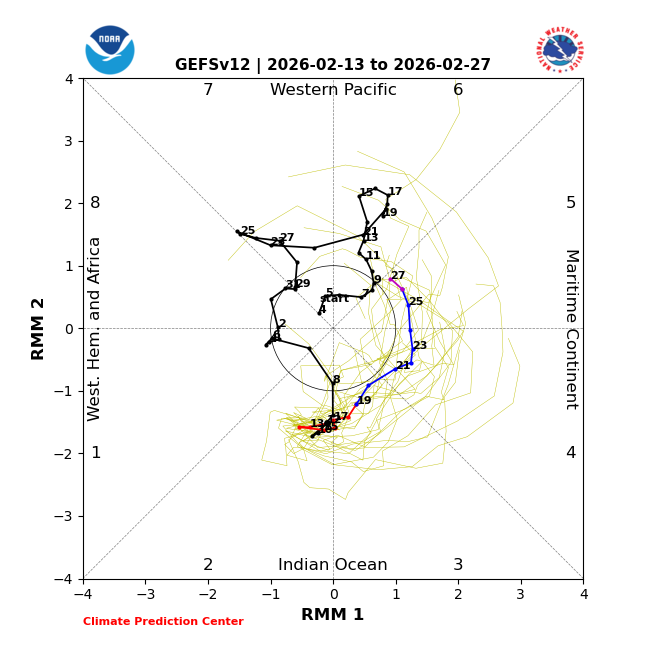
It's a warm index period, yet the dailies/oper models cinemas are low balling on that potential. The main reason this takes place is to annoy me... winter enthusiasts don't realize that is happening, they just assume the world is the way it should be. I'm neurotic about that. LOL. I don't like it when the idiosyncratic vagaries of wind and weather patterns placate and even enable one side, in general - cold or hot. But the reality is that index just mean favored regimes. It's a matter of how much or how little. There is variance within those regimes. Anyway, here on Earth... in this case, the pattern is acting like a -NAO without actually having a block. One does eventually formulate up there - as usual, inconsistently in both time and space by the guidance'. But these system running along a pinned polar boundary late next week ( it's a mixy storm signal that's been there for several days actually...), are acting ling the blocking patterns is there whether it is actually manifested or not. That behavior is the non-linearity of forcing. In wave mechanics, fields interact in both linear and non-linearity. The linear is what you see; the non-linear dictates where waves amplify verse damp out, emerge and decay. That's what exposes the non-linear field Another way to think of the non-linear relationship, the PNA in fact is positively correlated to the NAO. SO, -PNA statistically wants to manifest a -NAO... it seems the physics of the models are exposing that relationship, whether it shows up in the linear structures (those that are readily observed).
-
I think 81-82 might be the best winter I clearly remember. We seemed to get a couple of small snowfalls a week punctuated by somewhat regular larger storms. At one point, our nearly 4' tall electric fence was buried.
-
-
-
So 8 days to get from 3 to 6. Can we get to 8 by the 8th of March for one last snow window?
-
Will probably end up as mix here in SW CT.
-
I think its similar to how MVY is..low lying surrounded by higher elevation. Might be the definition of fake cold but legit
-
That’s the same way I feel, it’s absolute bullshit. Especially up here in the pretty far N/W burbs, where that storm can absolutely drop 18” if we don’t have bad trends the last 24-36 hours to penetrate the primary so much more north and a razor thin ass warm nose at 925…
-
It's a weird spot. Essentially sea level.
-

Is we back? February discussion thread
40/70 Benchmark replied to mahk_webstah's topic in New England
Yea, the extreme cold is done....March 2018 wasn't that cold. -
I'd take that over 24/5 just because it's nicer feeling and living in that... pretty simple. lol
-
Amazing how many climate alarmists still site that 97% figure as some sort of proof of man made climate change. Fortunately, the climate religion is losing followers daily!
-
return
-
Tuesday looks warmest. 45 with some spots maybe near 50
-
qc schmegma said winter was over yesterday. euro/gfs/AIs all looking good
-

Is we back? February discussion thread
Damage In Tolland replied to mahk_webstah's topic in New England
What are the mild days.. Mon/ Turs? -
Which is comical to say it’s over. There’s still a solid 2-3” of snow with universal coverage outside of south facing aspects.


(002).thumb.png.6e3d9d46bca5fe41aab7a74871dd8af8.png)