All Activity
- Past hour
-
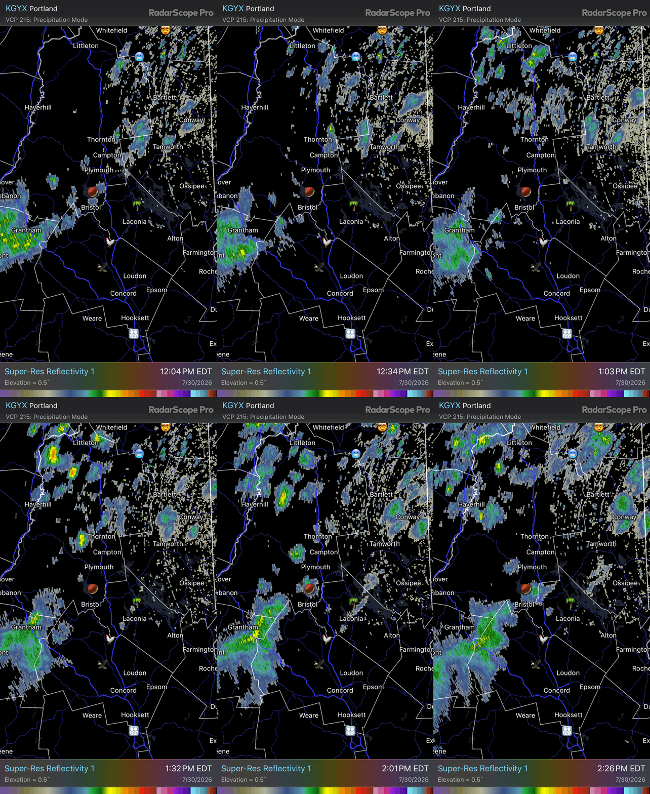
 Idk what these radar echoes are even doing anymore. There’s literally echoes moving away from Winni while some just to the west are going in the opposite direction. In the end the vector is away from the coop and lake.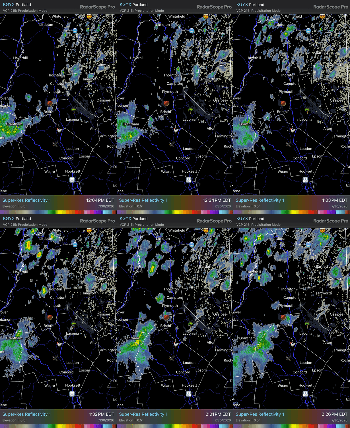
-
 Fortunately, you’ll have that this winter when you’re the only one getting frozen.
 -
Even down here the dewpoints are actually down to 66-67! That’s the lowest I’ve seen quite possibly all month. Temp is 93.3 here vs 100.5 exactly 24 hrs ago (high was 101.1). Skies still have ugly haze with only a few clouds. Winds are light/variable vs yesterday’s hot SW winds.
-

Occasional Thoughts on Climate Change
WolfStock1 replied to donsutherland1's topic in Climate Change
Re: "Wildfire swept" - I hope people don't think that's due to CC. Because if so - look what Europe as a whole shows: It's an extremely low wildfire year across Europe as a whole. https://gwis.jrc.ec.europa.eu/apps/gwis.statistics/seasonaltrend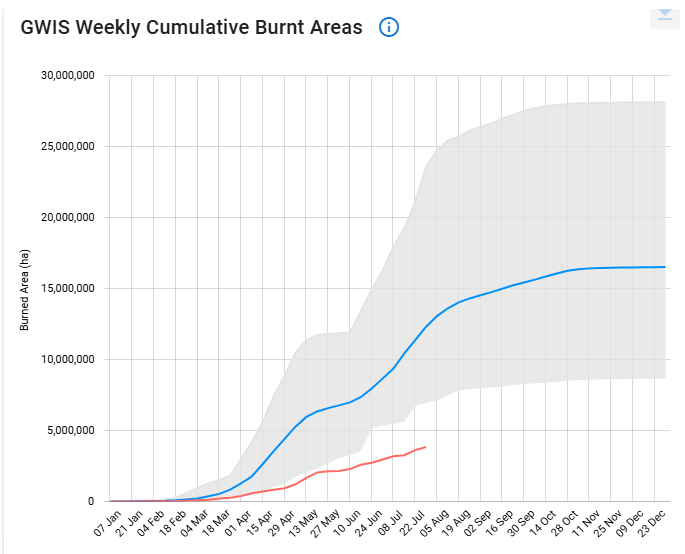
-
Time for a GYX only subforum
-
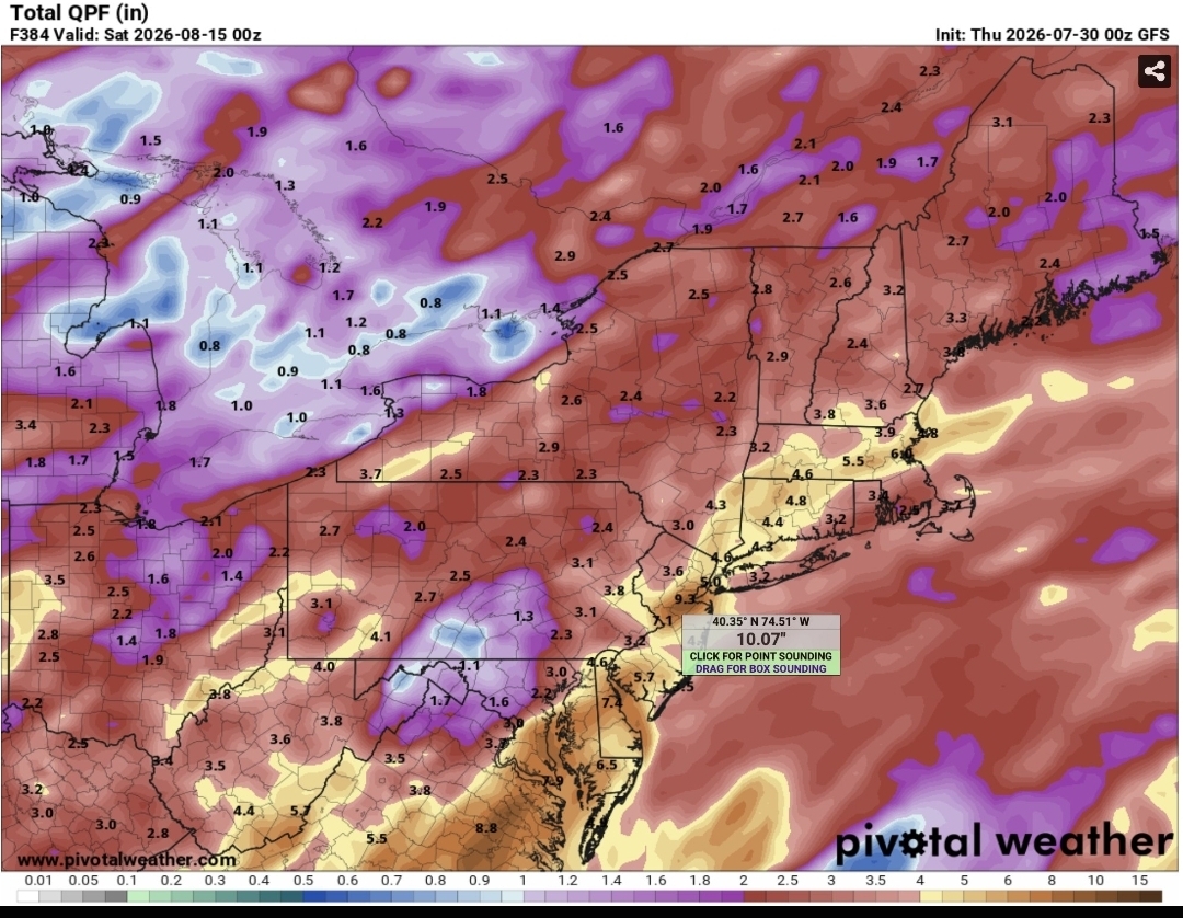
 Everyone had enough of the rain? I know I have. Unfortunately it looks like more in the coming weeks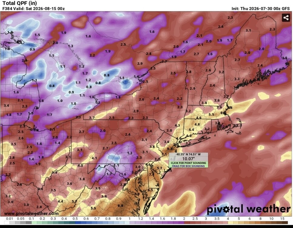
-
 Used to do some night skiing back in the 70s when I was at URI.
 -
I remember seeing that place on the ski reports back in the day. What a name lol.
-
 Buy Viagra online cheap and sildenafil 50 mg price Viagra online price https://www.google.com.qa/url?q=https://medmennews.com sildenafil online and http://yangtaochun.cn/profile/kylcdqcibr/ viagra without prescription [url=http://sfmission.com/rss/feed2js.php?src=http://medmennews.com]Sildenafil Citrate Tablets 100mg[/url] buy Viagra online and [url=https://nidobirmingham.com/user/wouxkyqtwq/]Generic Viagra for sale[/url] Cheap generic Viagra
 -
 Pretty cool! Never heard of it but looks like they're still around: https://yawgoo.com/
 -
 Yep. Still operating. Their season passes are incredibly expensive. lol
 -
Yawgoo Valley, last ski area in Rhode Island! Don't know if it is still open. You drove down the hill past the slopes to get to the base.
-
 Decent cold patch off the coast that's developed in the last few weeks...
 -
 Is that where the ski area is too?
 -
I can’t say I looked extensively, but I know the buoy south of Block Island was like 69° a couple days ago. Over recent summer those waters have been warmer. Edit: now 65°
-
Day 3 Marginal risk issued for middle TN parts of east TN and southern ky west TN and rest of east TN in general thunder "HAZARD WITH THE MOST INTENSE STORMS; HOWEVER, SOME TORNADO THREAT COULD MATERIALIZE FROM PORTIONS OF IN AND OH INTO MIDDLE TN WITHIN THE ZONE OF STRONGER LOW-LEVEL SHEAR." .
-
I just move the decimal to the left one space for up here now
-

Dewgust 2026: Summer's Last Stand
Damage In Tolland replied to Prismshine Productions's topic in New England
Warm, wet , and dewy the first two weeks of Augdewst. Signals are there dew friends.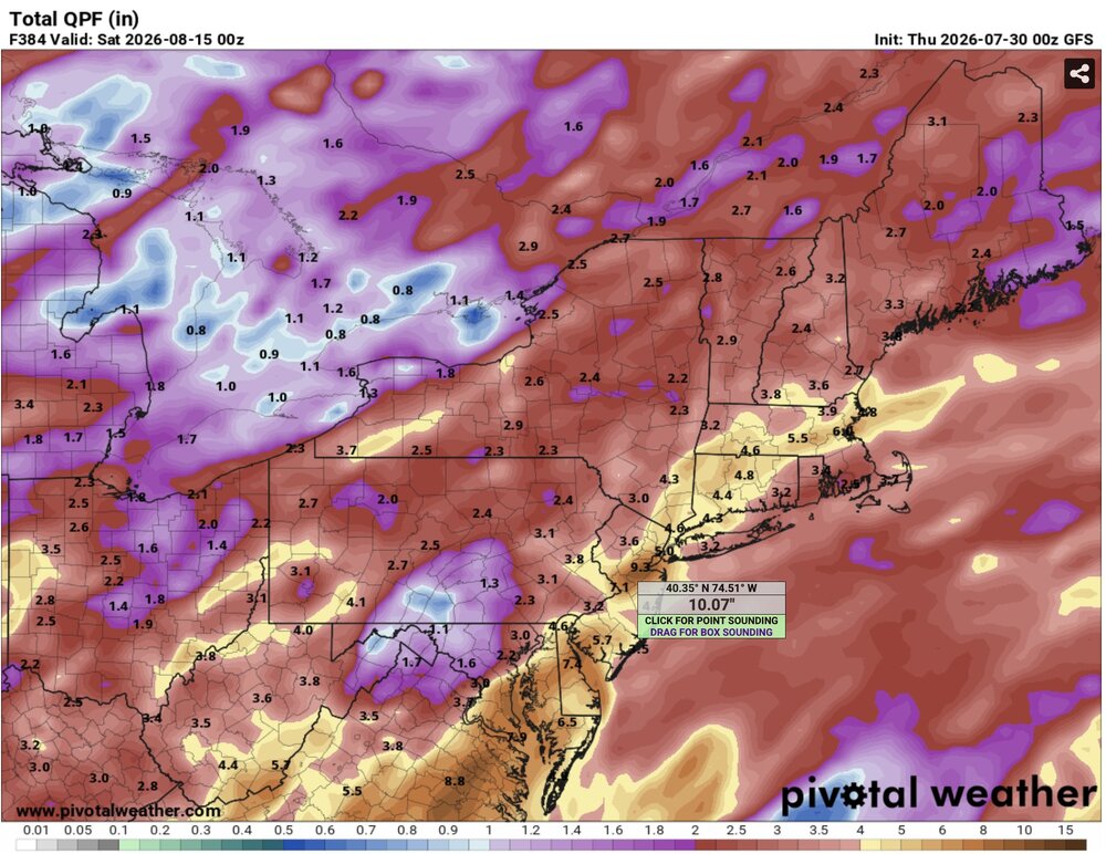
-
 I was doing some digging last week and some of the extended guidance seemed to want and relax wind shear across the MDR a bit, however, I wasn't particularly sold and was wondering if that was a product of guidance in the extended favoring climo and wanting to decrease shear as we get closer to peak climo. Waters in the MDR are also pretty meh. Will continue to be a focus for home brew, especially as we start getting more active with fronts.
 -
Water temperatures are way too cold once you quickly get north of NC and there will be a lot of upwelling early next week. You would need probably a high end 3 or 4 approaching the Carolina coast and rapidly accelerate northward to get a cane hit here. Otherwise any system is would transition to extra-tropical or sub-tropical extremely quickly.
- Today
-
Rains developing around me in Kearny, nj. Had some heavy mist. 75 degrees out.
-
 Something will pop in the subtropics eventually, but this ain’t it. Today was actually the first day I started thinking about my annual peak season forecast. It’ll be a dead basin this season, but how dead is TBD.
 -

2026-2027 Super El Nino
George001 replied to Stormchaserchuck1's topic in Weather Forecasting and Discussion
Imo the following winter is the one to watch for northern areas, not this upcoming one. I don’t see the roaring STJ dying off quickly especially if the El Niño lingers into the spring before collapsing into La Niña. When you combine the lingering STJ with a La Niña, big things can happen for northern areas. When it comes to sustained cold in an El Niño this powerful, I need to see it to believe it. Historical precedence for these super ninos is a warm east. -
Yeah all day basically with an occasional burst of a moderate shower. Today is a more dreary, wetter, cooler day than yday. Yday was fairly nice for the most part.
-
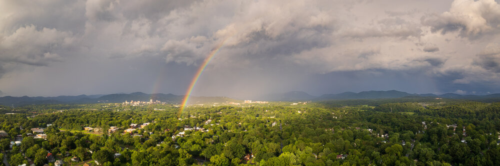
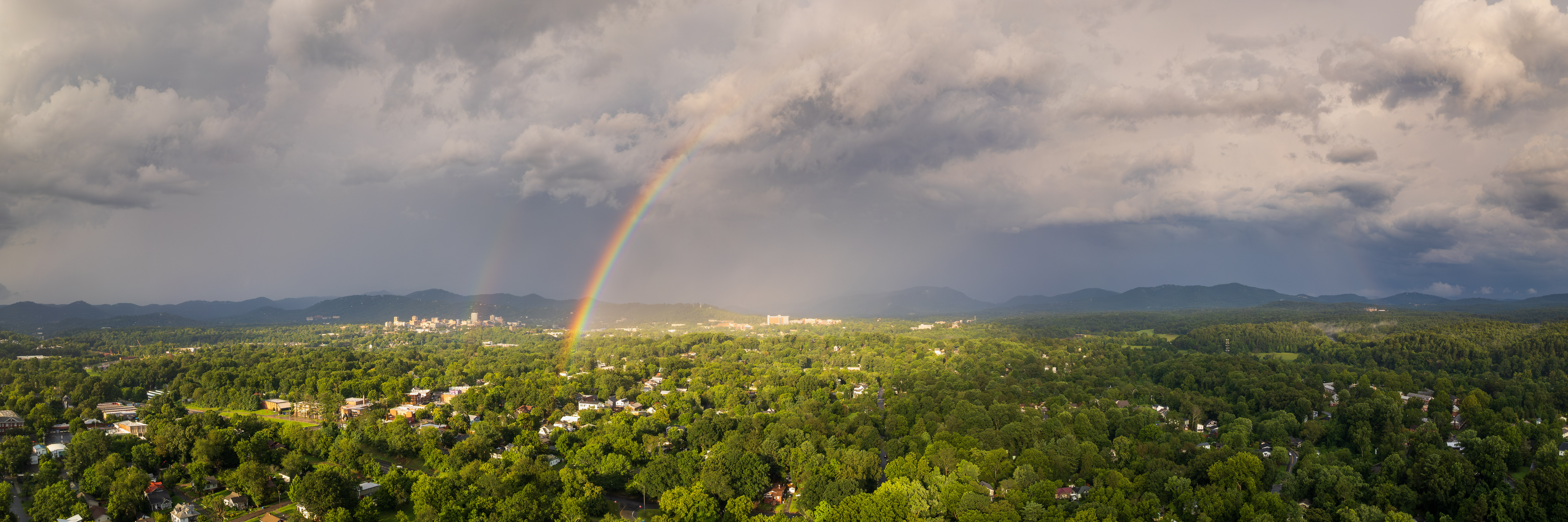
And here's a rainbow that appeared for a few minutes after the storm passed. Both shots were from my DJI Air2S drone.