All Activity
- Past hour
-

2026-2027 Record-breaking El Nino
40/70 Benchmark replied to Stormchaserchuck1's topic in Weather Forecasting and Discussion
In case there was any doubt as to where the west Pacific warm pool has migrated..... -

Strong Nor'Easter/Hybrid Storm Late September 2026
gravitylover replied to Rjay's topic in New York City Metro
Over .9 already today. -

October Comes Early: Late September Multi-Hazard Hybrid Storm
Brewbeer replied to WxWatcher007's topic in New England
glad I have a 2 car garage that's not full of junk, was able to replace the factory radio in my other, newer Accord with a new Sony head unit, Alpine amp, and backup camera. took most of the weekend but man, the new radio is sweet. -
 cheapest viagra [url=https://sildendirect.shop/#]Silden Direct[/url] Generic Viagra for sale
 -
October Comes Early: Late September Multi-Hazard Hybrid Storm
40/70 Benchmark replied to WxWatcher007's topic in New England
I would have lost my mind if this were winter. Puts a dent in the drought up here. but definitely doesn't entirely alleviate it. -

Strong Nor'Easter/Hybrid Storm Late September 2026
Intensewind002 replied to Rjay's topic in New York City Metro
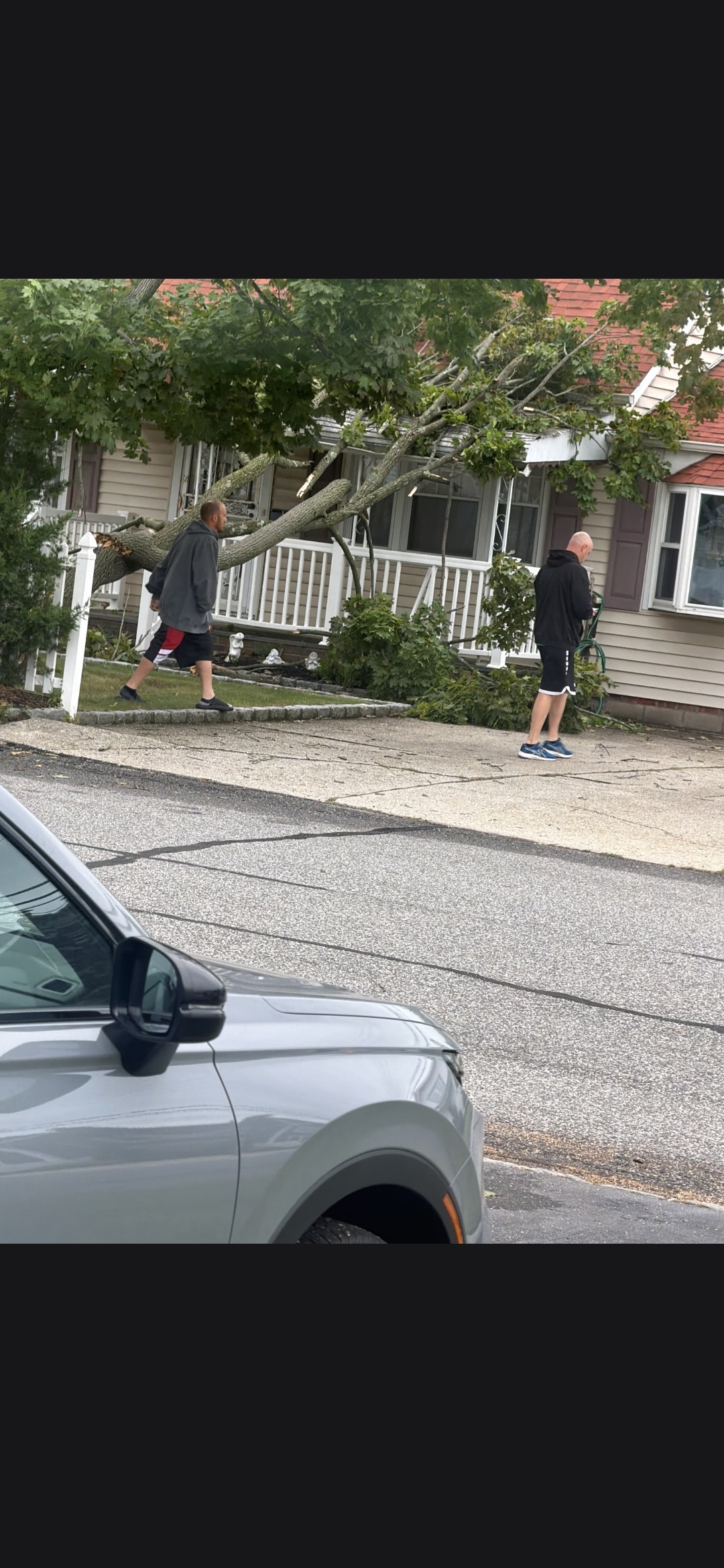
2.92" rainfall total here, forgot to share yesterday but a friend of mine sent this pic to me from north babylon, neighbor had their tree fall on the house. Otherwise for the most part only twigs and small branches down in lindenhurst, only a handful of larger branches and small trees.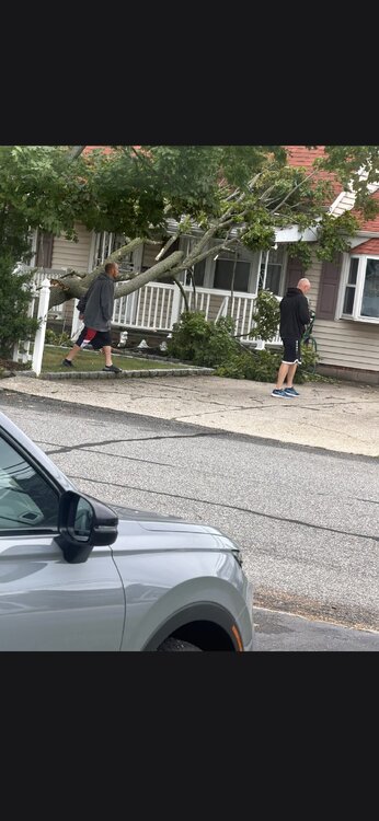
-
Buy Tadalafil 5mg: Tada Stream - Cialis 20mg price in USA
-
2026-2027 Record-breaking El Nino
40/70 Benchmark replied to Stormchaserchuck1's topic in Weather Forecasting and Discussion
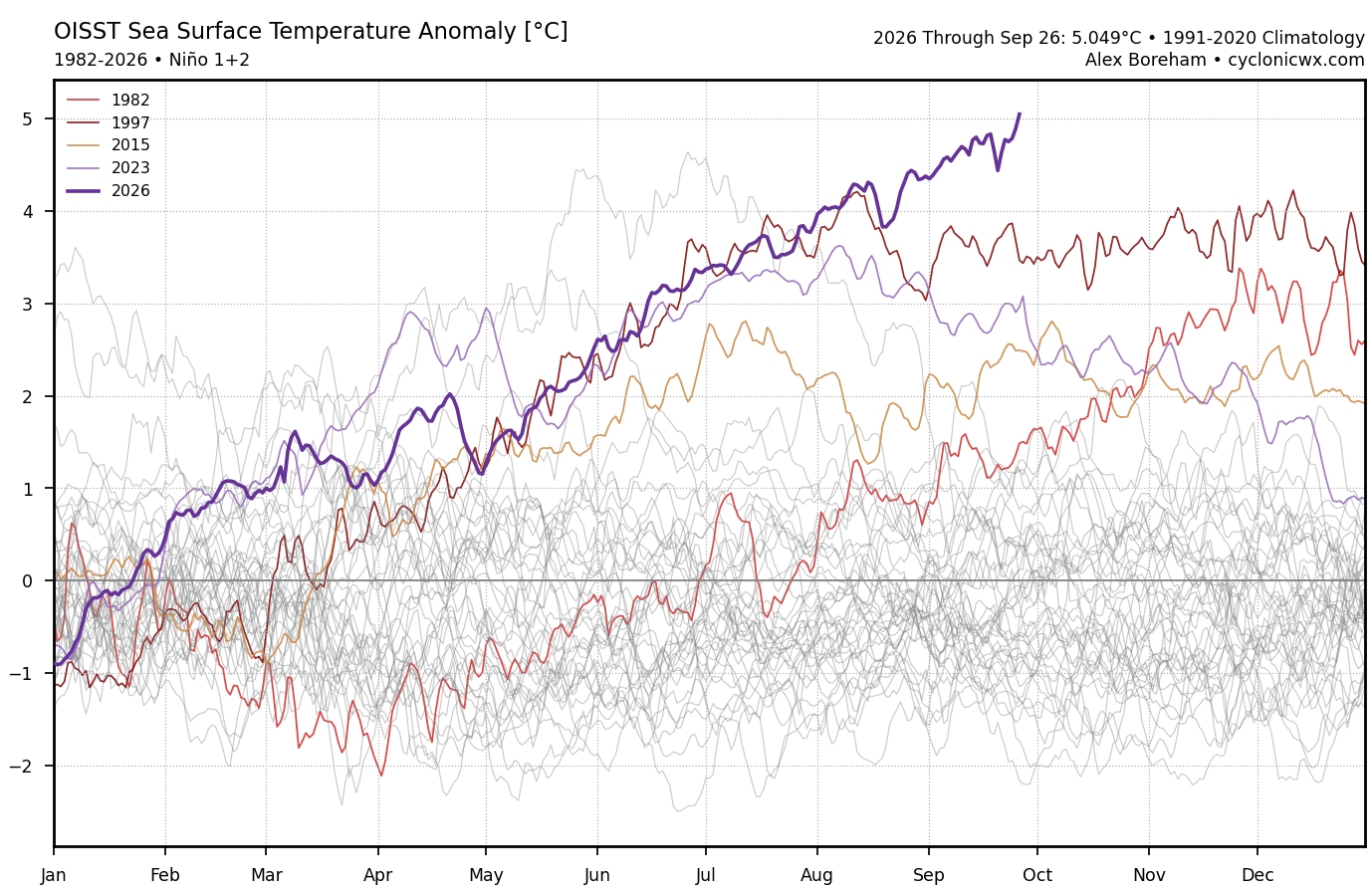
This is a stronger version of 1982 with the main difference being the warm pool east of Japan, hence the lower PDO....But QBO, solar, east-based super El Nino trying to shift more basin-wide mid season and the secondary 1.2 peak. Elite analog...about as good as it gets. -
highs i am seeing for central park are upper 70's..
-

2026-2027 Record-breaking El Nino
OSUmetstud replied to Stormchaserchuck1's topic in Weather Forecasting and Discussion
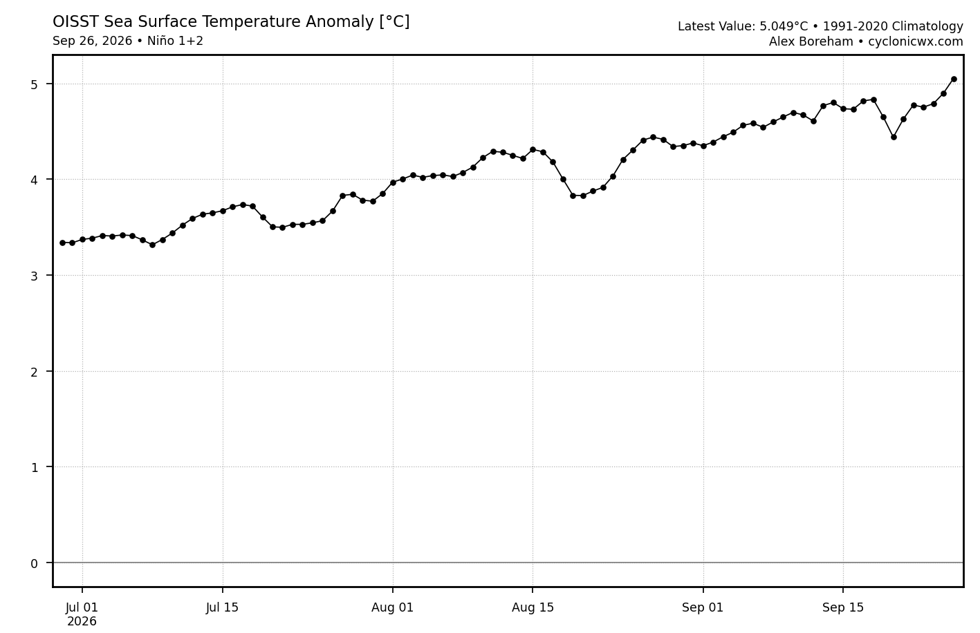
Anomaly increases the past 15 days.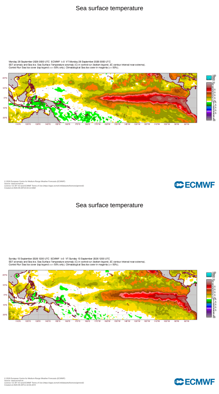
-
-

October Comes Early: Late September Multi-Hazard Hybrid Storm
CoastalWx replied to WxWatcher007's topic in New England
Will be nearing 7” soon. -
2026-2027 Record-breaking El Nino
OSUmetstud replied to Stormchaserchuck1's topic in Weather Forecasting and Discussion
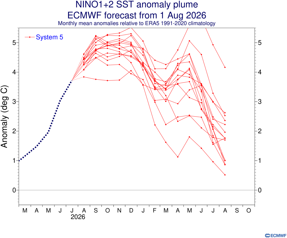
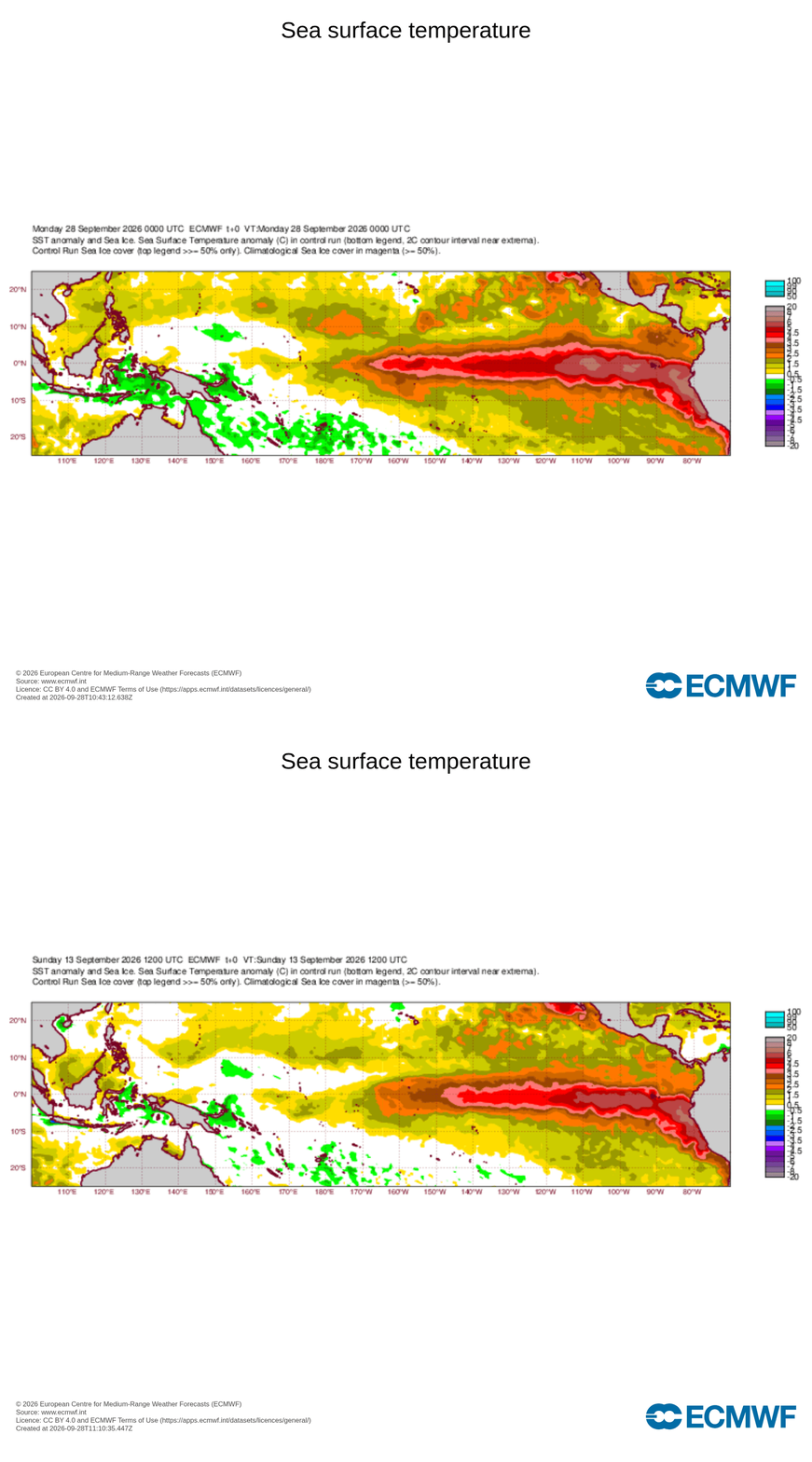
Nino 1+2 is going to verify on the high side of early month released models in contrast to nino 4 verifying on the low end. Some of the real small decreases in nino 3.4 near term rises continue to be the direct result of this nino being incredibly strong and super east based not because of any weakness. Peak sst anomalies on the latest ecmwf product are over 7C and are mainly centered in 3 and 1+2 not as much in 3.4..thumb.png.b35f696b0462b6cd8147508b82d589e6.png)
-
Some warm days this week, another weekend rain event, then really seems like fall arrives in earnest with a series of strong cold fronts. Probably frost risk for far NW burbs and freeze risk for the mountains.
-

October Comes Early: Late September Multi-Hazard Hybrid Storm
TalcottWx replied to WxWatcher007's topic in New England
It's been raining relatively heavily since afternoon yesterday. Radar is impressive right now, cool rain shield. -

October Comes Early: Late September Multi-Hazard Hybrid Storm
kdxken replied to WxWatcher007's topic in New England
Heavy drizzle/light rain. Miserable. Beginning to understand why they regulate handgun sales so tightly in the UK. -

October Comes Early: Late September Multi-Hazard Hybrid Storm
Baroclinic Zone replied to WxWatcher007's topic in New England
Been raining off and in since about 2am. -
October Comes Early: Late September Multi-Hazard Hybrid Storm
CoastalWx replied to WxWatcher007's topic in New England
Pouring again. -
Septorcher 2026 Discussion - Endless Summer
Brewbeer replied to Damage In Tolland's topic in New England
Septorcher bust - Today
-

2026-2027 Record-breaking El Nino
bluewave replied to Stormchaserchuck1's topic in Weather Forecasting and Discussion
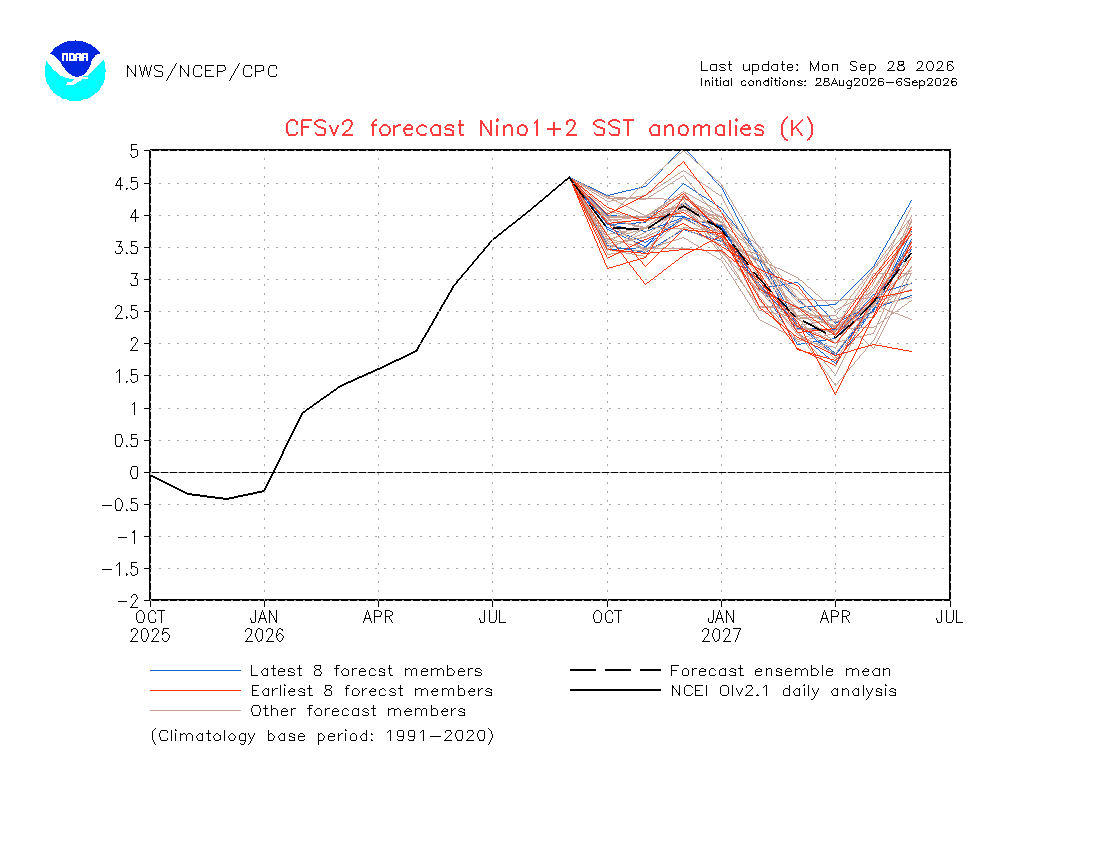
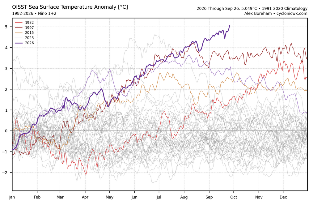
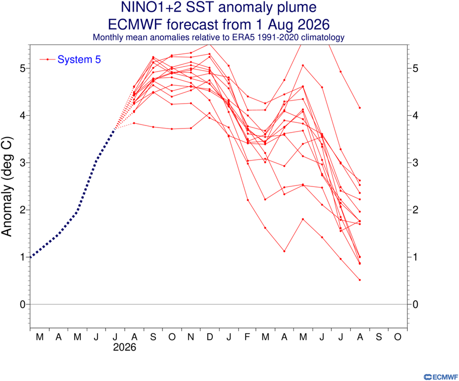
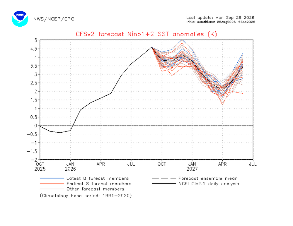
Even though the CFS forecast was too weak with the current all-time daily +5 Nino 1+2, it has a 2nd peak late next spring into the early summer. These very long range forecasts aren’t as accurate. But even the Euro extended is showing something similar. 1982-1983 had a second Nino 1+2 peak in June 1983 which was stronger than the one from the fall. But this fall is so much stronger than 1982 that the models have a lower peak late next spring. The 1983-1984 La Niña was significantly weaker than 1998-1999 since it got off to such a late start with a much weaker cold pool. We’ll get a new update on October 5th to see if it has the same forecast idea from the August 5th extension. The Euro was much closer to the current +5 than the CFS.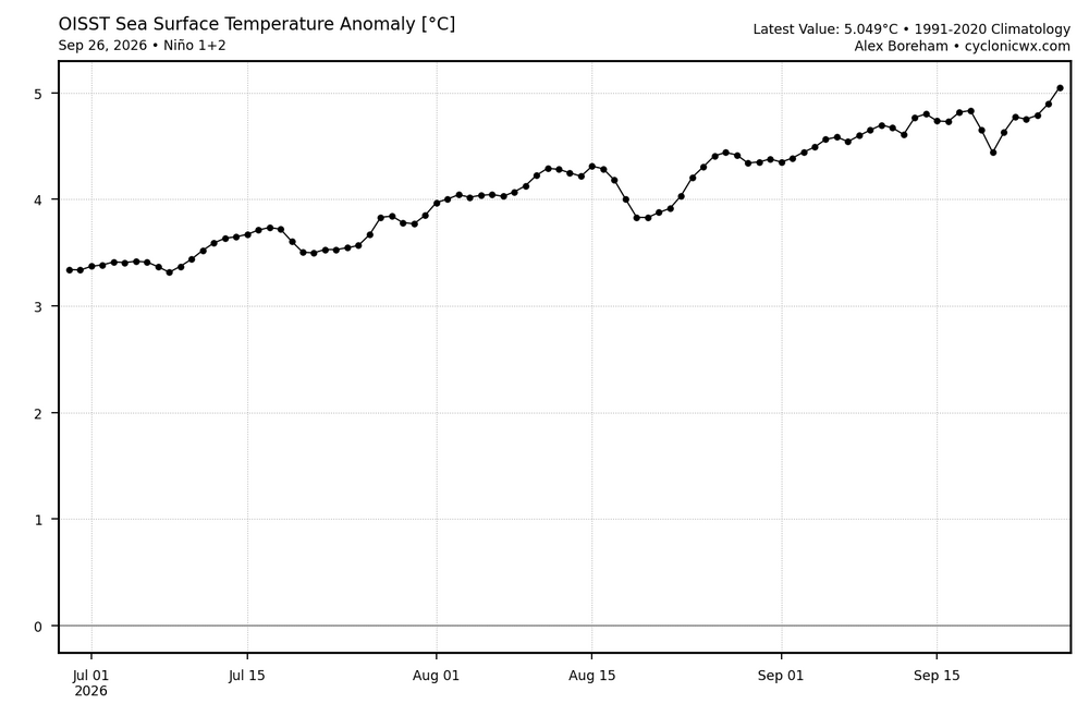
-
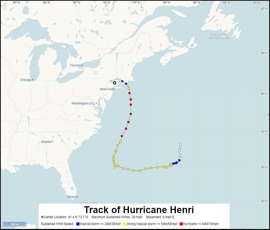
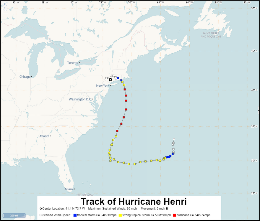
Sandy was obviously the most extreme since it was such a strong system which occurred at the end of October in 2012. Henri was another much weaker system to come in from the east but was further north than this event. Henri lead to record flash flooding in August 2021. So these much stronger blocks to our north make these type of tracks possible. https://storymaps.arcgis.com/stories/693bb9ddab5b4fb3a4aa5b79e5435b9f
-
It's a lot more than milder. Mid to upper 80s late week
-
Cialis over the counter: Tada Stream - Generic Cialis without a doctor prescription
-
58 degrees this morning.
-
Cheap Cialis: TadaStream - Tadalafil price





.png.aa2e063718bba1c63d08ddda476c5f4b.png)