All Activity
- Past hour
-
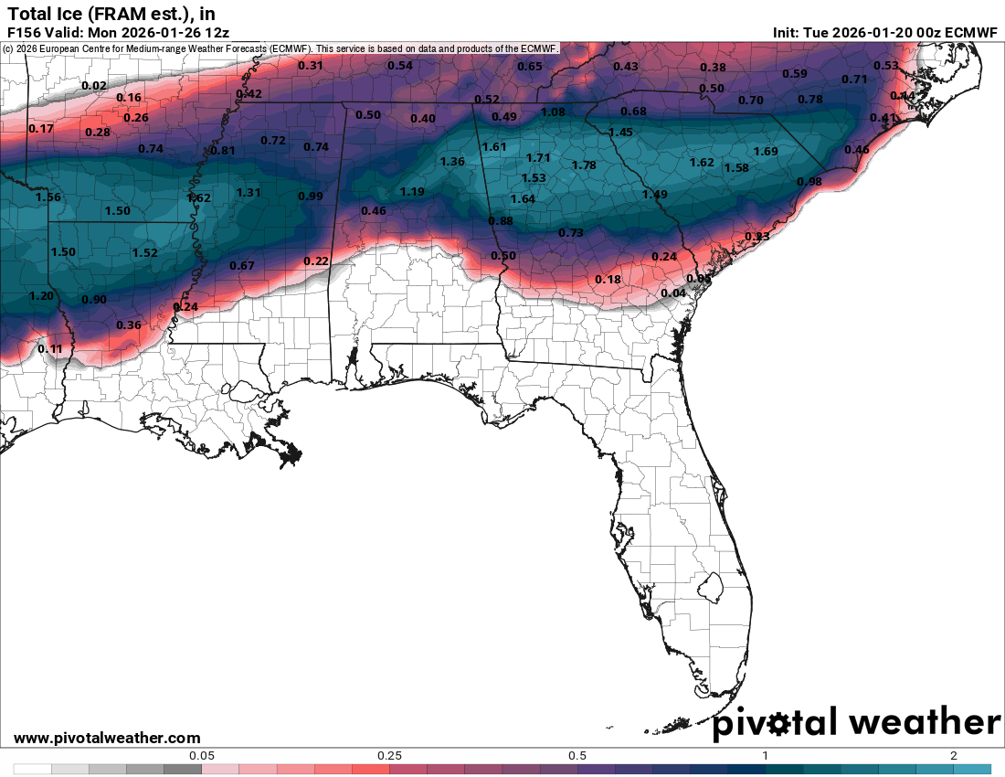
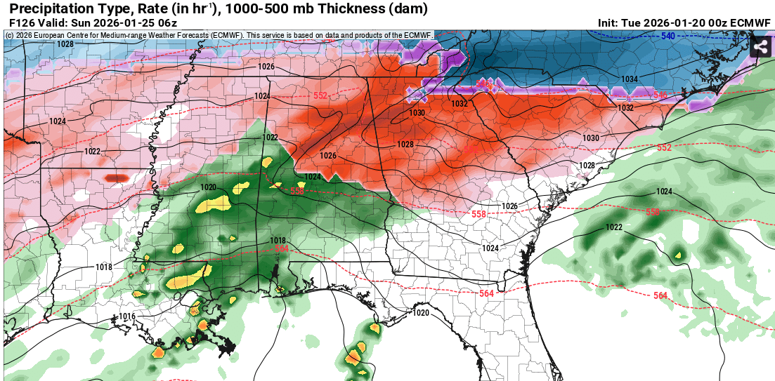
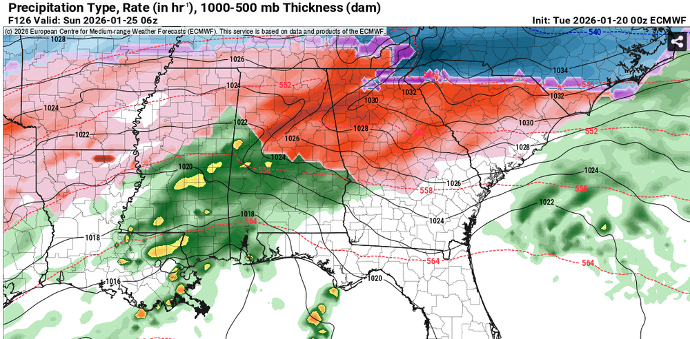
1.5+" of ice for much of the Atlanta metro/N GA thanks to an extremely strong CAD wedge. This is a nightmare.

-
I think the areas in the wedge core like GA and SC will get mainly sleet, but those outside of it like N AL/N MS AR/TX would likely be FZRA. They all could use a CMC or UKIE solution which spares many areas down there from a FZRA event but to me that hard early phase is not likely.
-
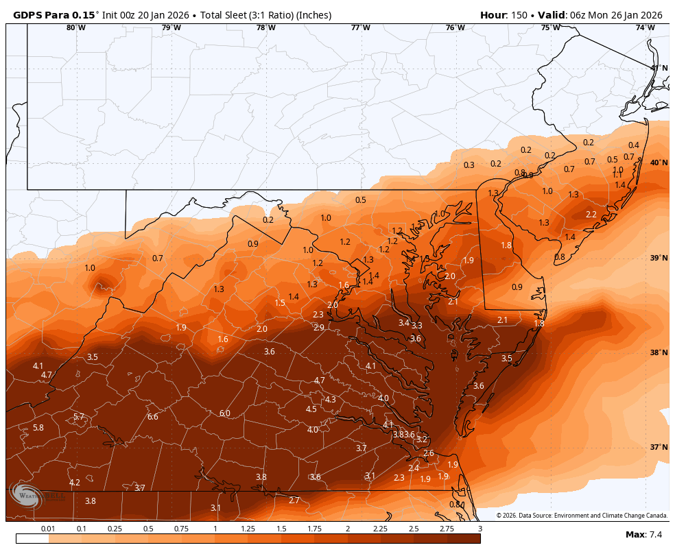
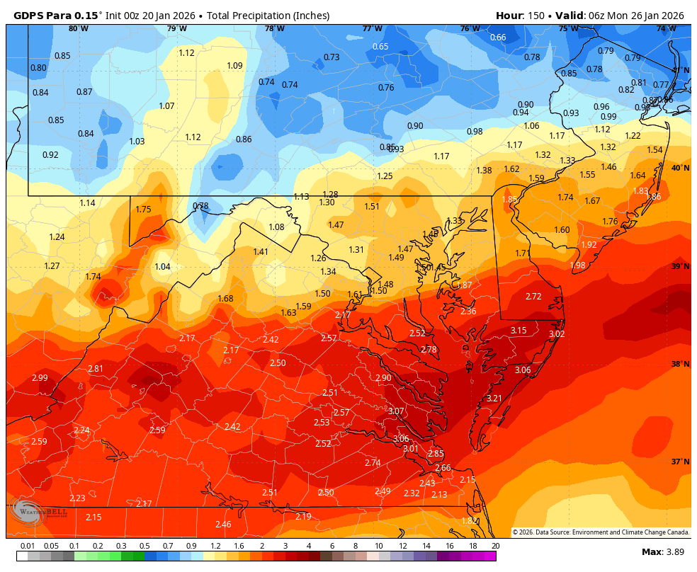
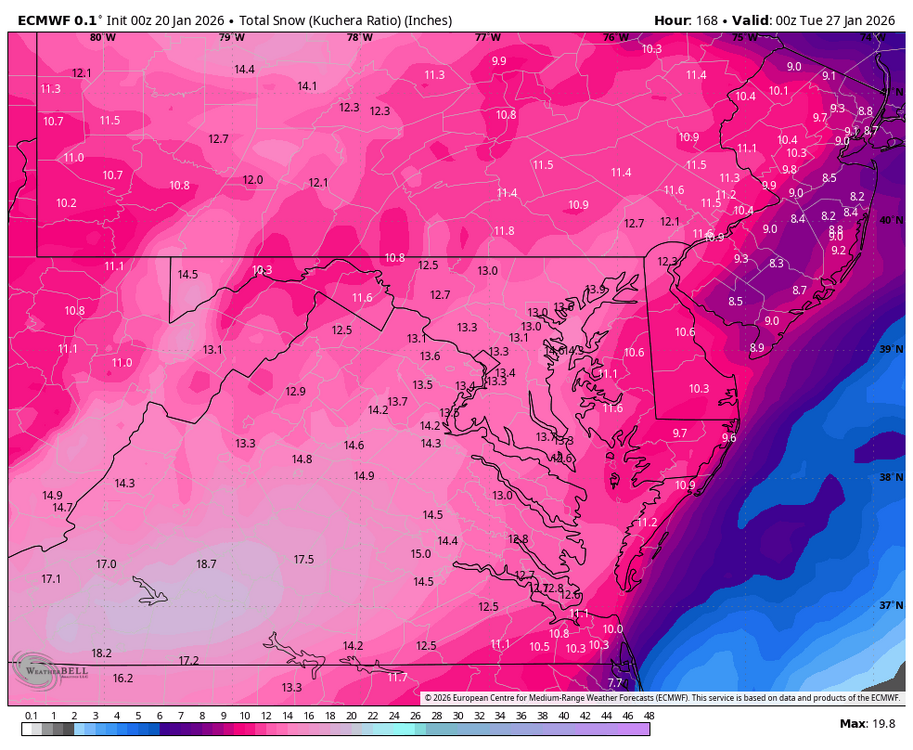
Basically along 40 and south has about .5 to .7 freezing rain on top of that 6 to 7 inches of snow.
-

Central PA Winter 25/26 Discussion and Obs
Blizzard of 93 replied to MAG5035's topic in Upstate New York/Pennsylvania
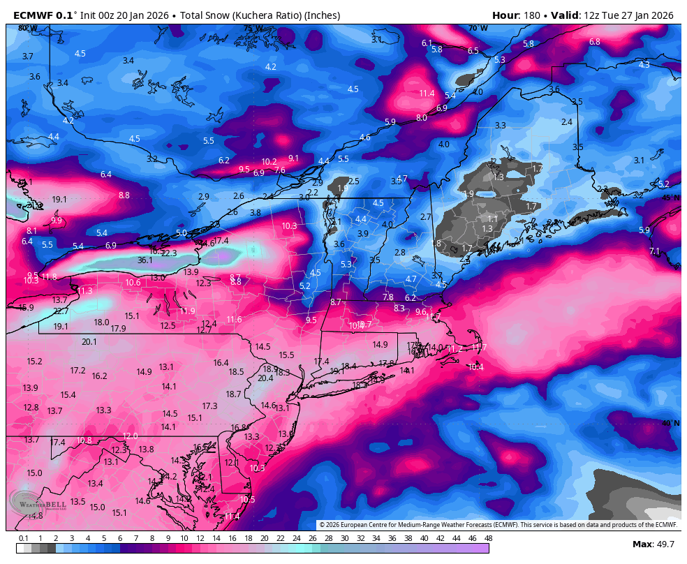
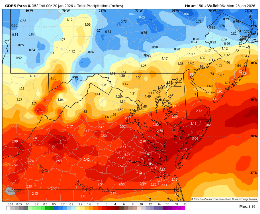
0z Euro is long duration beauty!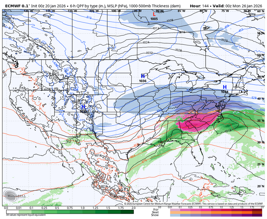


-
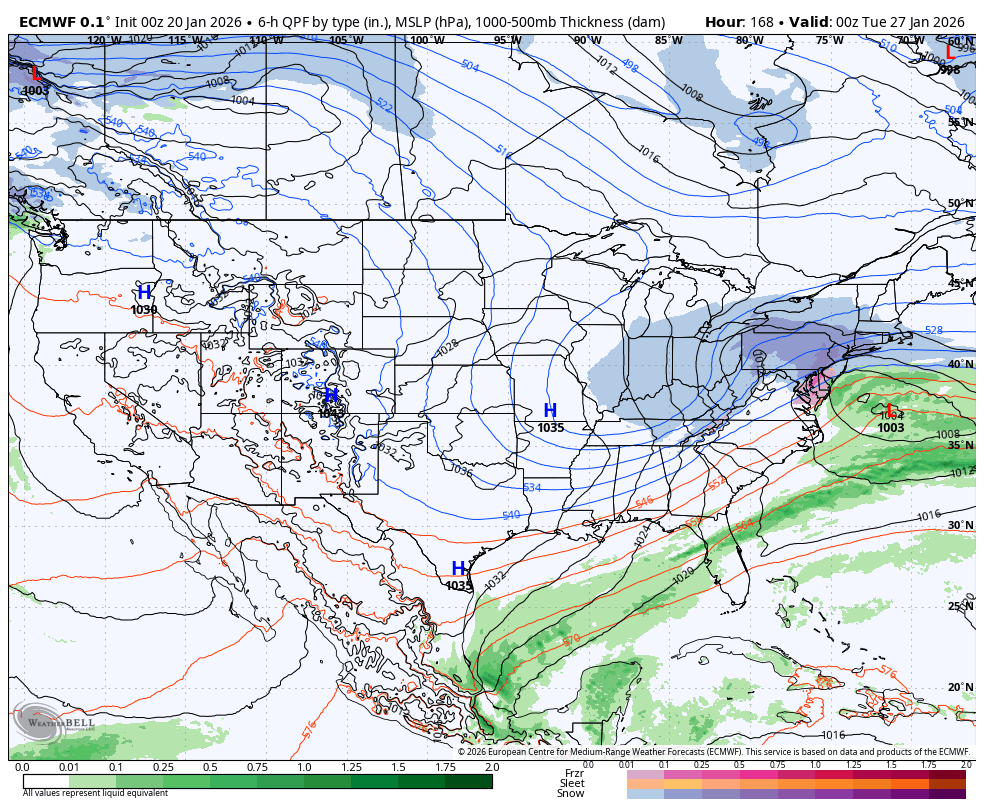
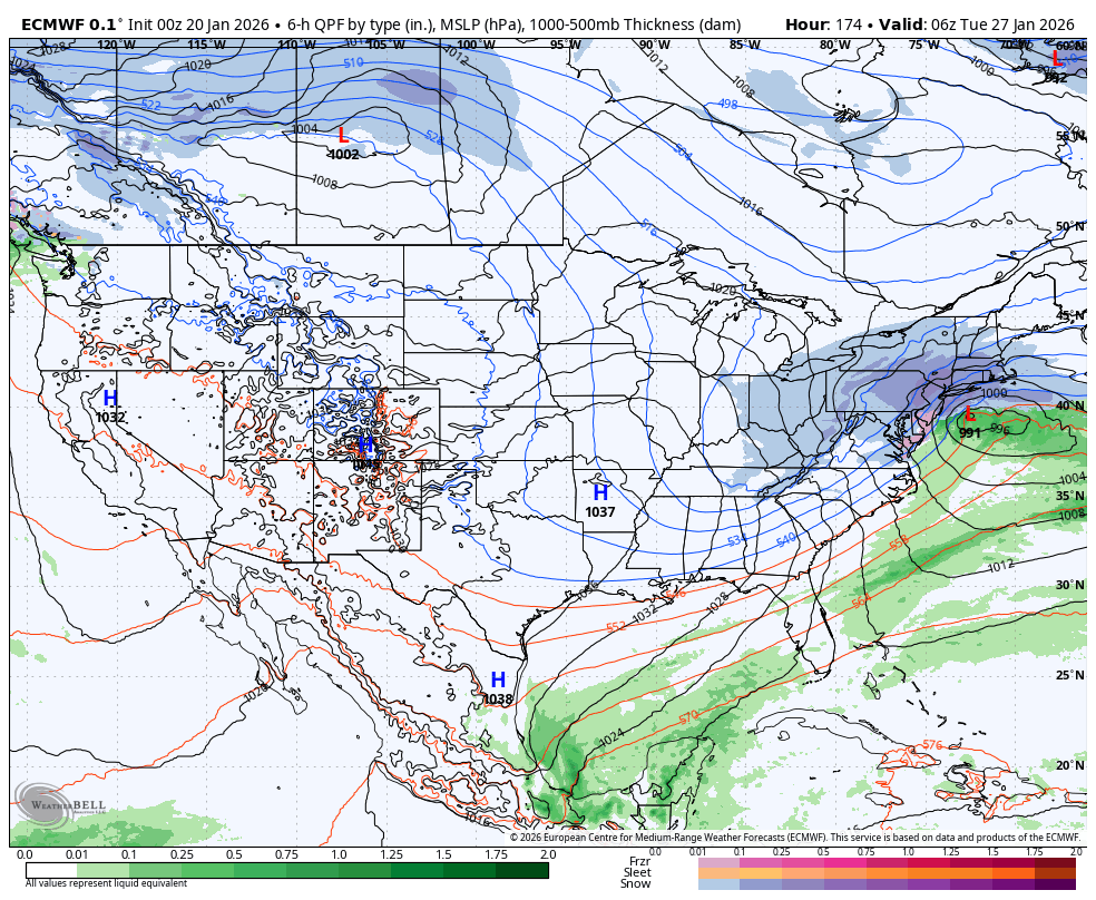
The Euro is a different evolution than we’ve seen: essentially a multipronged event with initial overrunning, a lull, and then transfer into a coastal where it bombs. Not far off from a February 2014 setup as a first thought. If the second piece comes in, that ups the ante and I really think HECS potential could be on the table. Fitting it’s basically on the 10 year anniversary of the last one.
-

E PA/NJ/DE Winter 2025-26 Obs/Discussion
RedSky replied to LVblizzard's topic in Philadelphia Region
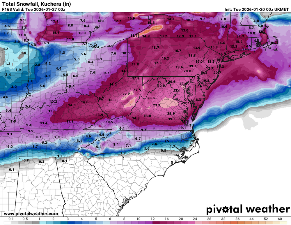
Euro and the para Canadian now i can get some sleep -
Seeing this much agreement among the suites is scary. Something historic is going to happen (not in a good way!)
-

January 2026 regional war/obs/disco thread
WxWatcher007 replied to Baroclinic Zone's topic in New England
Euro phases and that triggers a coastal that tracks under New England. That’s one way to do it. Somebody is going to get obliterated in this setup—Grid collapse from Texas to Virginia Beach? -
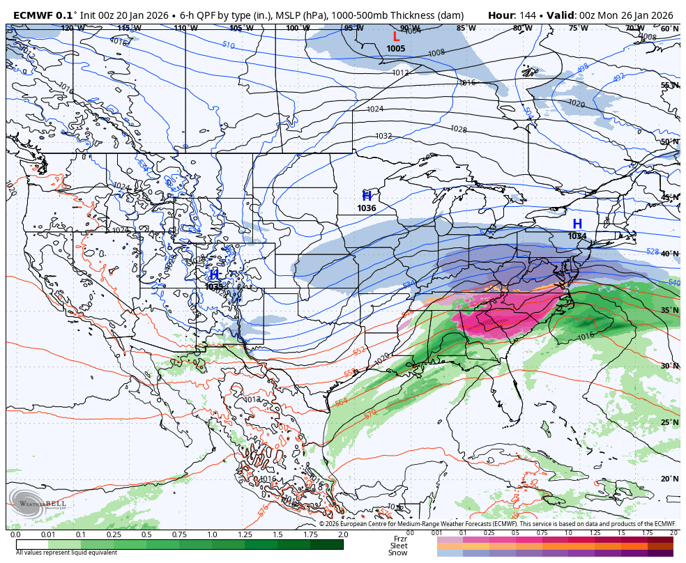
Euro warm noses all the way to just north of 40 this run. Lots of ice just below the pink areas.
-

MO/KS/AR/OK 2025-2026 Winter Discussion
ouamber replied to stormdragonwx's topic in Central/Western States
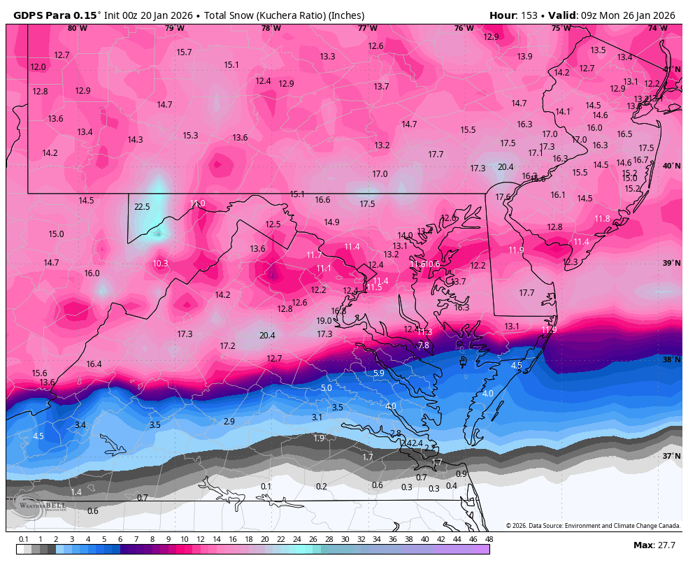
Wow! The Euro has some crazy convective bands showing up! I wonder if someone in our area will get thundersnow! This looks like a pretty long event! -
0z Euro is long duration beauty.
-
Correct. Definitely sleet (at least in central Maryland) with the '96 storm. In Germantown at one period during that heavy snow we had "thunder sleet." That was a spell of winds high enough to sharply bend tall bare trees, frequent lightning (multiple hits per minute,) and raging sleet. Never seen anything like it before or since.
-
He is jipping you
-
Absolutely historic, devastating ice storm on that 00z Euro run for a wide swath of the Southeast. You do not want that verifying.
-
E PA/NJ/DE Winter 2025-26 Obs/Discussion
RedSky replied to LVblizzard's topic in Philadelphia Region
2003 Pd2ish? -
Ditto. The EURO is going to be a DRUNK RAGER of an ice storm. I think you boys up in NC are going to score a pile of snow. Upstate SC, your power is not on and neither is mine Saturday afternoon. I will be asleep to the hum of the generator Sunday morning.
-

MO/KS/AR/OK 2025-2026 Winter Discussion
StormChazer replied to stormdragonwx's topic in Central/Western States
The Euro Speaks. Interesting setup this run though, the storm comes in 2 distinct waves of precip. The 1st is roughly Fri night through Sat evening, then a break and a second wave overnight Saturday night into Sunday morning. -

Central PA Winter 25/26 Discussion and Obs
MAG5035 replied to MAG5035's topic in Upstate New York/Pennsylvania
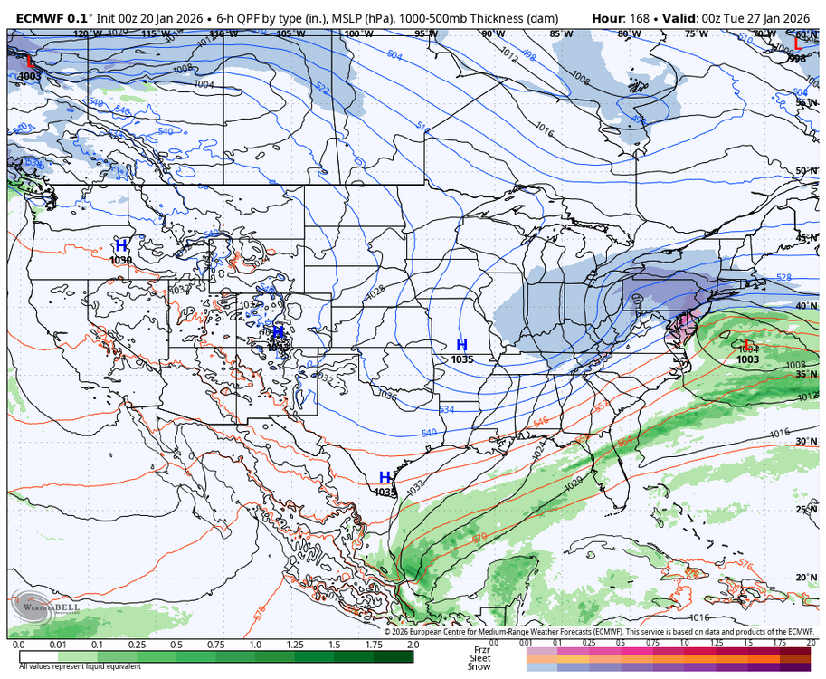
Man the Euro is a hammer. Snowing the whole way into Monday evening with an upper low passage and everything. -

Pittsburgh/Western PA WINTER ‘25/‘26
colonel717 replied to Burghblizz's topic in Upstate New York/Pennsylvania

-
Kuchera still isn't too shabby
-
0Z Canadian Parallel looking good. Will post shortly.


-
Congrats everyone lol
-
Like this one a lot better
-
WB OZ EURO
-
If this keeps trending up some of you might need this information.