All Activity
- Past hour
-
What an incredible stretch of weather we've had. CLE finished October +2.4 -- seemed warmer than that though with all of the sunny days. Leaves are 90%+ down at this point but Fall clean ups have been easy with the dry weather.
-
2026-2027 Record-breaking El Nino
40/70 Benchmark replied to Stormchaserchuck1's topic in Weather Forecasting and Discussion
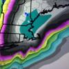
That looks like the porn I tried to watch growing up during the 80s and early 90s in mom's house....I think I can make out a nipple there, Donnie, you dirty birdie... -
It almost looks like the temperature variation between Dec and Jan is in stasis ... like constant straight across while the climate normal dips below.
-
Up to 30% now: Tropical Weather Outlook NWS National Hurricane Center Miami FL 100 PM EST Mon Nov 2 2026 Western Atlantic: An area of low pressure is likely to form along a weakening frontal boundary a few hundred miles northeast of the Bahamas in a couple of days. This system could acquire some subtropical characteristics late this week while it drifts over the western Atlantic. The chances of subtropical development should end by the weekend when the system is expected to move eastward or northeastward into unfavorable environmental conditions. * Formation chance through 48 hours...low...near 0 percent. * Formation chance through 7 days...low...30 percent. 12Z UKMET now forms it SE of Bermuda followed by ENE movement into the open Atlantic: MET OFFICE TROPICAL CYCLONE GUIDANCE FOR NORTH-EAST PACIFIC AND ATLANTIC GLOBAL MODEL DATA TIME 1200UTC 02.11.2026 NEW TROPICAL CYCLONE FORECAST TO DEVELOP AFTER 96 HOURS FORECAST POSITION AT T+ 96 : 26.2N 60.7W LEAD CENTRAL MAXIMUM WIND VERIFYING TIME TIME POSITION PRESSURE (MB) SPEED (KNOTS) -------------- ---- -------- ------------- ------------- 1200UTC 06.11.2026 96 26.2N 60.7W 1000 34 0000UTC 07.11.2026 108 27.0N 59.4W 1000 32 1200UTC 07.11.2026 120 28.3N 58.7W 1000 31 0000UTC 08.11.2026 132 28.8N 56.3W 1000 33 1200UTC 08.11.2026 144 30.4N 54.0W 996 34 0000UTC 09.11.2026 156 30.1N 49.9W 992 37 1200UTC 09.11.2026 168 29.4N 45.6W 989 40
-

2026-2027 Record-breaking El Nino
frontranger8 replied to Stormchaserchuck1's topic in Weather Forecasting and Discussion
No, it wasn't about my location. It was about NYC's lack of March snowfall in recent years, and people pushing the idea that this trend is entirely driven by global warming, and therefore a return to more normal March snowfall won't happen. My point was simply that if you look at short term trends, small sample sizes for a specific location, it won't always match what's happening globally with temps. -
What next, retire the NGM?
-

2026-2027 Record-breaking El Nino
Typhoon Tip replied to Stormchaserchuck1's topic in Weather Forecasting and Discussion
Just adding to this for those unaware ...there's an apparent category 4/5 "marine heat wave" going on from the near shore waters of San Francisco all the way down the coast... There's some modest suggestion in the total larger scale SST to be indirectly linked with the El Nino - though this is likely an artifact of proximity rather than the same forcing. -
AIGFS gets stormy (wet) mid-month, but no agreement from EuroAI.
-

Mountain West Discussion
mayjawintastawm replied to mayjawintastawm's topic in Central/Western States
Great to see a true upslope pattern blossoming on radar. Just a few tens of miles could make a big difference for the whole Front Range (including Fort Collins!!). I keep thinking there's gotta be enough week to week variation for the northern Front Range to cash in eventually. -
 https://apexrxdirect.shop/# no prescription pharmacy paypal
-
It's 11/2. History suggests it's very unlikely we see as little or less than last winter. Very strong El Ninos almost always deliver a huge storm or two at some point to the Front Range.
-
2026-2027 Record-breaking El Nino
SnowenOutThere replied to Stormchaserchuck1's topic in Weather Forecasting and Discussion
I thought we were talking about your specific location? I'm not sure how the West Coast cooling offsets the idea that your specific location (due to the differences in atmospheric circulation and climate change impact on specific Rossby wave configs) is warming. Frankly it makes sense that if your area has been warm over the past 10 or so years then somewhere else will get cooler: that is the stationary wave component moving in response to climate forcing. If anything, this argument proves my point here. -
2026-2027 Record-breaking El Nino
frontranger8 replied to Stormchaserchuck1's topic in Weather Forecasting and Discussion
Has the world not warmed since the 1990s and 2000s? Wasn't that the logic behind this discussion? -
2026-2027 Record-breaking El Nino
frontranger8 replied to Stormchaserchuck1's topic in Weather Forecasting and Discussion
Not "entirely wrong" lol, ok I'll take it. That map shows exactly what I said. -
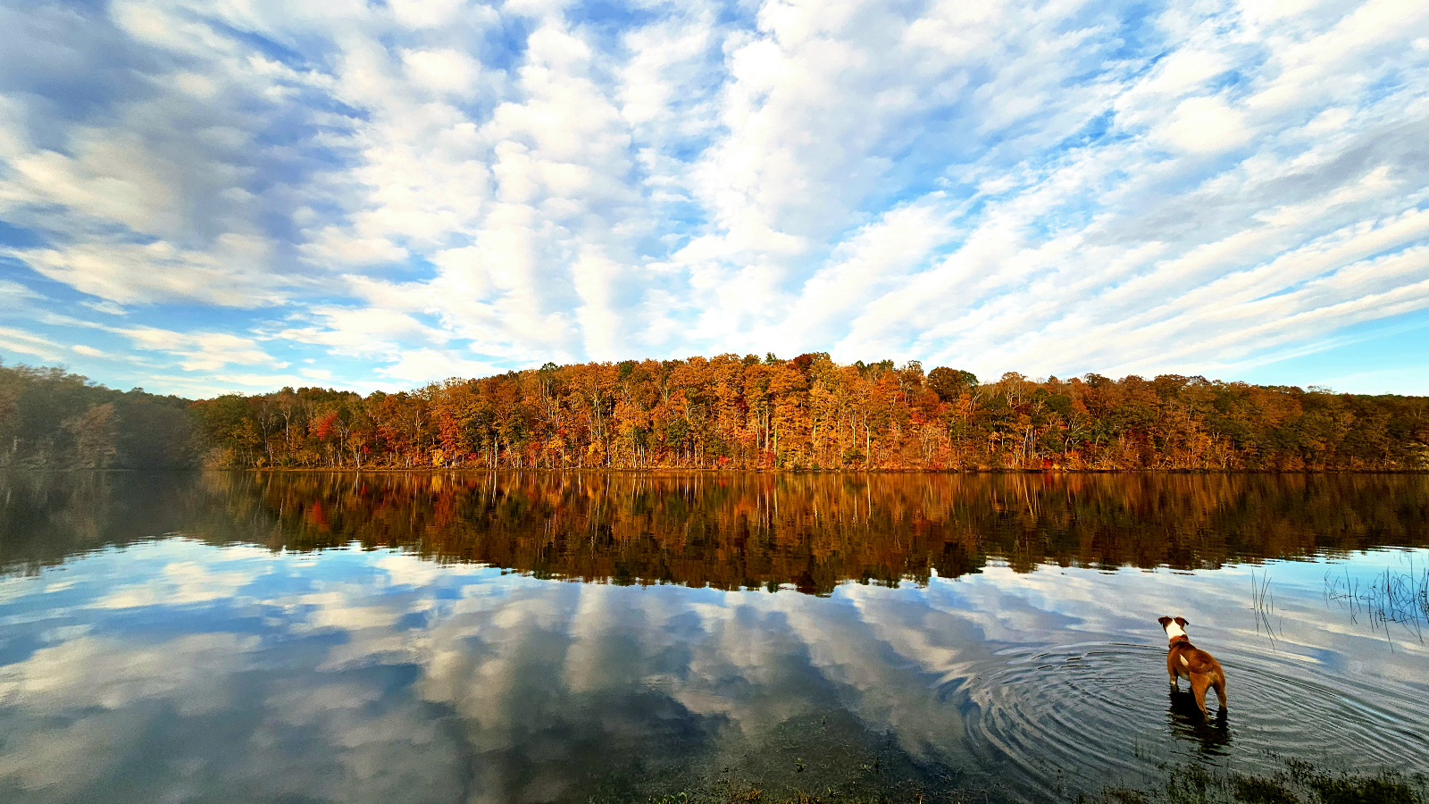
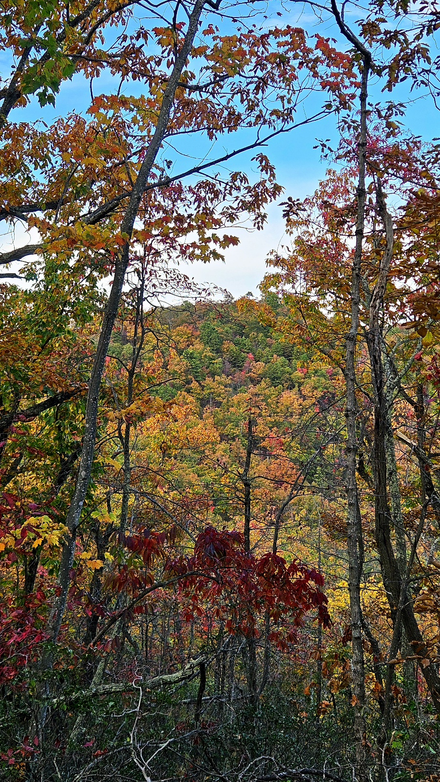
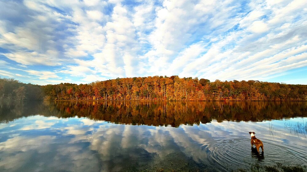
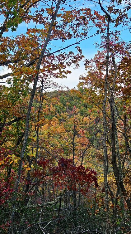
Love this dog photo Took a walk up Smith Mountain WMA yeaterday. Elevation on this pic is around 1800. Still some late green but scenic
-
2026-2027 Record-breaking El Nino
frontranger8 replied to Stormchaserchuck1's topic in Weather Forecasting and Discussion
See above. And of course you just ignored the Seattle stats I shared. How is that possible in a warming world, in a location that struggles to get snow much more than NYC?? -
Chart is on the previous page. Strato warming is more likely to dump on Europe. I truly hope I'm wrong for the sake of Ukraine. Anyway SSWs typically impact Europe first. Esp now we also got a Scandinavia block. I'd love to be wrong. Maybe instead of a true PV split it'll just jostle and reflect for North America. If Europe first, and warm Eastern USA, I'll take severe wx thanks. We need the rain. Hope to see y'all in the severe thread soon!
-
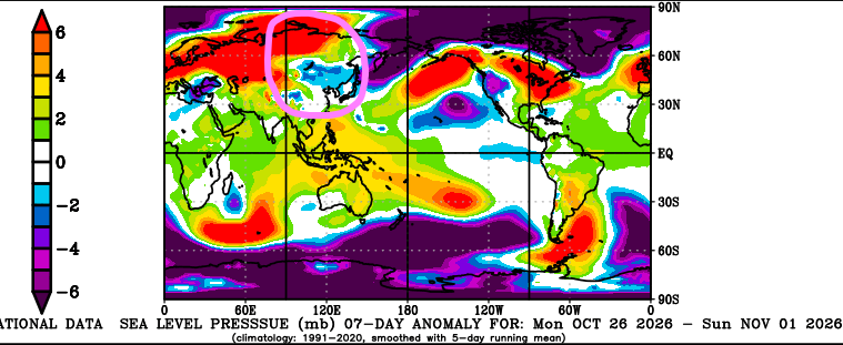
Well we are starting to get a proper pressure signal in Asia, but the snow is AWOL. Pressure chart is below; pink circle is mine. Snow is not worth posting. Noth America screams, vortex is bottled up. No cold up there and no mechanism to deliver anyway. Continue very mild forecast at my shop.
-
Hopefully never
-
online pharmacy without scripts or overseas pharmacy no prescription safe online pharmacies https://kyl.guru/forum/away.php?s=http://apexrxdirect.com online pharmacy no prescription and https://brueckrachdorf.de/user/nmaqlkipbx/ pharmacy order online [url=http://www.dynonames.com/buy-expired-or-pre-owned-domain-name.php?url=apexrxdirect.com]pharmacy order online[/url] trusted online pharmacy or [url=https://www.0468wudi.com/home.php?mod=space&uid=339185]trusted online pharmacy[/url] legit online pharmacy
-
online pharmacy without scripts or overseas pharmacy no prescription safe online pharmacies https://kyl.guru/forum/away.php?s=http://apexrxdirect.com online pharmacy no prescription and https://brueckrachdorf.de/user/nmaqlkipbx/ pharmacy order online [url=http://www.dynonames.com/buy-expired-or-pre-owned-domain-name.php?url=apexrxdirect.com]pharmacy order online[/url] trusted online pharmacy or [url=https://www.0468wudi.com/home.php?mod=space&uid=339185]trusted online pharmacy[/url] legit online pharmacy
-
I don't quite buy that . Hopefully the SSW will be shaking things up by then. If so, there should be somewhat different look to Canada and the Northern Lats.
-

2026-2027 Record-breaking El Nino
donsutherland1 replied to Stormchaserchuck1's topic in Weather Forecasting and Discussion
El Niño Regions 1+2 (+5.4C anomaly) and 3 (+4.4C anomaly) set new weekly records for the week centered around October 28th. Region 3.4 (+3.4C anomaly) tied its weekly record that had been set during the prior week. Despite some social media chatter of a "weakening" El Niño, the ongoing event is continuing to strengthen. It will likely peak this month or next month. It will also likely be the dominant influence on the hemispheric pattern for December, January and maybe February. The biggest wildcards concern whether meaningful blocking develops late in the winter (possibly allowing for one big snowstorm as occurred during 1982-83 and 2015-16), the degree and rate of weakening following El Niño's November/December peak, and whether the stratospheric polar vortex will recover from the forecast sudden stratospheric warming event then lock in for much of the winter. Yesterday's November monthly record rainfall in parts of Arizona, including Flagstaff where records go back to 1898, and today's extreme rainfall in parts of Florida have been, in part, aided by El Niño's enhanced moisture and subtropical jet. This aspect is likely to play out throughout much of the winter with a high degree of confidence. Artwork generated to illustrate El Niño's rising impact.
-

2026-2027 Record-breaking El Nino
forkyfork replied to Stormchaserchuck1's topic in Weather Forecasting and Discussion
use older averages and that blue disappears -
2026-2027 Record-breaking El Nino
forkyfork replied to Stormchaserchuck1's topic in Weather Forecasting and Discussion
you said february and march